This was the craziest and best chase of our five-day trip. After overnighting in the car near Wray, we headed back to a target area east of Denver and spent about an hour with a storm that struggled south of Strasburg. I was unsure about veered wind profiles downstream in the deeper moisture, especially noting SPC guidance that storms would probably tend to grab supercell structures early on before lining out. And that's kind of what this storm was doing. It had joined some friends and wound up on the south end of a mushy line of storms moving to the east and northeast by 21Z. And it appeared to be weakening after that.

Developing storm south of Strasburg || 2020Z
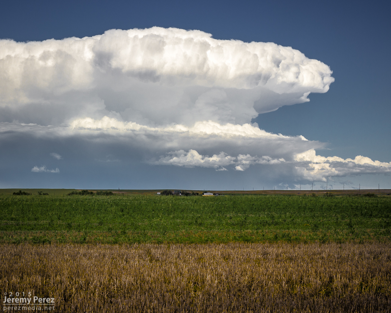
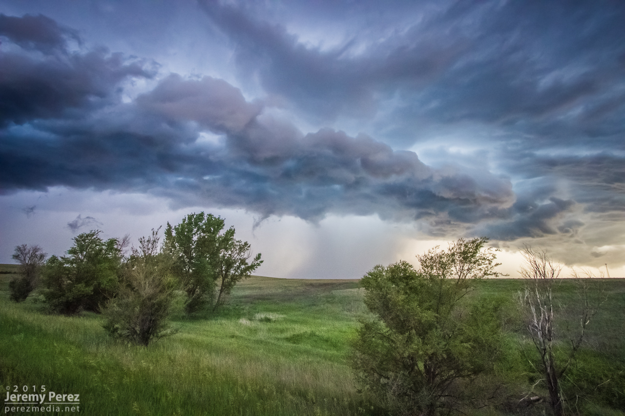
Storm struggling south of Byers || 2045Z
So I let it go, figuring I didn't want to waste energy on eventual garbage. Not a good idea, as it turns out. But I was worn out and feeling kind of sorry for myself about missing the Simla storm a couple days earlier and not seeing so much as a cold air funnel on anything yet. As we sat in a spot with horrible data for accessing current radar, I figured the whole day was probably destined to be a wreck of grungy, linear convection. To show how miserable I was making myself, I even mulled the idea of heading into Denver to catch a movie so the whole day wouldn't be a complete disappointment.
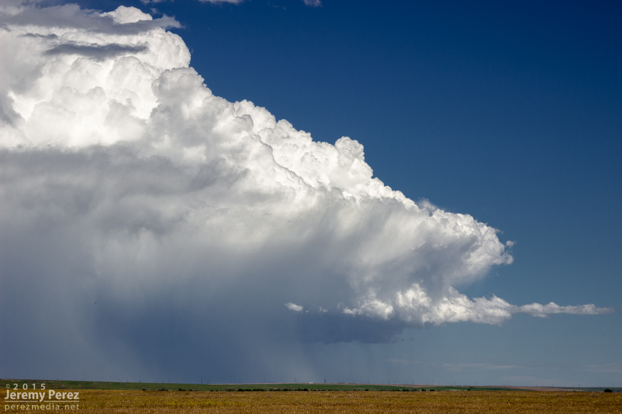
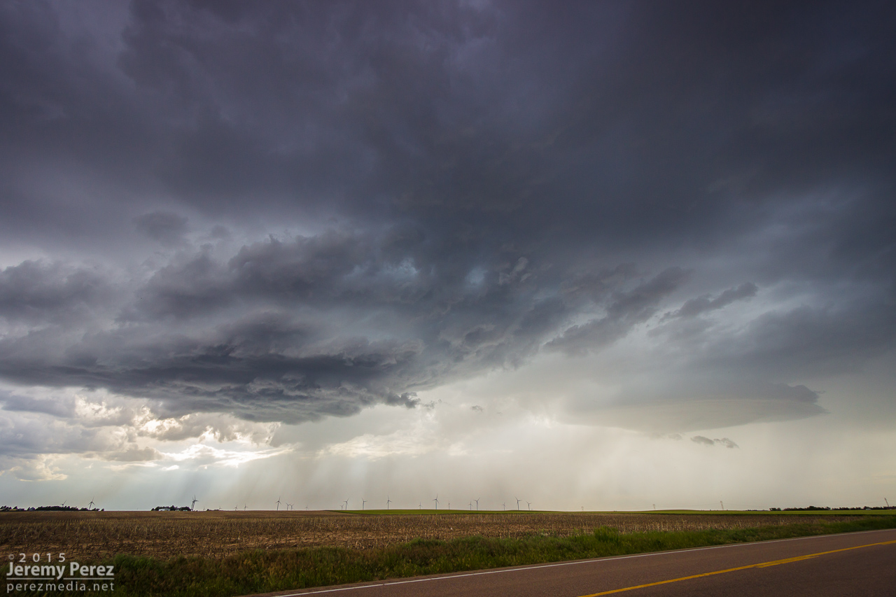
South end of line of convection moving away || 2135Z
I probably spent a good twenty minutes in my pity party, facing west, watching sad blobs of convection trying to get going over I-20. When I finally turned back 180 degrees, to my immense shock, the departing storm had separated from its linear friends and blossomed into an enormous, incredible mushroom cloud on the eastern horizon. My self pity turned to shock and then anguish. It seemed too far gone to catch up to. I had been re-defeated.
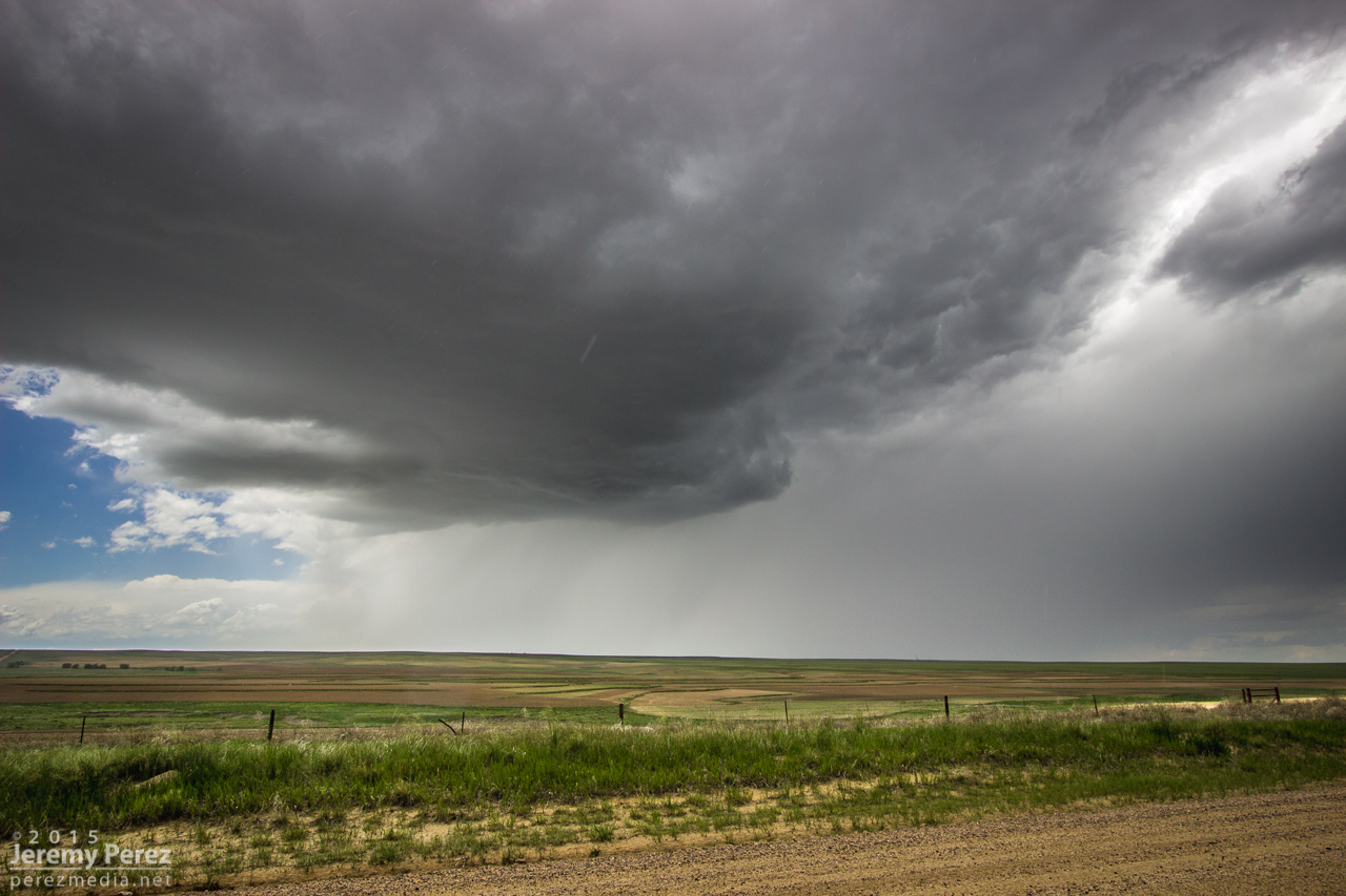
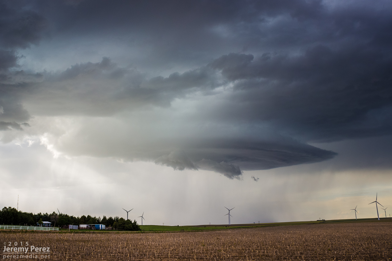
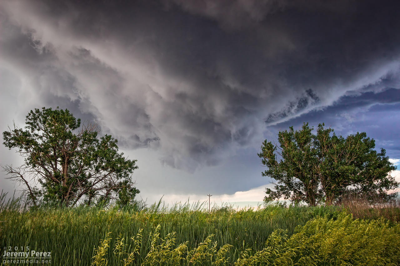
Sudden, explosive convection south of Last Chance || 2200Z
I'm not sure what kind of soliloquy I was rendering at that moment, but my daughter finally decided it needed to stop. With simple optimism: "We should try to catch it anyway." I love that kid. I'm glad she said it and glad I listened to her. We hopped on I-70 and made our way eastward. The whole time I was working the math of two moving targets and the time/location of intercept. If only the storm would stay interesting that long.
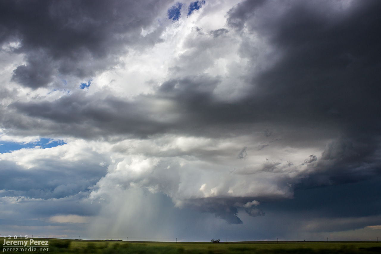
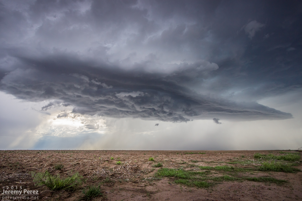
RFD and wall cloud as we approached Bethune || 2345Z
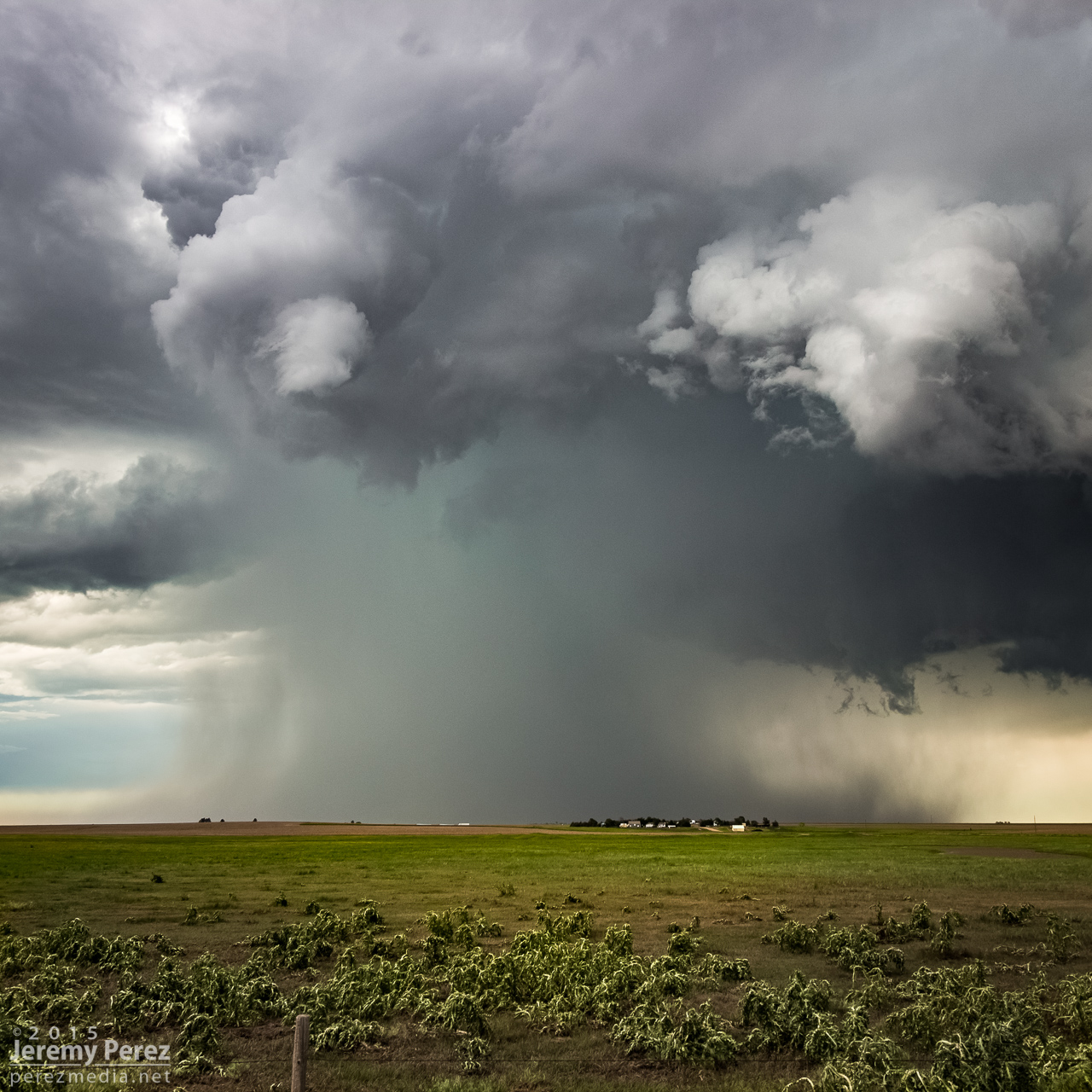
We finally caught up to it near Stratton with decent wall cloud and RFD action ongoing. Then we got ahead of it a couple miles north of Burlington. There was a sleek, saucer shaped lowering on the original meso with a new base forming to its south. I'm not sure whether that bell-shaped base was receding behind its own RFD curtain or if it was getting hidden by the developing forward flank of the new updraft. Either way, it was the greatest view of a meso handoff I've had so far.
Saucer shaped base north of Burlington || 0000Z
Meso handoff in progress north of Burlington || 0005Z
We were in good position on a fantastic road grid with an easy-moving storm, so the photo ops were excellent. At one stop, the new base was looking particularly awesome and I stopped to grab shots while the video camera was running. It wasn't until reviewing video later that I realized a cold air funnel had been twisting around for a couple minutes on the west side of the base.
New base northeast of Burlington || 0015Z
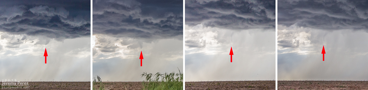
Cold air/shear funnel behind rain free base || 0013-0016Z
We paralleled the storm as it moved eastward. An RFD surge carved an inverted soft-serve ice cream cone into the base at one point. Not ten minutes after that, a glance out the window revealed a beautiful funnel whirling away inside some sort of strange RFD eddy on the south edge of the storm. We pulled over quickly to hop out and get shots. Time was of the essence, so we didn't wind up with the best foreground elements for photos. That issue took a back seat to the fact that we were standing on the side of the road looking up as a gorgeous funnel stared us down. Turning around to find my daughter embracing the outflow topped this off as the best storm chase turnaround ever.
RFD carving the base northeast of Burlington || 0025Z
Funnel and core between Burlington and Kanorado || 0035Z
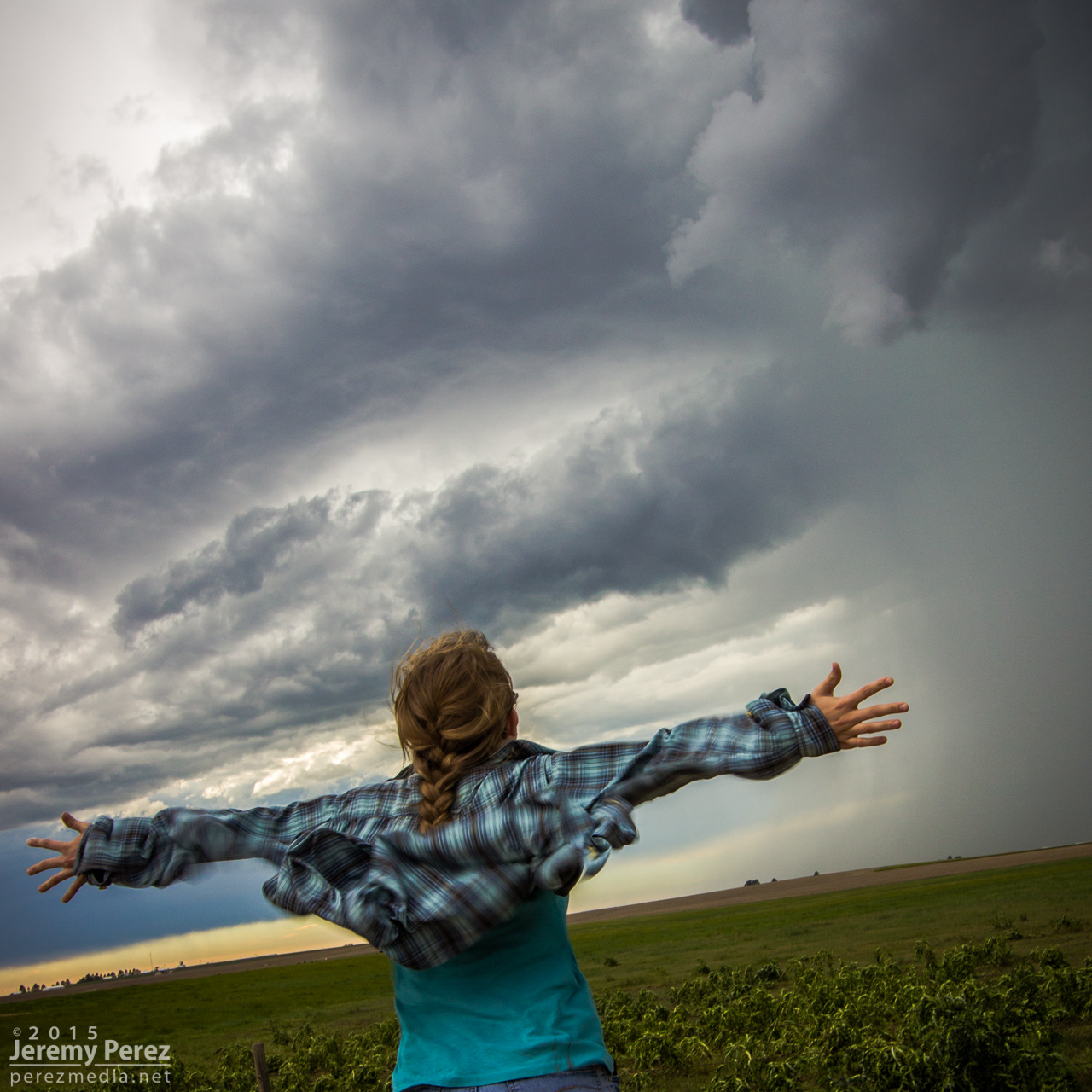
My daughter embracing the outflow as the funnel dwindles || 0035Z
By now, the storm had fallen too far behind the expanding outflow boundaries and started to wither away. So, we paused to photograph an idyllic farmscape south of Kanorado. Then we enjoyed the view of an inbound gust front moving in from Colorado before calling it a night at a comfy hotel in Goodland.
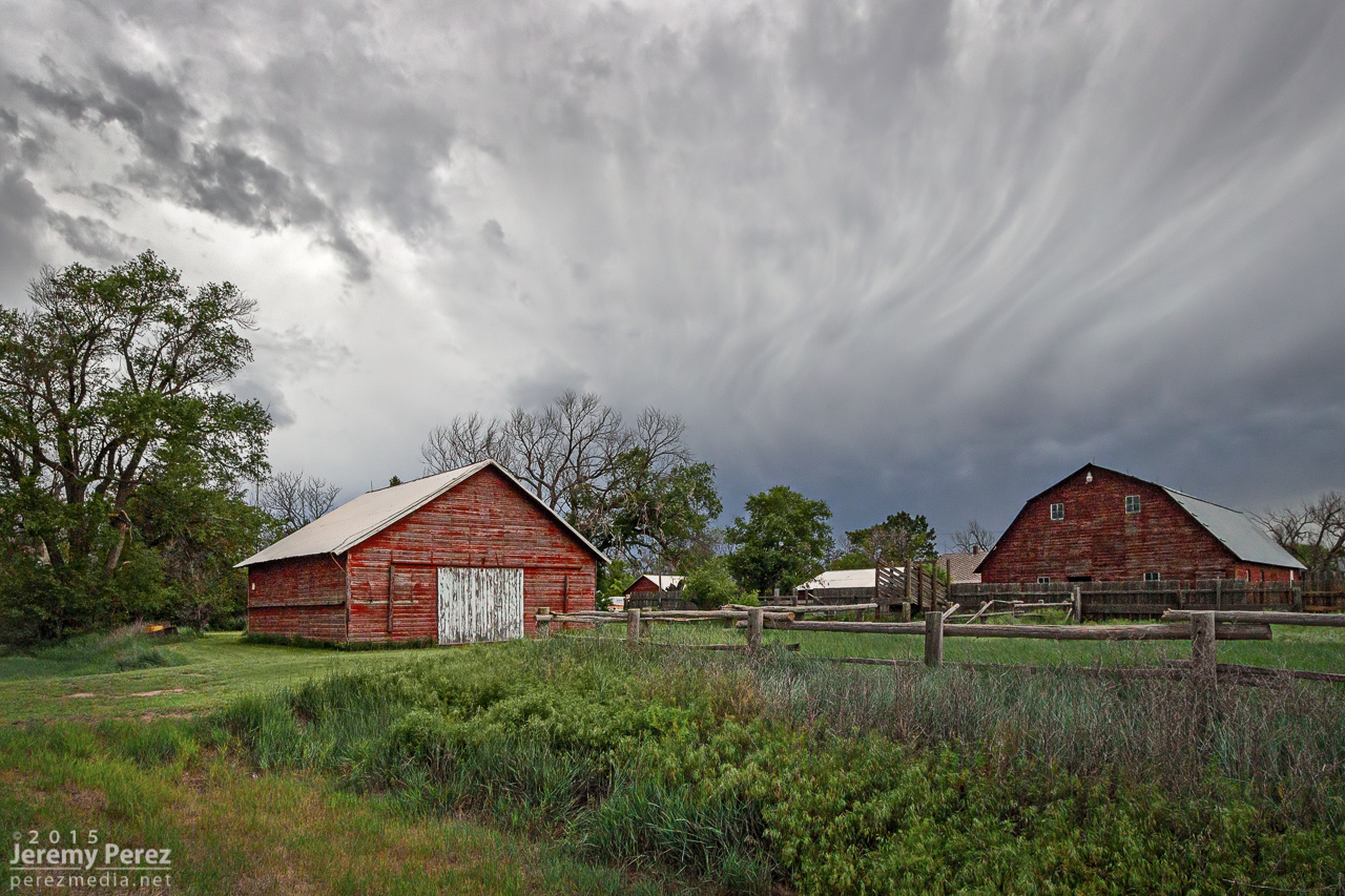
Farmstead southeast of Kanorado || 0120Z
Gust front moving in south of Kanorado || 0150Z
