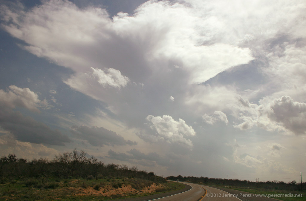
This day didn't promise to be much of a storm producer. Southwesterly flow aloft was weak--30-35 kts--over a solid cap. However, with instability from 1000-2000 j/kg, 35 kts of bulk shear, and low/mid level SRH around 100 m2/s2, the possibility of a photogenic storm going up had me ready to head out.
By midday, the HRRR model was forecasting convection breaking through the cap along the dryline in the Oklahoma panhandle. Satellite was showing a patchy cumulus field developing along the dryline in the panhandles. So Giselle and I headed out from Elk City to see if something would break through.
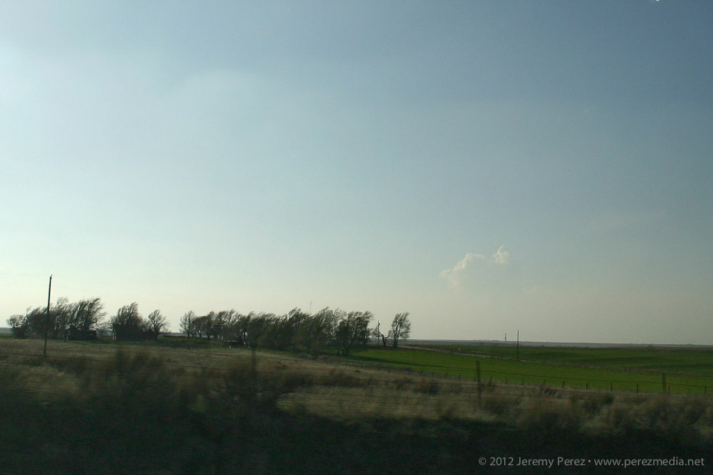
As we headed north on 283, we were introduced to the horrible Wireless data coverage of northwest Oklahoma. With no satellite updates to tell us how things were going along the dryline, we kept moving and hoping cloud tops would start to show above the haze. I'm used to the clear, dry air of Arizona where storm bases are visible from 50 or more miles away. So it's frustrating at first to see how quickly visibility drops off on the plains--of course, it's that hazy moisture that makes the storm environment so explosive here.
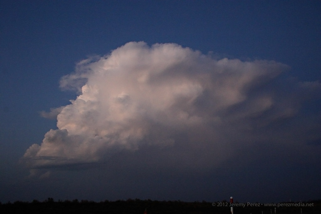
By the time we approached Shattuck, Oklahoma, we were seeing hints of the dryline cumulus to the west. Some of the cloud heads popping above the haze layer looked like they might be developing cu towers, but it was impossible to tell without seeing whether there was a rising tower beneath the bubbling fringe. After some more driving with that frustrating feeling that the cap might hold everything down, we finally saw some convincing development that egged us onward.
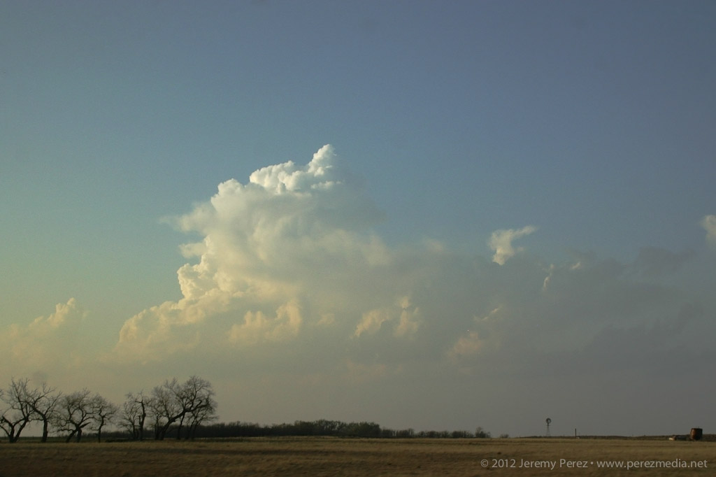
Growing cumulus tower in the north Texas panhandle
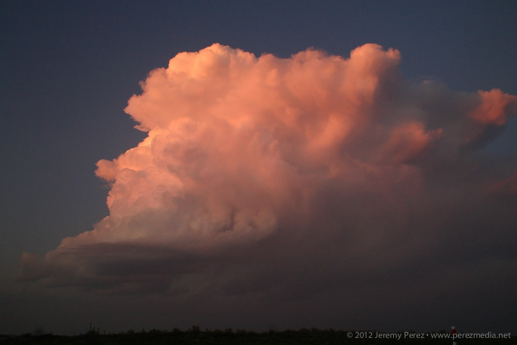
While the initial tower collapsed, another congested batch further north on the Kansas-Oklahoma border was holding together.
Congested cumulus near the Kansas-Oklahoma border
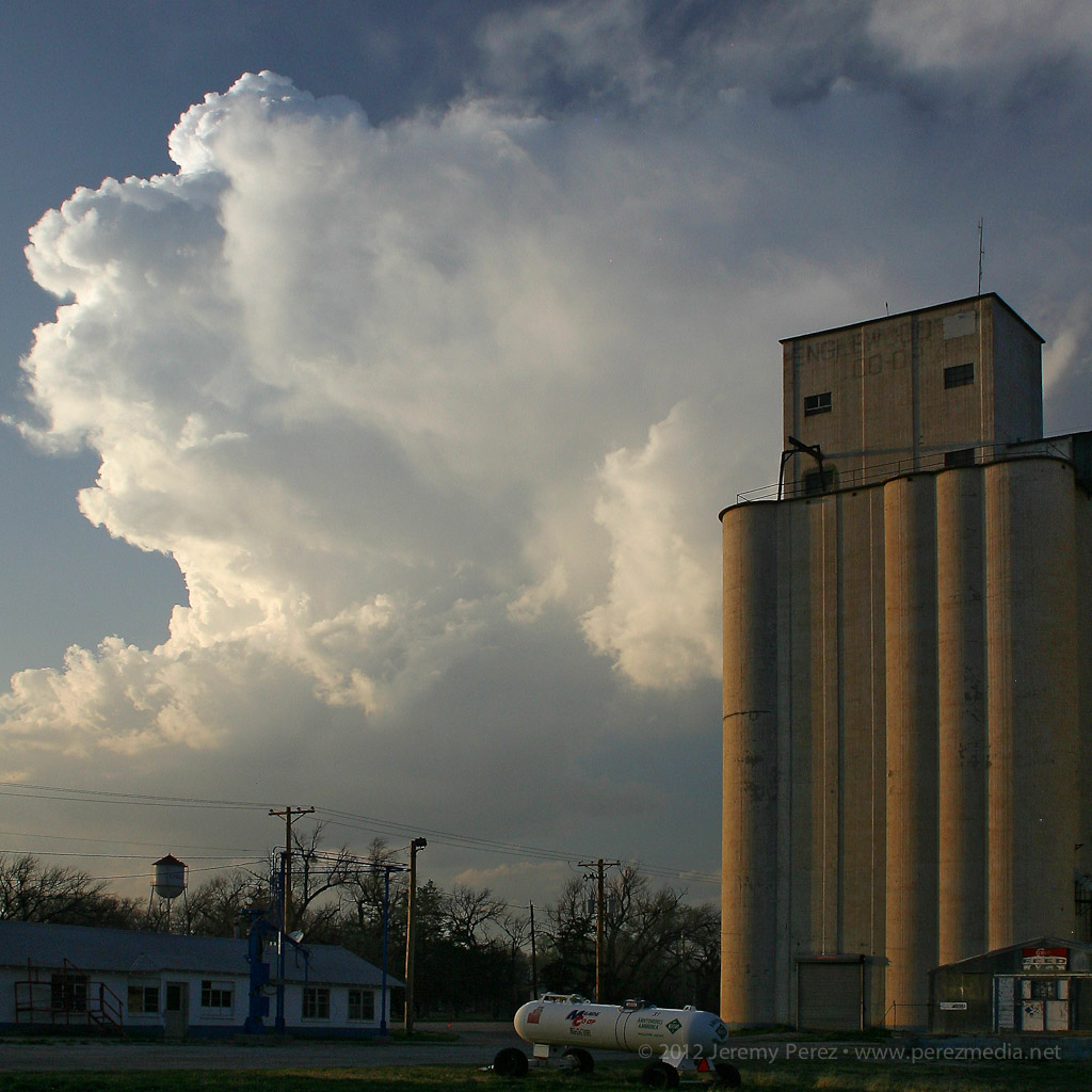
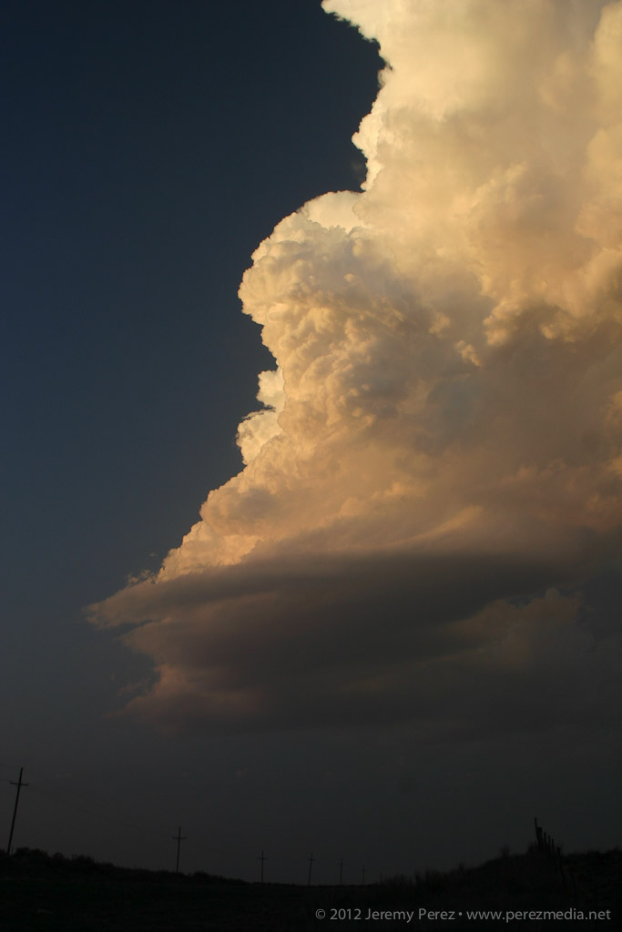
We headed for that developing storm, and by the time we reached Englewood, Kansas, it had developed an anvil and was putting on a beautiful display northwest of town.
Developing cell northwest of Englewood, Kansas
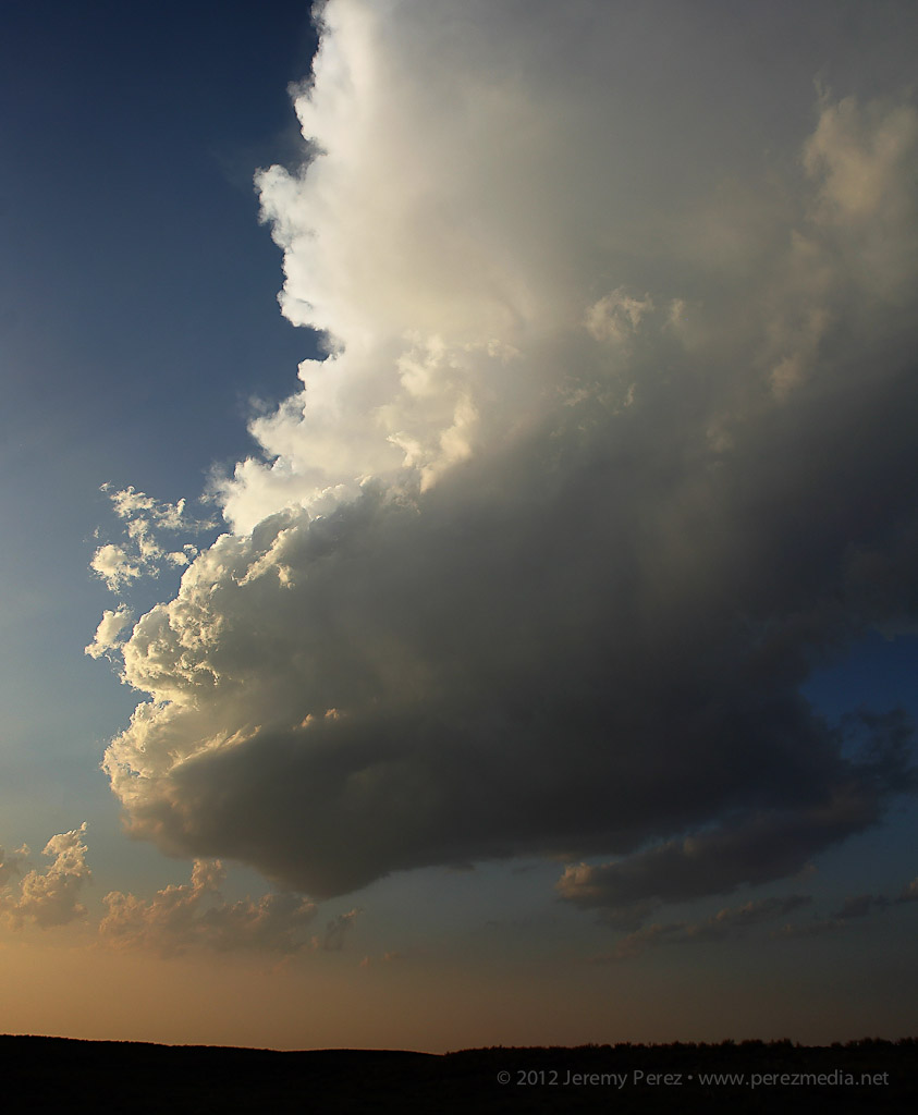
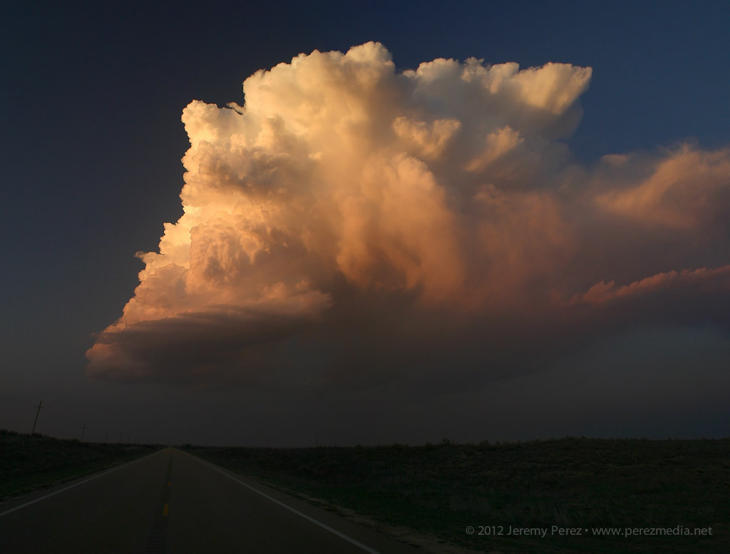
As expected, the cell remained elevated for the two hours that we followed it, but the updraft displayed broad rotation and barber pole structure with some limited lightning. Colored by the setting sun, this isolated, mini-LP cell was a beautiful sight as it glided away over the lonely Kansas landscape.
Mini LP Supercell drifts from Englewood to Ashland, Kansas
While visiting family in Elk City, I chased some storms on March 14, 16 and 18, and wound up seeing three tornadoes on the 18th. (I'll post details of the other two chases later).
I made the Sunday chase after a convective shambles in the TX panhandle on March 16. This turned out to be an incredible follow-up. Deciding between better moisture south near the Red River vs. better H5 winds north by the OK panhandle was my biggest challenge as I made my way toward Shamrock, TX on I-40. Based on reliable results with NAM and HRRR forecast models on March 14 and 16, I was relying on them more heavily.
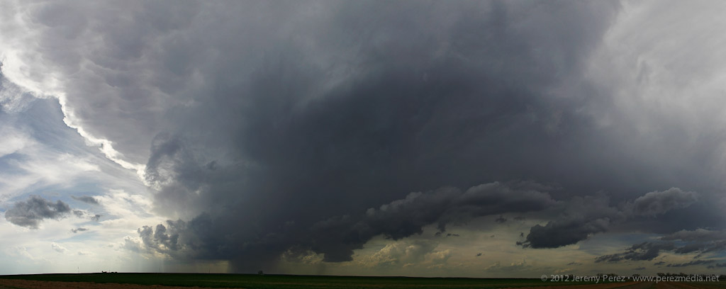
By the time I got to Shamrock, HRRR was forecasting some convection up by the OK panhandle and southwest KS, but it was showing this to be short-lived. The more robust, sustained development was forecast along the dryline west and southwest of Childress and moving into southwest OK. When I got to Shamrock, the cumulus field was congesting along the dryline in agreement with that area proving to be a successful initiation point, so I fueled up, cleaned the windshield and headed south.
As I approached the Red River, towers were going up, and as I moved into Childress, a really nice updraft and anvil were overshadowing the town.
Storm Initiation
Developing Cell Panorama
Following the storm back over the Red River meant either racing the core along Hwy 62 and glomming with an inbound stream of chasers, or taking some side roads over to Rt. 680 just NE of the OK/TX border. I chose 680, and after sledding along several miles of farm road whose last maintenance heralds from before the dust bowl days, I made it to an I-Dare-You type bridge crossing with the storm moving over the OK border just ahead.
Bridge Crossing at the Red River
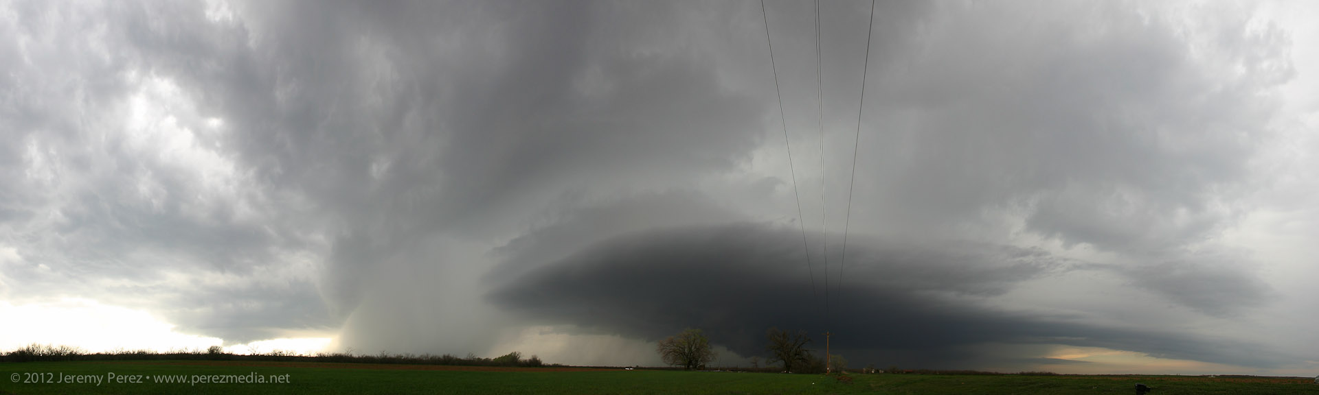
After cringing at the forbidding screeching noises as I rolled across the bridge, I parked about a mile further north and shot some time lapse video and panorama shots. The lead cell was being hugged by a trailing cell with an incredibly solid hail core. I wondered if this would be like the mess on Friday near Lubbock with each batch of convection being demolished by whatever formed behind or in its inflow. For a while, both cells sported great structure and inflow features, and I couldn't decide what to photograph.
Wall Cloud on Lead Cell
Structure on Trailing Cell
Solid FFD Core on Trailing Cell
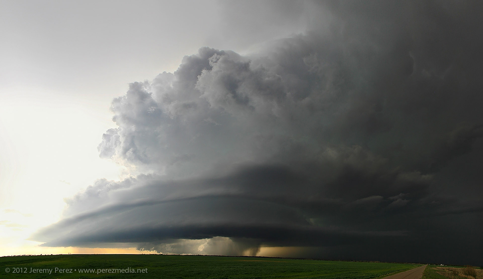
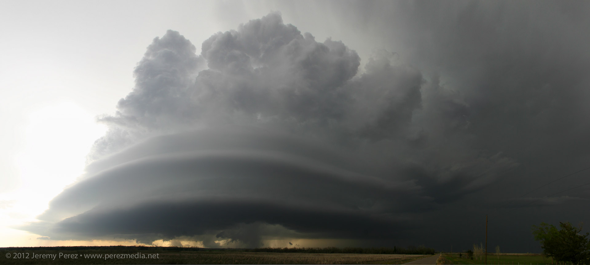
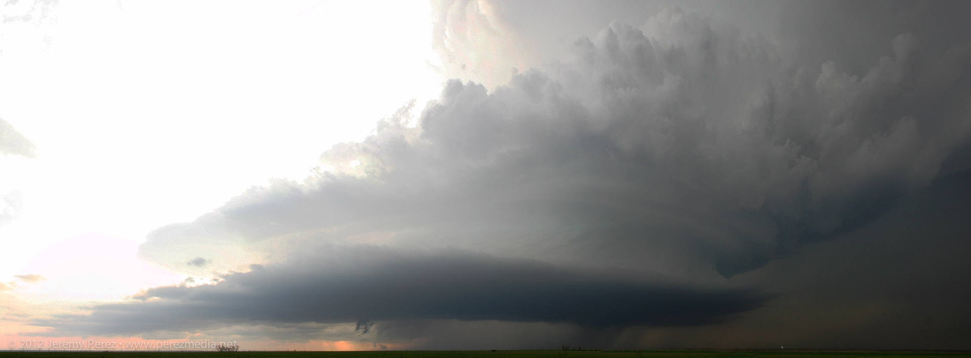
Panorama of Both Cells
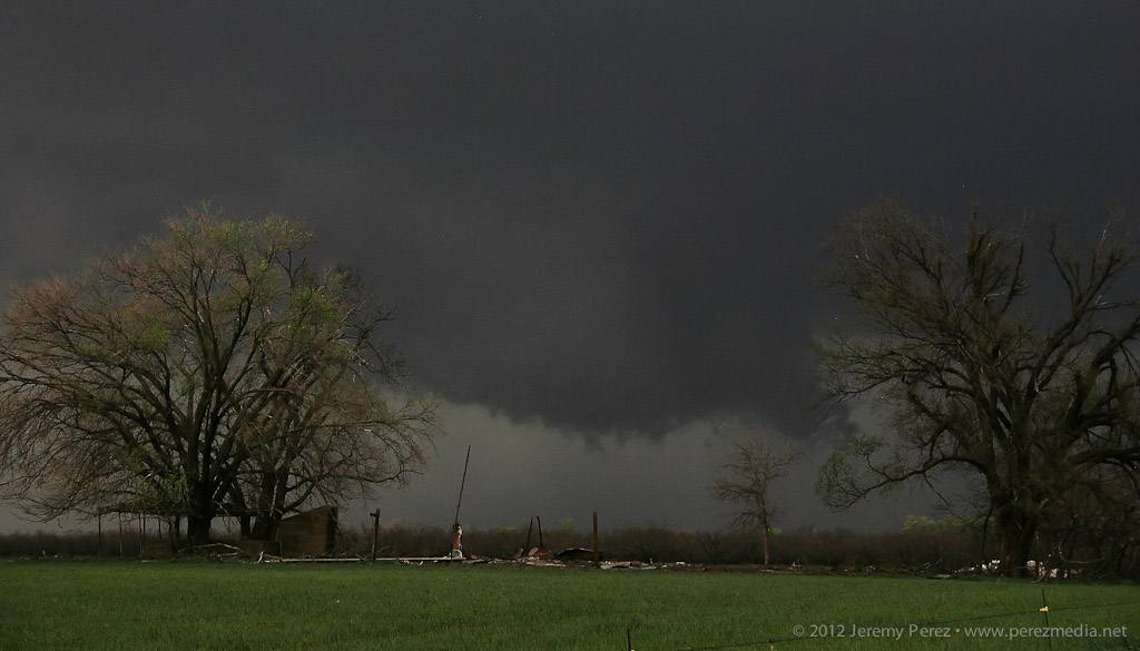
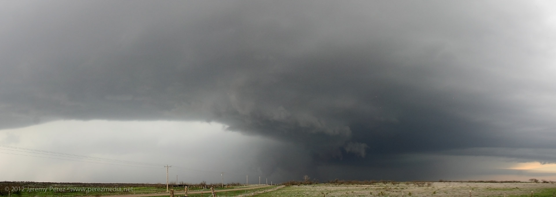
As I followed at a hail-safe, happy-rental-car distance, the lead cell became dominant and from there, the RFD did all sorts of wonderful things to the updraft base and enclosed wall cloud. From that distance, I was having a hard time resolving details behind the nearly constant precipitation curtain, but rotation had become sustained and it was one great photo op after another with some very tantalizing wall cloud structures emerging periodically through the hazy mists.
RFD Shelf and Wall Cloud Behind Precipitation Curtain
RFD with Rotating Wall Cloud Structure in Background
Structure Panoramas
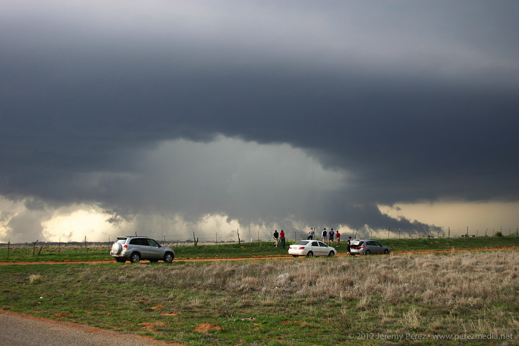
I travelled the smaller county roads as much as possible, which lowered the convergence factor with chaser hordes. I still encountered smaller groups at key intersections and vantage points. This small group was enjoying a perfect RFD donut hole backed by a shaggy wall cloud and tail.
Chaser Audience, RFD Donut Hole and Wall Cloud/Tail Cloud
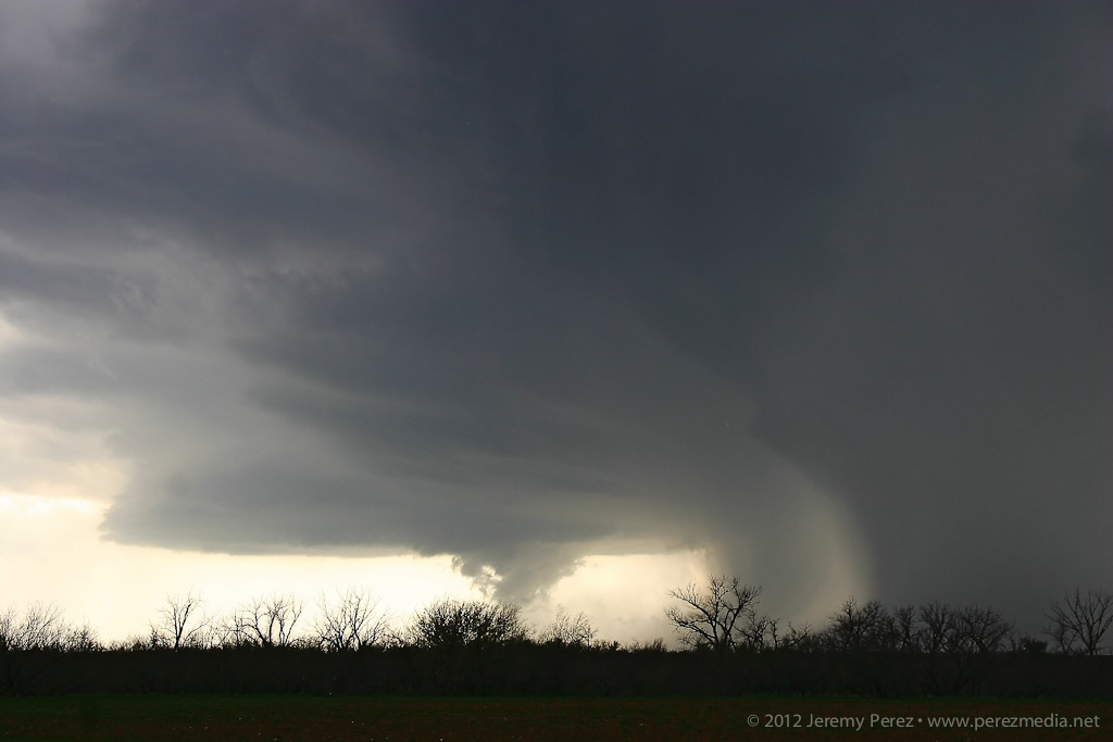
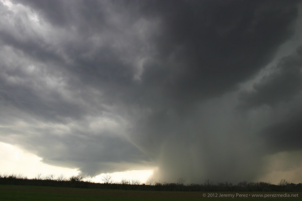
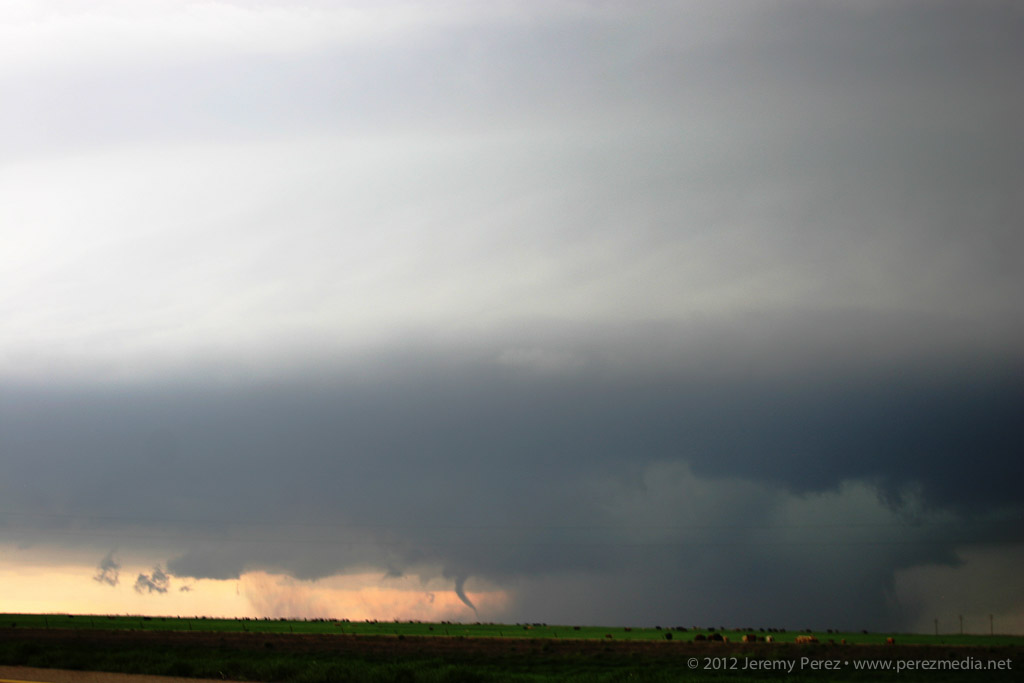
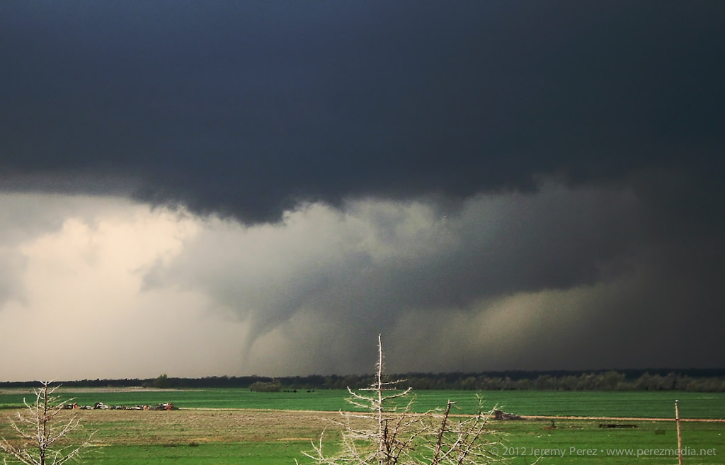
About the time the tornado warning went up for the storm, I was back on a main road headed north, trying to get in better position when I was passed by law enforcement blazing north with lights flashing. I figured they were getting ready to road block my route, so I started to detour east to find another dicey county road, when a quick check out the side window showed a funnel snaking down (7:04 PM). I squeezed off some still shots, but wasn't in time with the video camera. The slender funnel I saw may have been a small satellite to something bigger happening behind the precipitation curtain--there appears to something ominous going on along the right edge of that rain curtain in the photo.
Satellite Tornado and Rain Wrapped Circulation (7:04 PM)
As I stepped my way north and east, I was awestruck by the incredible structure on this storm. While I wish I could have been closer to view the detail in and around the wall cloud and the tornadoes it spawned, I can't complain in the slightest about the views I got of the entire storm from a few miles away.
More Awesome Structure
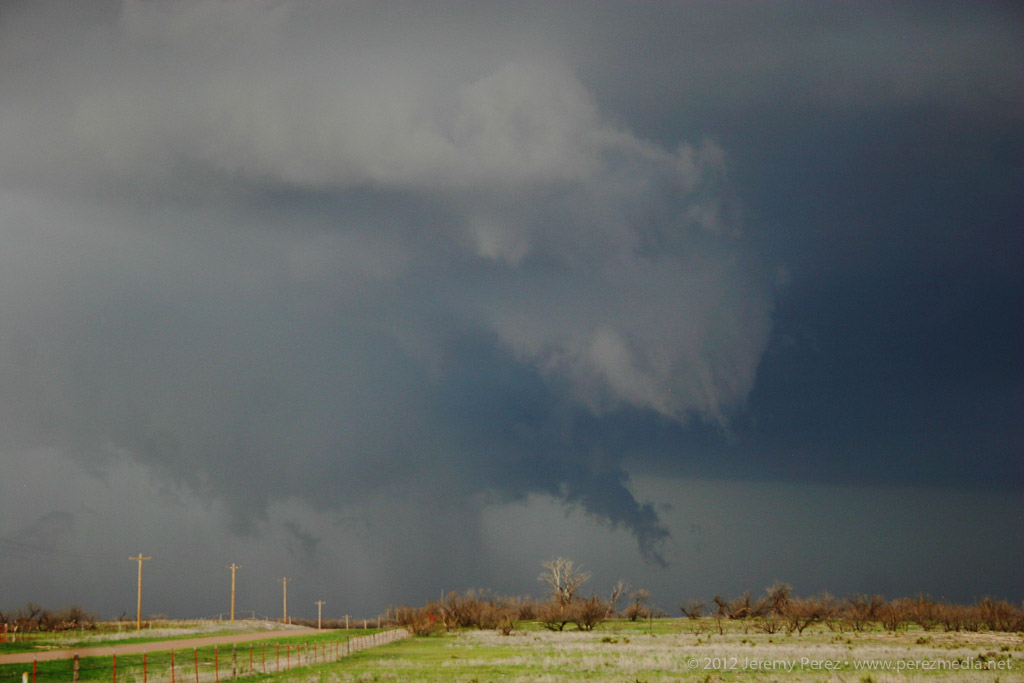
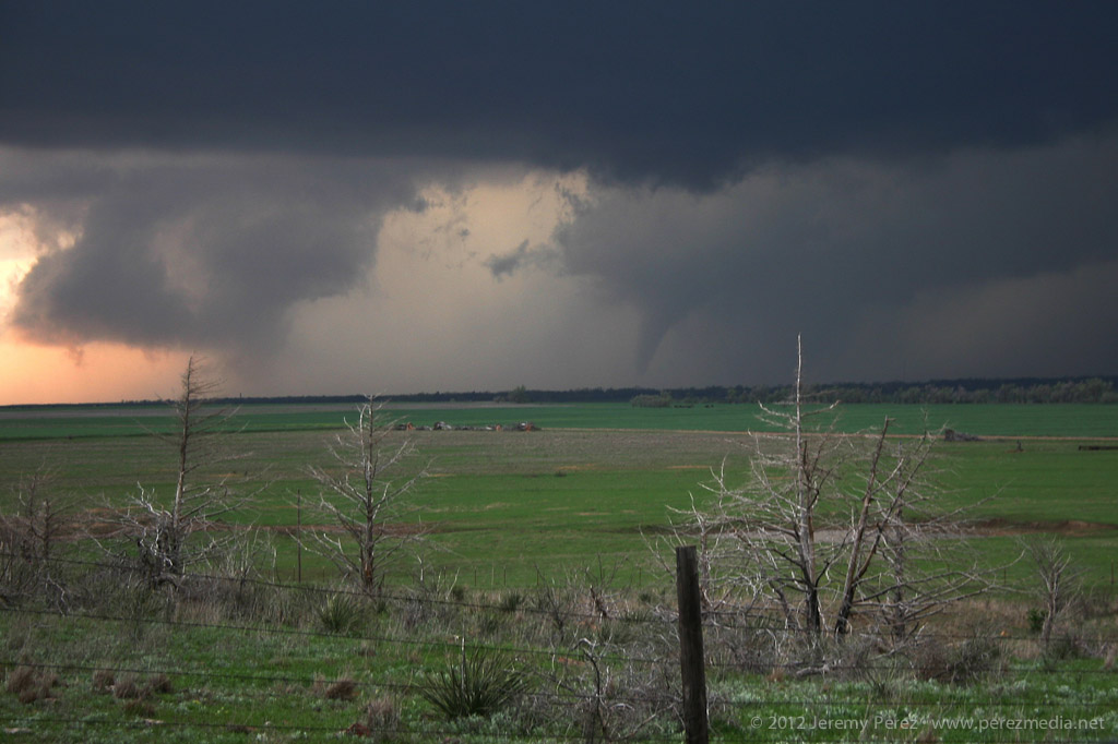
As I navigated northward near Granite, OK, I found a high vantage that gave me a view of a second tornado spinning up near Willow, OK (7:30 PM).
Willow Tornado (7:30 PM)
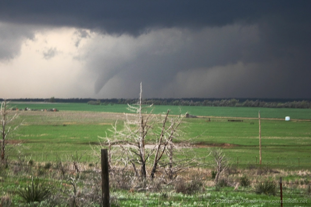
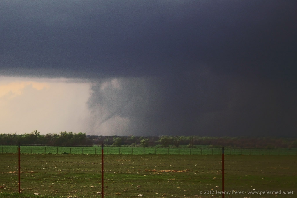
My third for the day spun up a few minutes later at 7:38 PM. This one lasted a couple minutes before the slender rope dissipated.
Third Tornado (7:38 PM)
I followed the storm a bit more as it approached Clinton, but lightning was too sporadic to make out any more features, so I made my way into Elk City for a big steak and fries at Western Sizzlin. Chasing solo, trying to run two cameras and experiencing this unbelievable storm gave me a case of full-blown sensory overload--I'm still having vivid flashbacks. It was a great chase and I can't wait for my next opportunity in the northern plains in June.
Video of Supercell and Tornadoes in Southwest Oklahoma
Links to reports and photos from others chasing the storm: