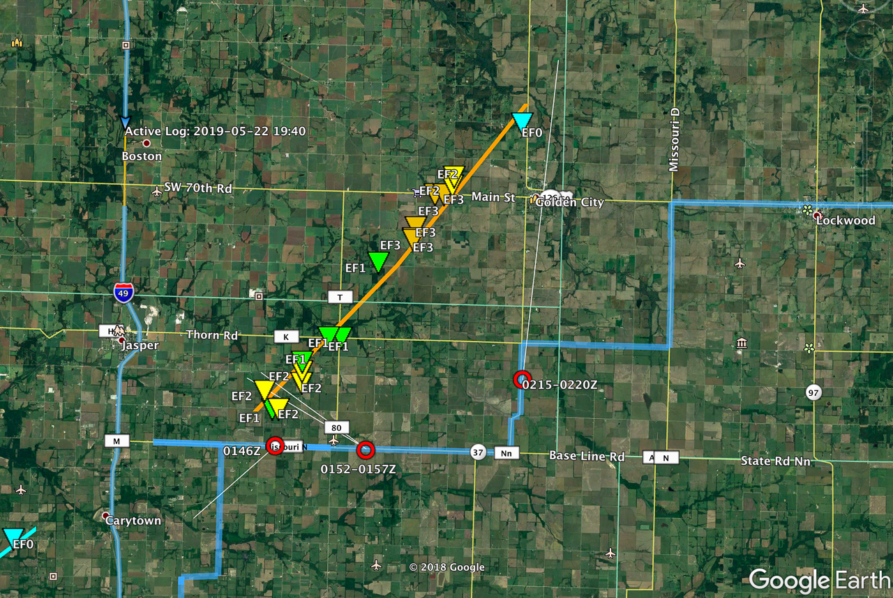
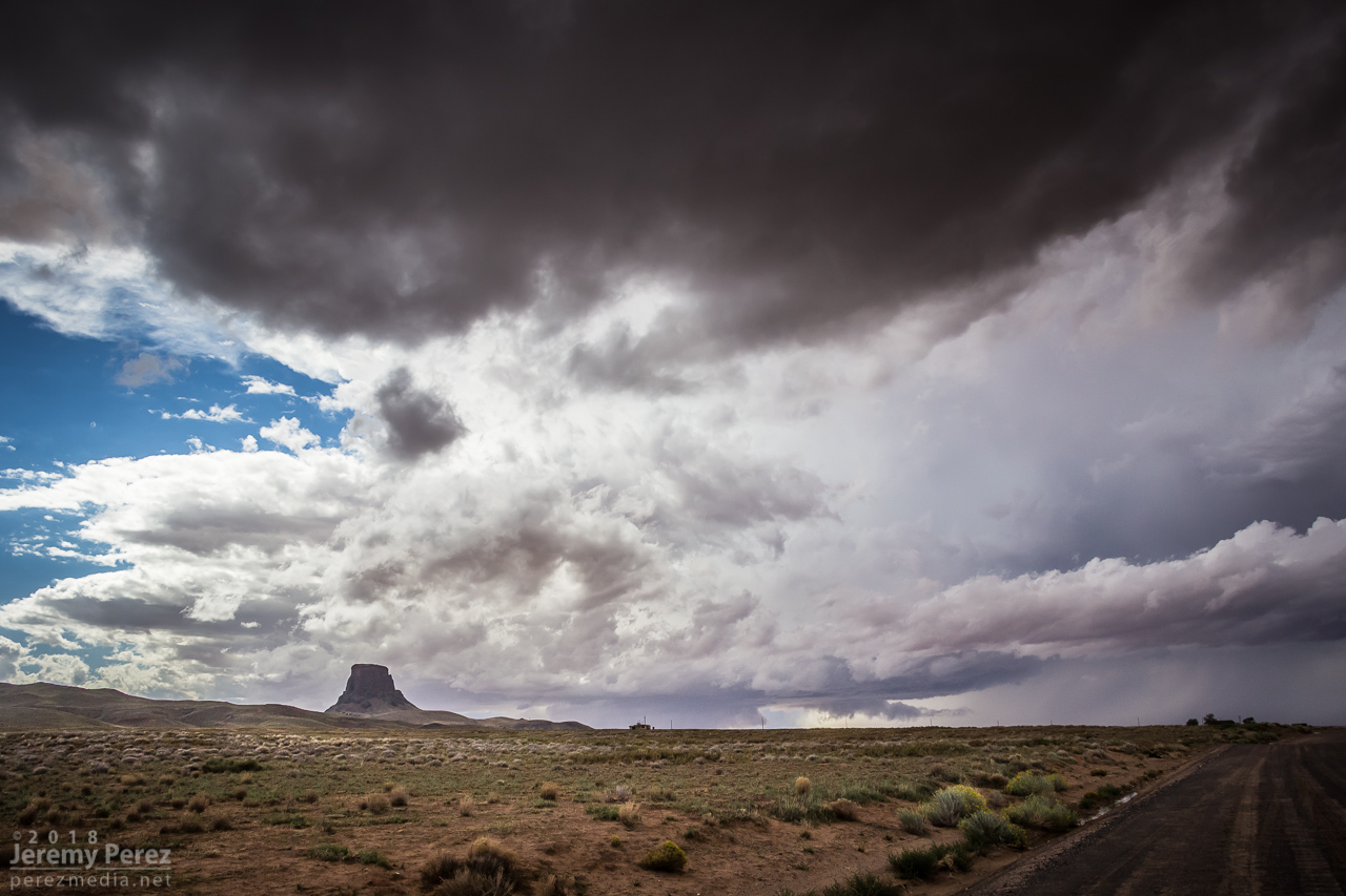
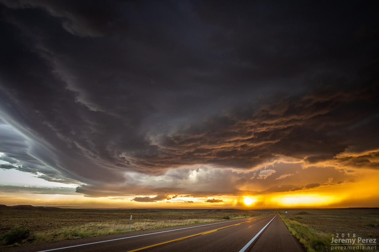
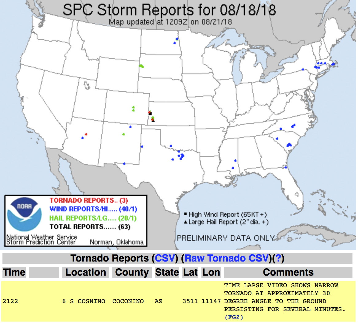
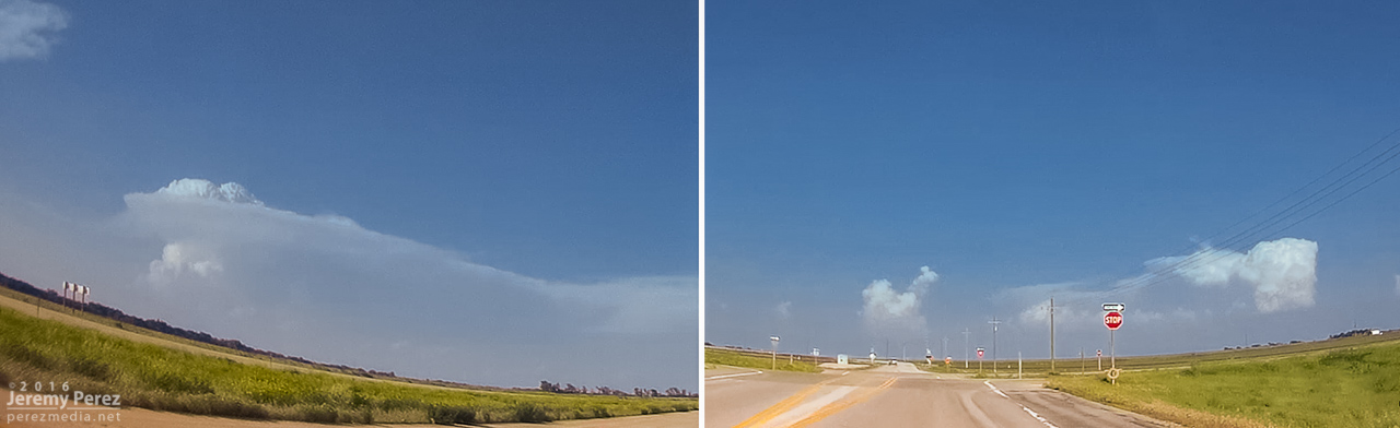
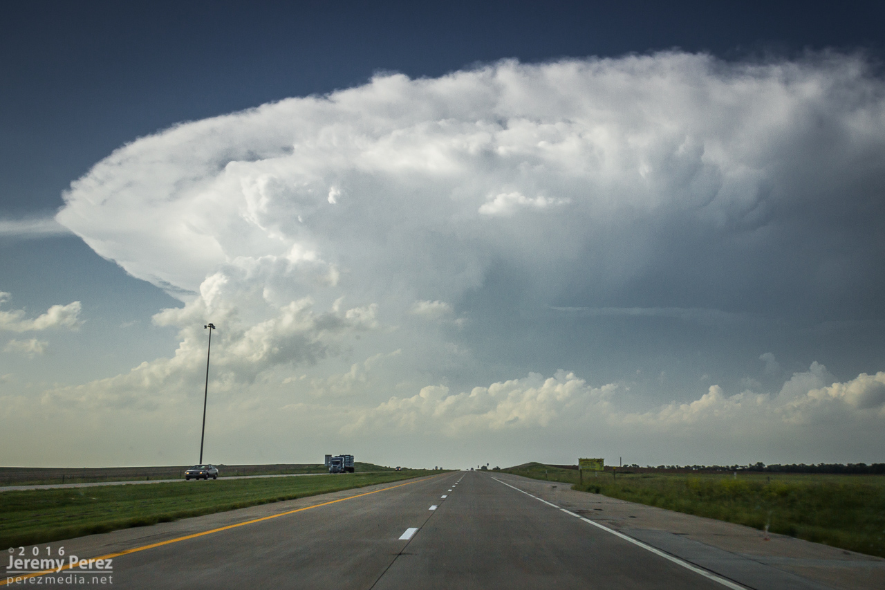
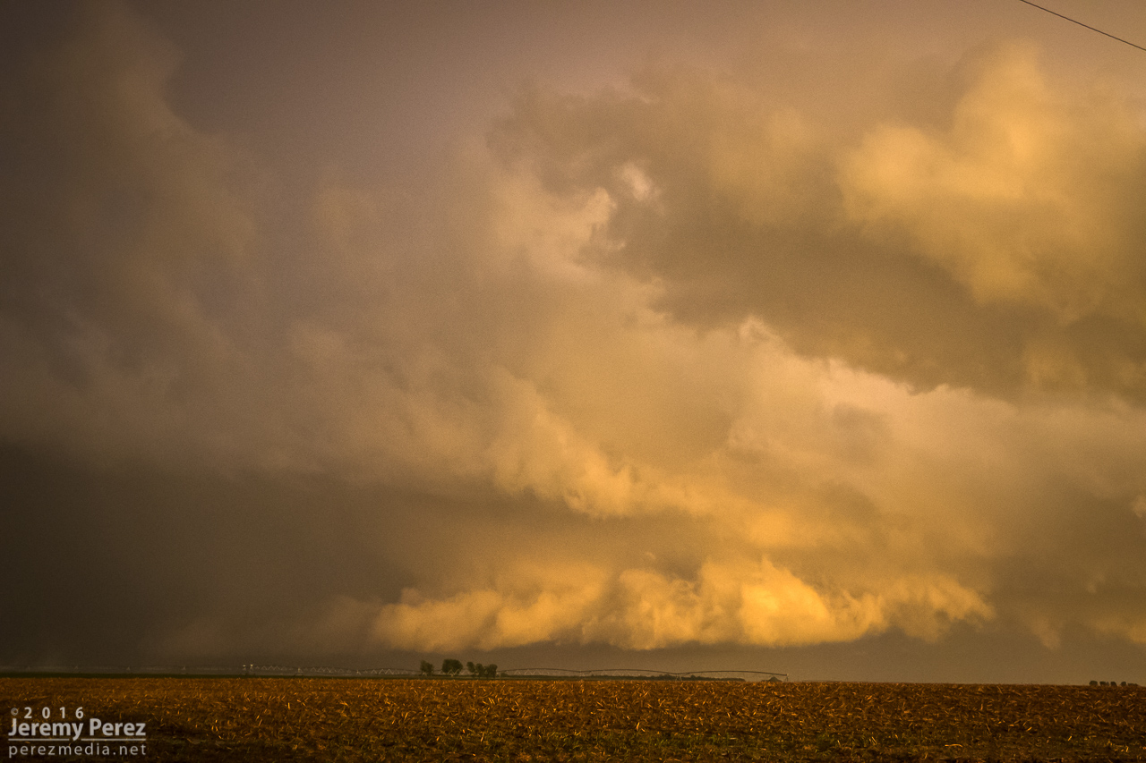
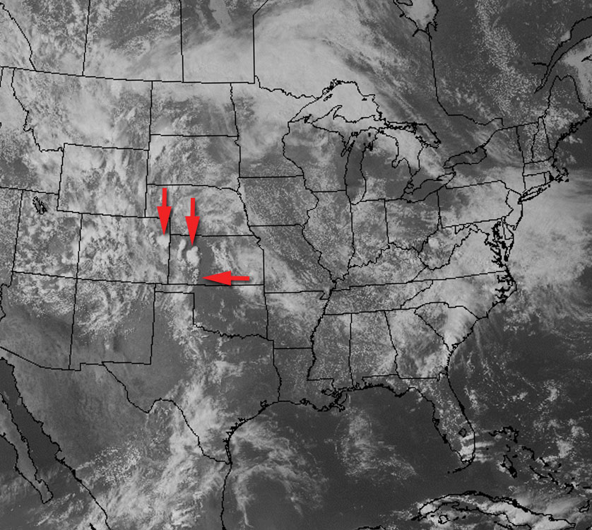
We started this day off out of Wichita after busting on the cold core setup the day before. After scrutinizing posted road closures and construction zones, we got moving and stopped near Pittsburgh, KS. Around 00Z a tornado warned cell nudged us into Missouri for a first attempt before it weakened as it moved out of Kansas. Another cell was strengthening to its southwest though, so we headed south to Carthage and explored vantages and road network as that one approached.
I was surprised how consistently paved the roads were in the area. As long as we could stay out of the river valleys, the grid tested out excellent with a lot of good visibility. I wound up liking Base Line Blvd southeast of Jasper for an intercept that would keep us in flatter terrain to pace on to the northeast for a reasonable distance before Stockton Lake would become a problem.
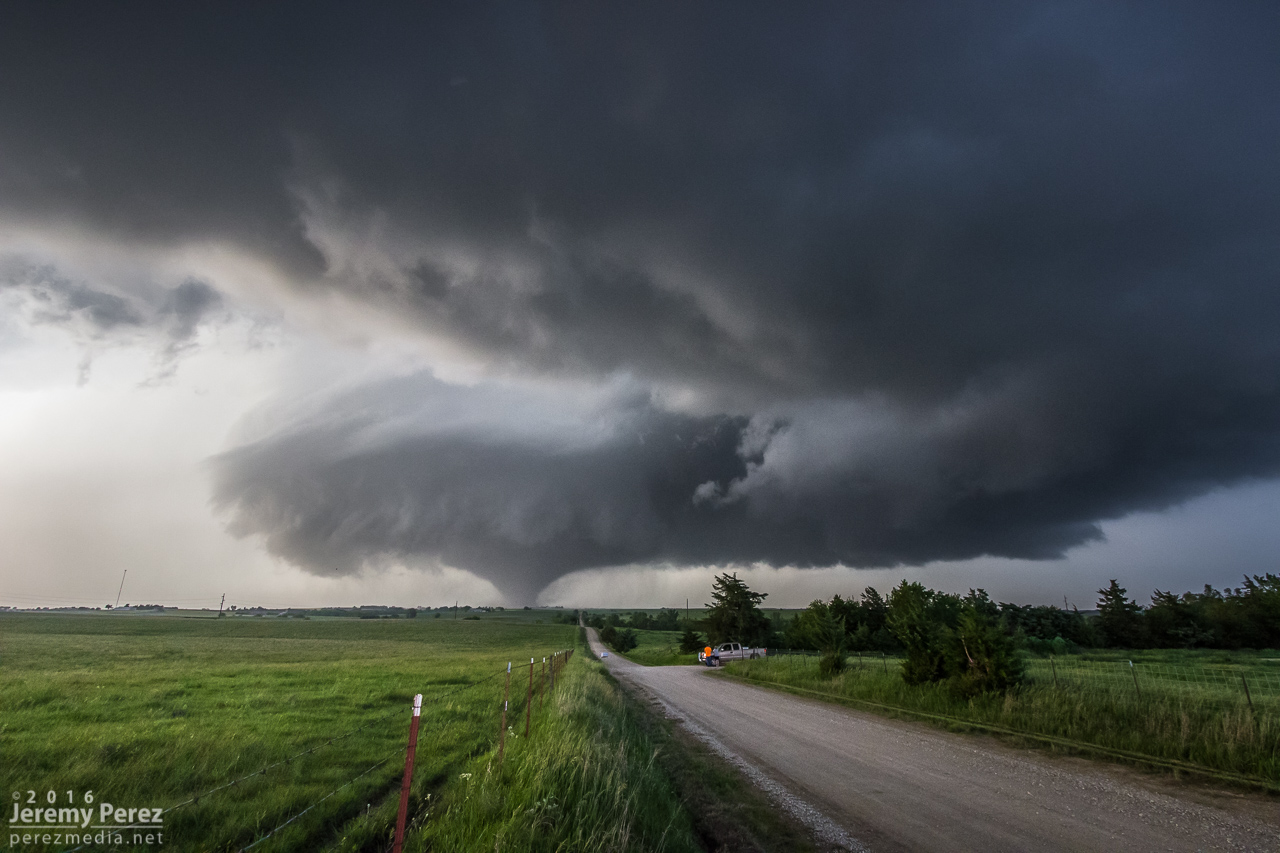
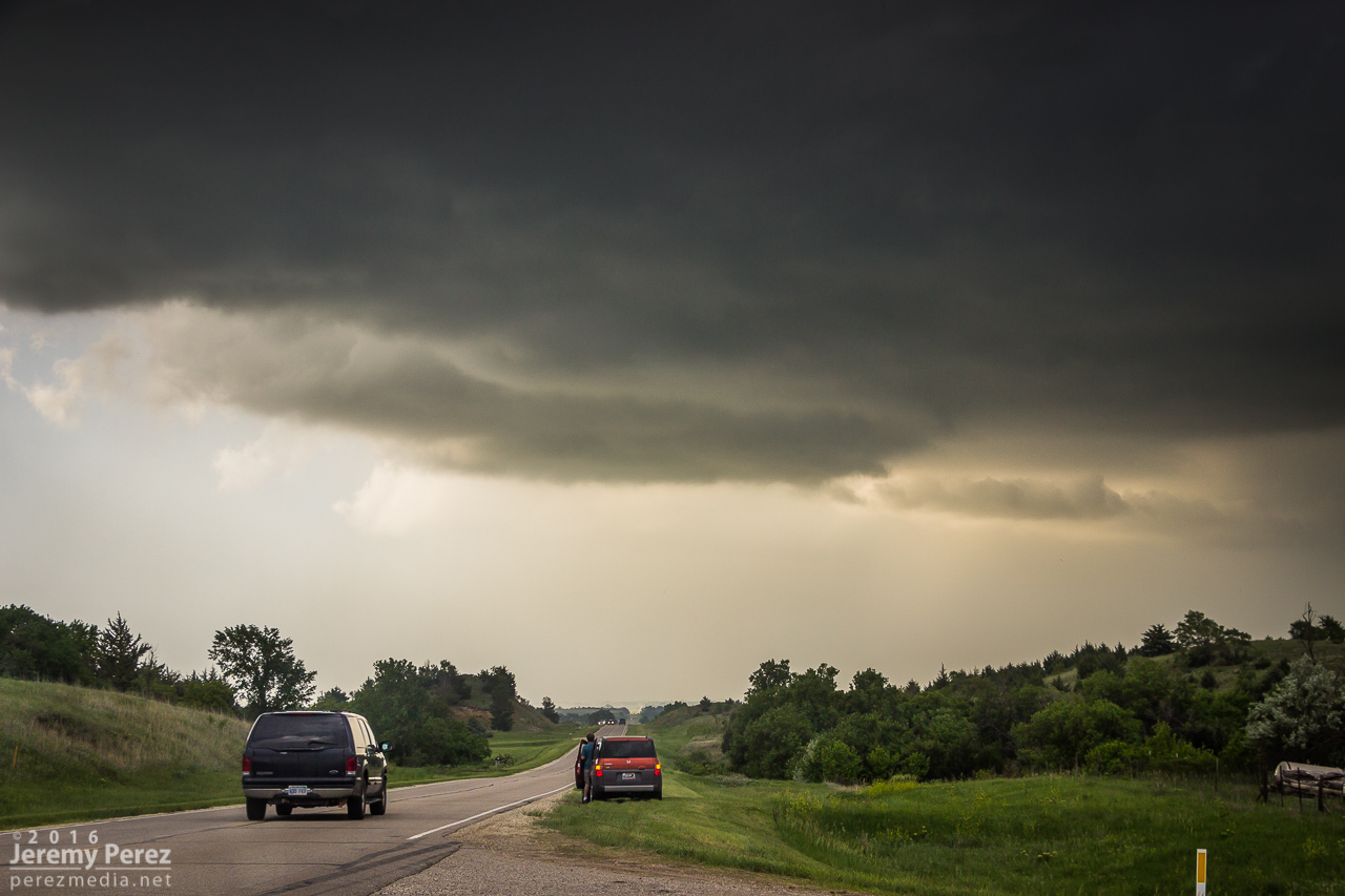
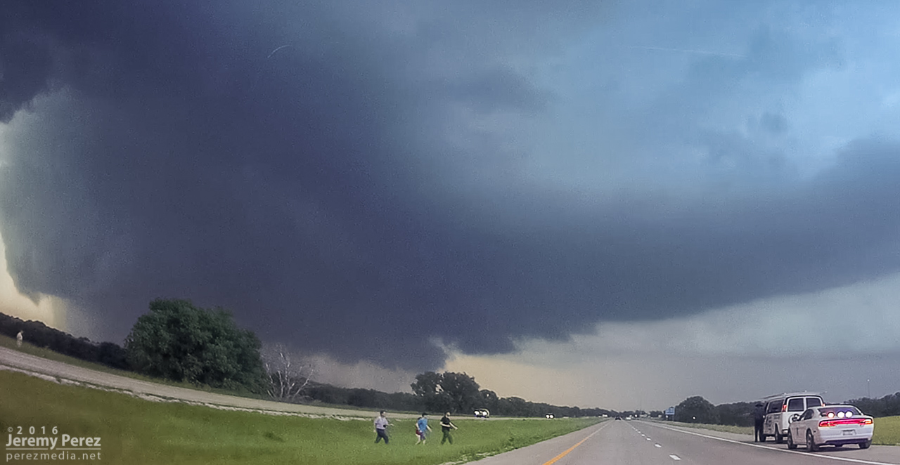
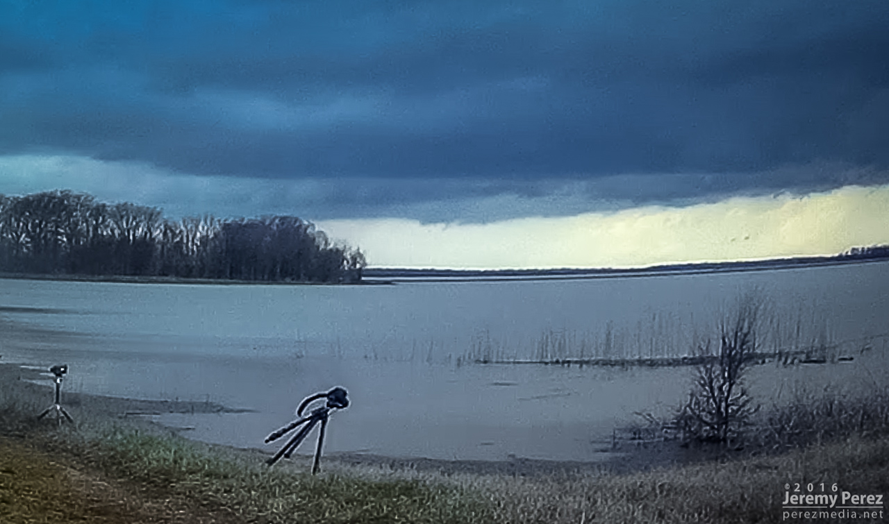
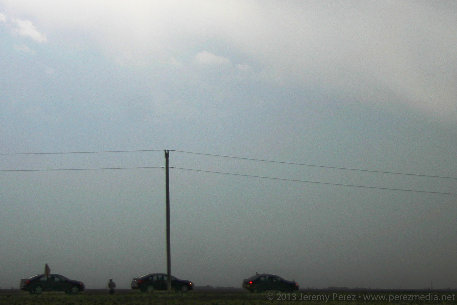
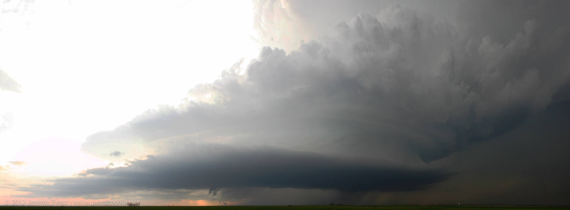
I jockeyed back and forth to make sure my escape routes and vantages looked good. The sun had gone down and it was getting dark just as the base and wall cloud started to take shape to the southwest. What unfolded next was so like my storm-photography nightmares that I caught myself actively wondering if I was actually having a dream. I was just a few days into actively using a new camera and lenses and as much as I thought I’d developed reflexive control and worked out any glitches, I was totally wrong. The first surprise issue was back button focus not working, which quickly morphed to the aperture not adjusting from the dial I thought I had it set for, which then cliff-dove straight into some horrifying card-write error. All of this while the storm was quickly winding up about 3 miles southwest and closing.
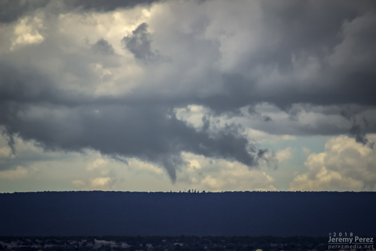
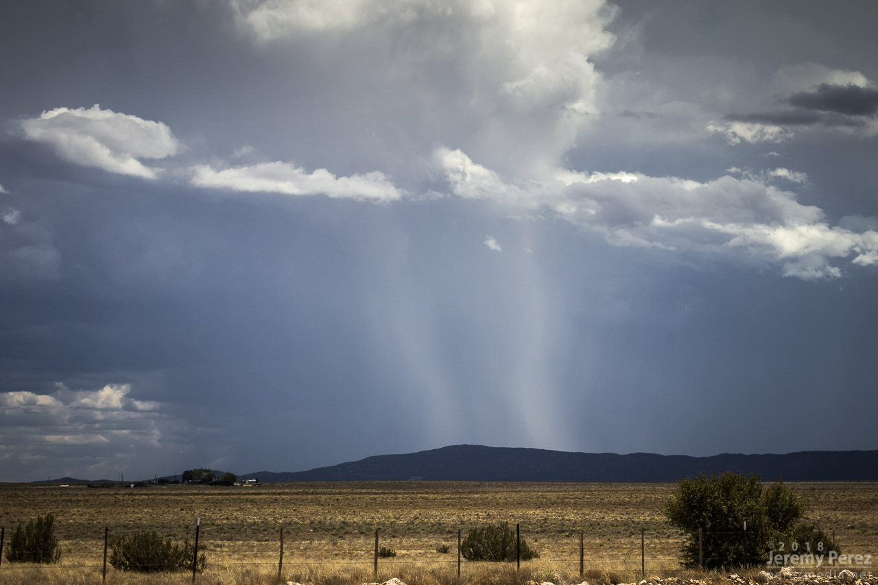
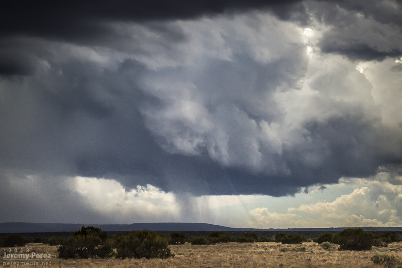
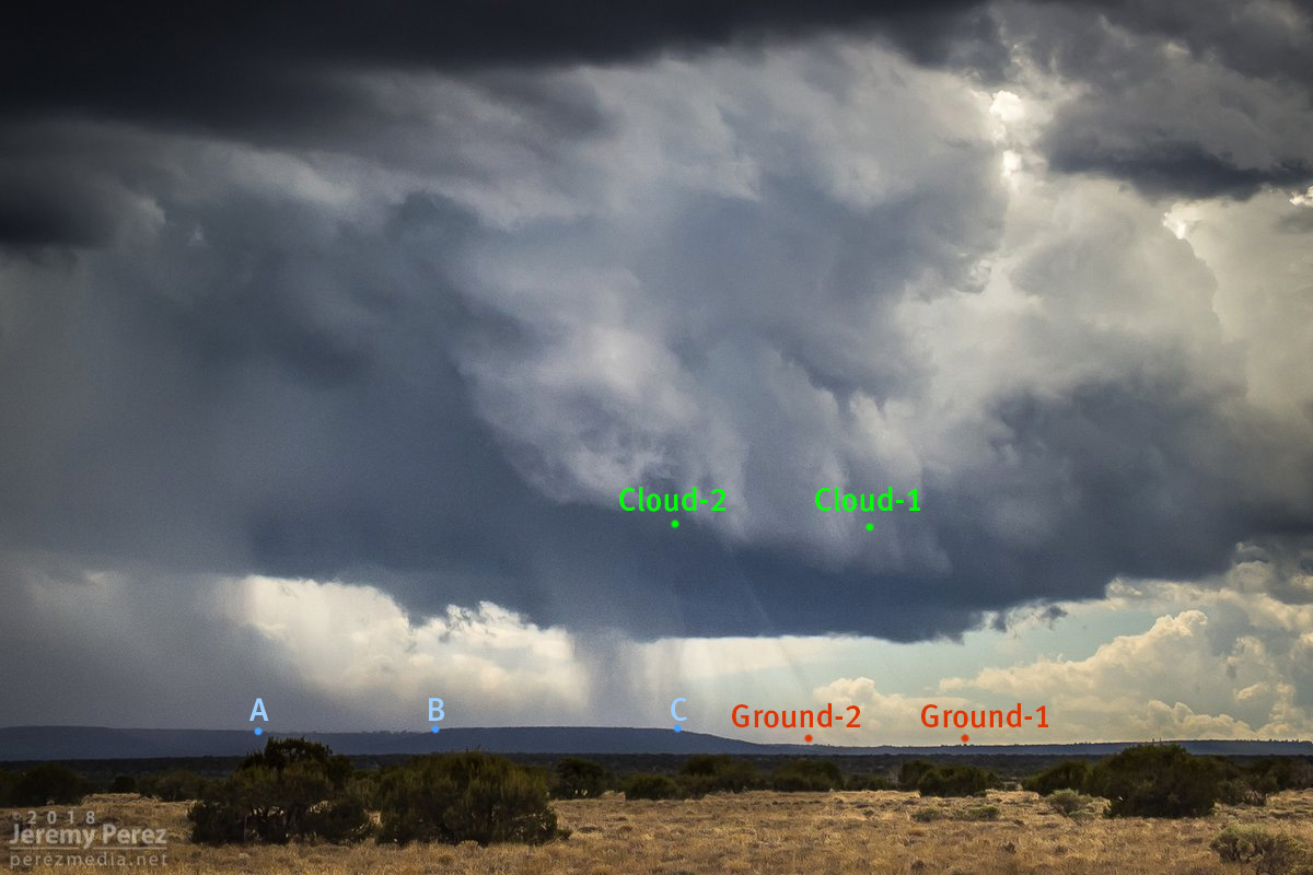
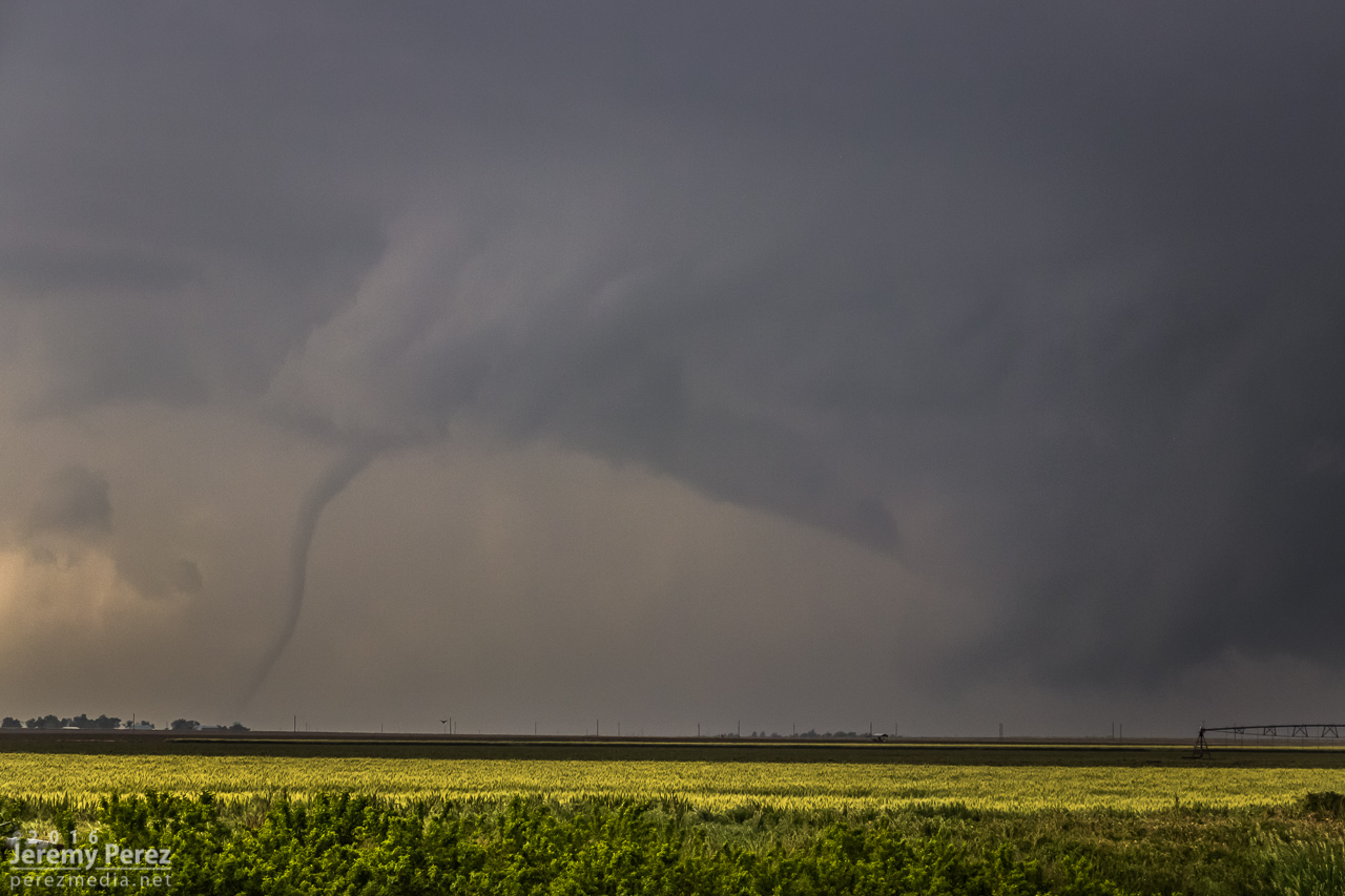
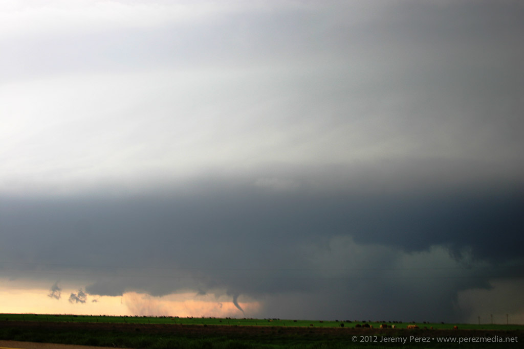
0146Z — blurry shots as storm approaches with possible funnel/debris toward left side—didn’t notice that smaller detail in the gloom at the time.
The first couple issues were frantic forgetfulness on my part, but the third glitch was due to a unique lens-camera-zoom-preview settings combo bug that I didn’t figure out until a couple weeks later. At the time, it was all just nightmare gremlins in deep twilight when every setting is critical, with a dangerous storm bearing down. After rebooting the camera a couple times, we jetted east a couple miles and tried again. By this time, I had re-set the camera to factory settings, which probably made things worse, and now I didn’t have decent light sources to focus on.
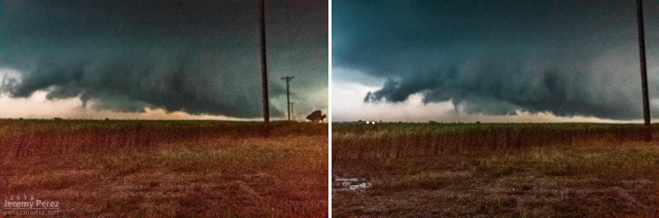
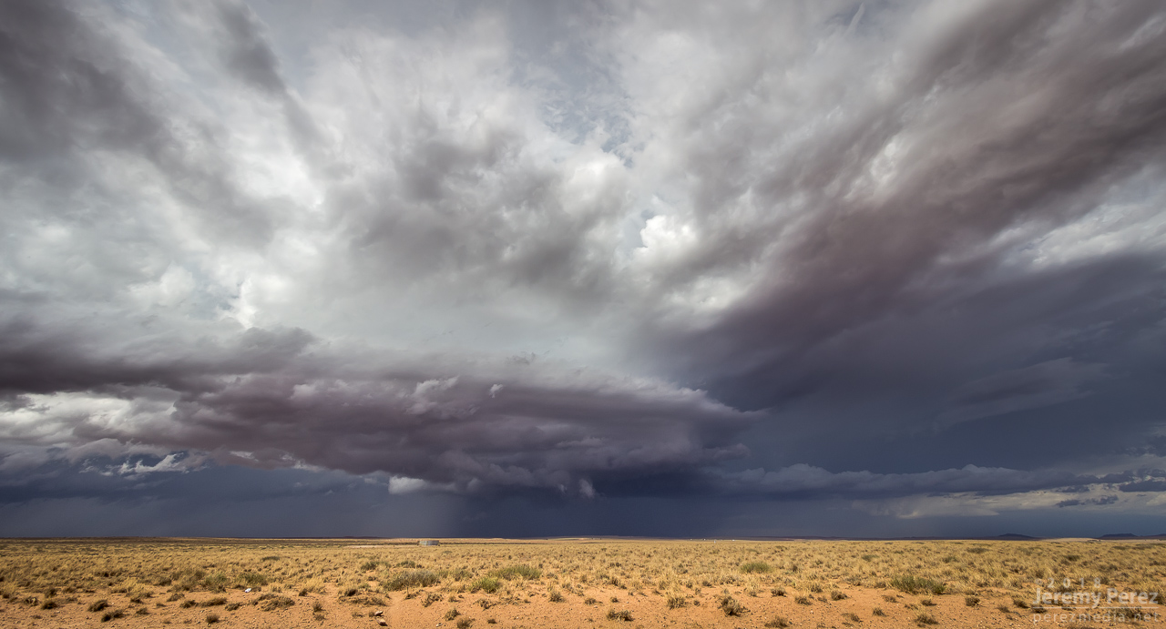
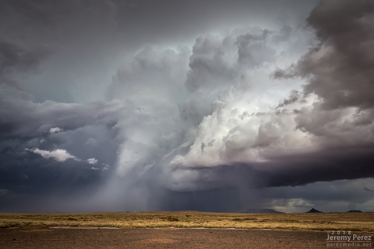
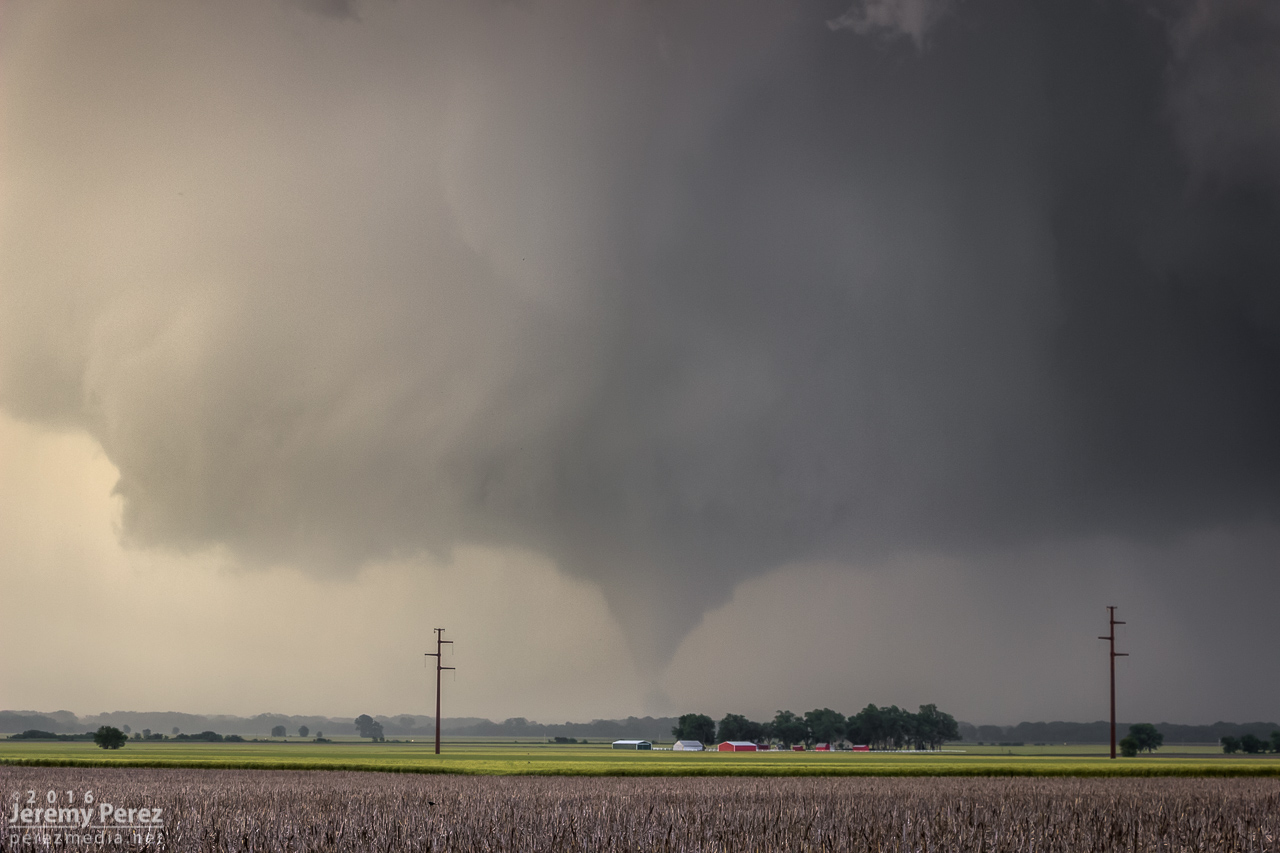
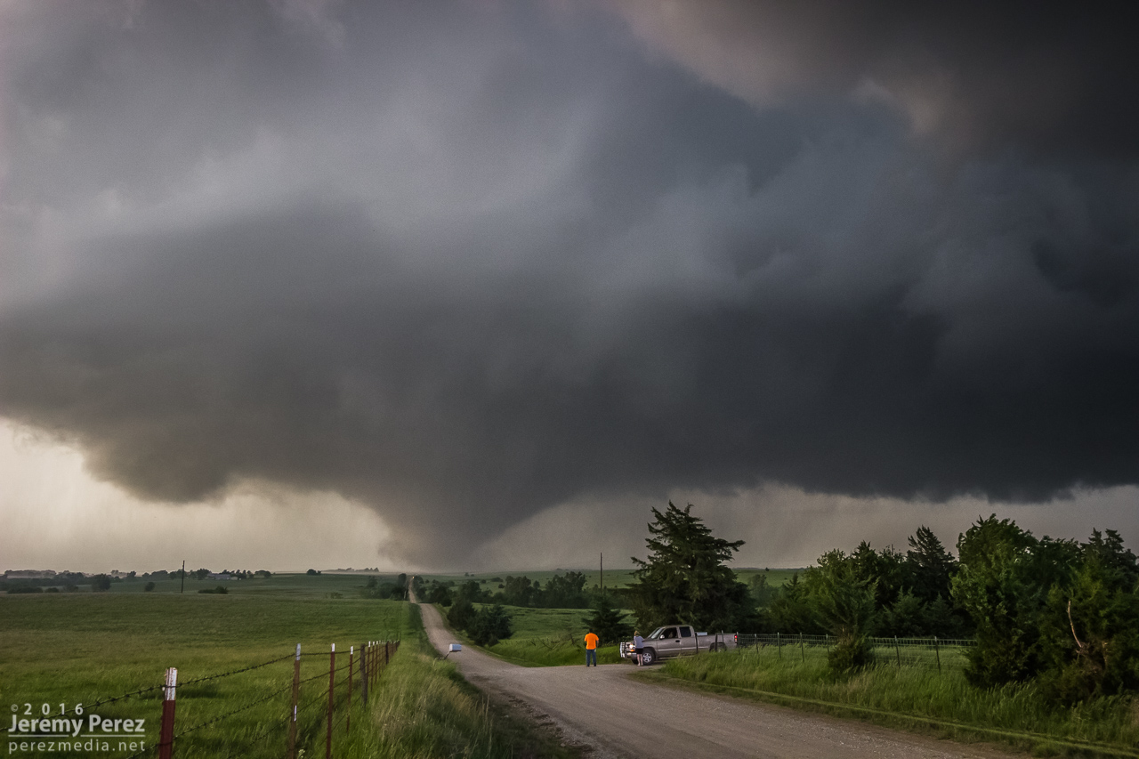
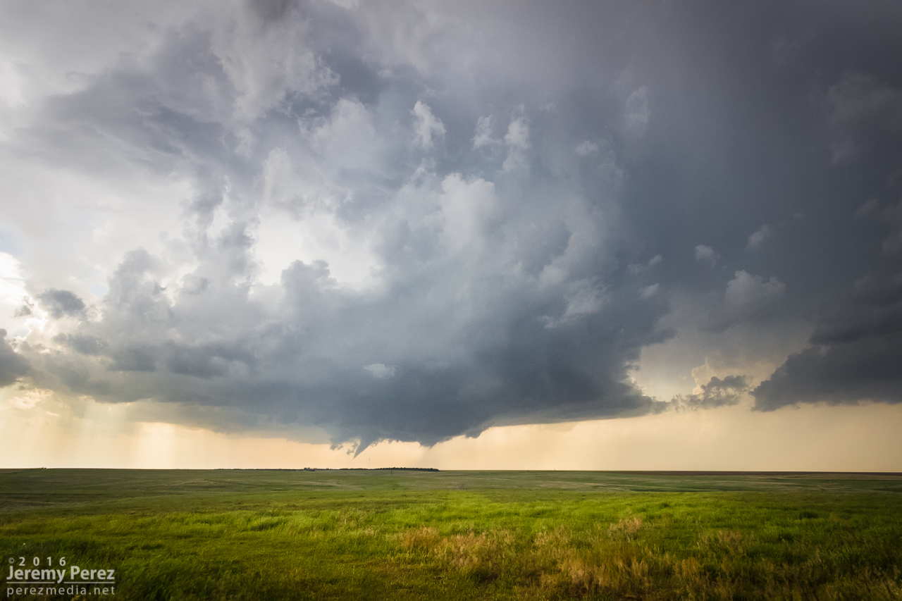
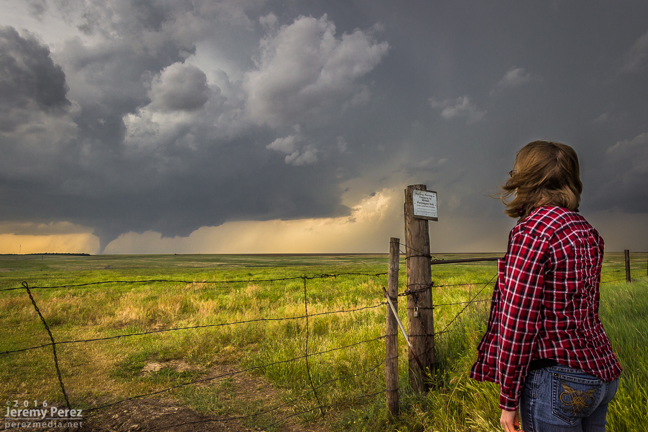
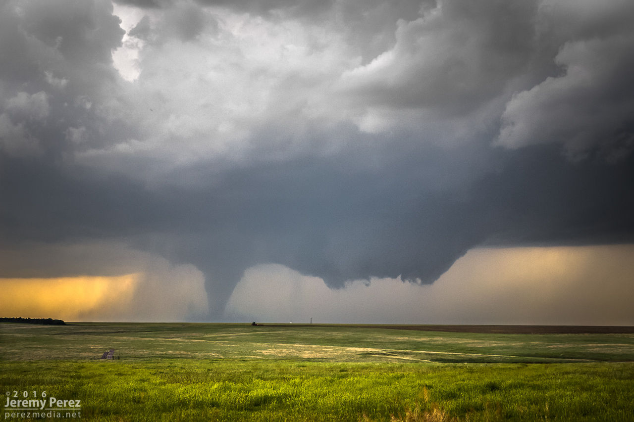
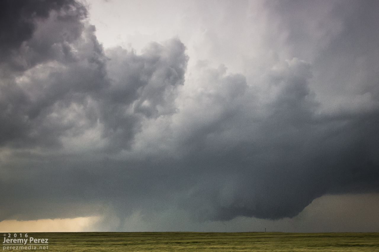
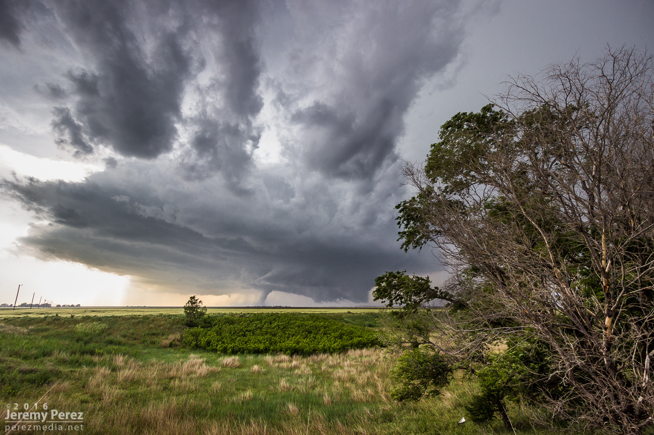
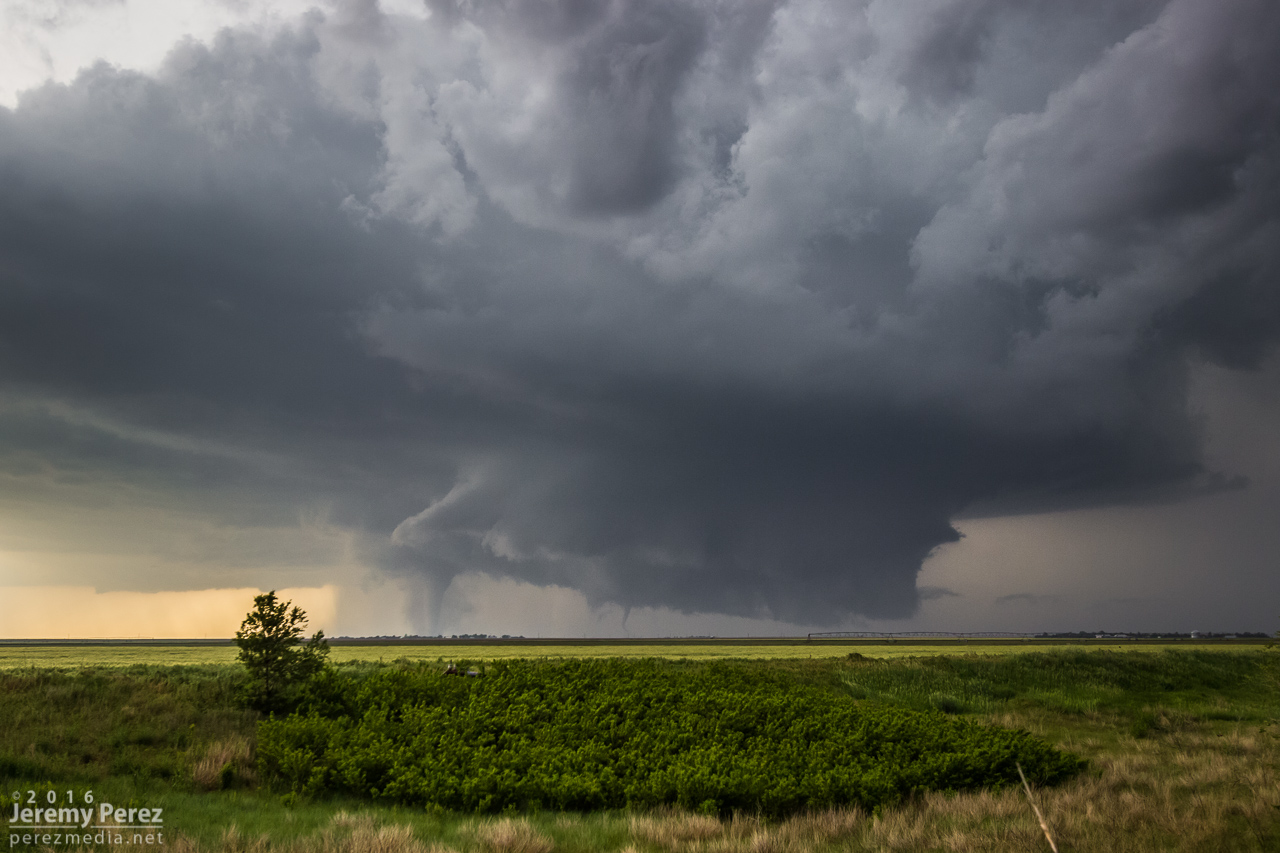
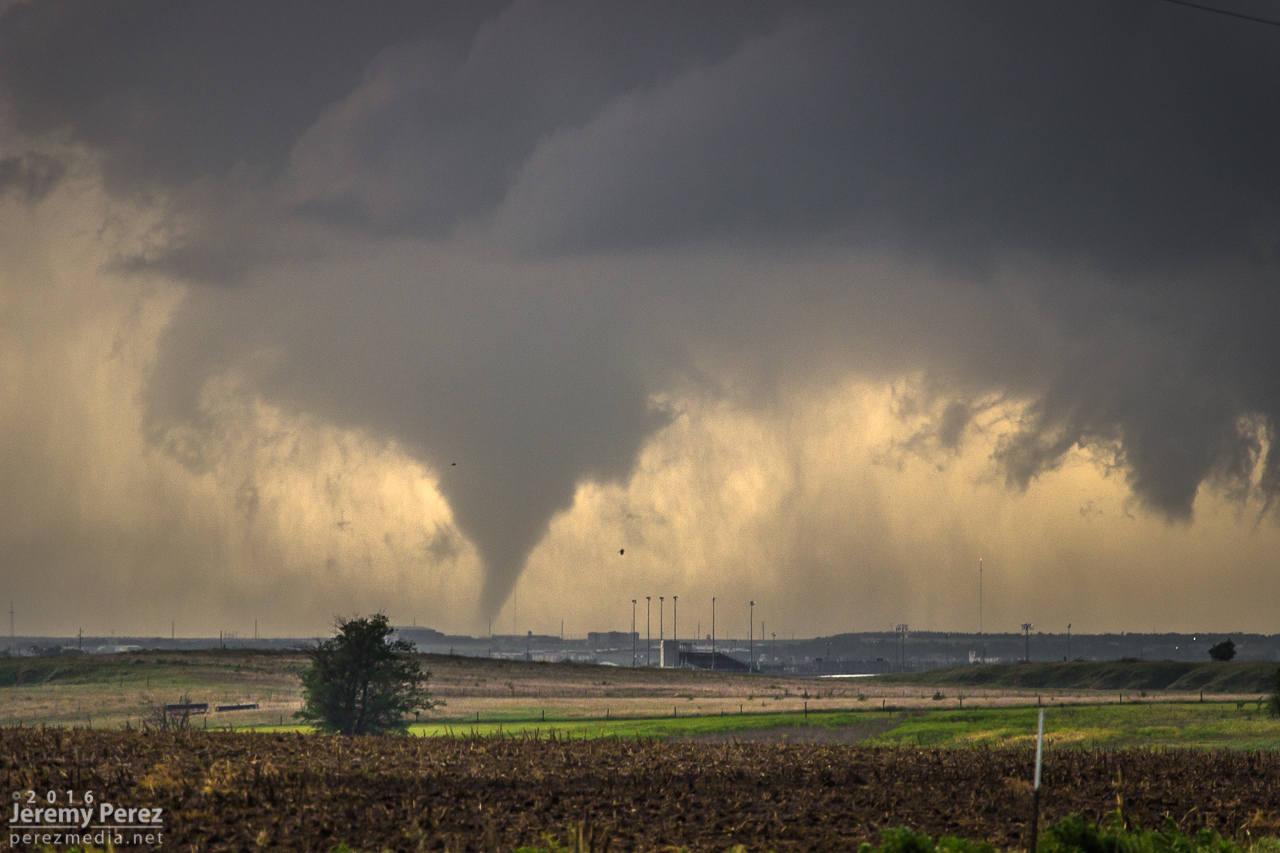
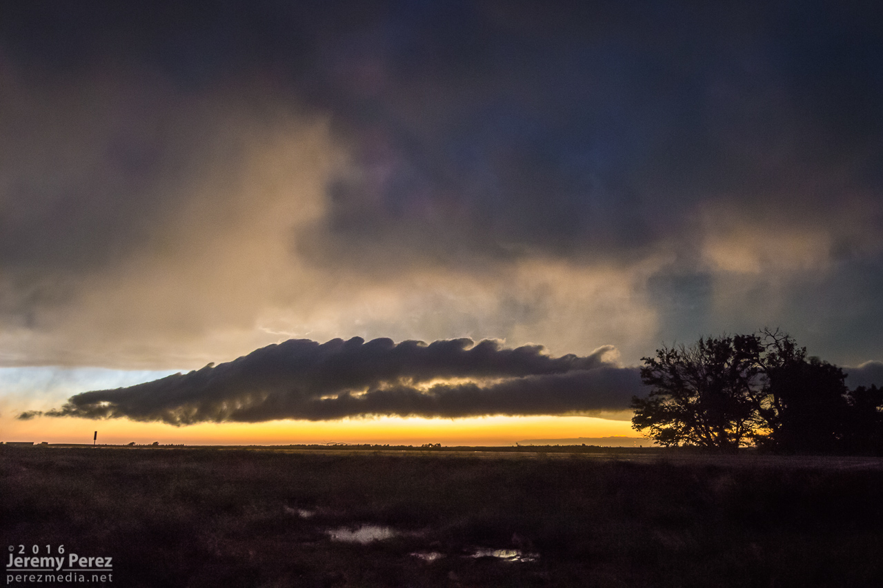
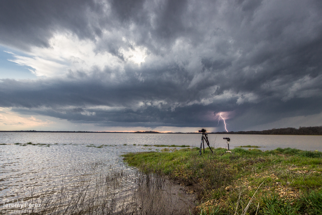
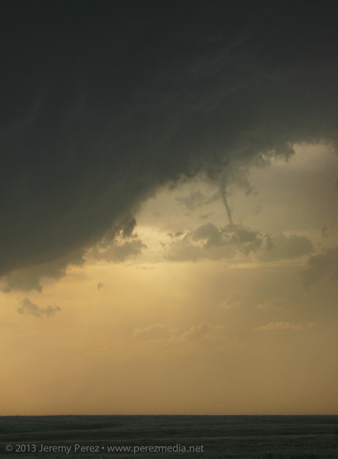
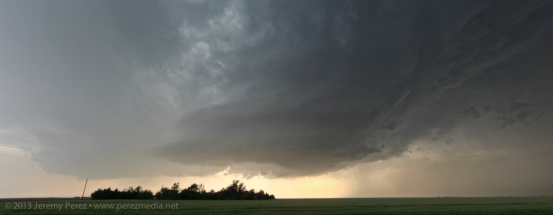
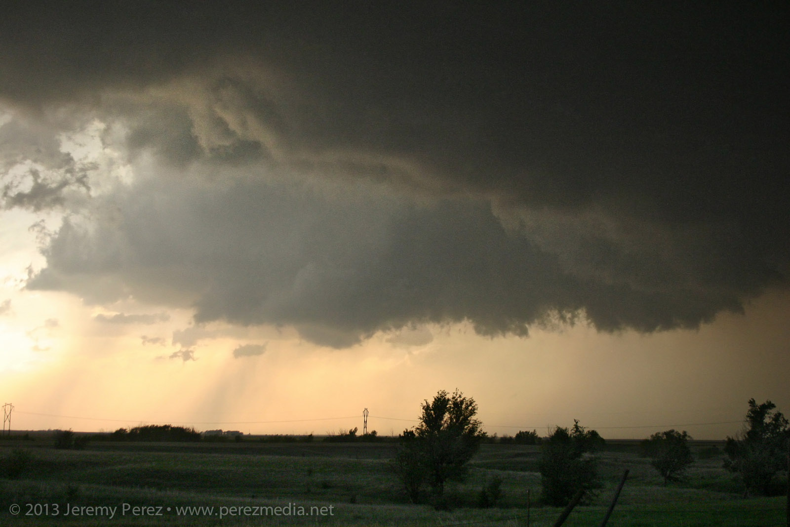
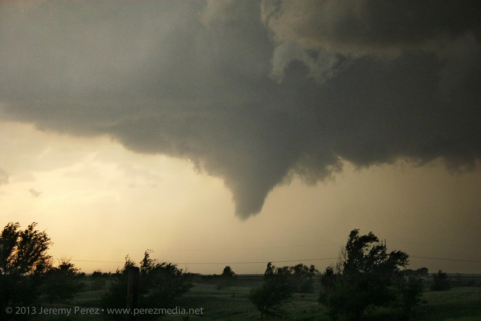
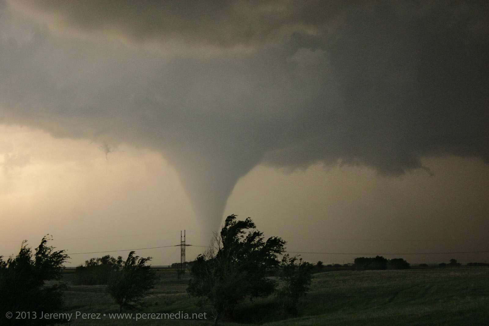
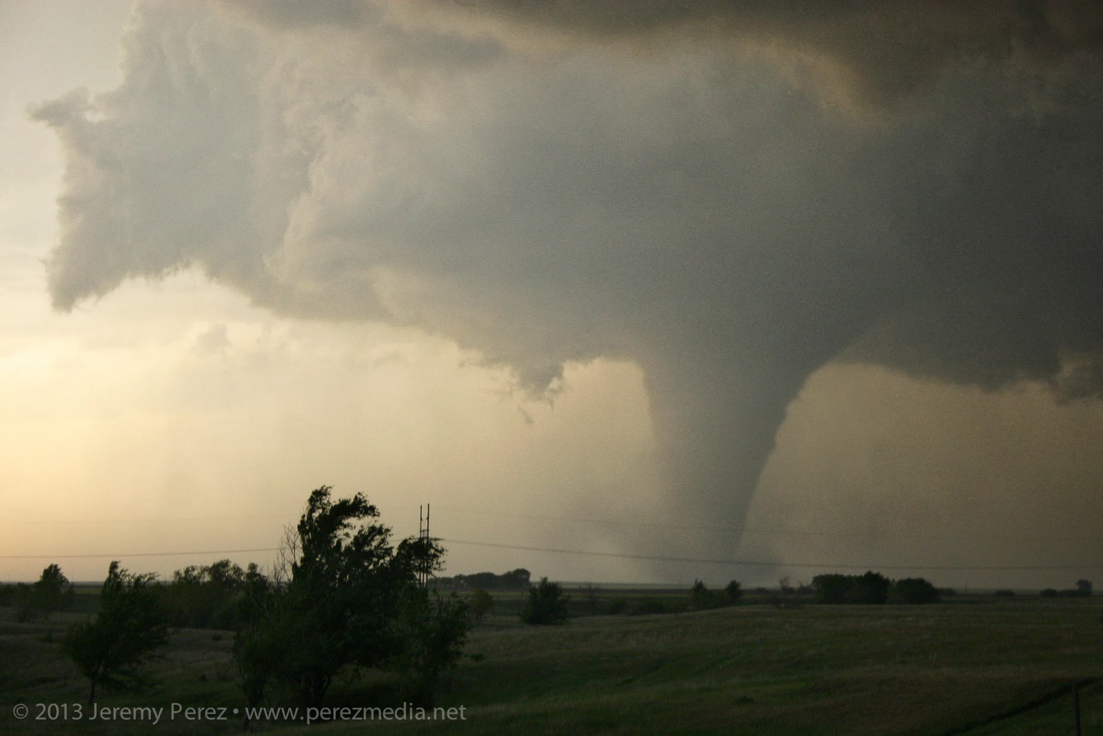
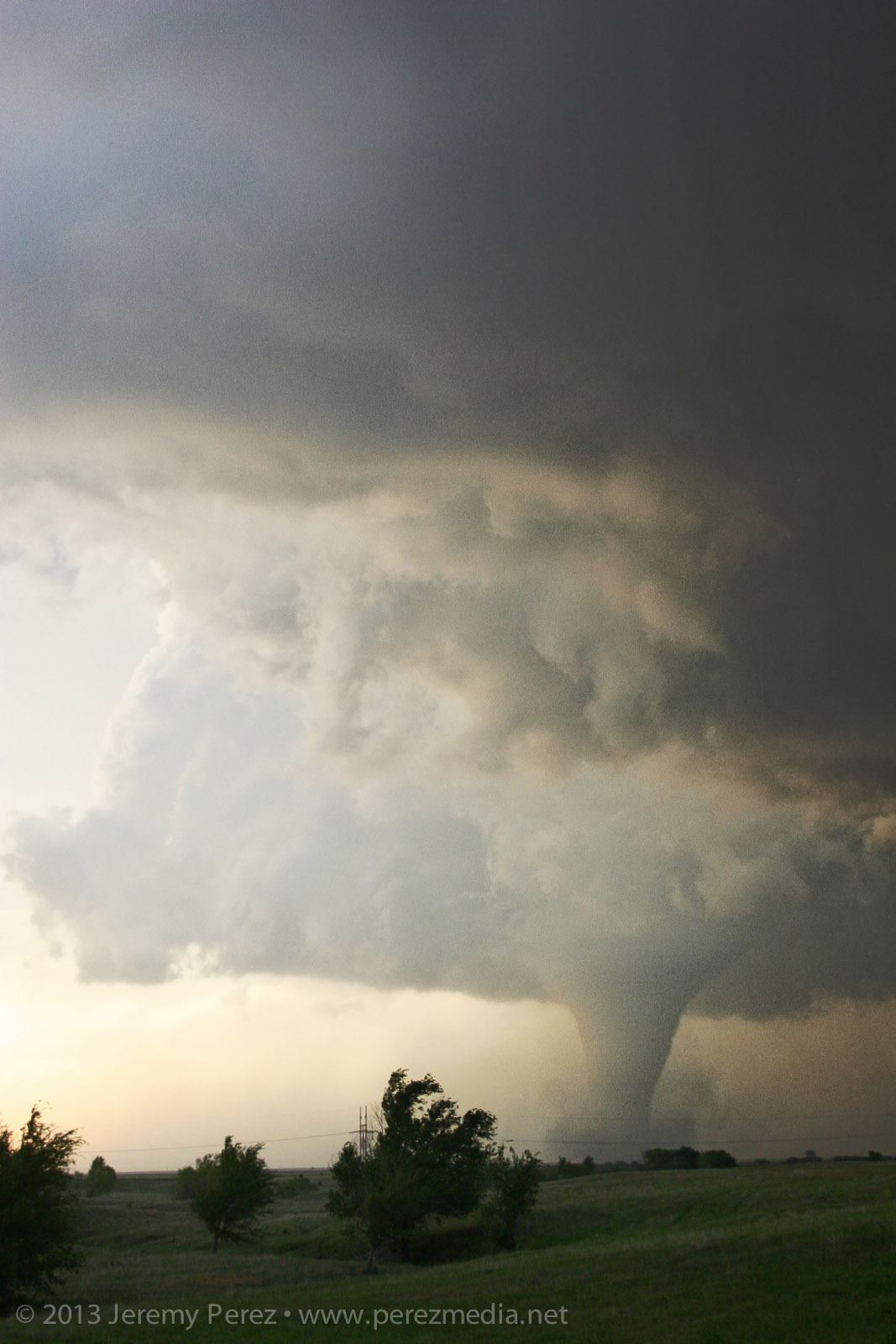
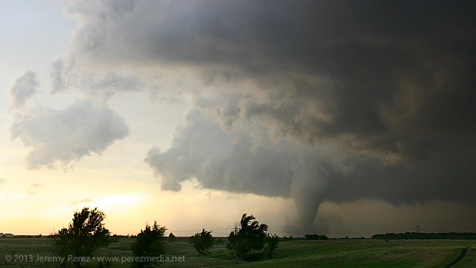
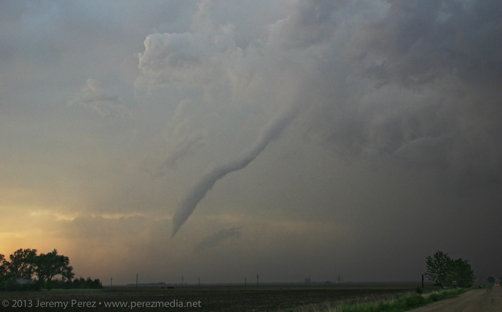
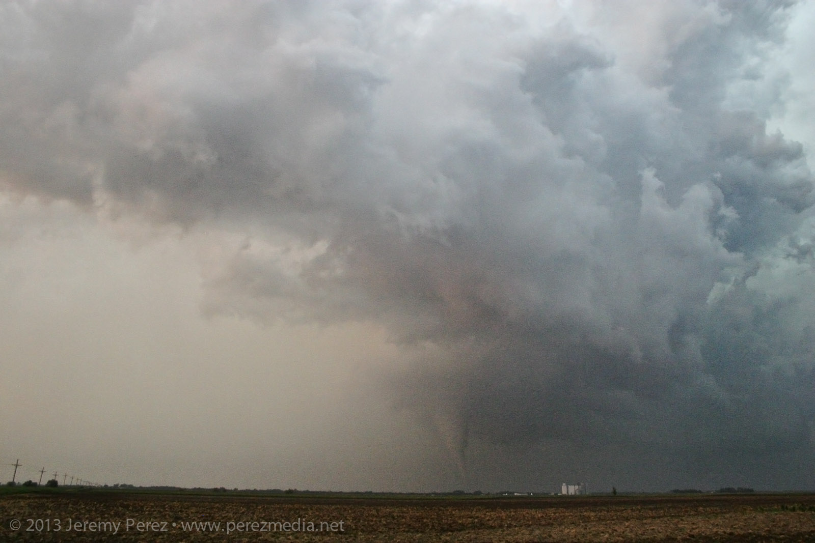
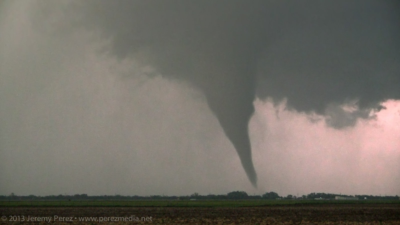
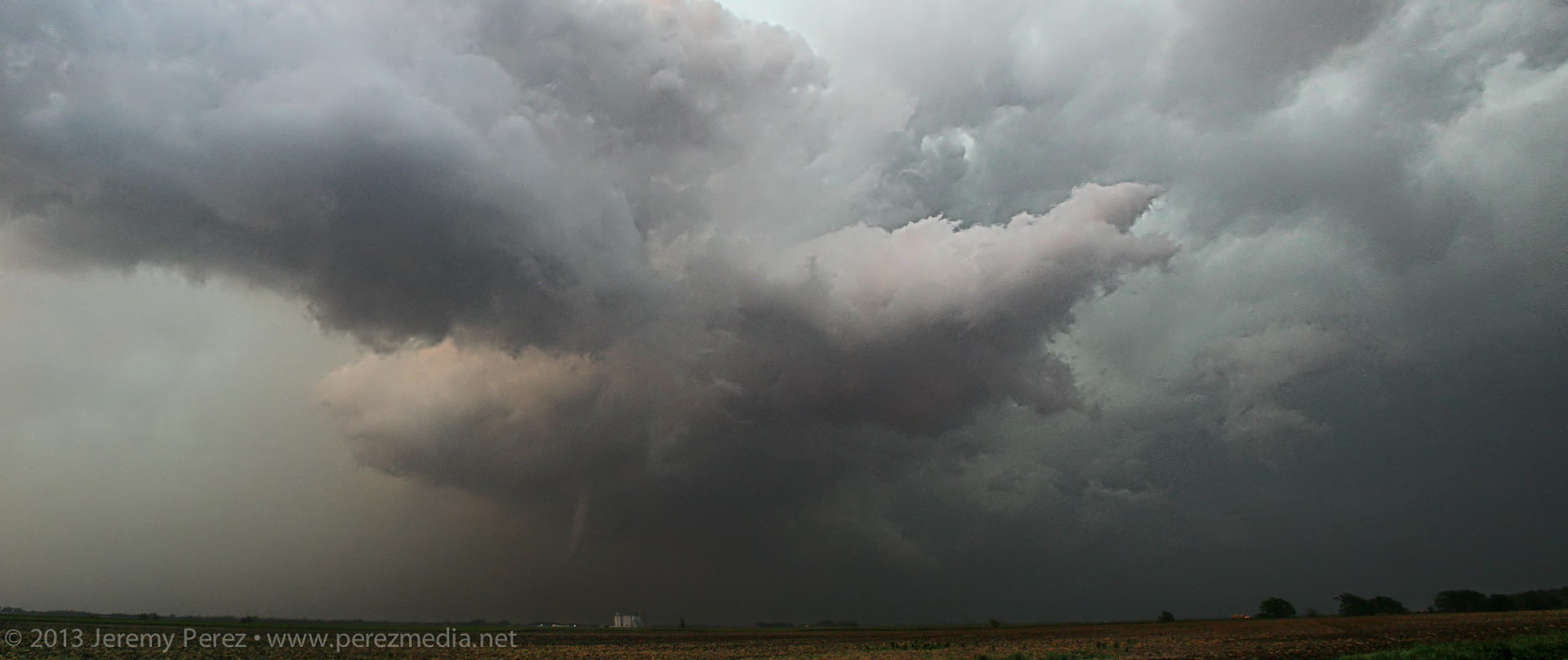
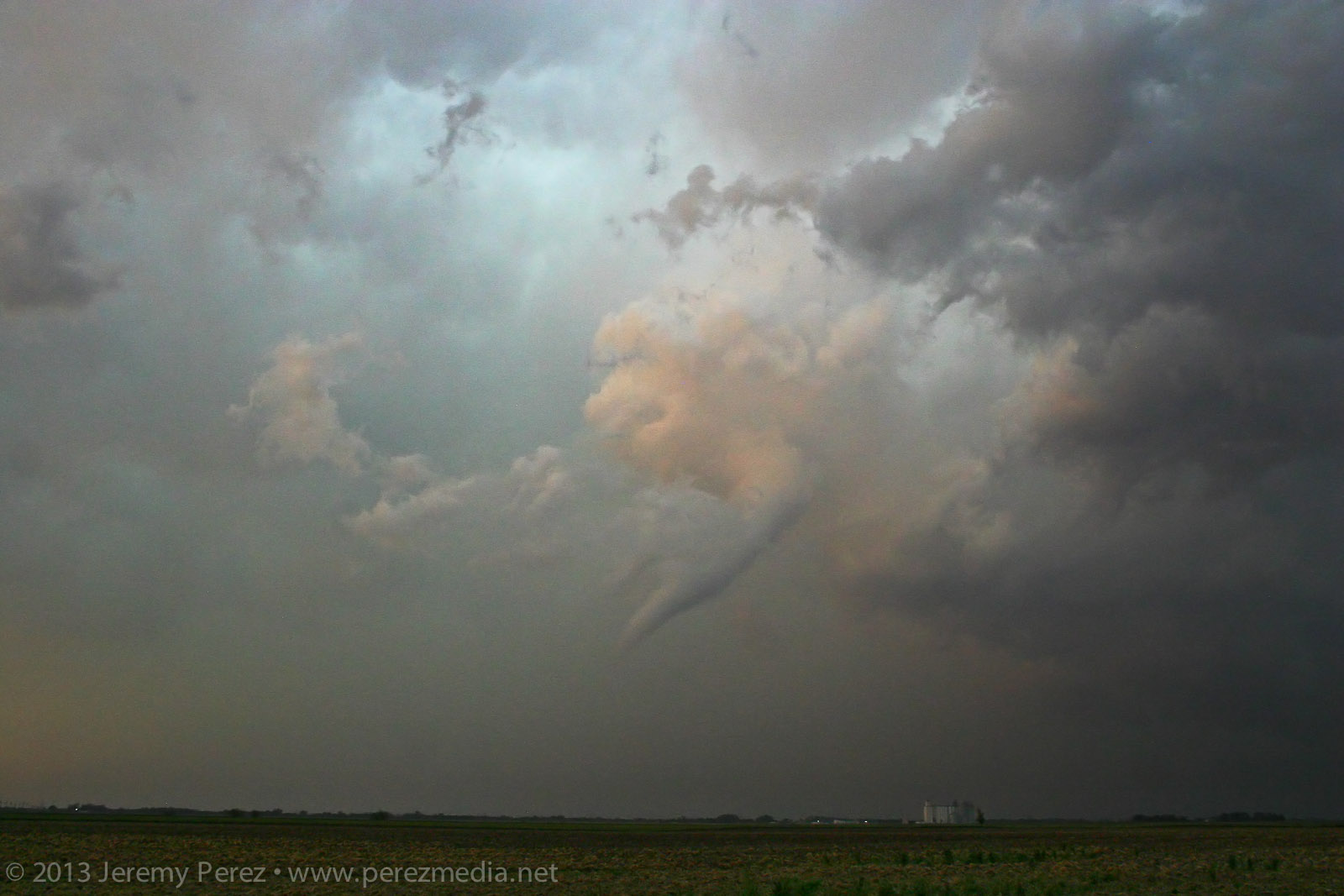
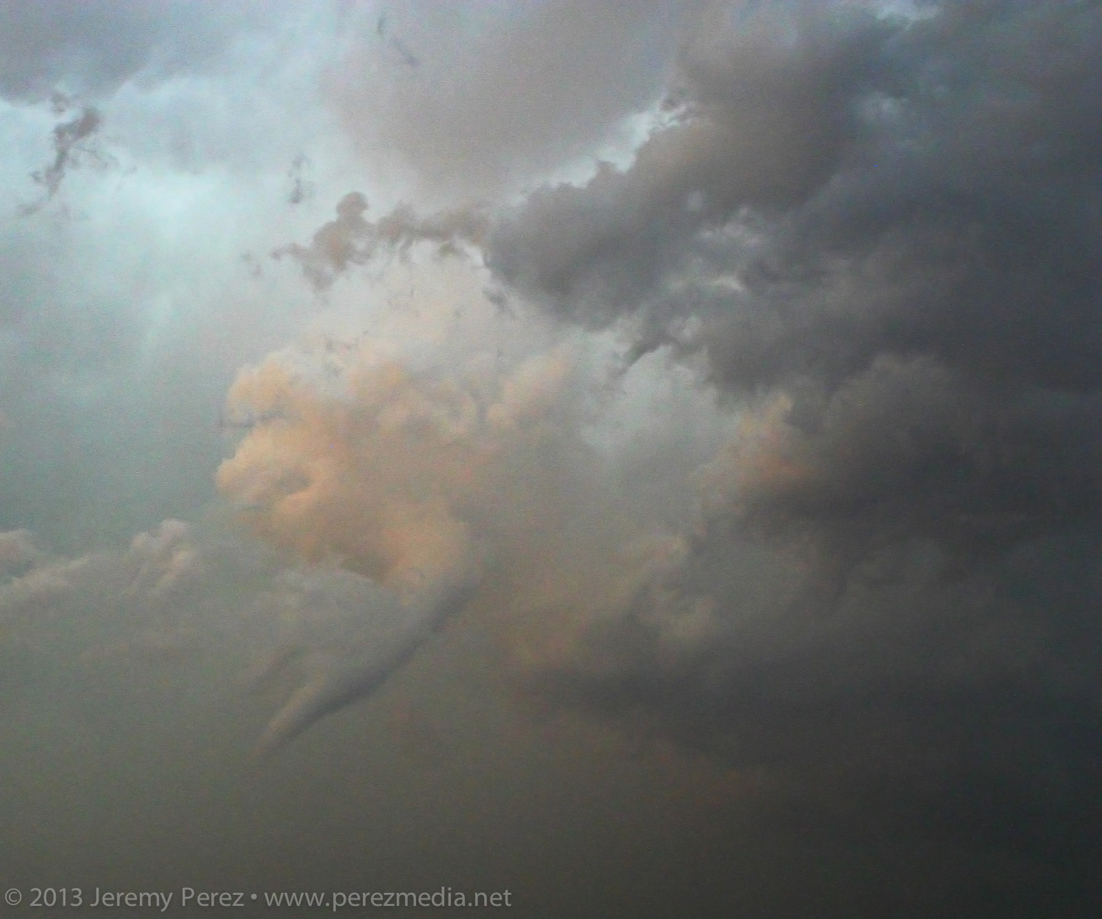
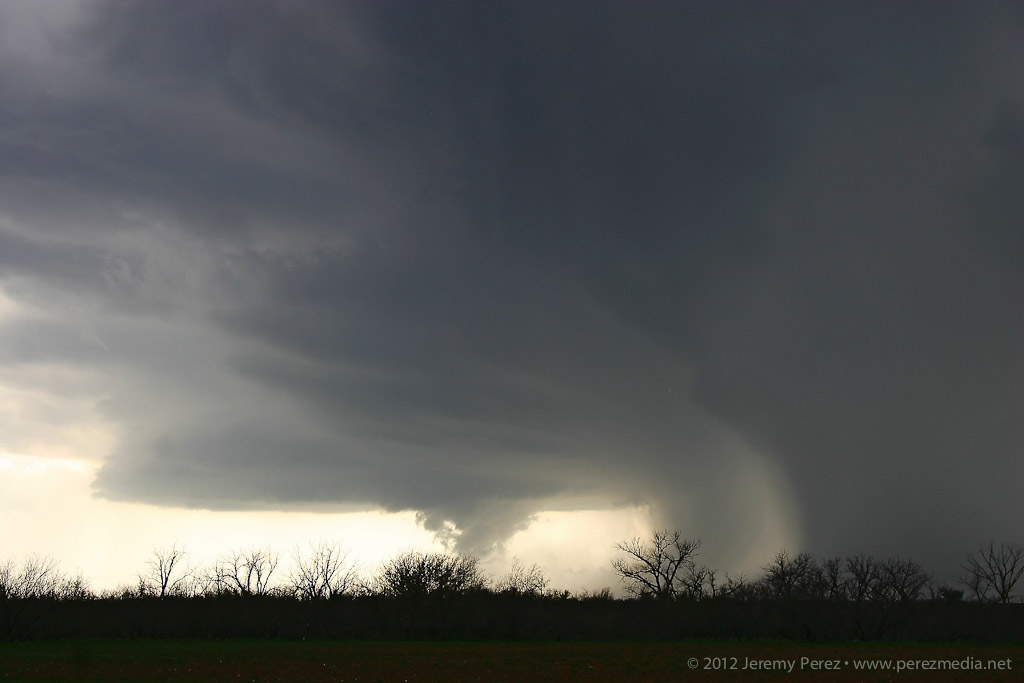
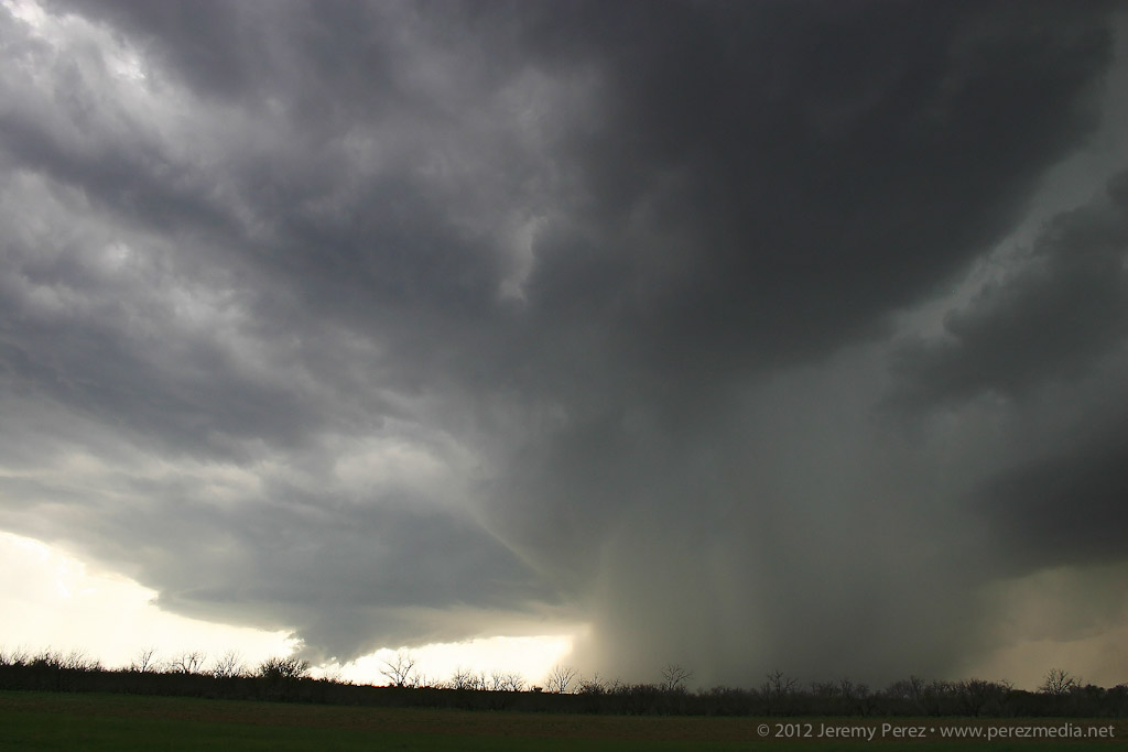
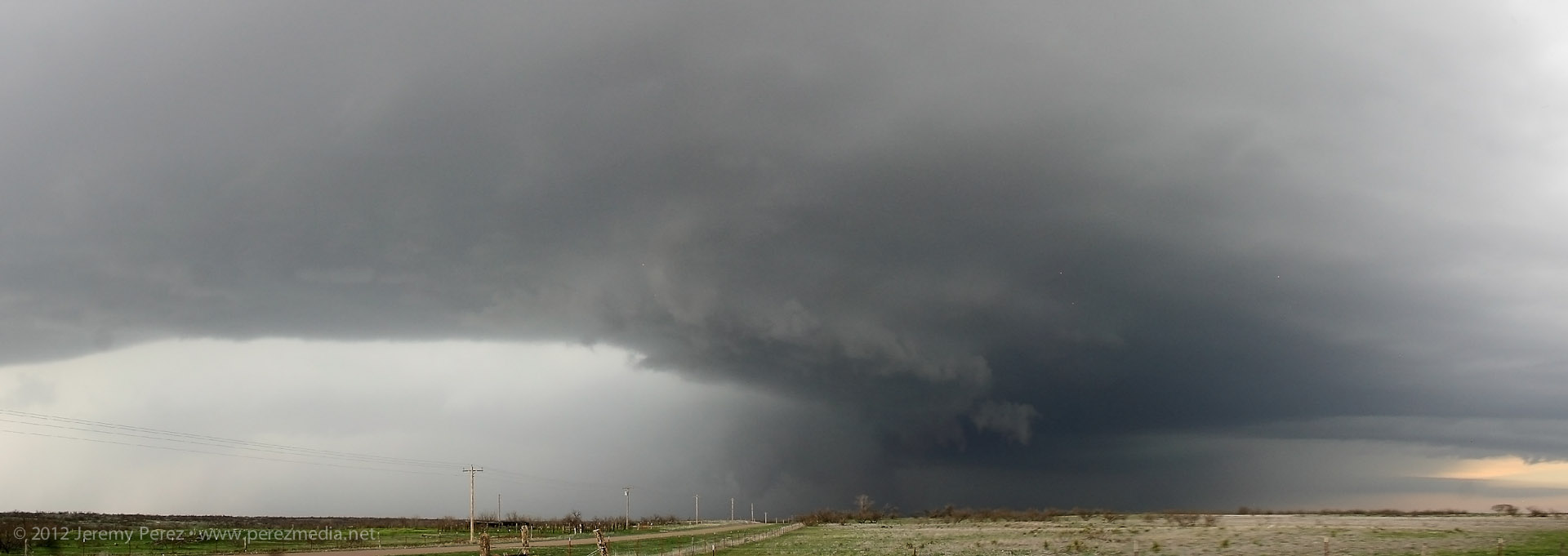
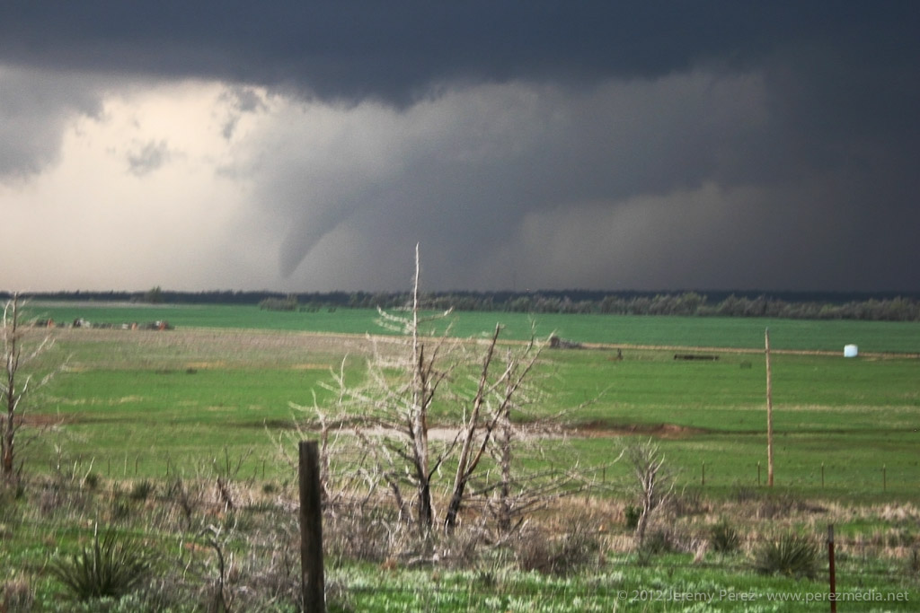
With my brain fried by technical issues and a ton of missed shots, I couldn’t actually tell that the storm was producing, other than it had developed a huge, incredibly solid wall cloud slanting above the trees. I didn’t pick up on the power flashes visually at the time, but the camera caught one as it illuminated the tornado in progress about a quarter mile northeast of where the first damage markers were surveyed. My daughter was running the video camera and picked up a couple more power flashes after that. We didn’t get an actual visual on the condensation funnel until about 20 minutes later as it was backlit by lightning as the storm was racing off north of Golden City.
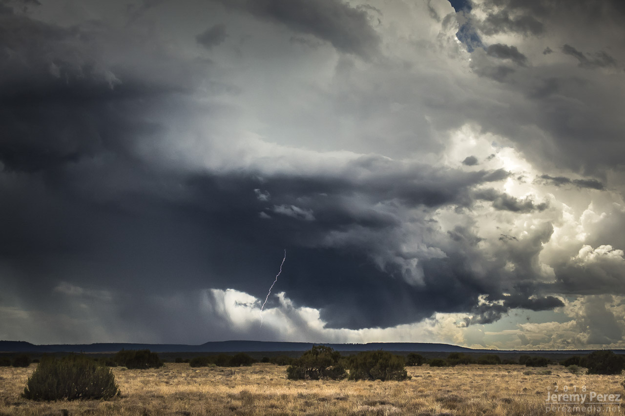
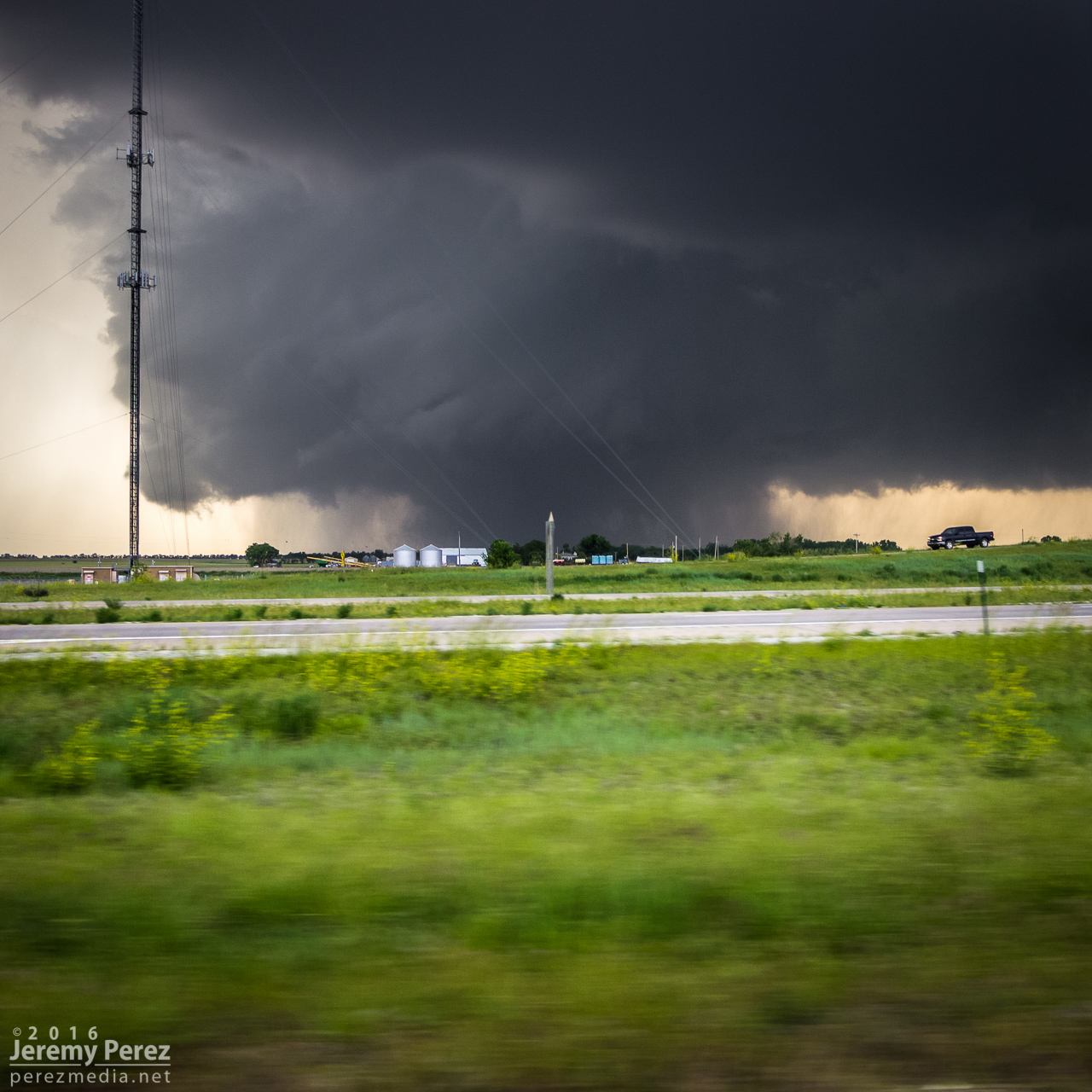
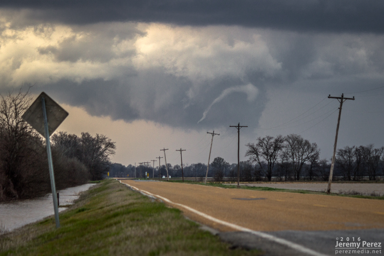
0152Z — Power flash illuminating tornado as it crossed 100th Rd. north of Rosebud 3 miles to our northwest.
0153Z — Video frames of power flashes as it approached 90th Rd. south of Sumac.
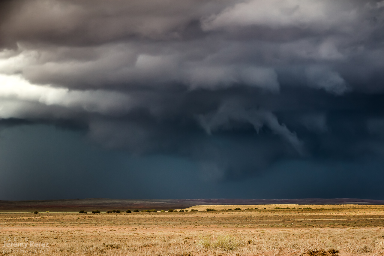
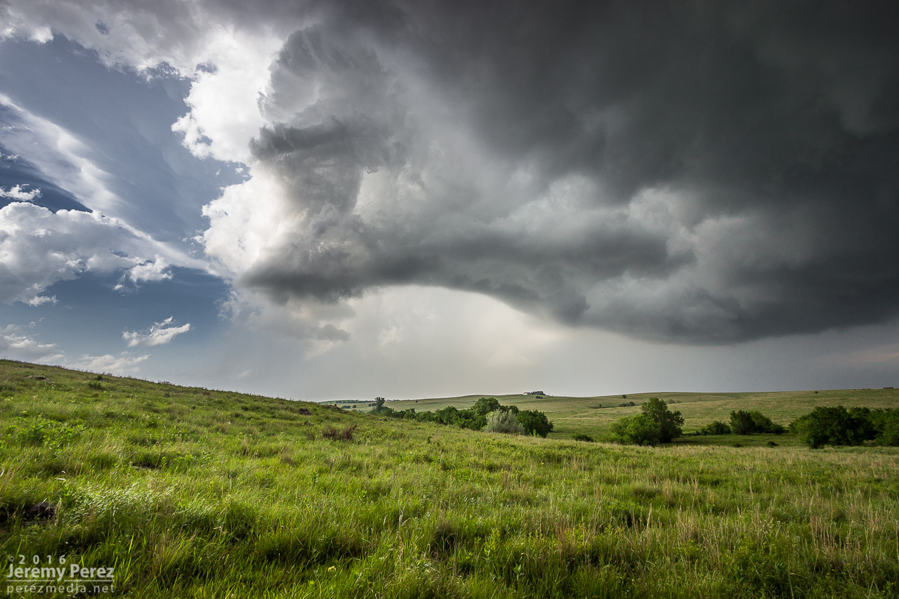
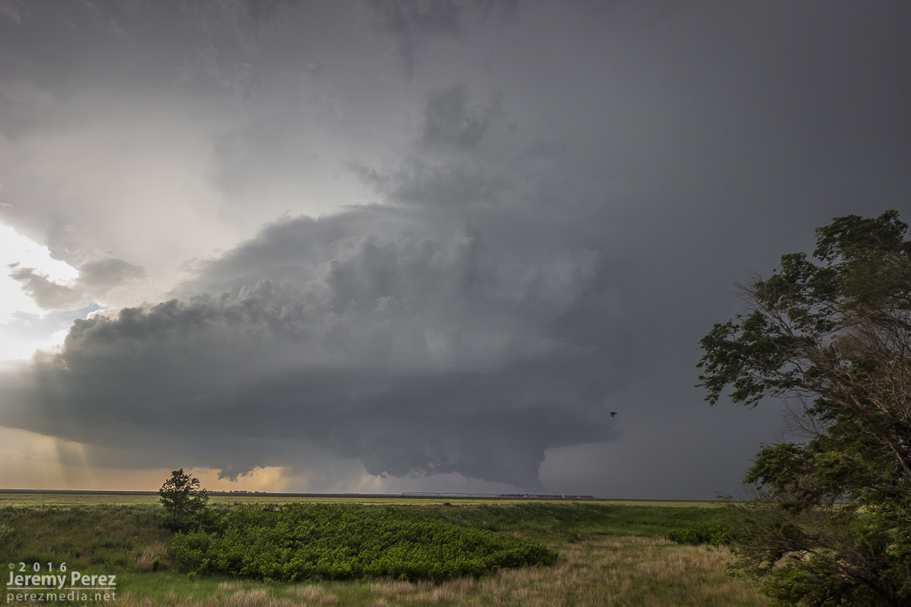
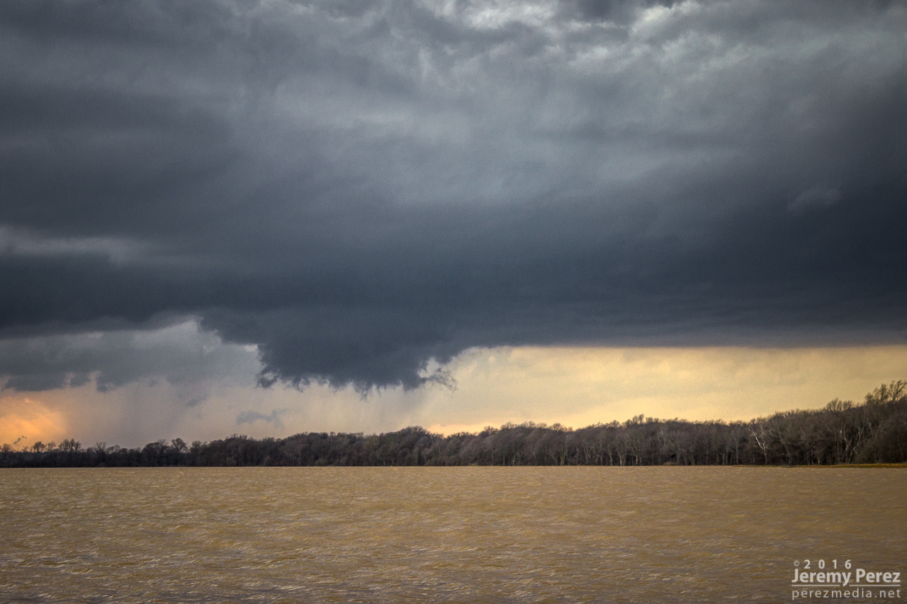
0154Z — Wall cloud and RFD shelf — tornado obscured by large tree at center.
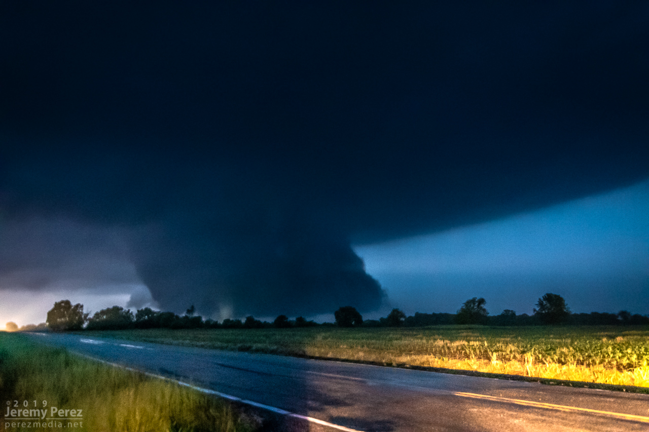
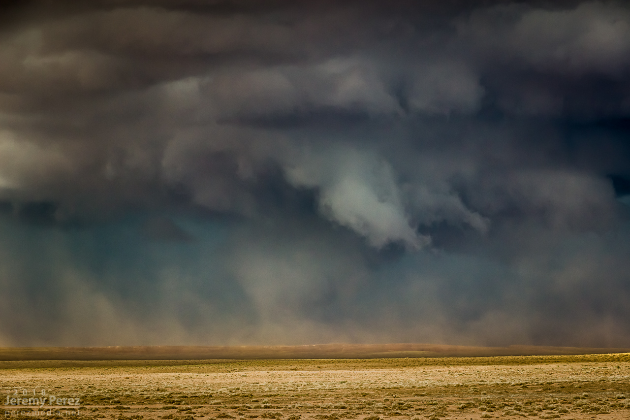
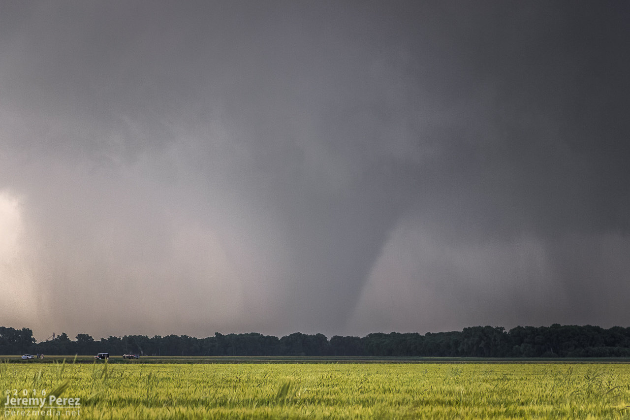
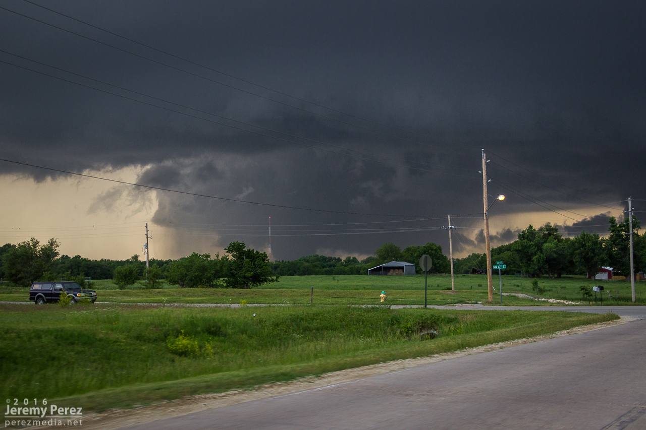
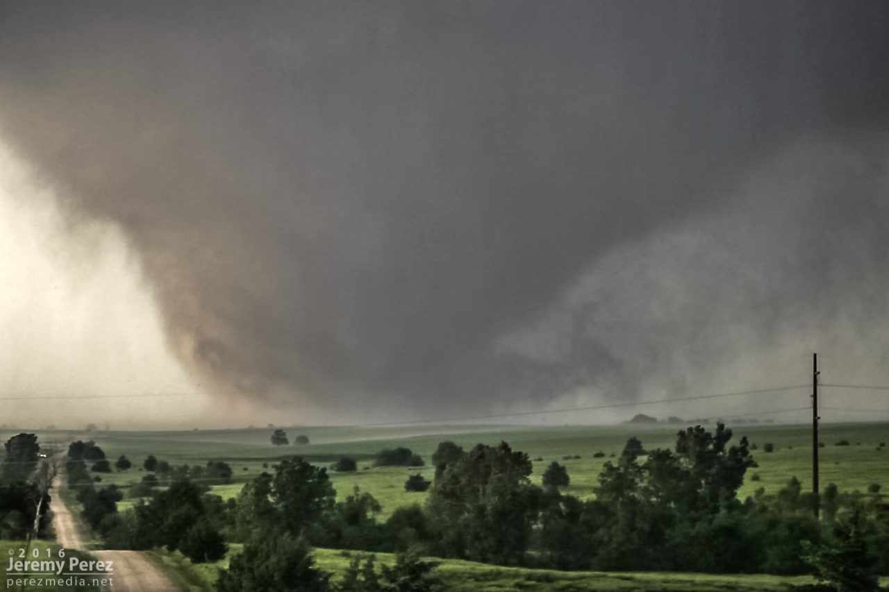
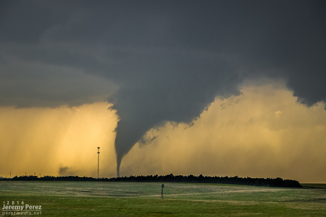
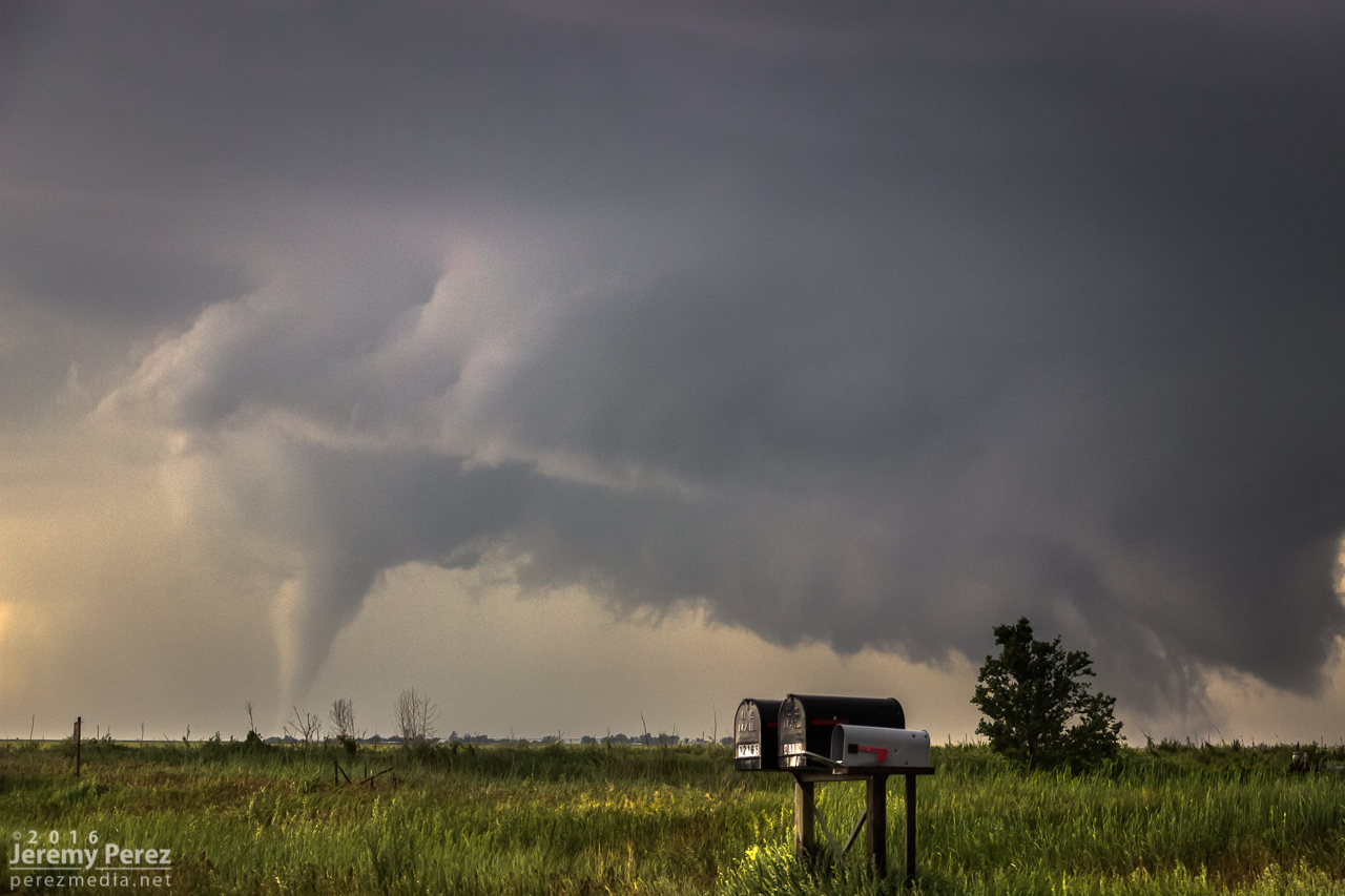
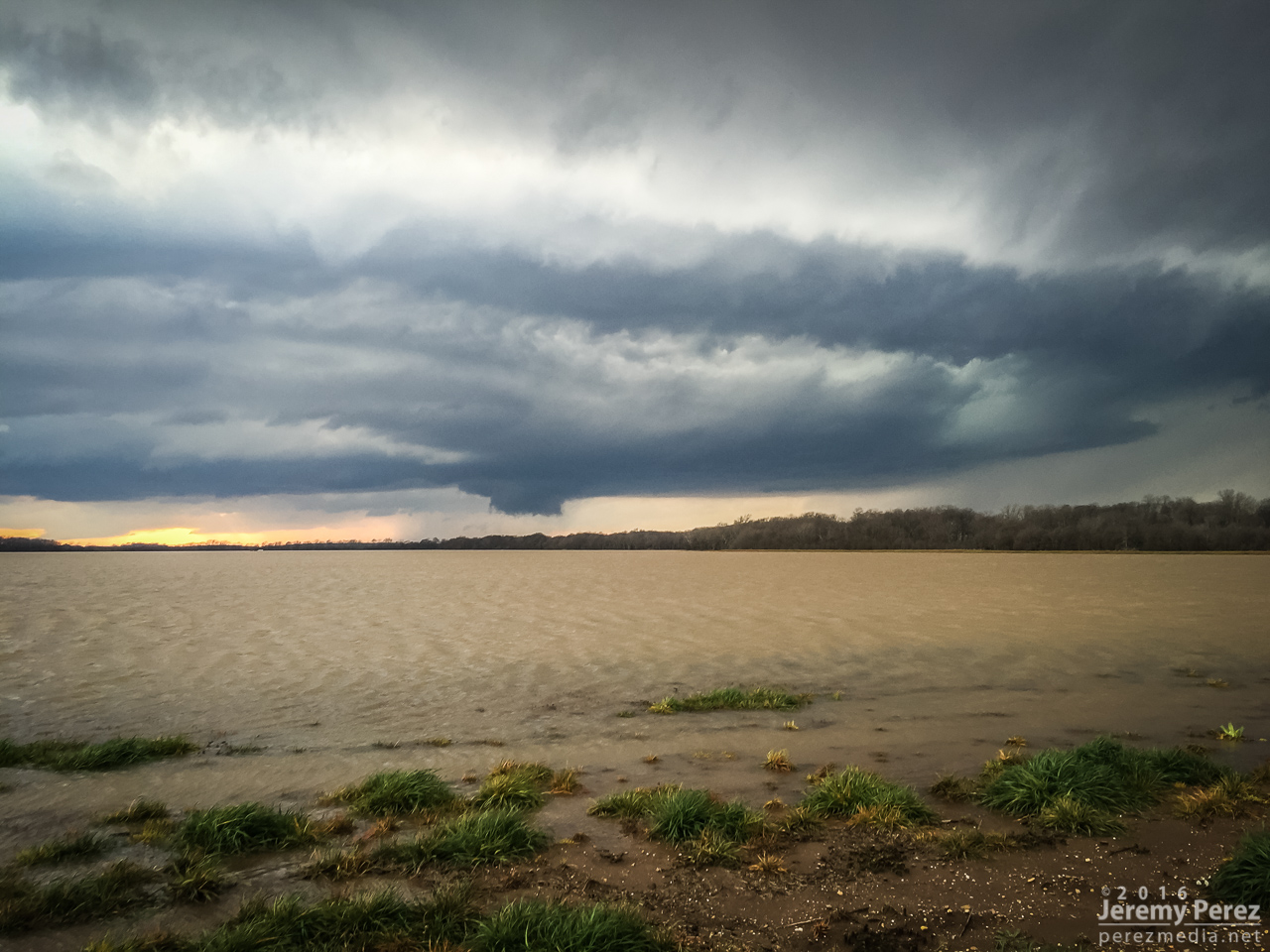
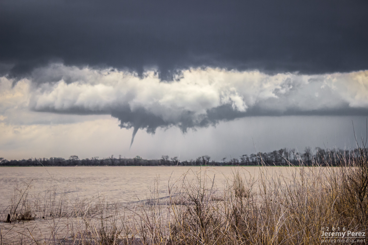
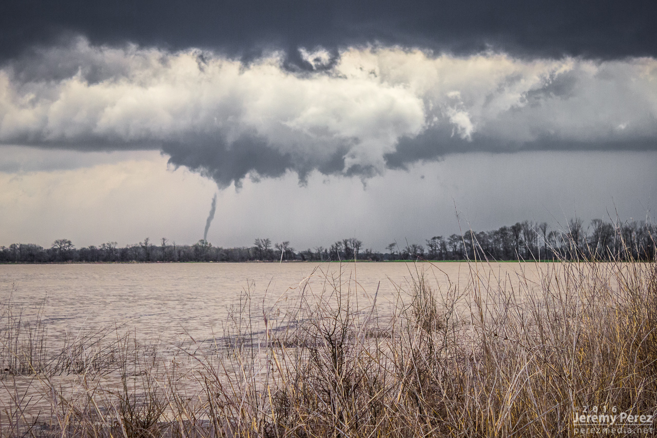
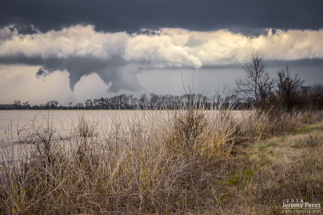
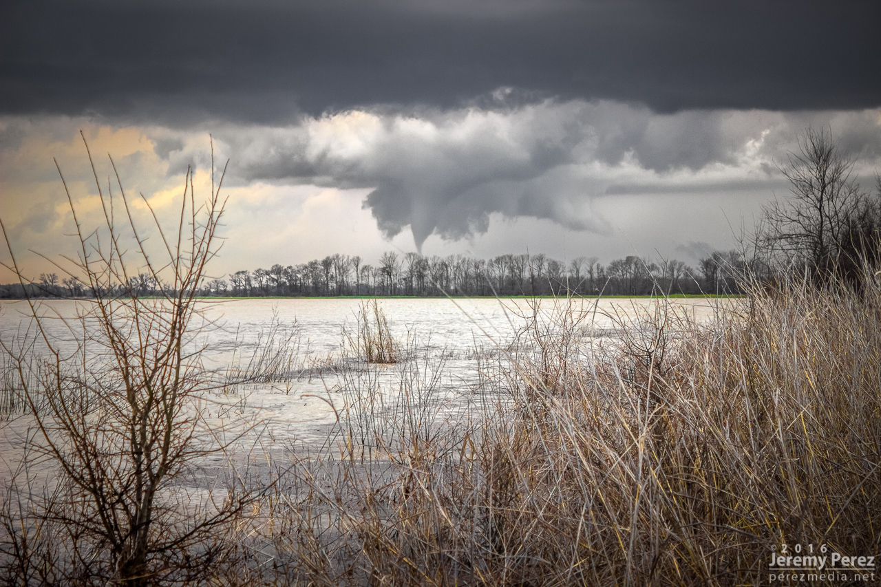
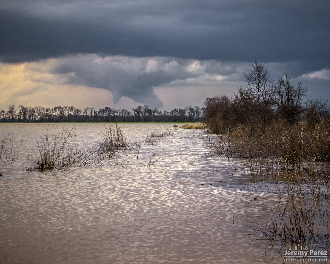
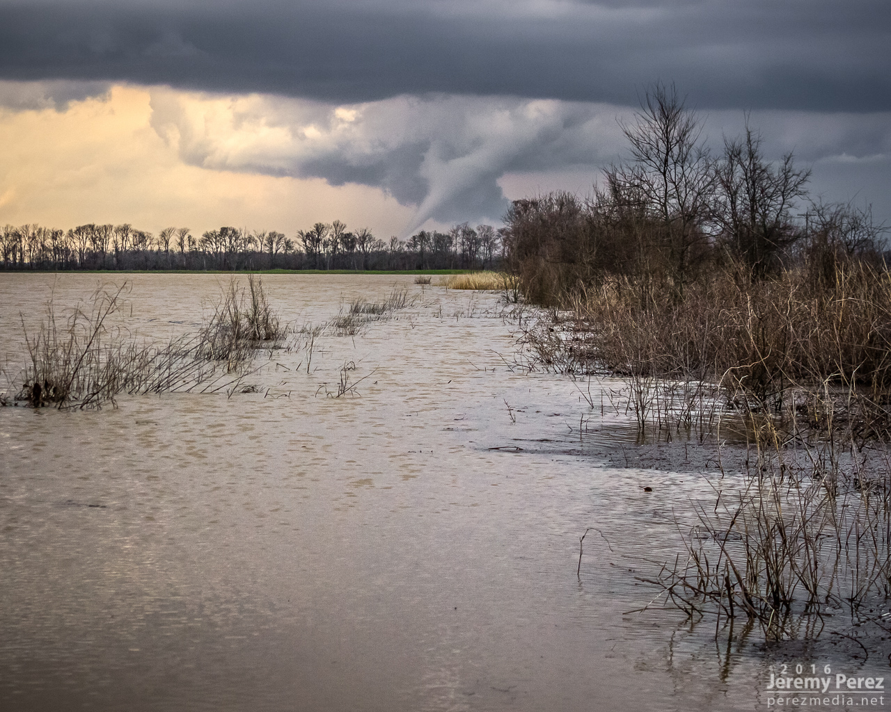
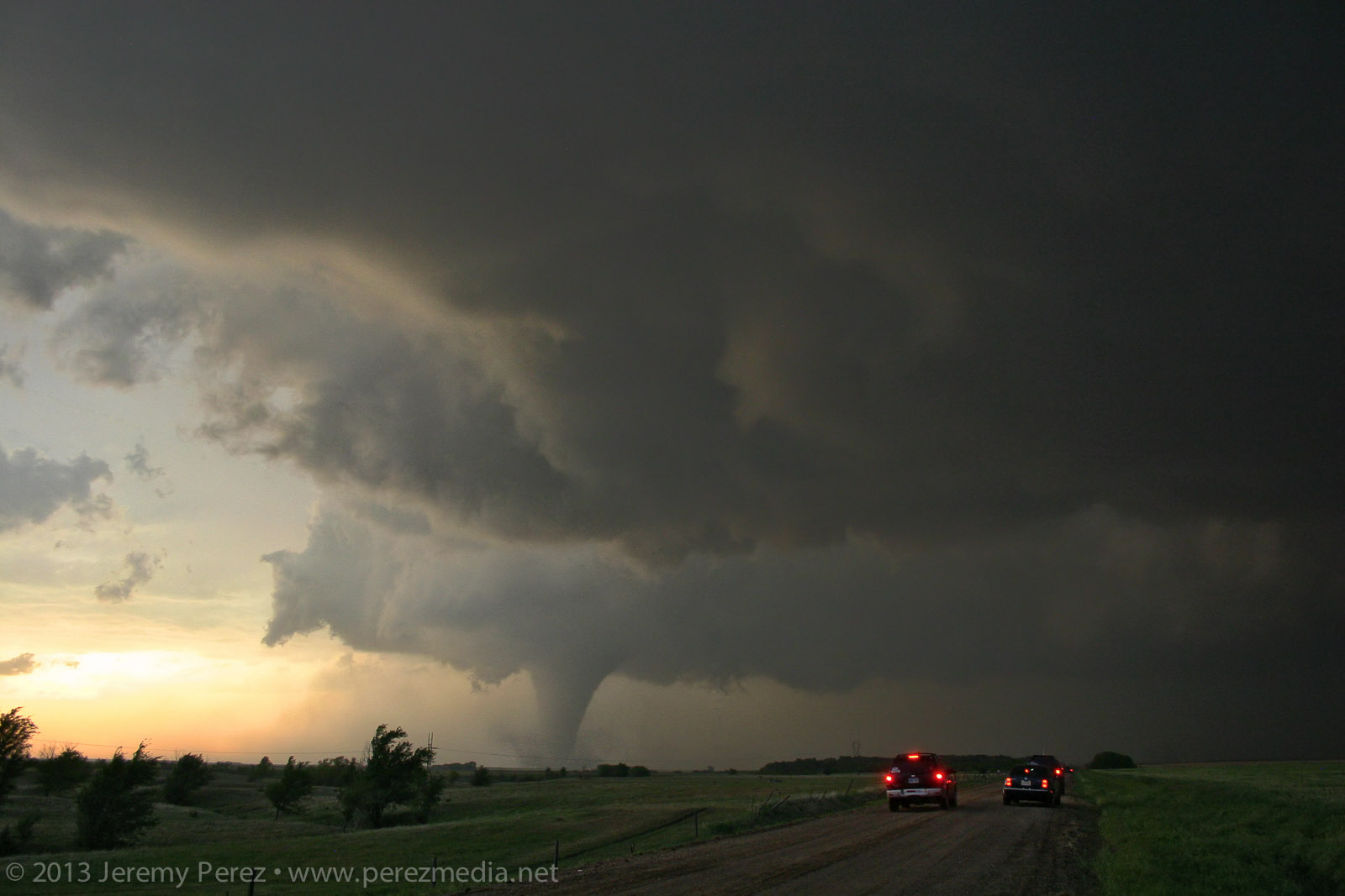
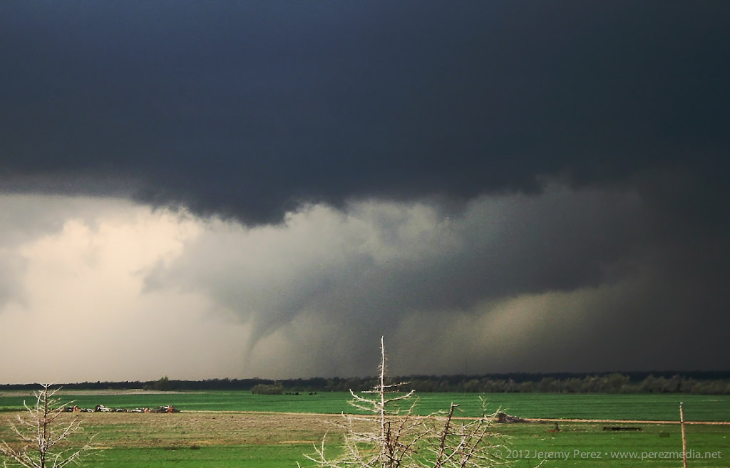
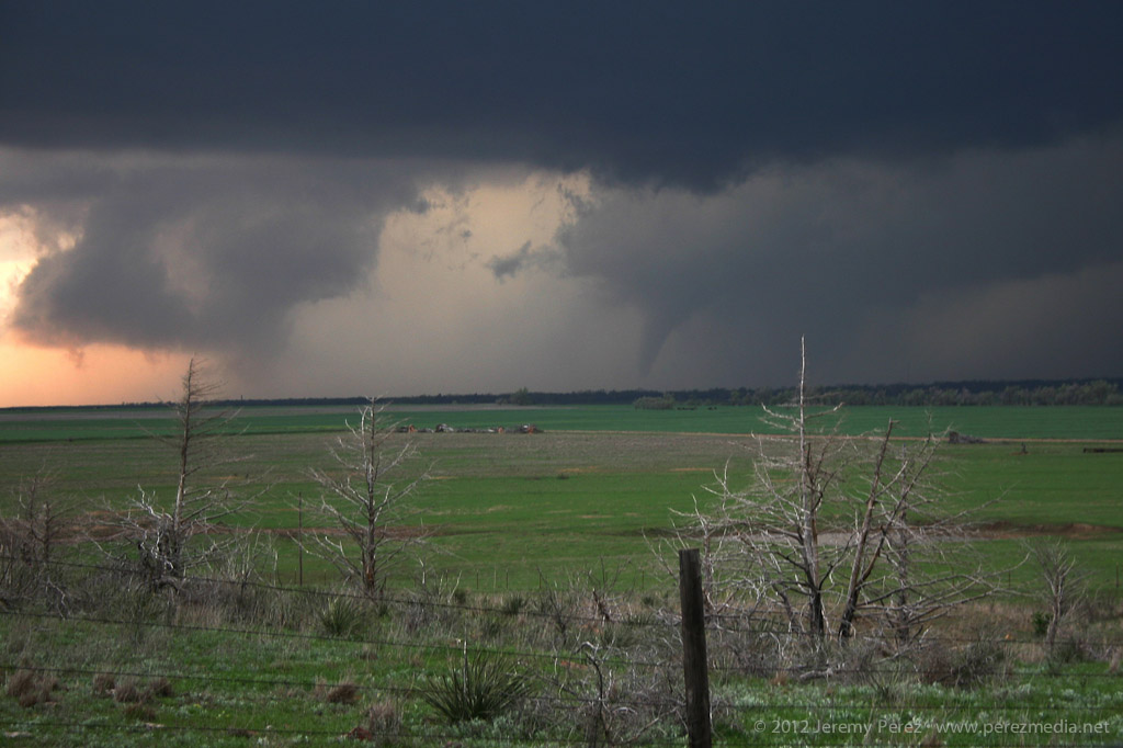
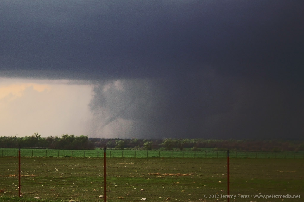
0217Z — Backlit funnel north of Golden City, about 8 miles to our north.
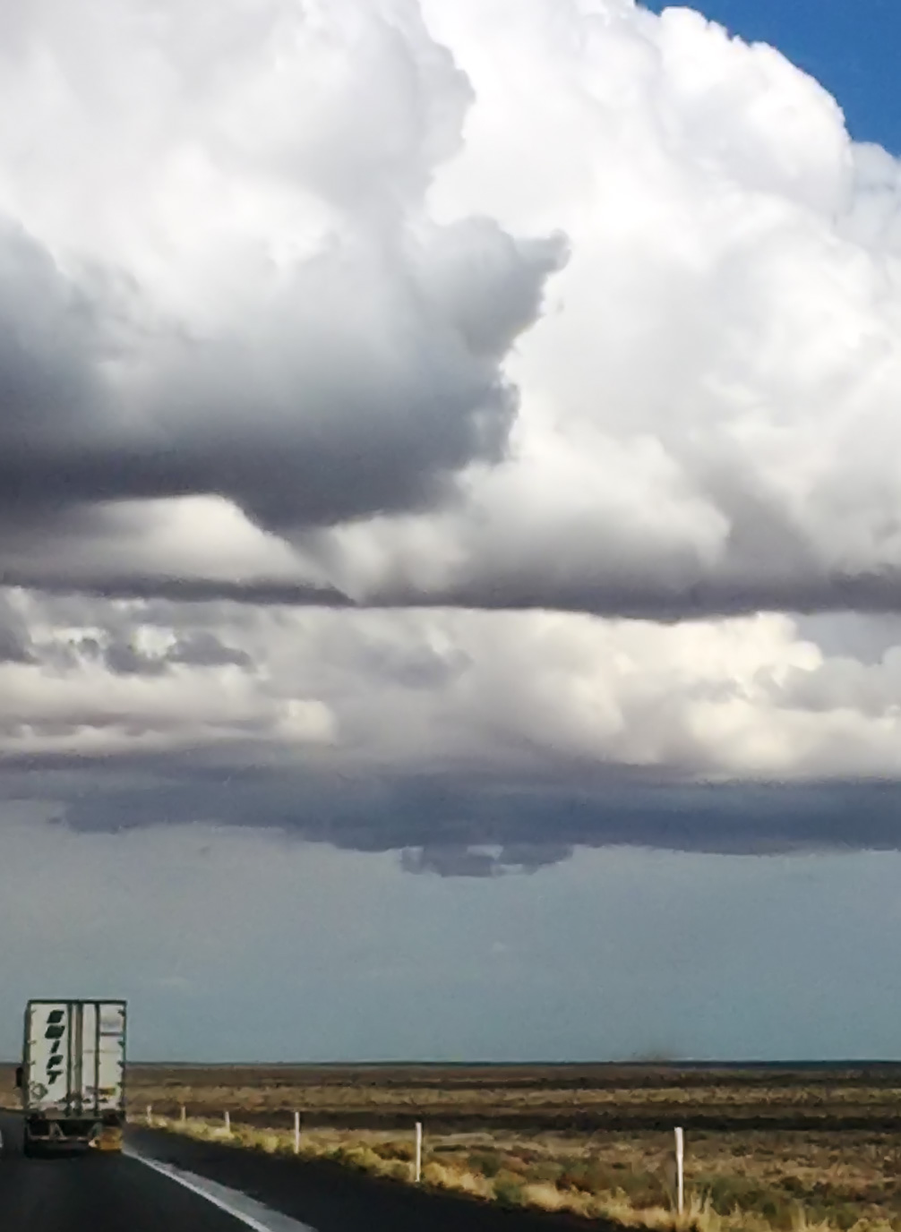
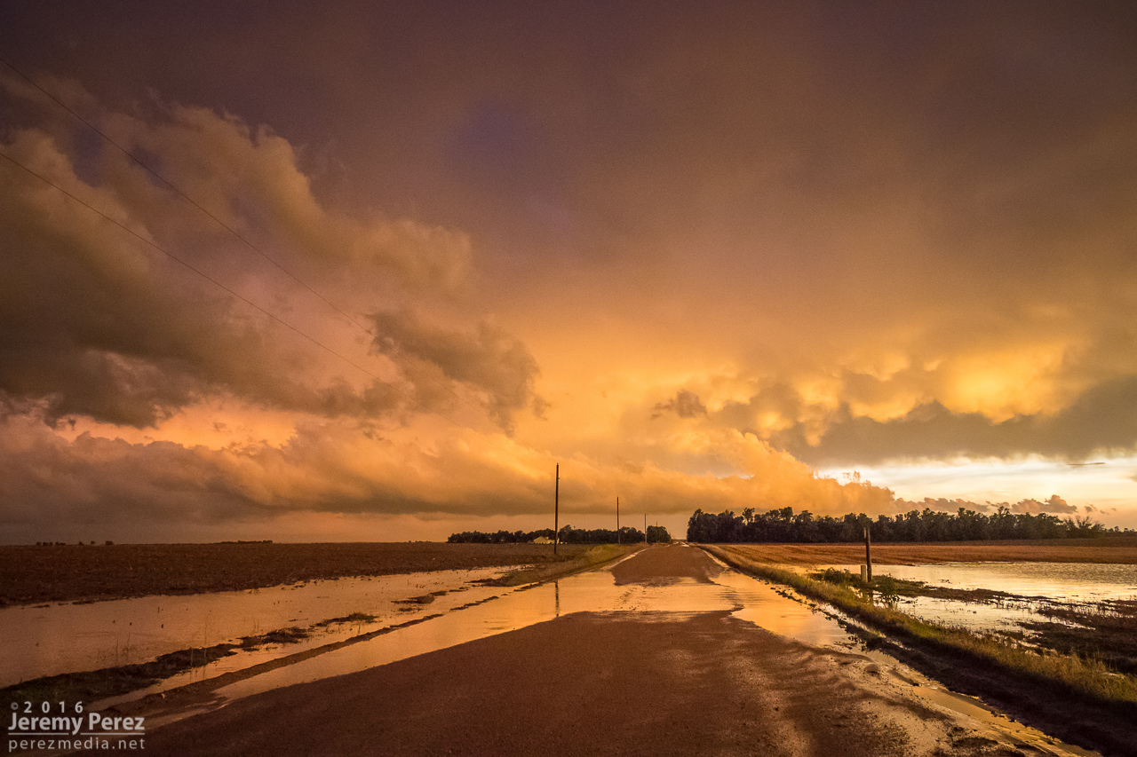
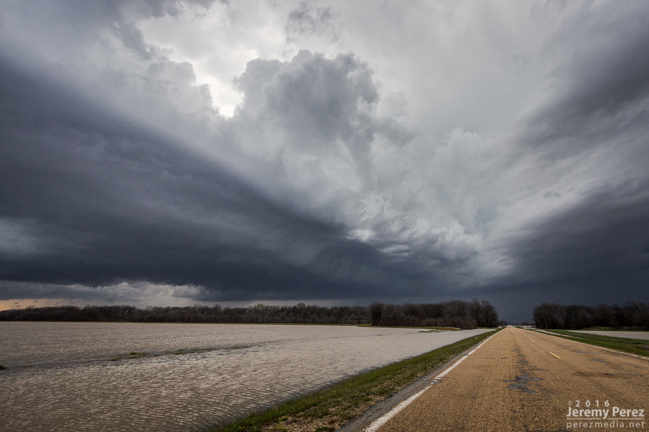
We paced it for a while, but terrain and trees gradually became a huge problem as we got east of Lockwood. We made our way back west to the next day’s target in the Texas Panhandle, dodging heavier cores and flooded roads along the way during a very long night of driving.
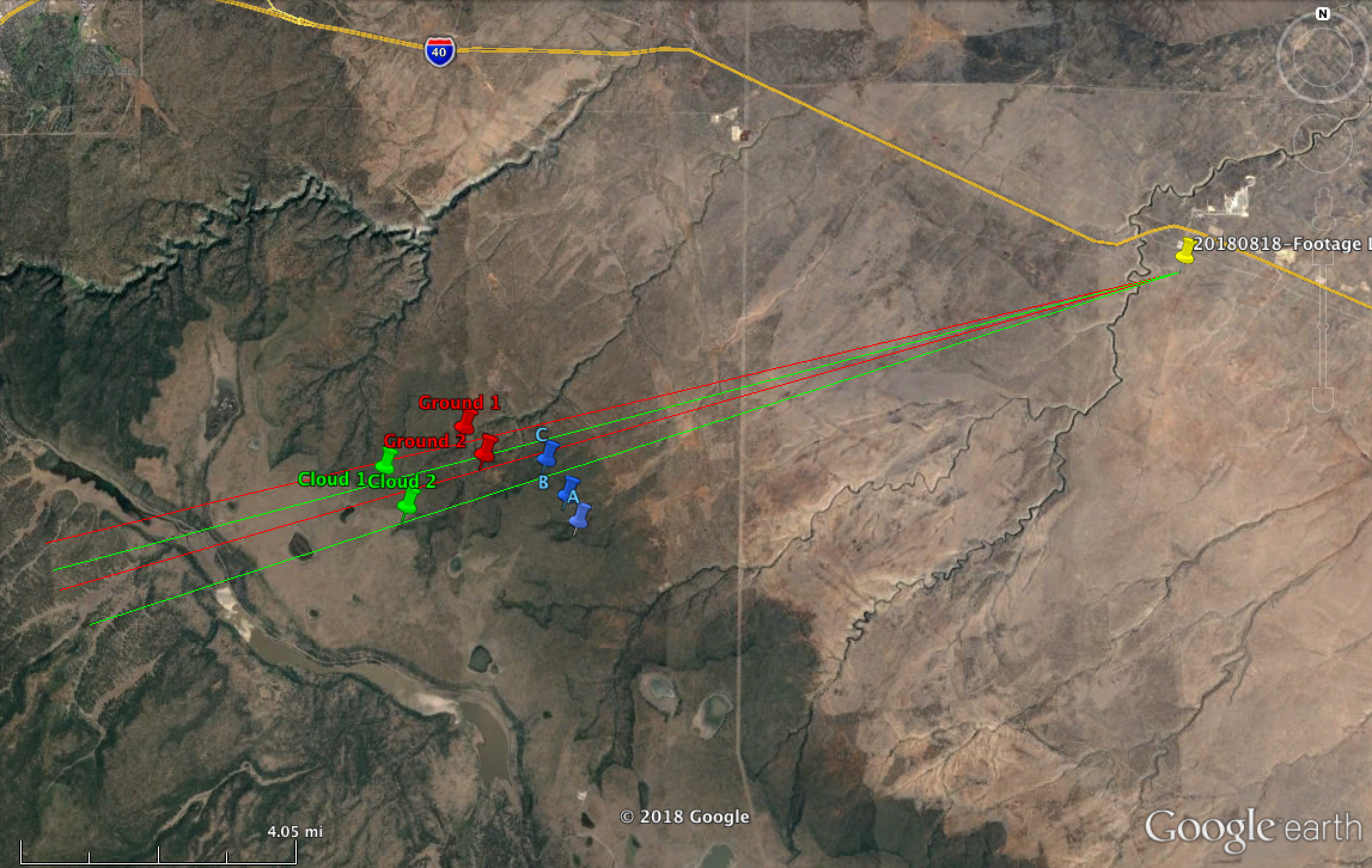
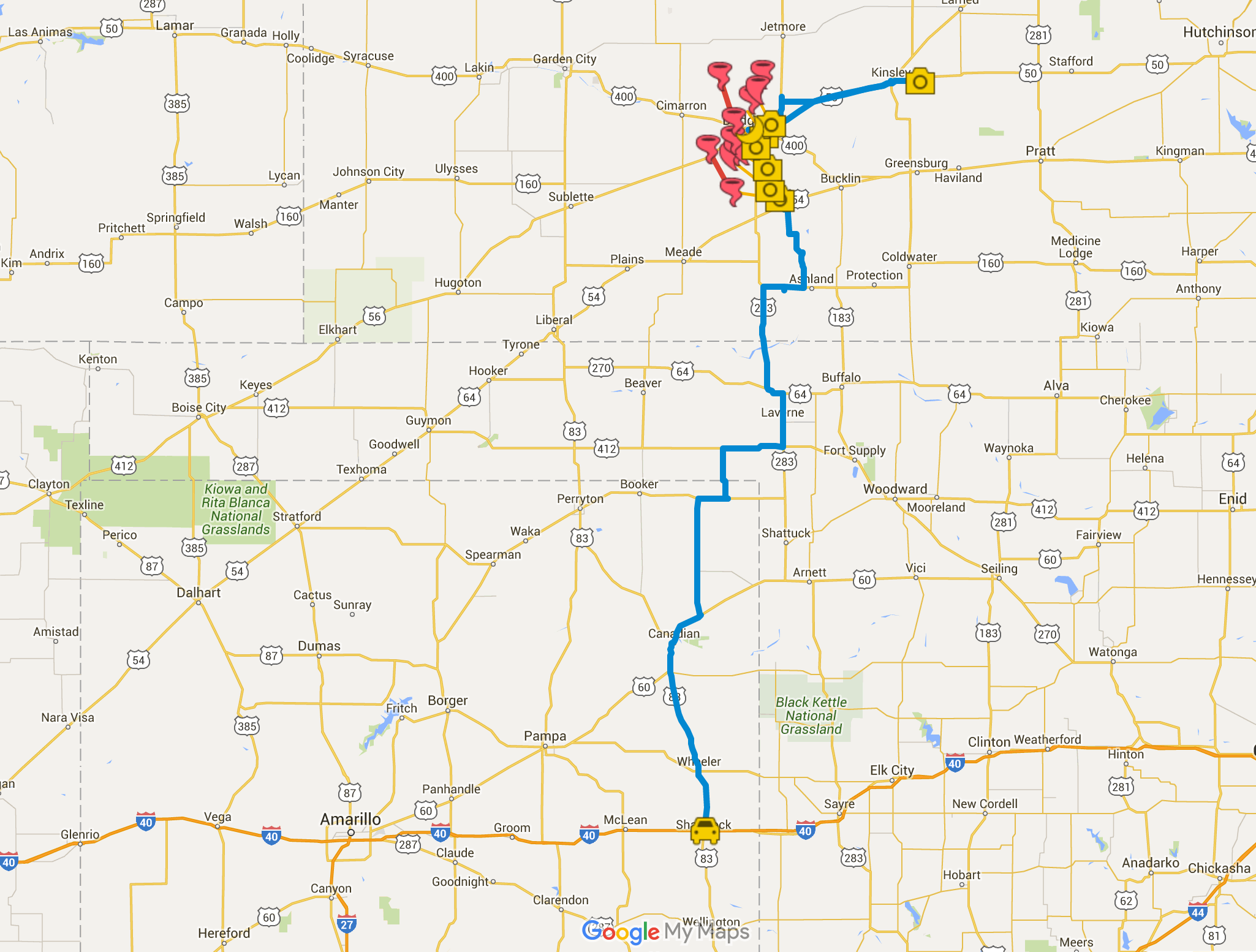
Map of image locations and damage survey
The next day was a punch in the gut to realize that the whole time I was aggravated and stressed about camera problems, the storm was taking three lives just a few miles up the road as it approached Golden City. I can’t rationalize anything that makes me feel positive about that day, just grief for the families of Betty Berg and Kenneth & Opal Harris.
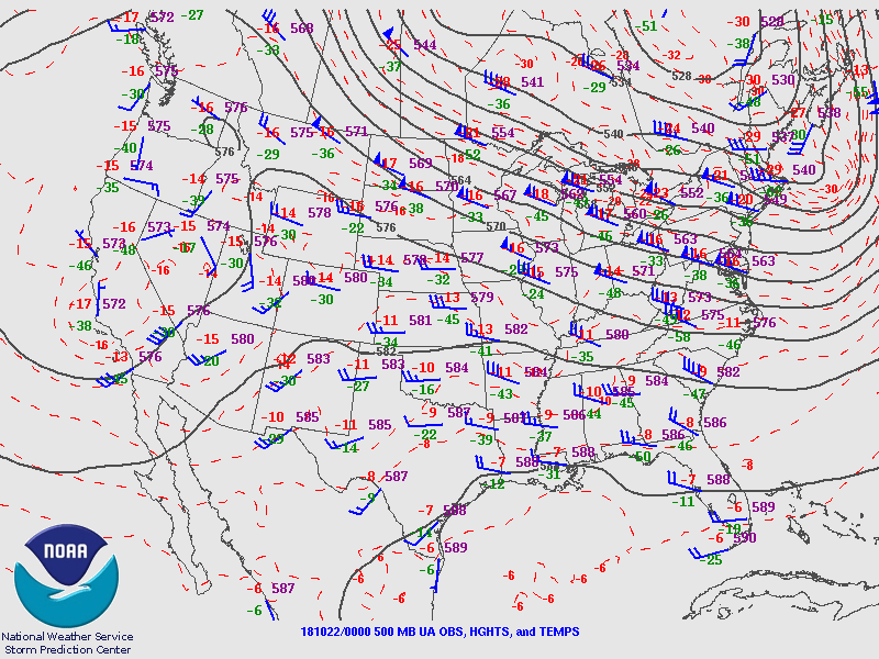
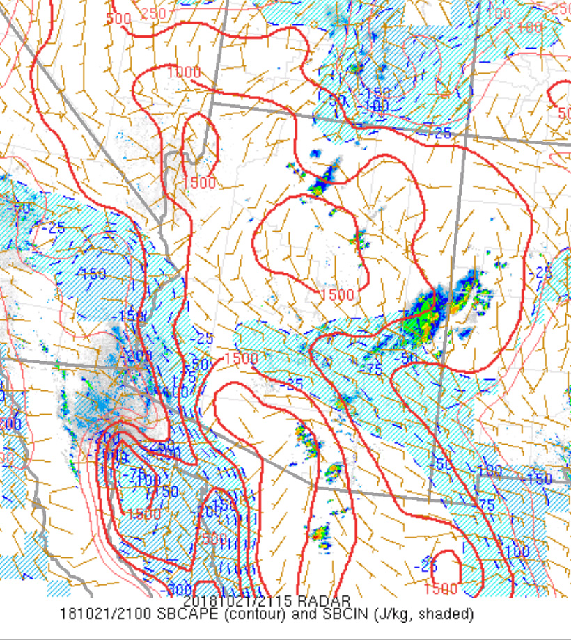
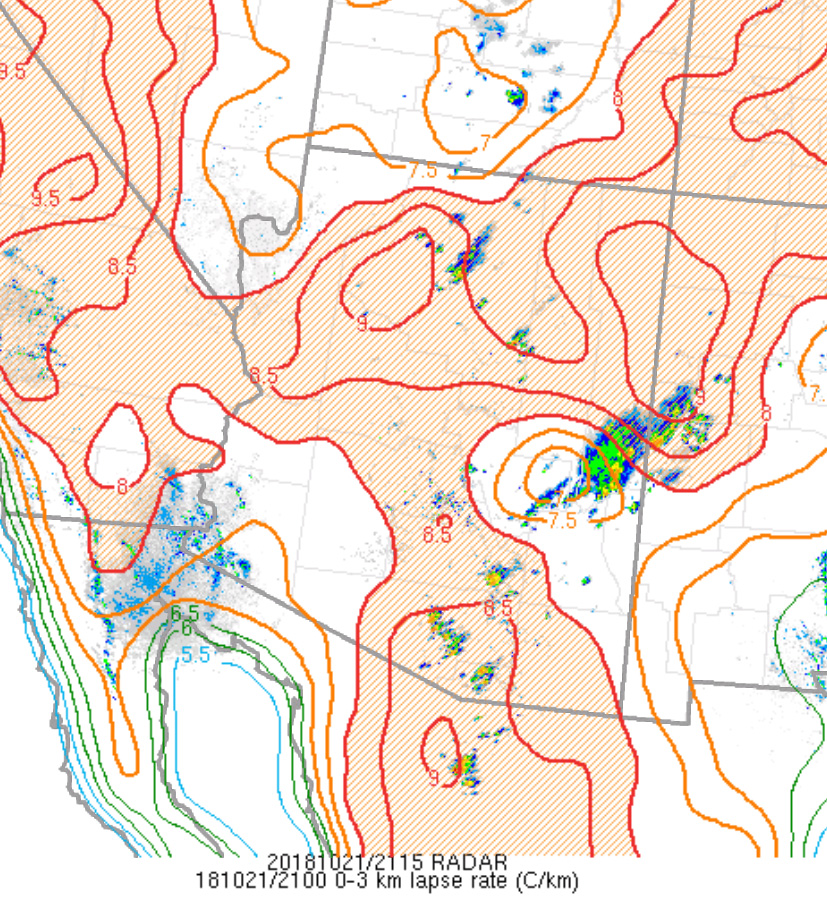
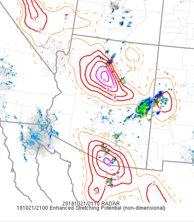
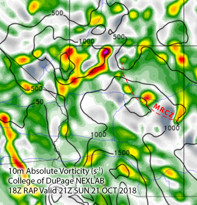
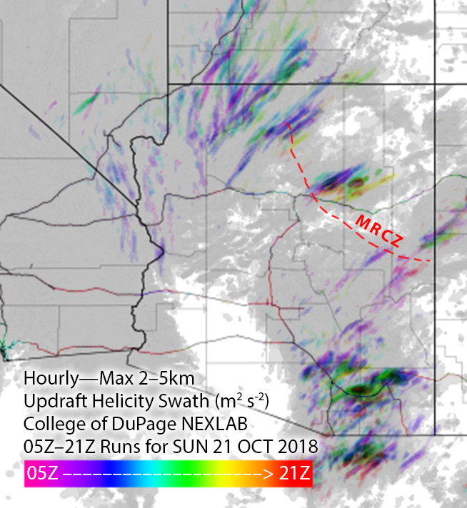
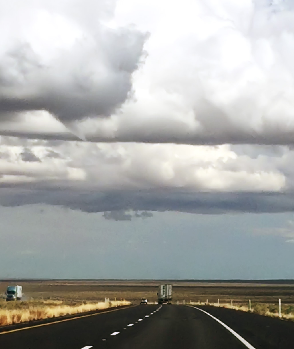
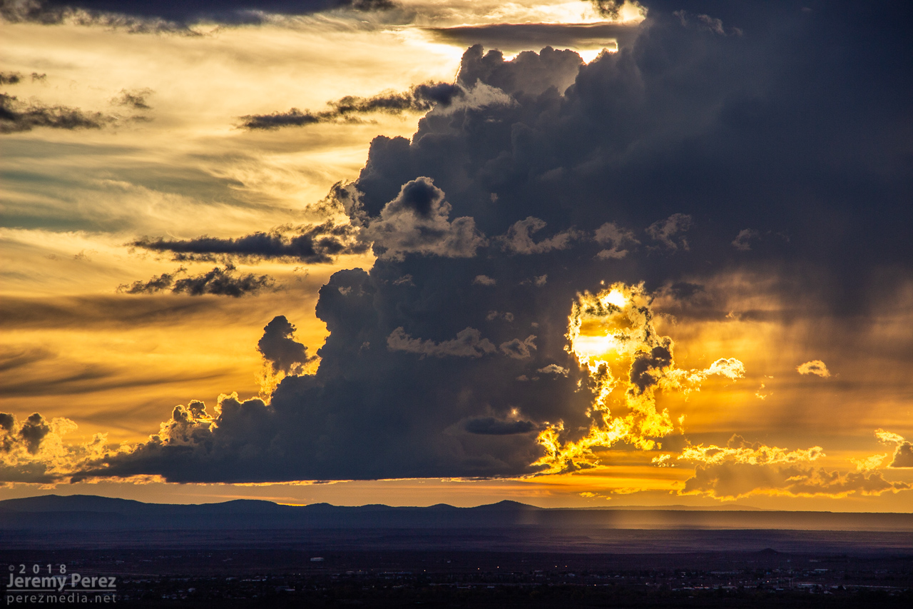
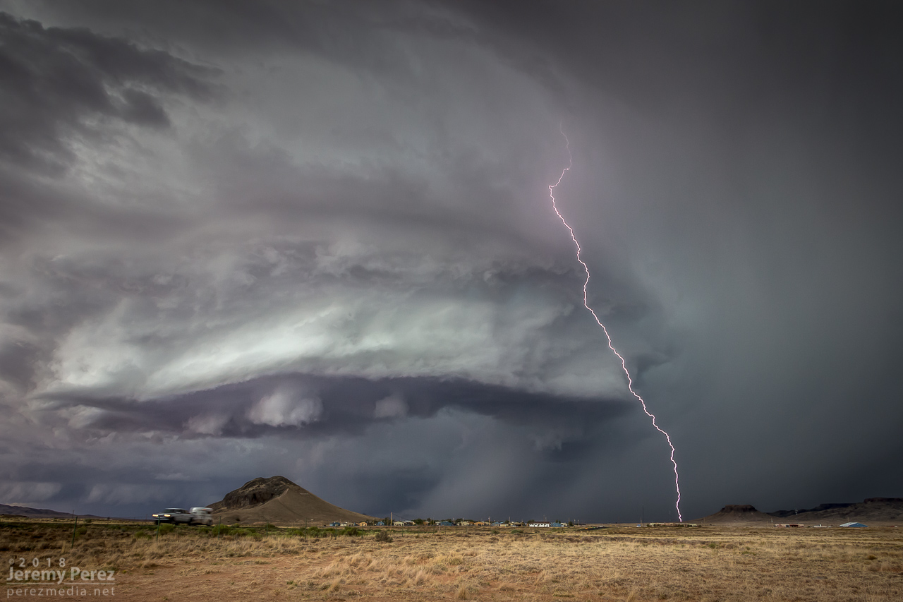
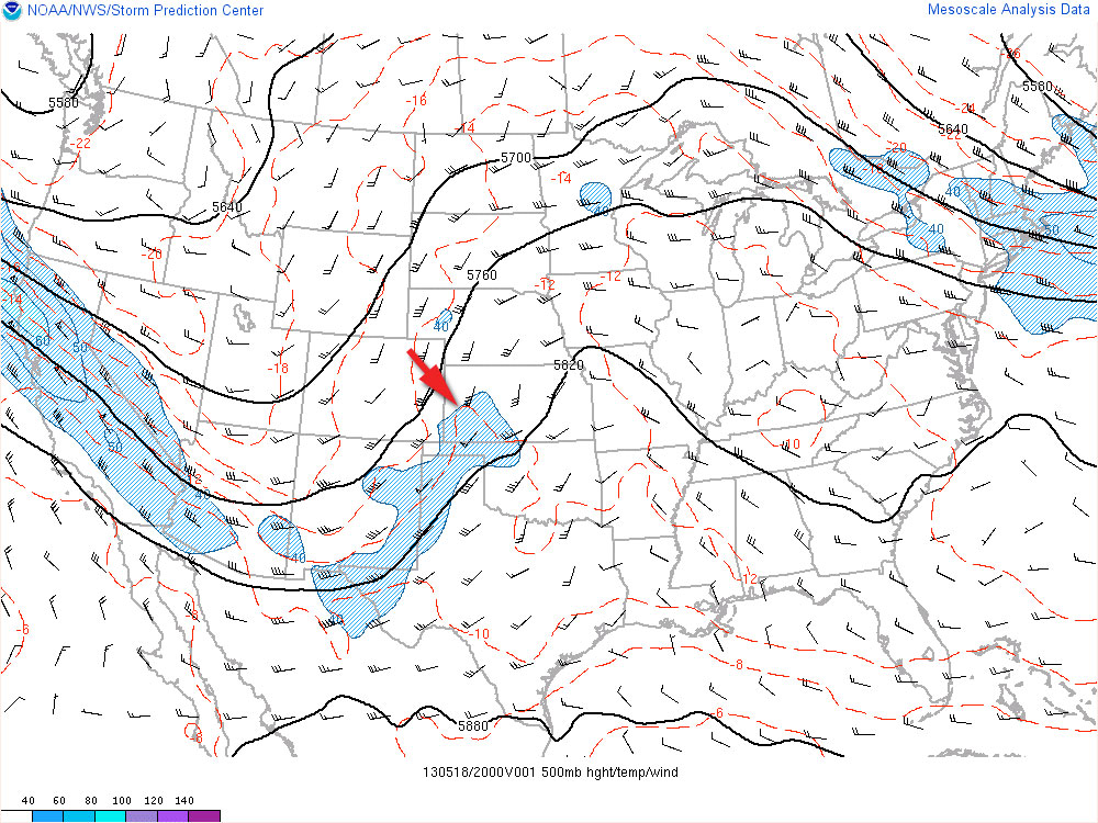
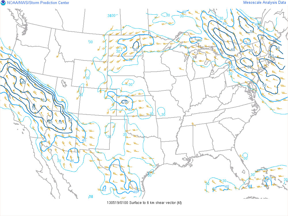
On Sunday, October 21st, tropical moisture was in place over Arizona, with a low impinging on it from the west. So southwest flow was in play over the Mogollon Rim Convergence Zone (MRCZ). Work had been a bear and I’d been dealing with a chest cold the previous few days so I wasn’t exactly eager to get out. But I felt better by Sunday morning, and was watching conditions and browsing HRRR/UofA WRF CAMs. HRRR had been pretty set on some stronger storms initiating and moving across the MRCZ, from Twin Arrows through Winslow. RAP surface vorticity suggested elevated vorticity in that same area. WRF CAMs didn’t have the same consistent signal, but with HRRR being so interested in it, I figured I’d mosey out there around 1-2PM and see what was up.
Forecast, nowcast, SPC data
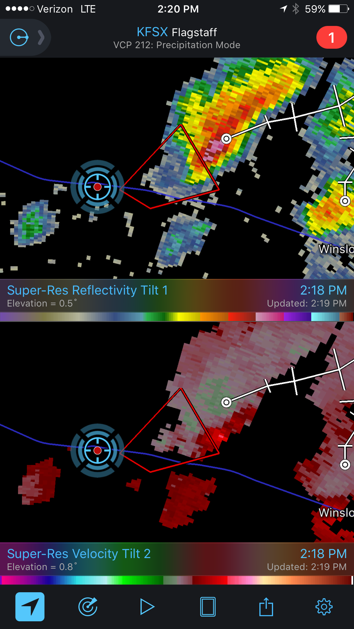
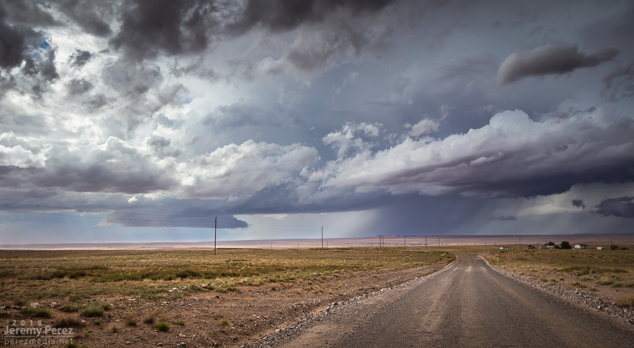
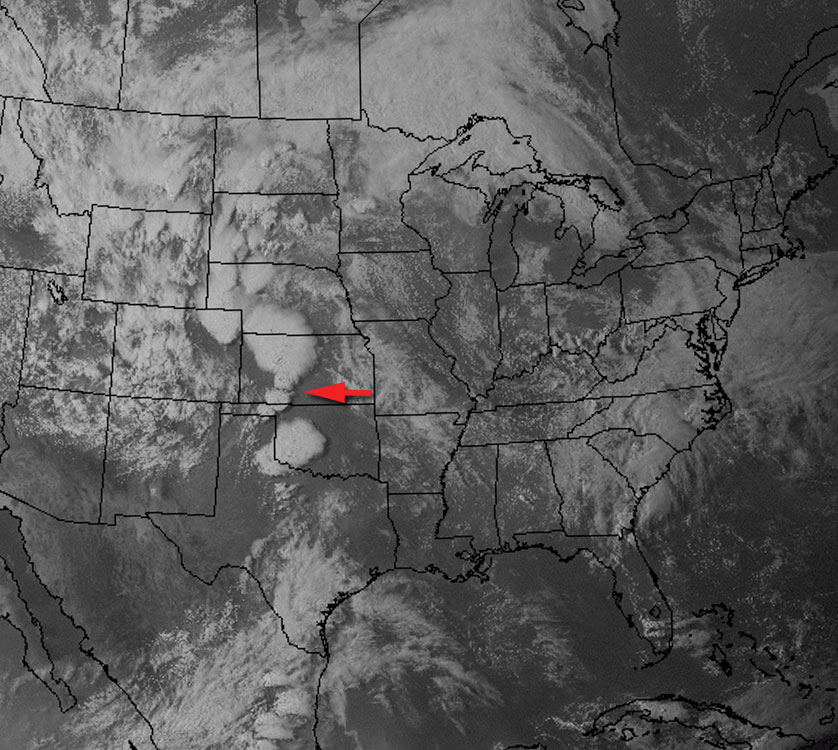
While I was out running an errand, radar showed convection trying to fire. It was pulsing inside a notch in the convergence boundary that had formed southeast of Flagstaff around 12:30PM. That was earlier than I expected, so by the time I was on I-40 heading east, one cell was already looking pretty good. With 30ish knots of bulk shear, I was mainly interested in some brief structure.
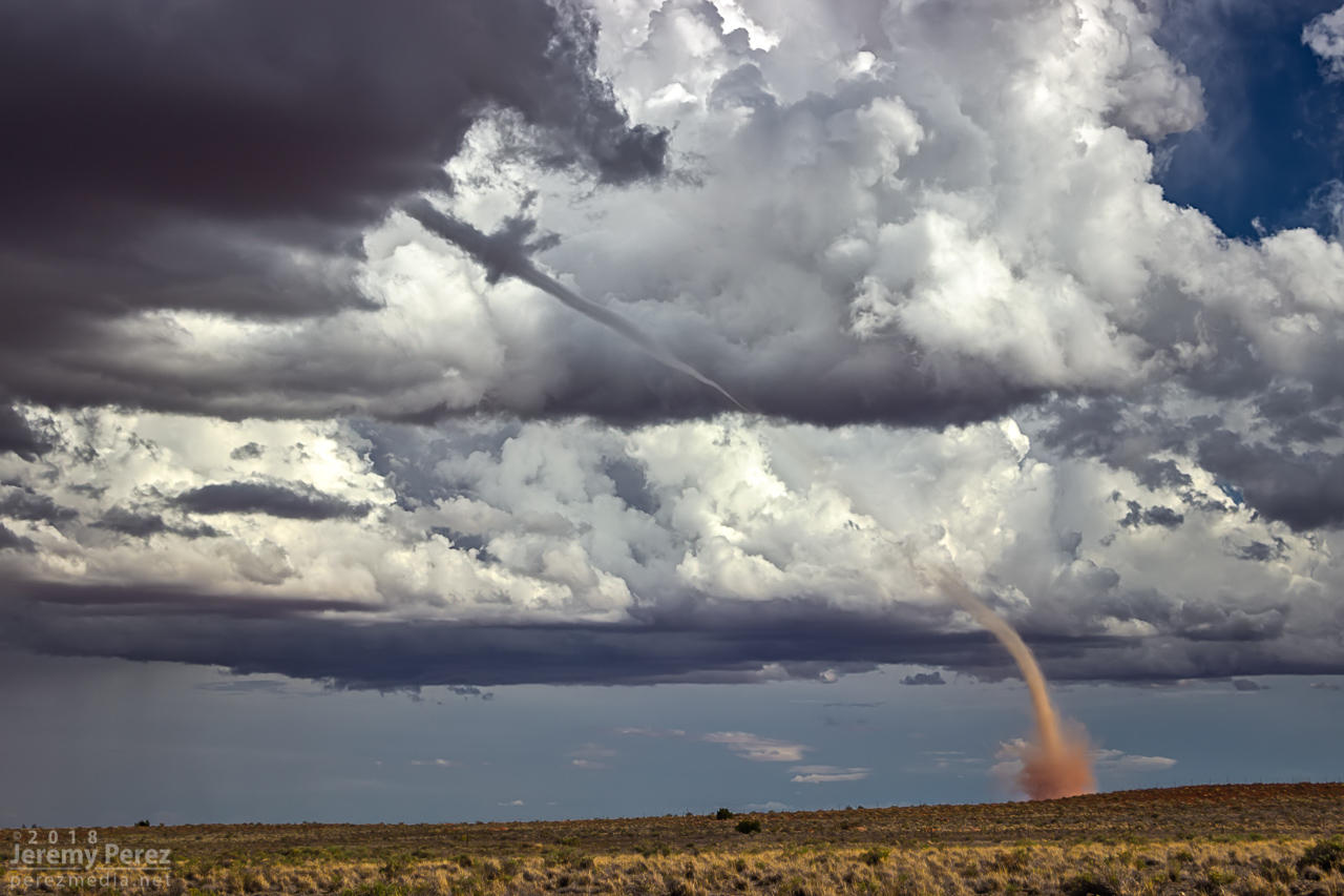
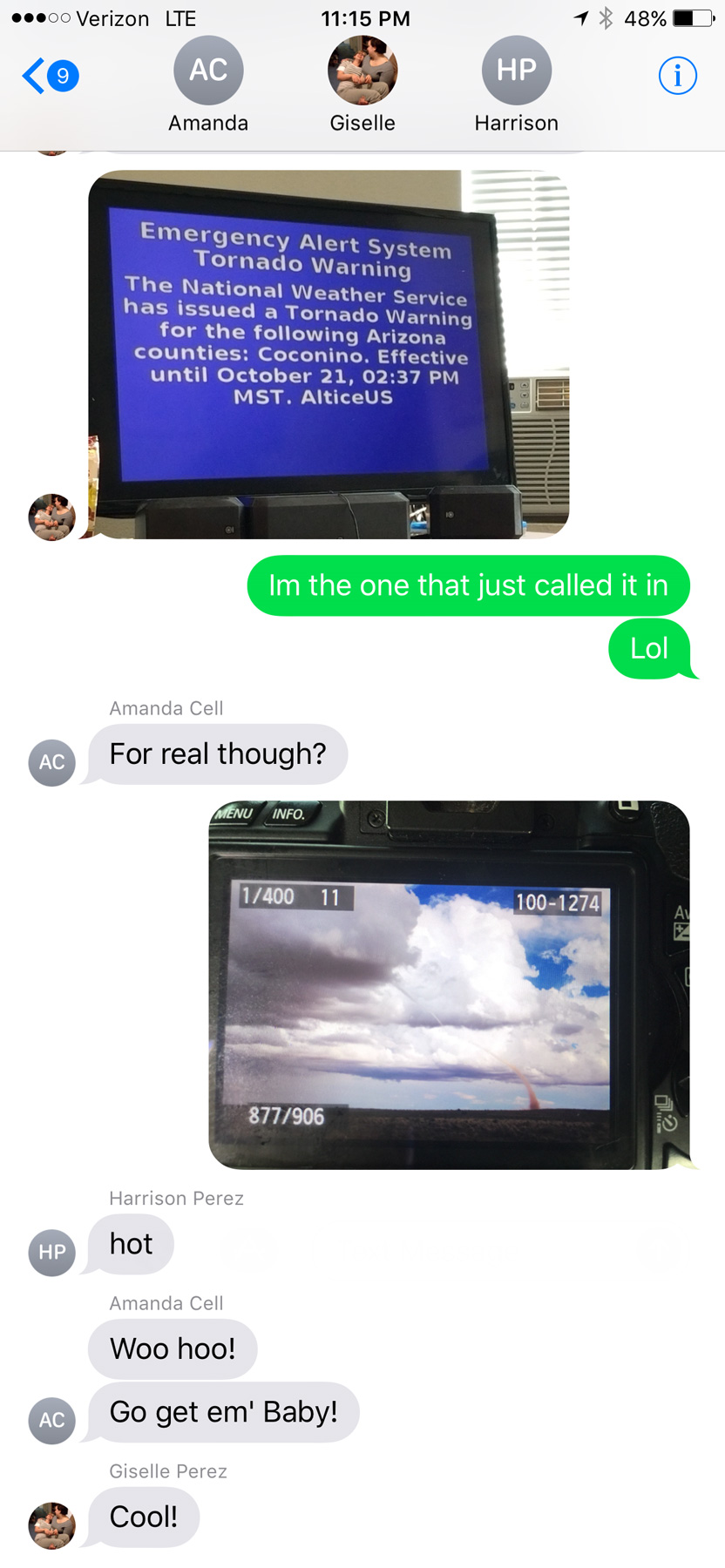
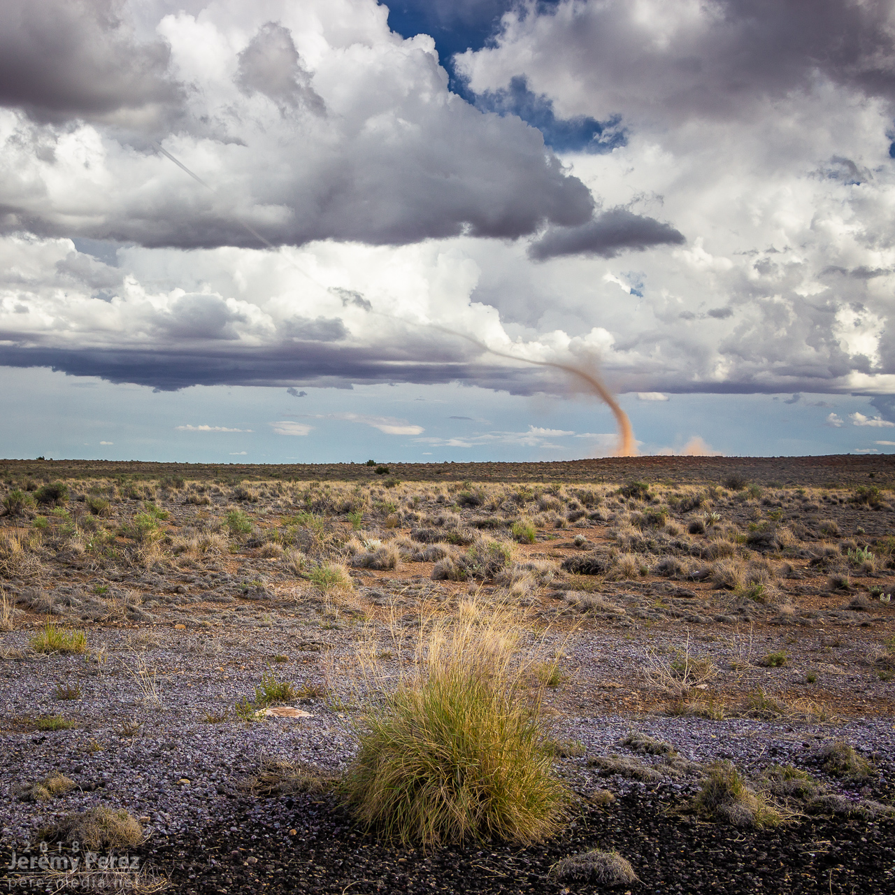
As I got near Buffalo Range Road, about 12 miles from the cell, it looked like a funnel was poking out of the southern tip of the base. So I started the cell phone rolling video on it.
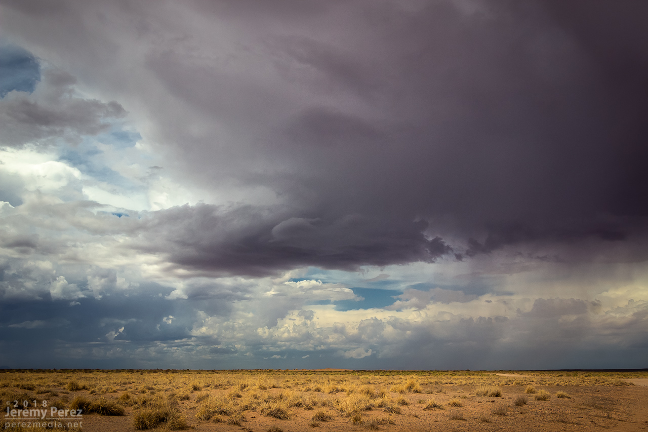
— 2057Z — Developing funnel with possible dust on horizon above truck
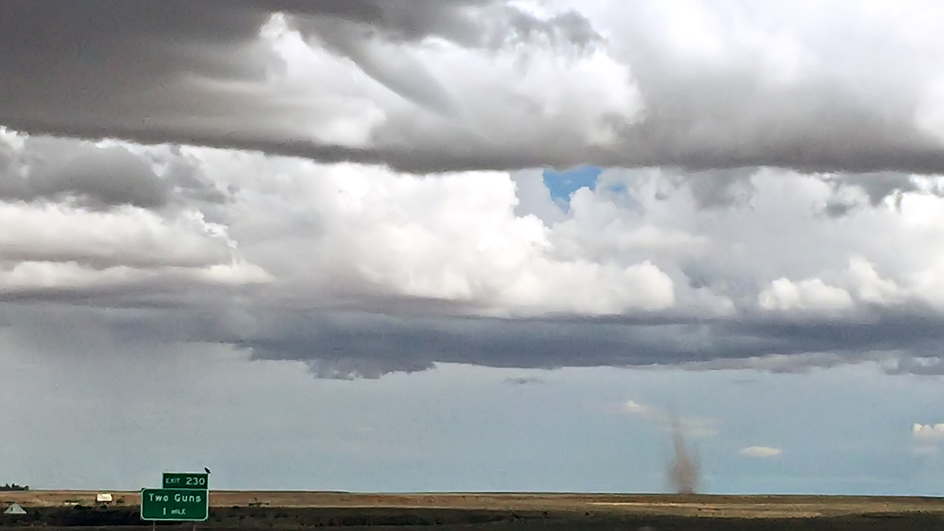
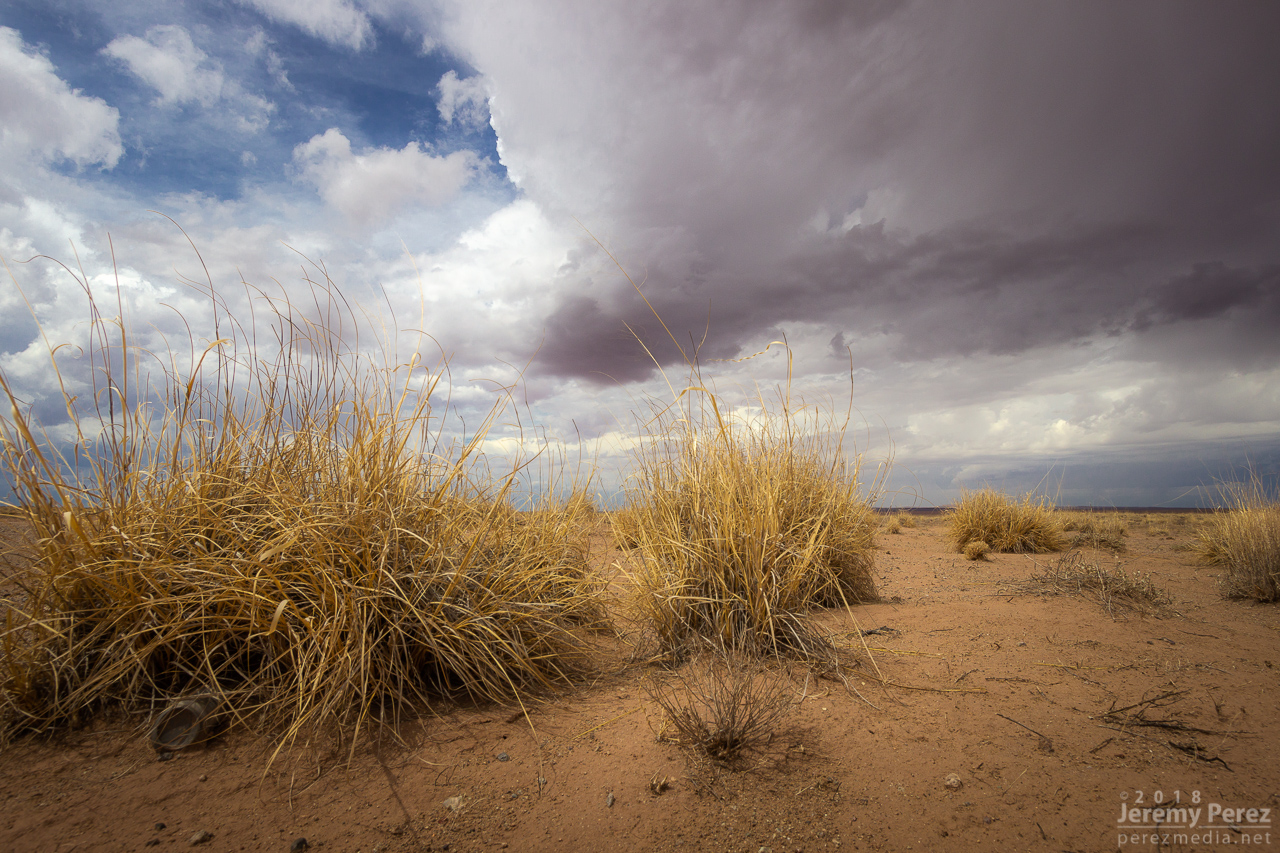
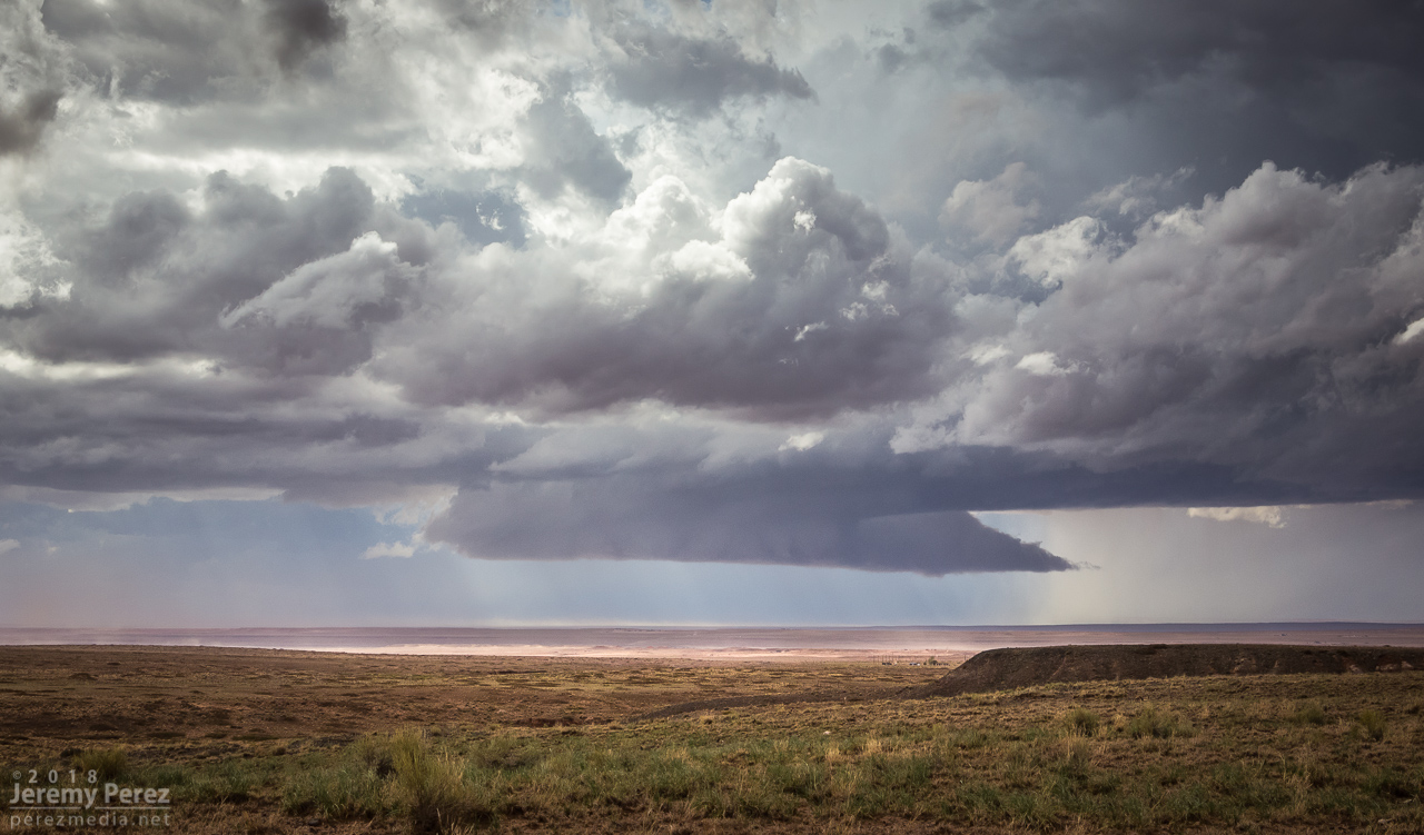
About a minute later, 2058Z, dust appeared on the horizon where the funnel was aimed, so landspout! You never know how much time you’ve got, but I didn’t want to pull over on the interstate. Fortunately, the Two Guns exit was just a couple more minutes down the road. Once I got there, I realized terrain to the west was going to hide the point of ground contact, but I couldn’t waste more time hunting down a better spot.
— 2058Z — Funnel and clear evidence of dust/debris
— 2059Z — Growing dust column with 1 mile to go to next stop
— 2100Z — Landspout strengthening beyond Two Guns
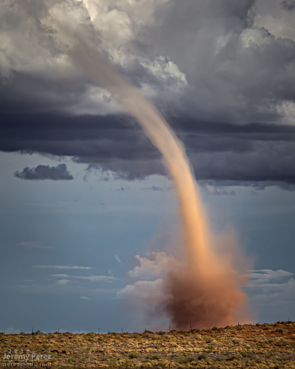
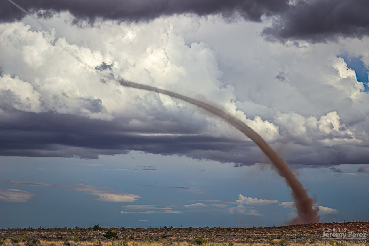
The condensation funnel gradually stretched down into the lengthening dust column. With the sun reflecting off orange dust and white vapor, it was more stunning than I could have hoped for an Arizona tornado. It’s one of the sights I imagine when heading out for a Plains chase — wondering if I’ll catch a high-definition, colorful rope-out among other things. And there I was, 30 miles from home, watching it happen on a Sunday afternoon.
— 2104Z — Looking east-southeast from the east side of Two Guns
— 2104Z —
— 2107Z —
Tornado warning polygon
Family chat recap
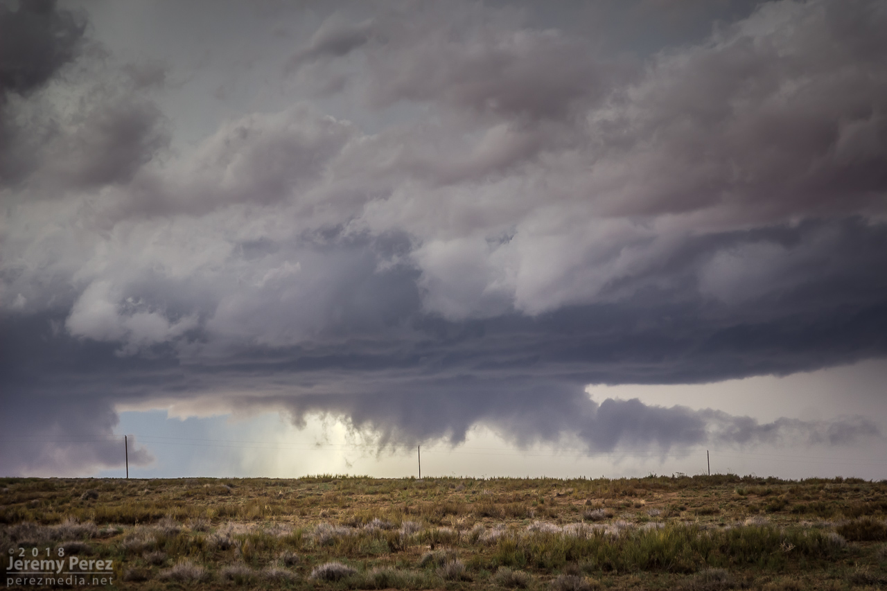
While the storm continued drifting northeast, the base of the landspout drifted slowly southward, stretching the funnel longer as they separated. It dissipated after about twelve minutes, lasting from 2058-2110Z.
— 2108Z —
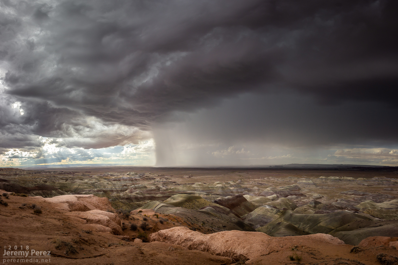
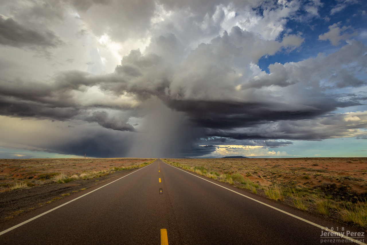
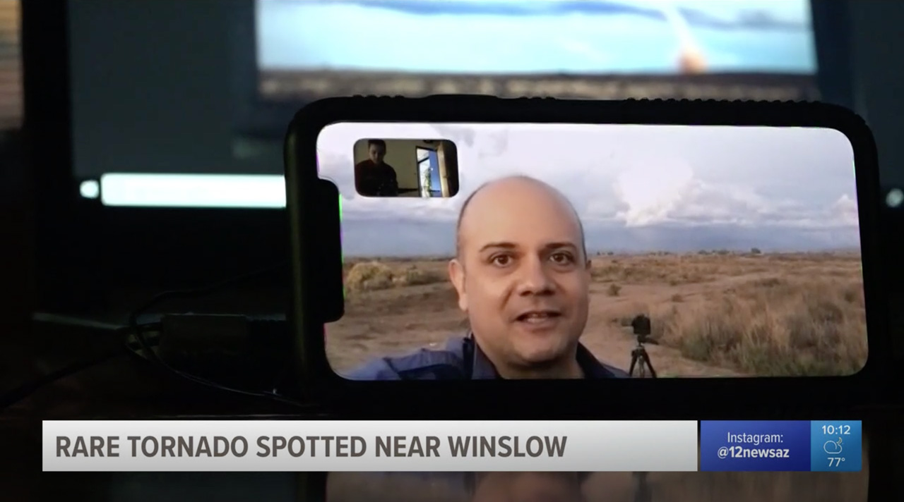
Once it wrapped up, I made my way up Rt 87 north of Winslow to see what new development might look like that way. I got some time lapse running at the Painted Desert Rim View and watched rain, hail and sunbeams roll across striped buttes and hills. Around this time I got a request from 12 News Phoenix for an interview. They were okay waiting a couple hours so I could finish up and get to a spot with better than 1x coverage. On the way back to Winslow, an isolated cell near Mormon Lake eclipsed the sun and while grabbing shots of that, I had a couple cars honk and wave as they drove by. I couldn’t tell who they were, but It kind of added to the feeling of being out on a Plains chase.
— 2310Z — Looking west-southwest from Painted Desert Rim View
— 0005Z — Looking northeast along Rt 87 at receding convection
— 0020Z — View to the southwest of an isolated cell near Mormon Lake
Down by Winslow, I grabbed a few last sunset shots and did a FaceTime interview with Ryan Cody. Funny to see a news camera set down on a desk and aimed at a cell phone to capture the interview. I barely watch broadcast news anymore, so these things are surprising to me.
— 0035Z — Last light on receding storms from north side of Winslow
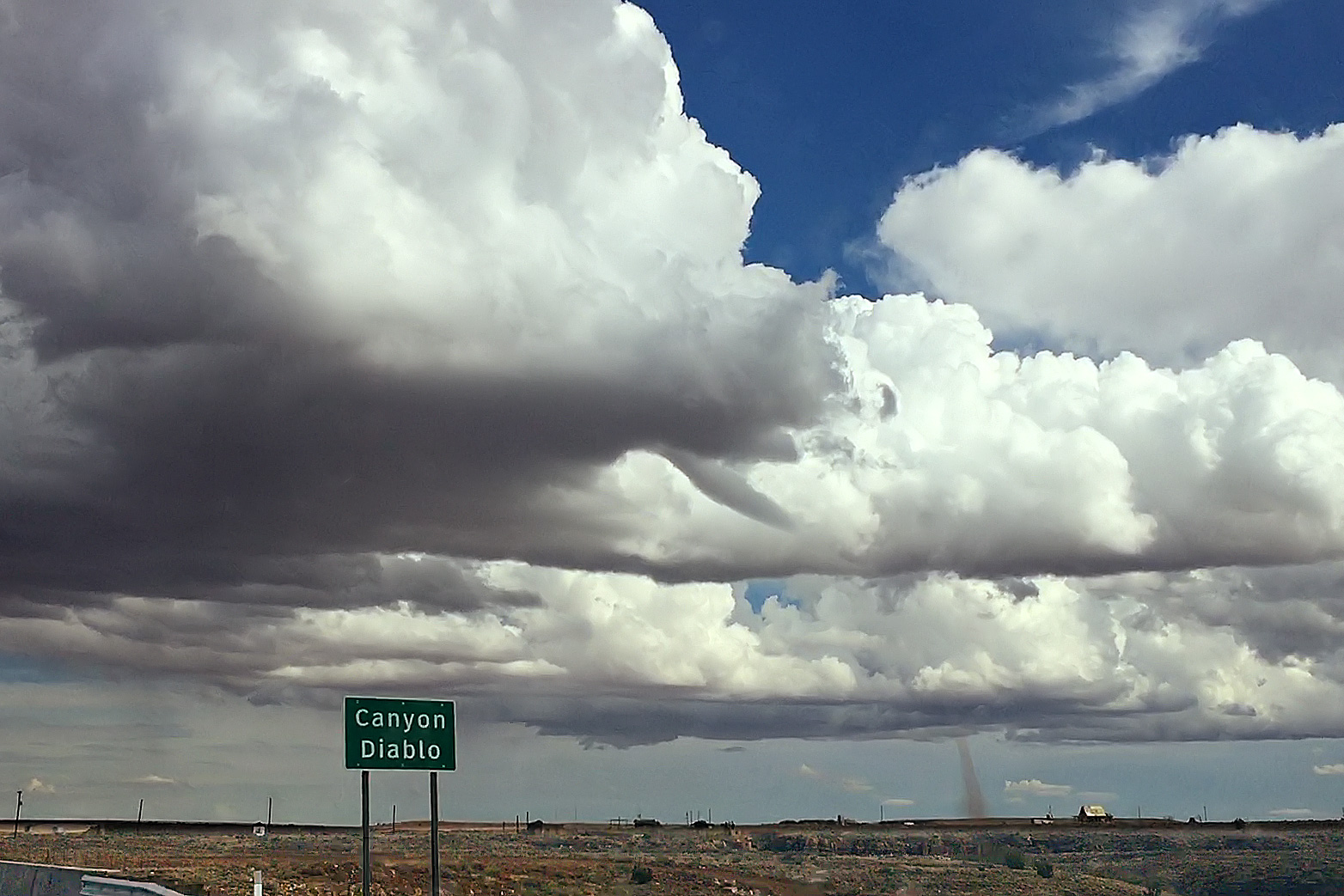
Based on information available at the time, SPC plotted the tornado report further north than I think it actually occurred. I drew up my line of sight in on Google Maps. Then using another series of shots from a visitor at Meteor Crater, I lined those up over the top of a recognizable structure which put it directly north of there. So that puts it over a rocky outcropping about a half mile east of Meteor Crater Road and 2 miles south of I-40.
Line of sight map of Meteor Crater landspout
Facebook reference photos for Meteor Crater reference view
Watching video later, it was fascinating to see the outer sheath of dust rippling downward around the smooth inner column. Such a spectacular thing. And then there’s the strangeness of chasing over eight years, a couple dozen tornadoes later, and suddenly in 2018 to finally get landspouts on three different chase days — two of them a half hour from home. Wish I could say I now feel more confident in being able to forecast and catch this special kind of twister. But no. The needle gets mixed to a different spot in the haystack each time. That really makes it rewarding when it pans out though.
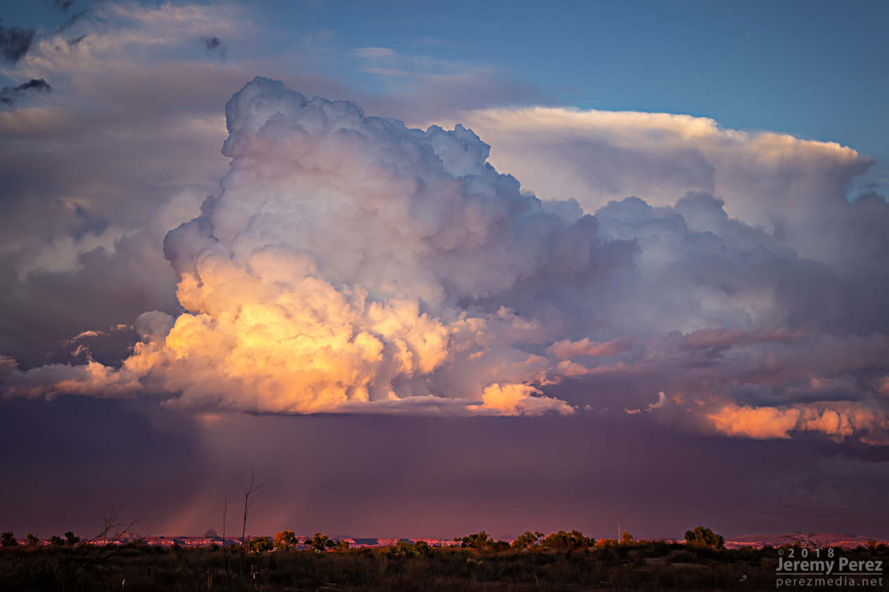
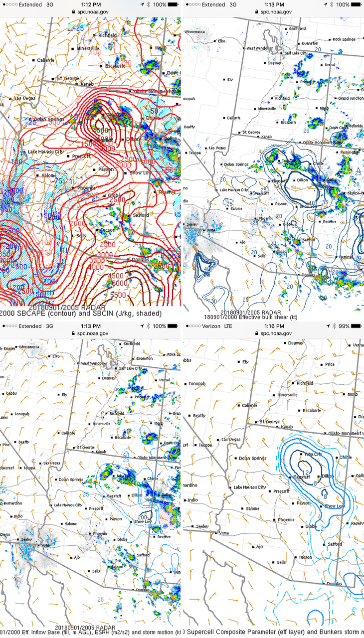
Arizona is not prime territory for supercells. Moisture, instability, and shear don’t superimpose often. The tail end of monsoon season is when that exciting combo is most likely to happen. And it set up perfectly this year on September first. This wound up being my best storm chase in Arizona yet, and rises above a lot of Plains chases.
A few days before, GFS was sparking my interest, hinting at a shortwave moving over monsoon moisture. By two days prior, 3KM NAM was indicating enough instability, bulk, and directional shear for supercells with tornadoes as a potential hazard. The day before, John Sirlin and I discussed target options. The MRCZ area on the Navajo reservation looked good early on, with options gradually moving southeastward toward New Mexico later in the day. John wound up driving north overnight to avoid Labor Day traffic and was in the Winslow area to catch an early morning shelf cloud over the Painted Desert.
I finally got moving and was hanging out on Sand Springs Road northwest of Tolani Lake by 1830Z. The sky was clearing after the morning storms and new convection was bubbling along Hwy 89 north of Flagstaff and gradually moving into the Little Colorado River Valley. The new cells struggled for a while, but even in their meager state showed they wanted to shear downstream and spin.
— 1910Z — Convection building over the San Francisco Peaks
— 1941Z — Weak convection drifting over Sand Springs Road
— 1957Z —
— 2016Z — Mesoanalysis indicating conditions were primed for strong storms
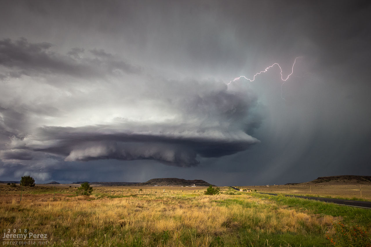
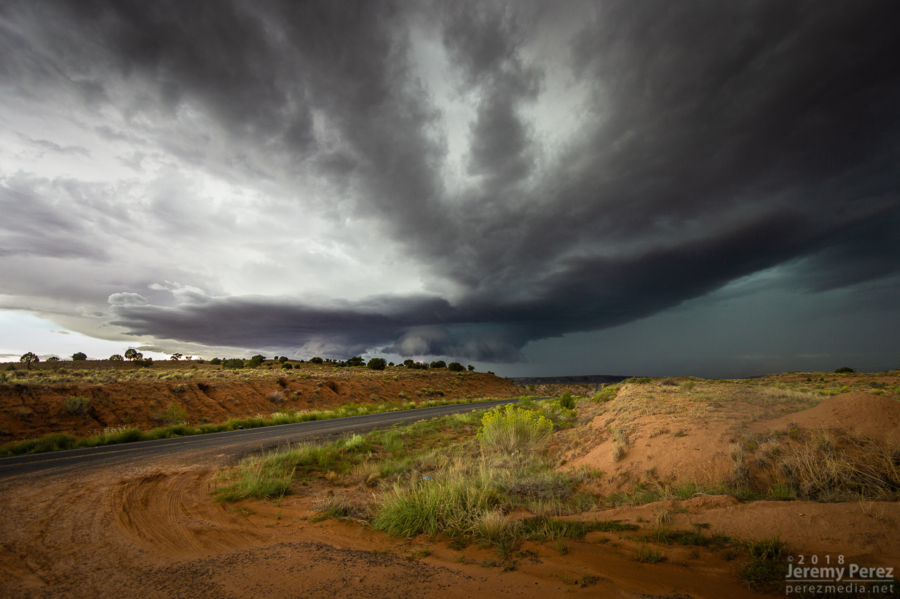
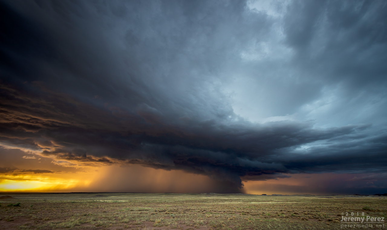
By 21Z, a line of convection from Tovar to Garces Mesas was strengthening rapidly. And doing so further east than I was expecting. I raced to Tolani Lake and headed east on Indian Route 6820—a road I haven’t traversed before. It led me across dusty plains, mud pits, semi-dry washes, and encroaching dune fields as storms darkened to the north.
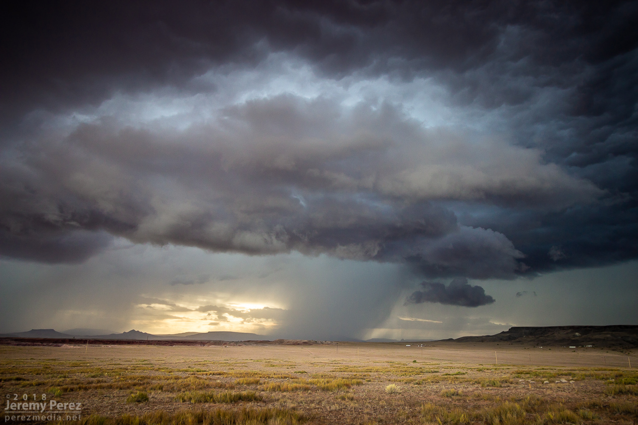
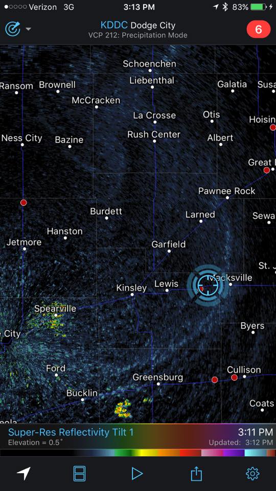
By 2130Z, I was about 10 miles east of Tolani Lake and the lead cell was directly north of me. It had an inflow tail, RFD cut and was showing a velocity couplet on radar. Fifteen minutes later, a wall cloud was evident, but contrast was poor and I couldn’t tell what it was doing. Dust was getting dragged into the storm, encouraging me to find spots to stop that weren’t obscured by trains of cascading dirt.
— 2113Z — Heading down Rt6820 as the eastern cell rapidly strengthens
— 2134Z — Structure taking shape on the lead cell, looking north from ten miles east of Tolani Lake
— 2145Z — Wall cloud taking shape
— 2147Z — Dusty inflow was an ongoing problem for visibility
— 2129Z — Velocity couplet developing on the lead cell
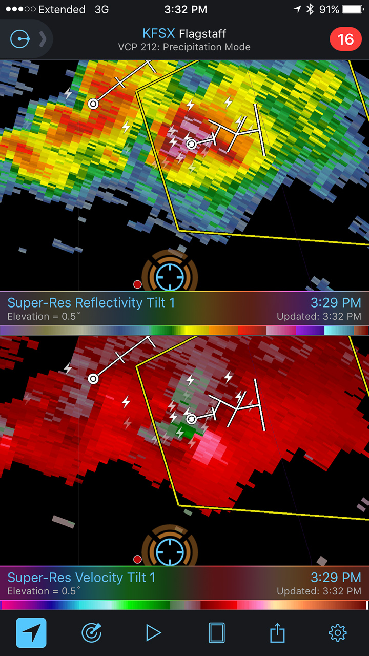
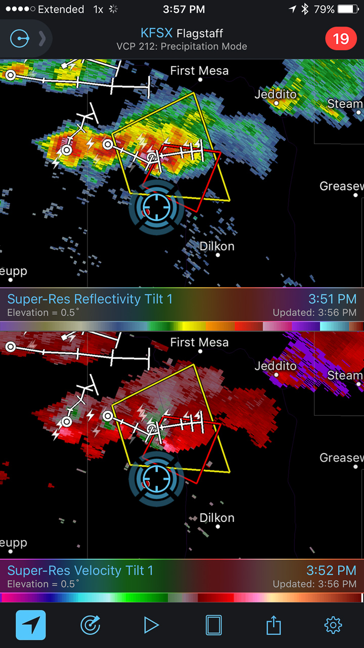
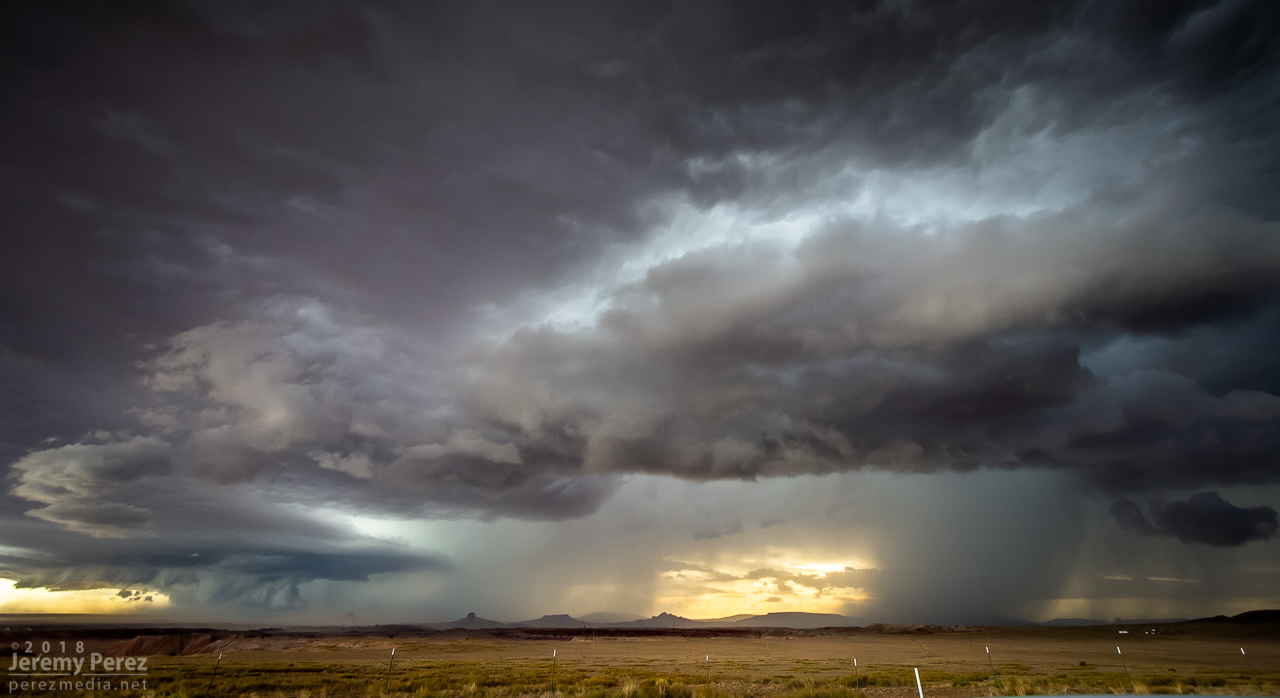
At 2147, the wall cloud got fairly pointy, but I was still too far out and squinting through a bright sunlight to tell what was going on. The velocity couplet intensified at this point and the storm received a tornado warning a few minutes later. I just kept shooting photos and video in hopes of enhancing contrast later to see what was back in there. I wish I could have tightened zoom on video, but sun was too bright to finesse using the LCD viewer, so I had to keep it wide. That’s happened to me before. I need to work out a solution for that.
— 2148Z — Wide view of the storm
— 2148Z — Close view of the wall cloud
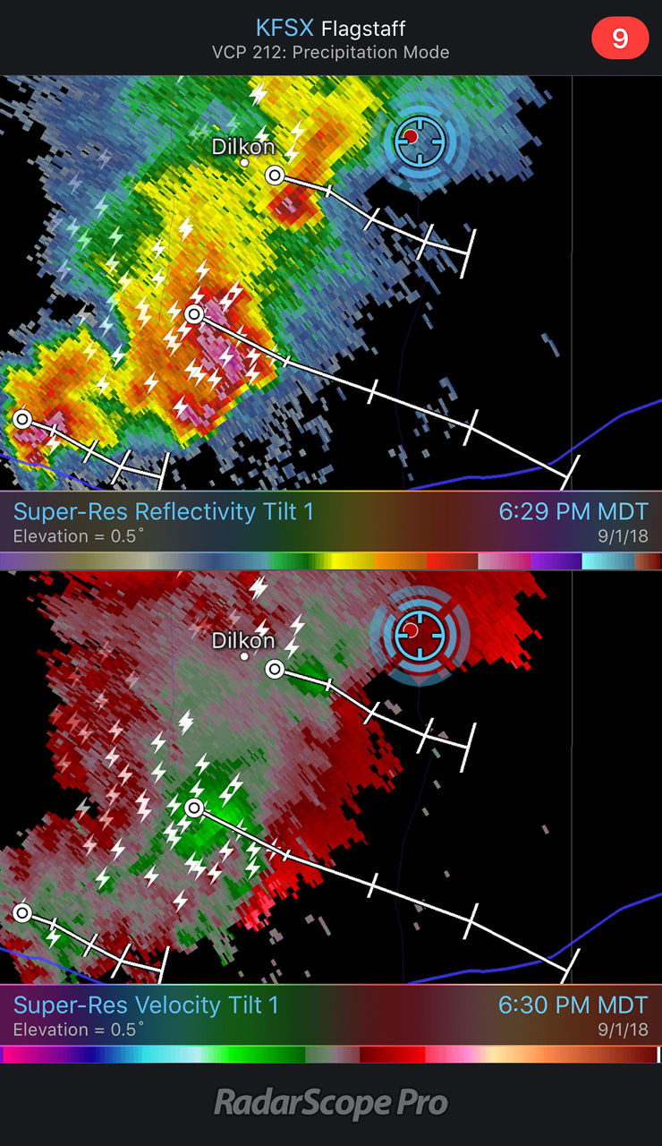
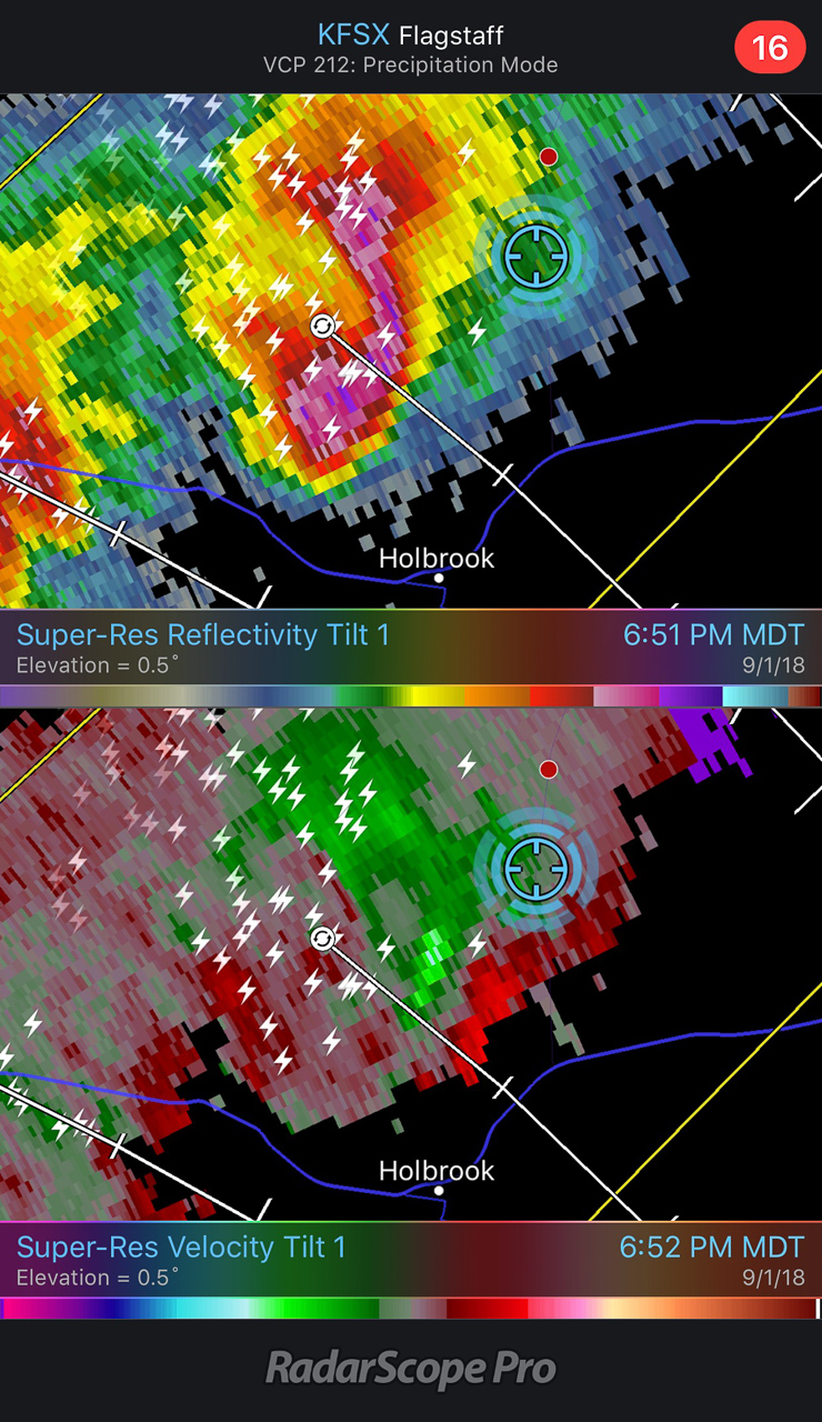
— 2148-2152Z — Reflectivity/Velocity Scans with the storm at its peak
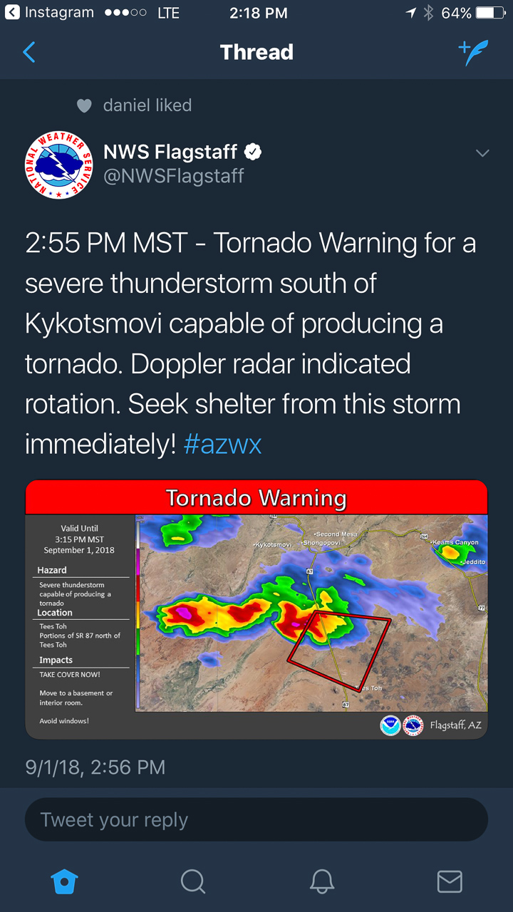
— 2155Z — Tornado warning issued by NWS Flagstaff office
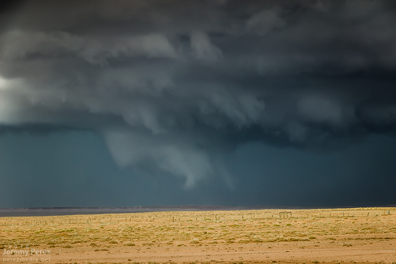
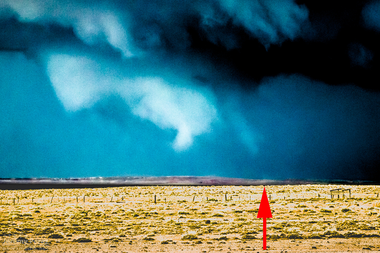
Pulling detail out of the shots and video later clearly showed rotation in the wall cloud. From 2147-2148Z, shots picked up a funnel rotating with the wall cloud. A couple zoomed images show what could be debris beneath the funnel at ground level. Right after this, the entire scene flooded with inflow dust and I had to move on.
— 2148Z — Zoomed view of wall cloud and funnel
— 2148Z — Contrast enhanced to show dust at surface
— 2148Z — Contrast enhanced 7 seconds later
— 2147-2148Z — Accelerated footage of rotating wall cloud 2147-2148Z
Meanwhile, over the last hour, John was right up under the storms, picking up at least one convincing tornado (to my eyes) at 2123Z, followed by other shots that I can’t wait to check out.
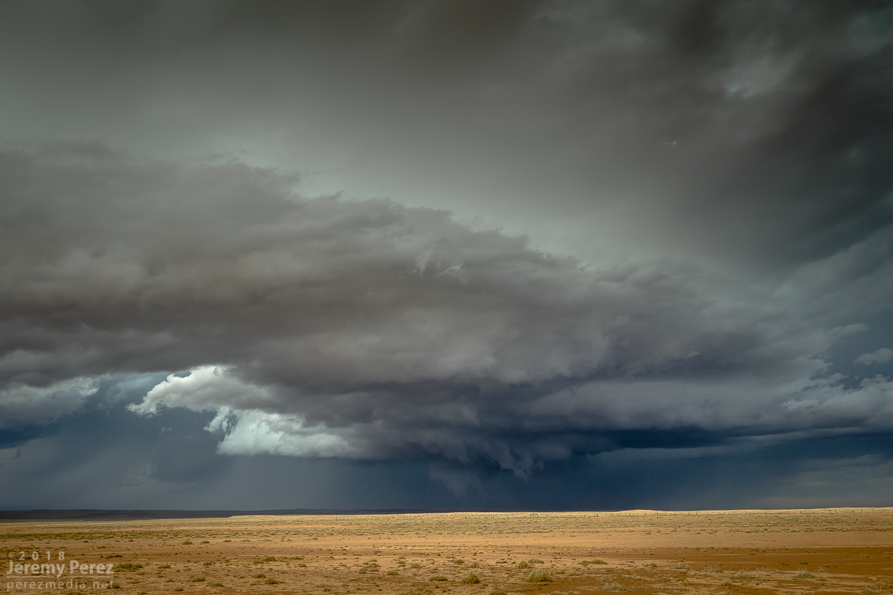
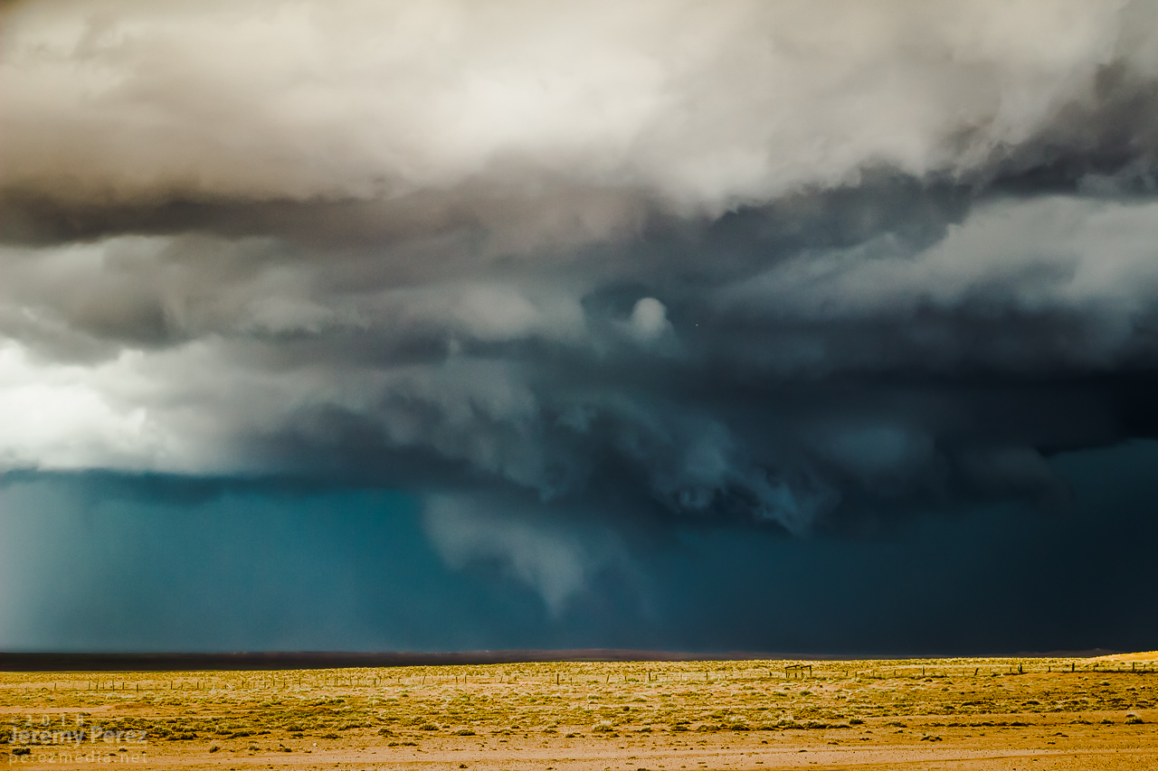
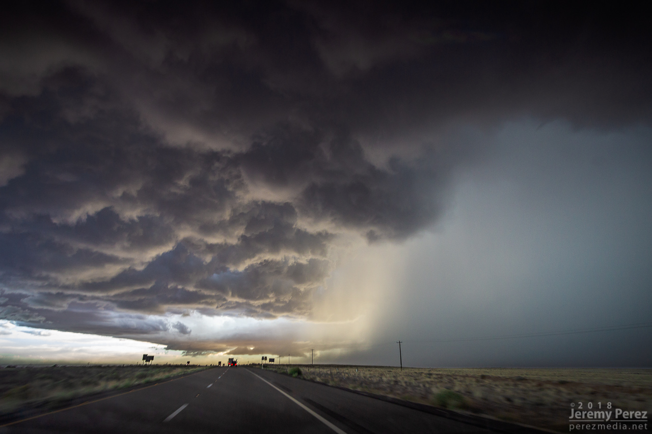
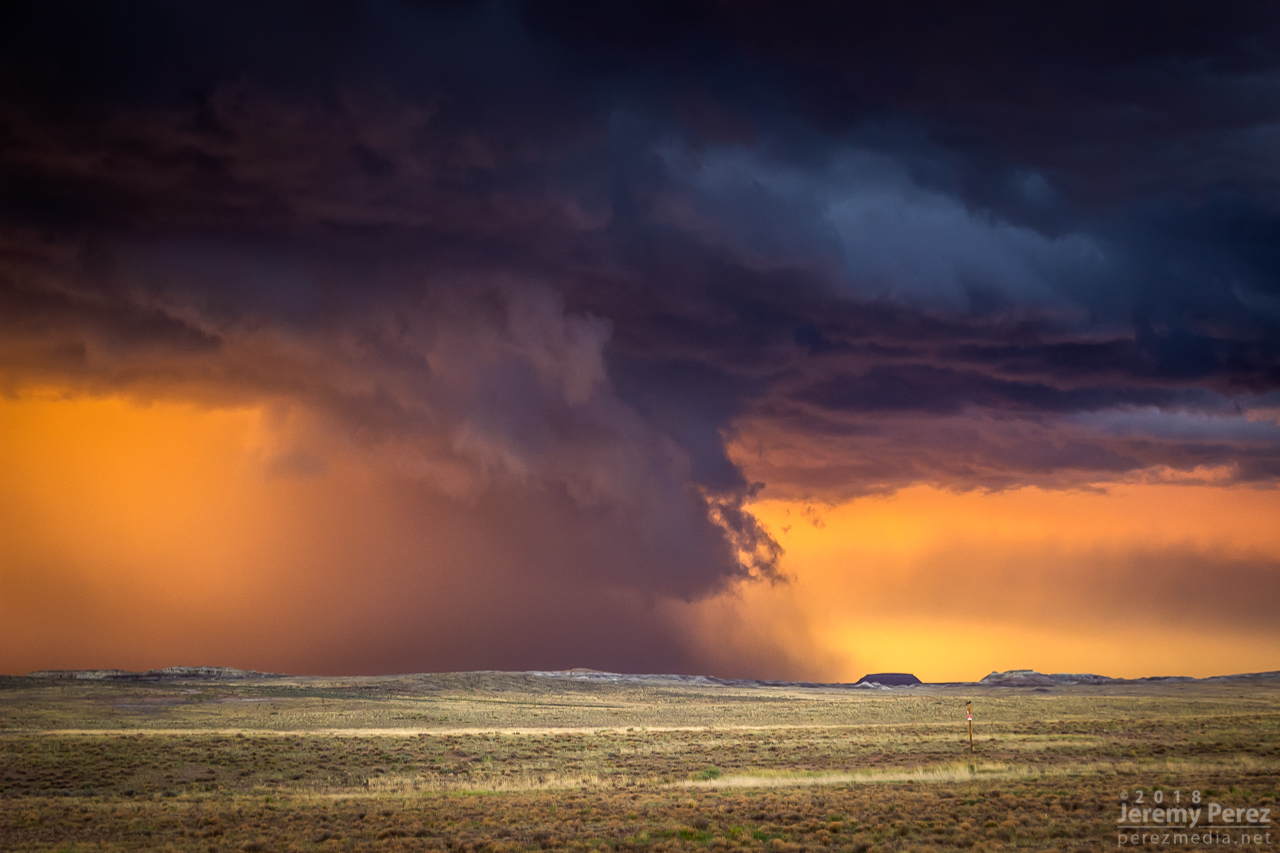
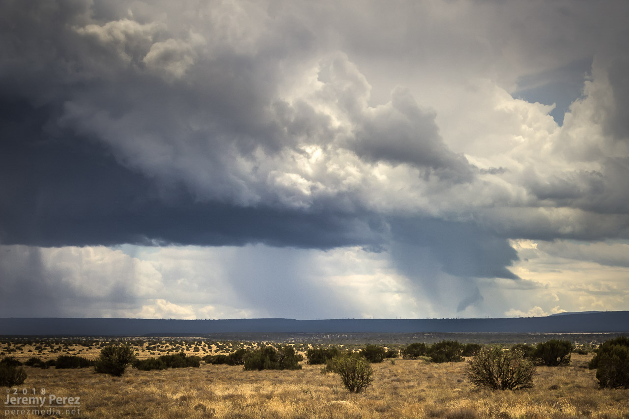
The RFD cut on the storm grew and continued to look promising, but I got detoured by a washed out section of road near Honey Spring and lost track of things making my way back to a different road. By 2213Z, the circulation had fully occluded and looked like a huge ice cream cone as a burst of hail and a high-based, roping funnel draped around it.
— 2152Z —
— 2205Z — RFD cut from a muddy wash near Honey Spring that was too risky to cross
— 2214Z — Occluded updraft and elevated funnel
The entire time this cell was being awesome, two other trailing cells were also spinning away. The middle one wasn’t faring too well and seemed to be riding elevated behind the lead cell’s outflow. I figured the third in line would be dealing with the same thing. However, it managed to hop south far enough to get surface based. So, eight minutes after the great ice cream cone view, I glanced over my shoulder and saw an awesome cow catcher RFD shelf scooping out of its base. Over the course of about five minutes, it picked up a shaggy wall cloud/tail cloud combo.
— 2221Z — RFD shelf/rooting base beginning to develop on the trailing storm
— 2223Z —
— 2229Z — Wall cloud/tail cloud developing
— 2218Z — Reflectivity/velocity of lead and trailing cell along with struggling middle cell
It’s both an awesome and frustrating problem to have two beautiful cells competing for attention with spectacular volcanic plugs taking turns hiding them with each turn in the road. The lead cell was moving into lower instability and weakening, but still looked awesome and I didn’t want to lose it. So I kept after it, figuring the trailing cell was headed my way anyway. I just needed to get to a spot where the terrain would let me see them both.
— 2229Z — Trailing cell vs. encroaching terrain
— 2244Z — Lead cell vs. encroaching terrain
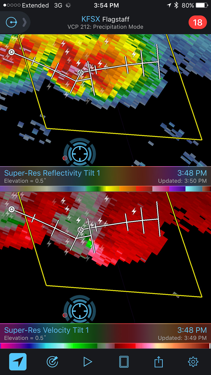
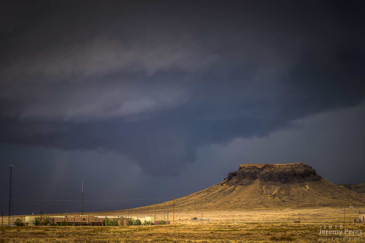
I finally found that spot just east of Dilkon. The lead cell was losing its battle to remain surface based. But before it went fully elevated, it wrapped up one last occlusion. Not as beefy as the previous one, but still lancing out with one last funnel.
— 2249Z —
— 2310Z —
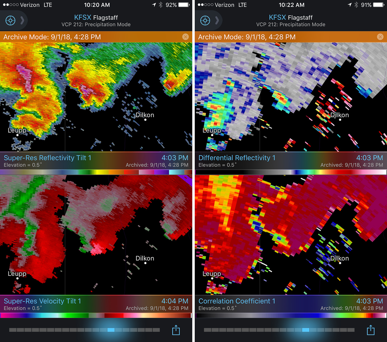
Meanwhile to the west, the trailing cell was getting a classic, sculpted look. At 2307, I realized a knobby wall cloud was dipping down out of its base. It was tough trading focus between the two storms, and wish I had been shooting the trailing one just a few minutes sooner, since reviewing radar later showed a low CC value under that circulation at 2304Z. Would love to have a few zoomed shots at that point.
— 2308Z — Trailing cell and wall cloud
— 2308Z — Tight view of wall could
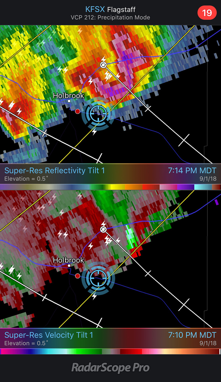
— 2303Z — Reflectivity, Velocity, Differential Reflectivity, and Correlation Coefficient
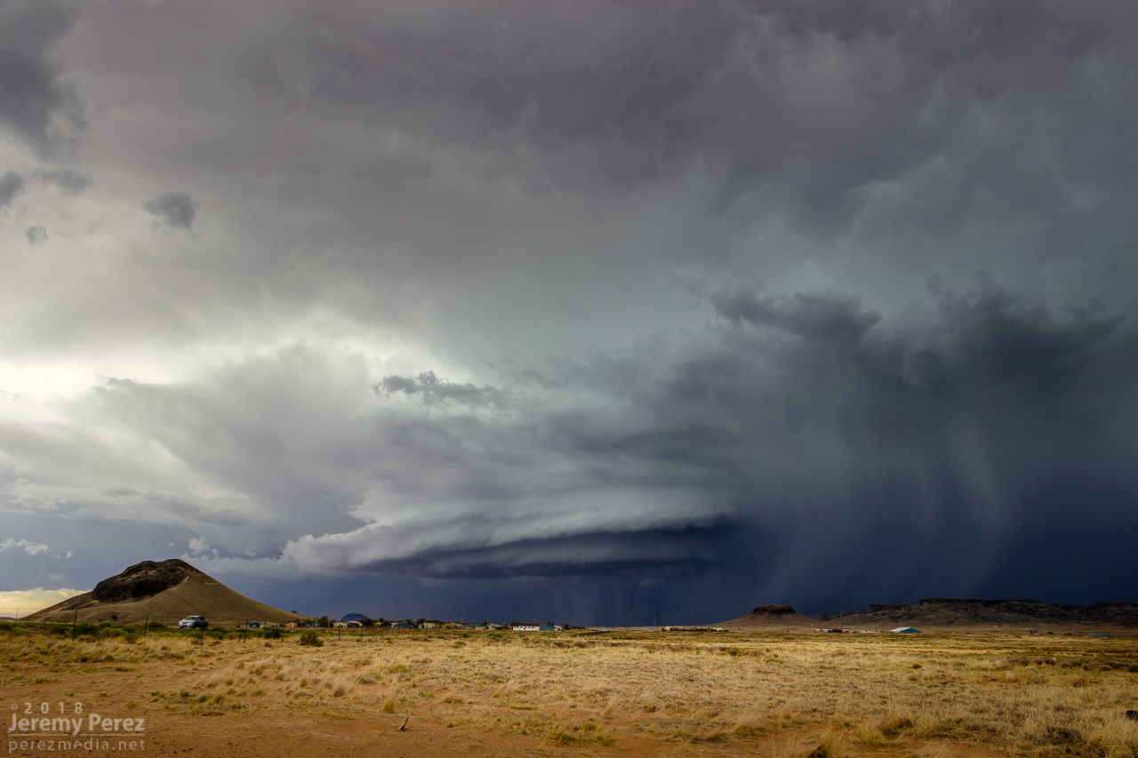
As the lead cell withered away, I set up for a time lapse of the trailing storm as it approached. It was a perfect spot with the stacked base spinning, morphing, spitting lightning, and draping feathers of precipitation as it aimed slightly to my south.
— 2326Z — The trailing cell is now the main show as it slowly approaches
— 2336Z —
— 2351Z —
— 2323-2357Z — Time lapse of approaching supercell from Dilkon
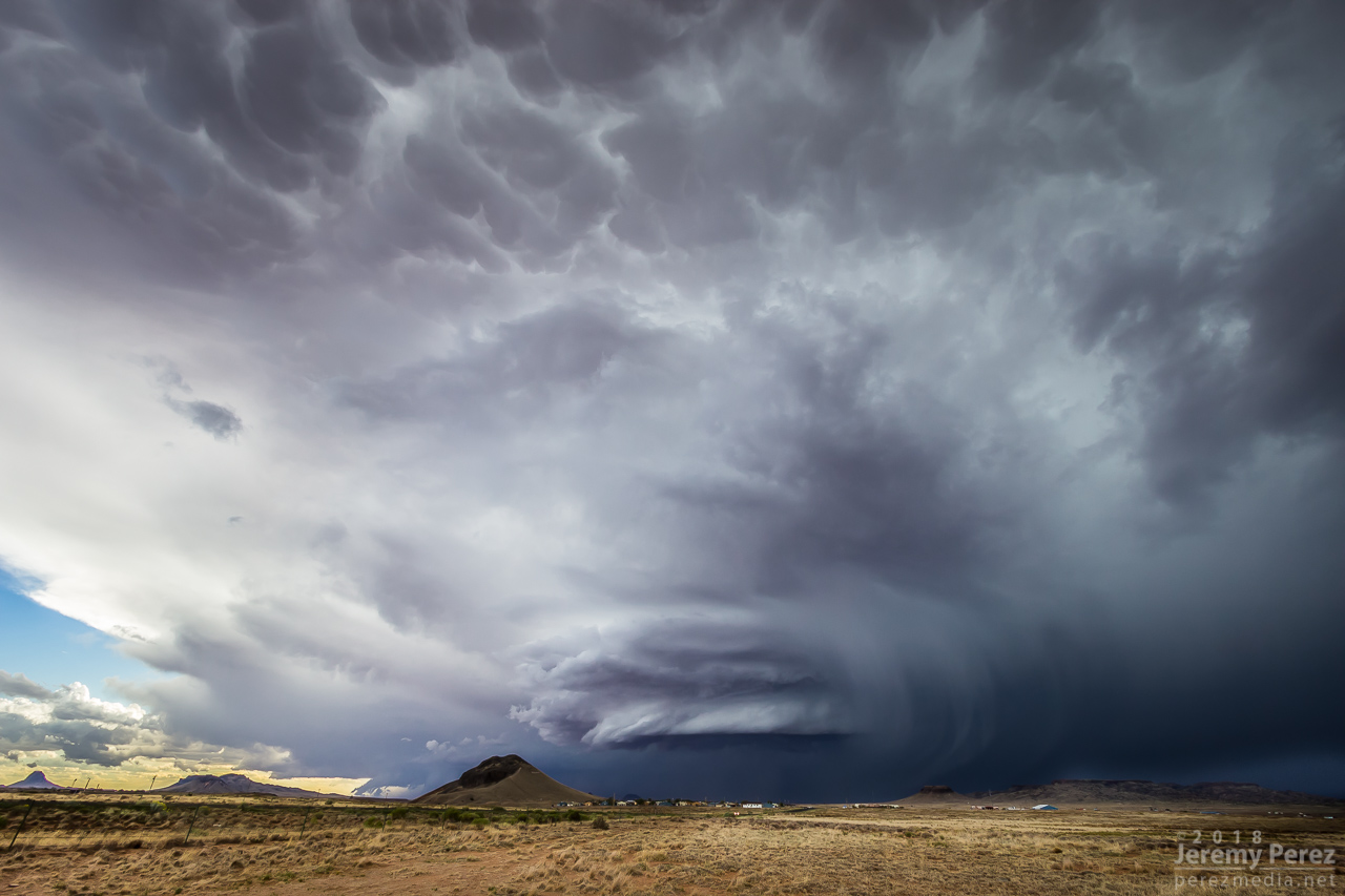
As it moved in, a new line of convection had filled in and was advancing quickly, shoving a low, gnarly shelf cloud as it tried to catch up to this spinning monument of rough pottery in front of me.
— 0007Z — Lead cell now with a line of storms hot on its tail as seen by shelf cloud hugging the horizon to the left
— 0024Z —
— 2312Z — Reflectivity/Velocity of line of storms rushing in
Staying ahead and in good position with that isolated cell seemed like a simple thing. I was planning to jog south on Rt 77 to Holbrook to get parting shots of it and pick up whatever new developments were inbound. But radar was showing me that the trailing line was getting serious, loaded with some big hail, and quickly expanding. I realized if I didn’t start hustling, it might cut me off from my planned route south, and punish my wife’s car in the process. So I only had time for quick stops or through-the-windshield shots as that isolated cell started to gust out and merge with the approaching line of storms. It wish I could have spent more time along that road. It looked down on an expansive, almost alien landscape with warm, late afternoon light flooding beneath approaching storm bases and greenish cores dumping on blackened buttes and red cliffs. Such a fantastic view.
— 0042Z — Once great supercell now dying out
— 0043Z — Panoramic view from Rt 77 as the hail-filled line of storms rushes in
— 0030Z — Reflectivity/Velocity of my new predicament for heading south
With just a few miles to go before reaching I-40, radar showed that line of storms accelerating into a bowing segment with a very menacing load of hail. I wanted to get onto Hwy 180, but to do so, I had to head southwest on I-40 into Holbrook before catching 180 back east. I had a tough call—either bail east at I-40 to escape the looming core, or jog in front of it to get to 180. When I got there, it looked like I had enough time to spare and I made for 180. That turned out to be a very tense six miles. The wind was picking up ahead of the dark, towering column of hail, and bits of ice were starting to hit as cars and trucks began hesitating, not sure what to do. I finally breathed easier as I got around the curving arc of monstrous ice and heading back east on Hwy 180. The views were incredible again. The bowing segment was reorganizing and developing a mesocyclone as it sailed over Sun Valley. The core looked fierce as the sun lit it in orange highlights agains black shadows. Around this time, the travel stop where I had to make that tough east-west decision was getting torn up by baseball size hail.
— 0103Z — Menacing wall of hail rapidly approaching my route to Holbrook
— 0134Z — Bowing segment has organized back into cellular mode after dropping baseball sized hail east of Holbrook
— 0135Z — Tight view of sunlit core and rugged shelf cloud
— 0051-0114Z — Reflectivity/velocity of baseball filled bowing segment
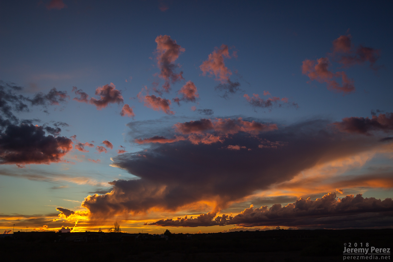
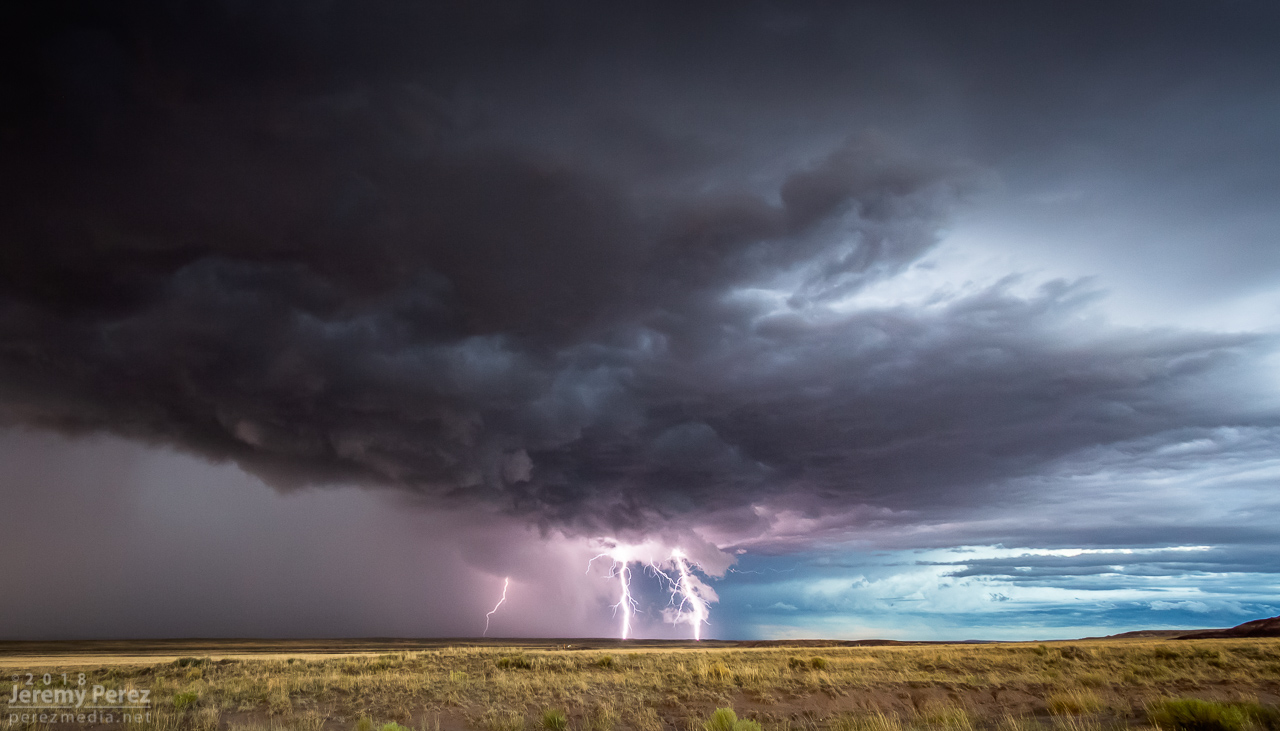
The big hail-maker continued onward to the east, spitting lightning as it departed. Further to the west, another cell was working on a weak mesocyclone of its own. Not as persistent and strong as the others had been, but still winding up a beautiful storm. As sunset and twilight deepened, the lightning from that cell served up a perfect combo of purple strikes on an orange and yellow sky.
— 0136Z — Sunset on Hwy 180 with a weaker cell trying to drape an inflow tail across the setting sun
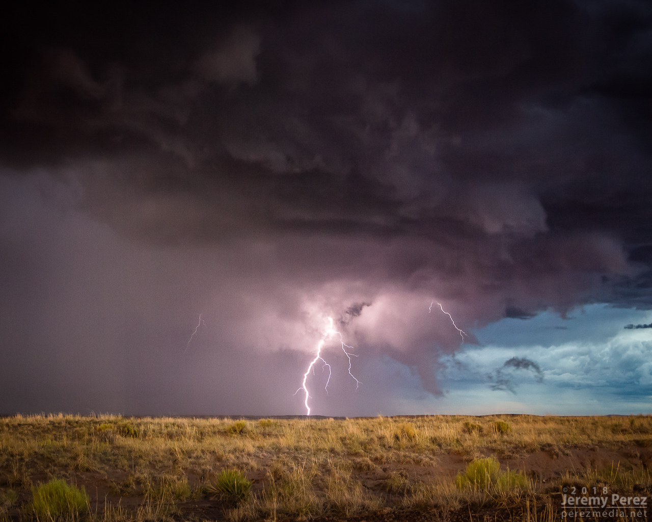
— 0151Z — Lightning dropping out of the core of the stronger cell to the east
— 0153Z — More from the core of the east cell
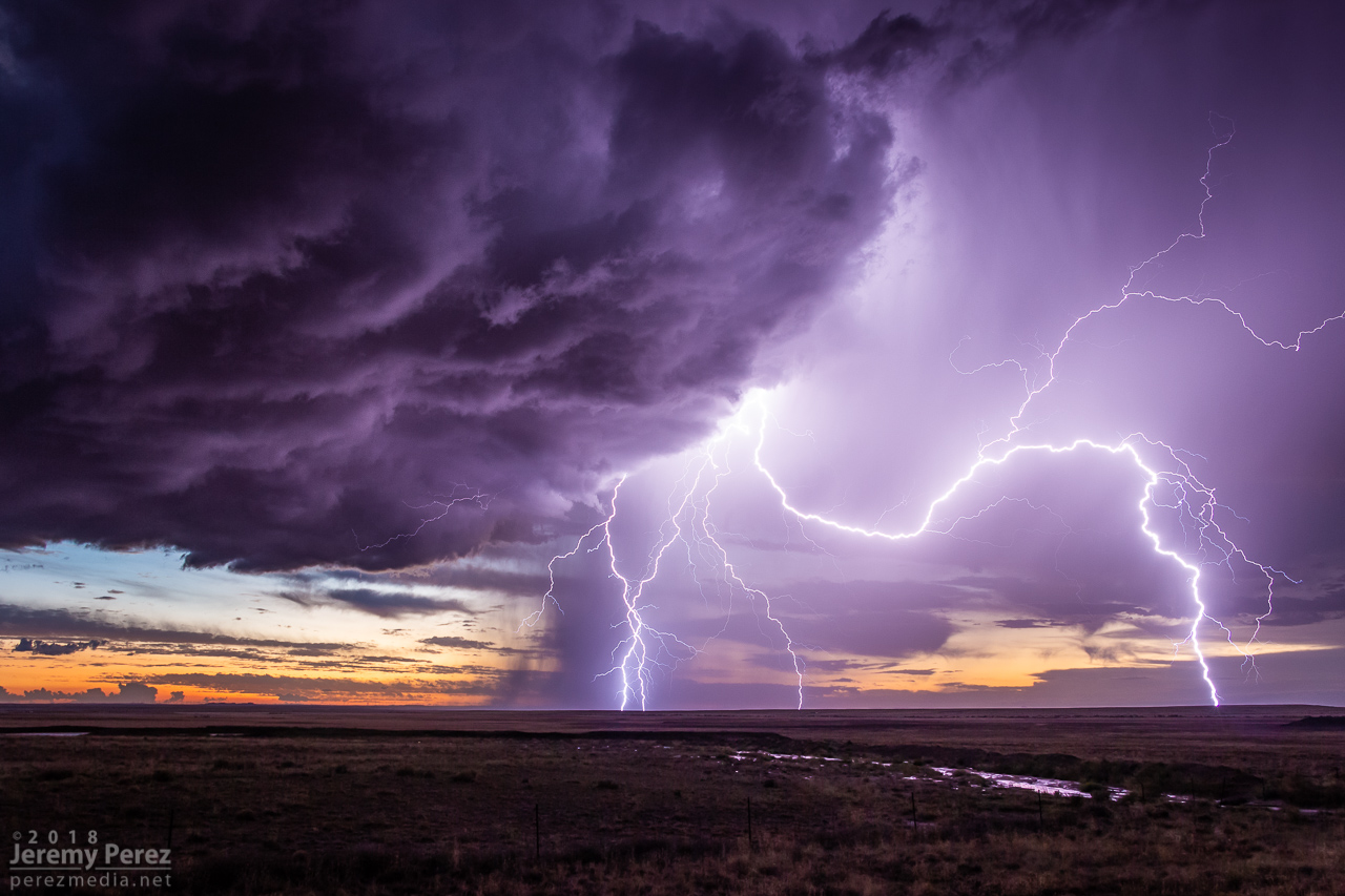
— 0214Z — Western cell gusting out with a spectacular lightning display against the twilight sky
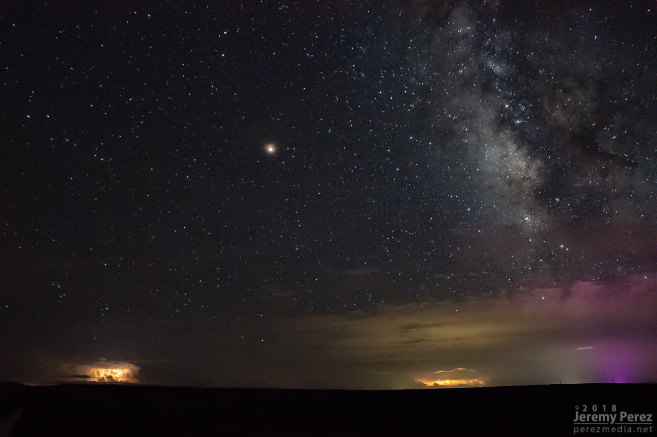
A short time later, John and I caught up and shared a few stories and LCD previews before heading off to attempt some final sprite photos. No sprites for me, but still a serene view of Mars and the summer Milky Way drifting westward as distant storms flicked light across bubbling cloud tops and coyotes yipped amid the surrounding hills.
— 0346Z — Mars, Milky Way, and flickering storms 130 miles to the south from Hwy 180 southeast of Holbrook
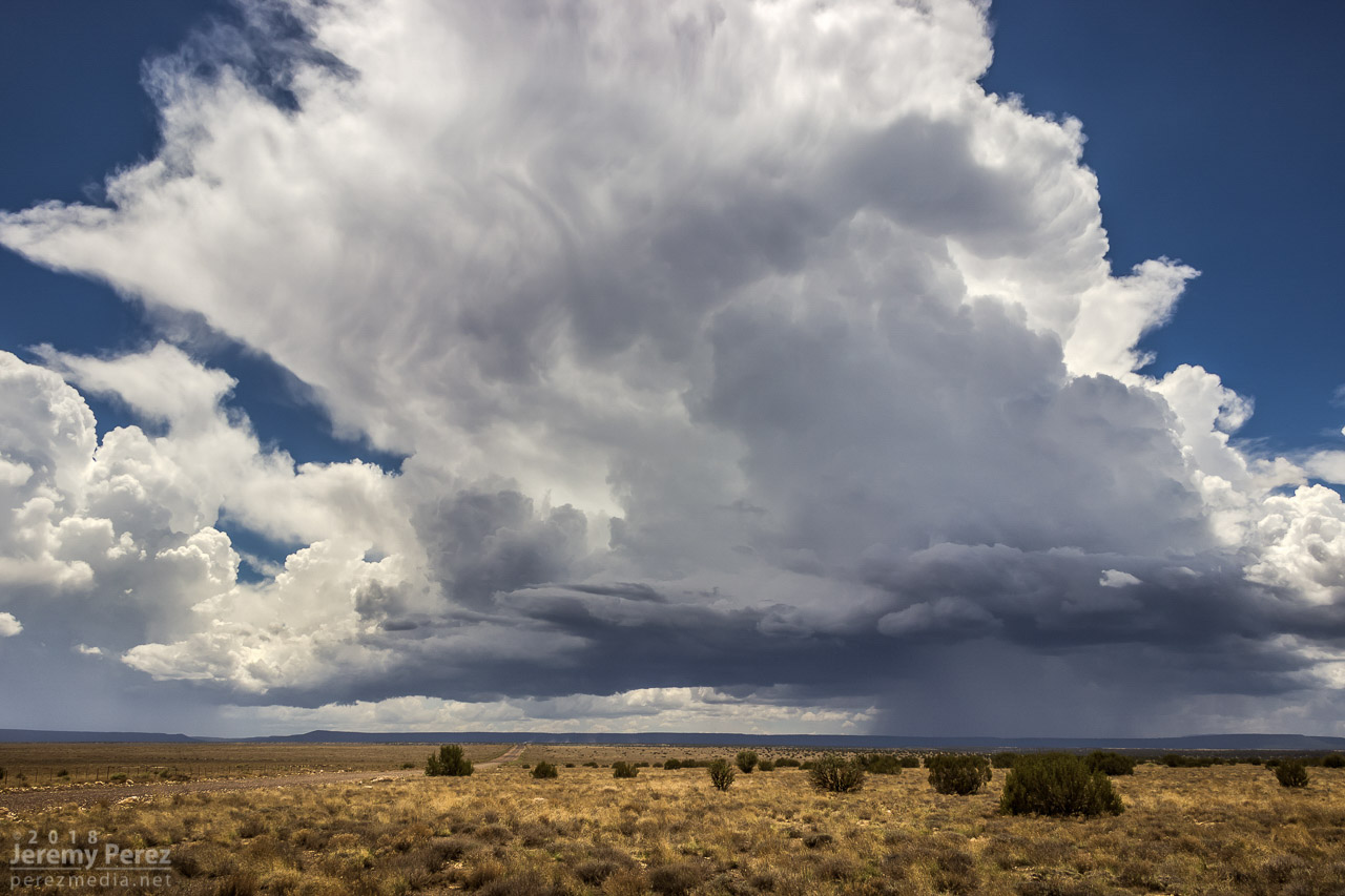
This started as a pretty simple, 20 mile local chase that wound up overperforming. The day featured northwest flow with storms firing on the higher terrain and moving along the Mogollon Rim which is oriented northwest to southeast. I headed east of Flagstaff on I-40 and drove down a dirt road to a vantage point less than a mile south of Twin Arrows. I was trying to catch the collision between a cell building south of Flagstaff with a fresh outflow boundary to its southeast. Sometimes these dish out some pretty structure before everything fills in. I figured I’d try some Lightning Trigger shots while I was at it.
The growing cell was a thing of beauty by monsoon pop-up standards, with a solid updraft fist punching a big ripple into a doughy anvil.
— 12:36PM / 1936Z —
As that cell approached the outflow boundary of the dying storm downstream, it sprouted up a choppy arcus cloud, but that was about it. Not quite what I was hoping for, but there was still plenty of afternoon left and I thought maybe something closer and further north would light up.
— 12:44PM / 1944Z —
It wasn’t long before another cell went up near where the previous one had started, and from then on, it seemed Anderson Mesa was going to be the tracks for a steady train of storms cruising southeast. By then, another Arizona chaser, John Sirlin, had situated himself about a mile and a half further south and was watching from a good hilltop vantage.
Storm chaser, John Sirlin, parked at the next hilltop
Over the next hour, I noticed that storms were picking up laminar striations in their bases and had a couple eye-catching silhouettes taunting me from 11 miles away.
— 1:19PM / 2019Z SSW of Twin Arrows —
— 2:00PM / 2100Z SSW of Twin Arrows —
— 2:01PM / 2101Z SSW of Twin Arrows —
— 2:10PM / 2110Z SW of Twin Arrows —
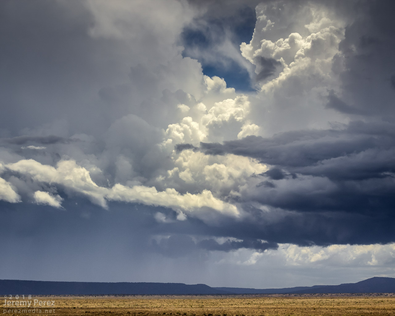
As that last funnel looking thing materialized, another storm had taken root northwest of it and was growing stronger. It was being led by a lowered, shelfy base while the trailing core looked cupped and hollowed out. I was noticing thin rain shafts on this and previous storms that kept catching my eye, but I wrote them off.
— Earlier pair of rain shafts 12:47PM / 1947Z S of Twin Arrows —
This new storm started to develop broad anti-cyclonic rotation on its north side but eventually picked up a tighter cyclonic couplet and a decent wall cloud on the opposite/south side of the core. And that core was gradually hiding the action. I wish I had been out on Lake Mary Road watching this, but road options require a huge commitment. Investing in a 35 mile drive through mostly trees to get to a probably-not-long-to-live storm with an unobstructed view 11 miles away is a tough call to make.
About the time rain popped up overhead and chased me into my car, I got a message from John asking “Did you get it?” Cold chill time. What did I miss? The pic he sent afterward showed a close up view of one of those ‘rain shafts’ stretching out at a 30 degree angle from the storm. I was time lapsing the cell at that time, and figured I should have caught the feature I wrote off. We finished watching a couple more cells develop and chatting with another chaser that had set up in the area, Nick Pease.
— 3:18PM / 2218Z severe-warned storm —
— 4:10PM / 2310Z last cell over Anderson Mesa —
Getting home and processing the shots, sure enough, that thin feature dangled cloud to ground, getting pulled along with the anticylonic rotation for about 6 minutes. In addition to John’s shot, I posted the time lapse and a line-of-sight map for the Flagstaff NWS office to review. Their assessment aligned with John’s earlier heads-up and the SPC storm report was updated to plot it as a landspout tornado.
— 2:26PM / 2126Z landspout about 12 miles SW of Twin Arrows —
Definitely not the hit-you-over-the-head variety that we saw in Colorado a few months ago, but it was pretty rewarding to finally document one in Arizona.
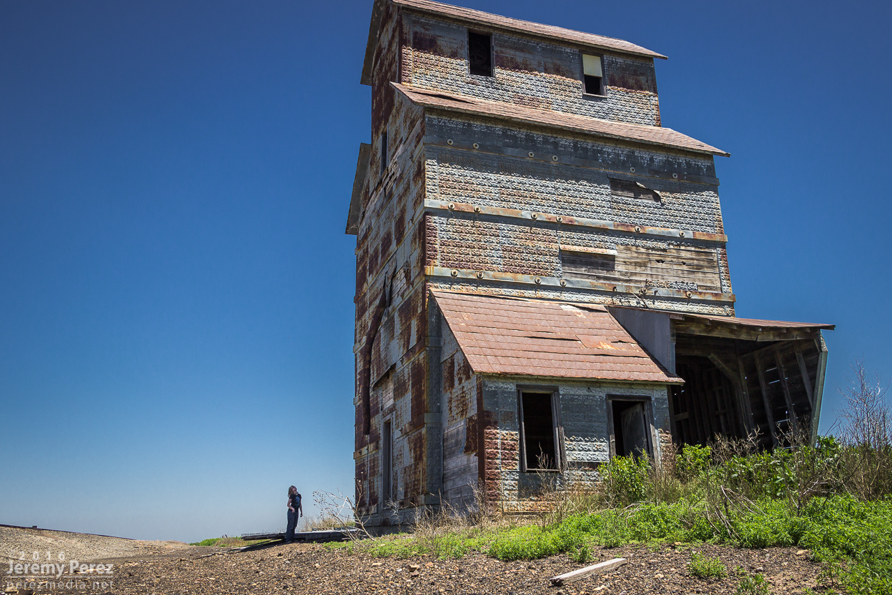
We started the day out in Dodge City where we had viewed several tornadoes the day before. This day’s chase took us further east into Kansas looking for convergence and backed winds along the dryline and other boundaries. As we made our way east on Hwy 50, we stopped at a couple abandoned buildings east of Spearville, at a spot on the map called Ardell. We had passed these the day before while shooting some sunset pics after the Dodge City storm. My daughter is a bit of an explorer and spent a lot of time checking things out, including peeking into a window where she was hissed at by a huge, cranky gopher snake that had wound itself around some pipes dangling over an inky abyss.
Exploring a towering abandoned building in Ardell.
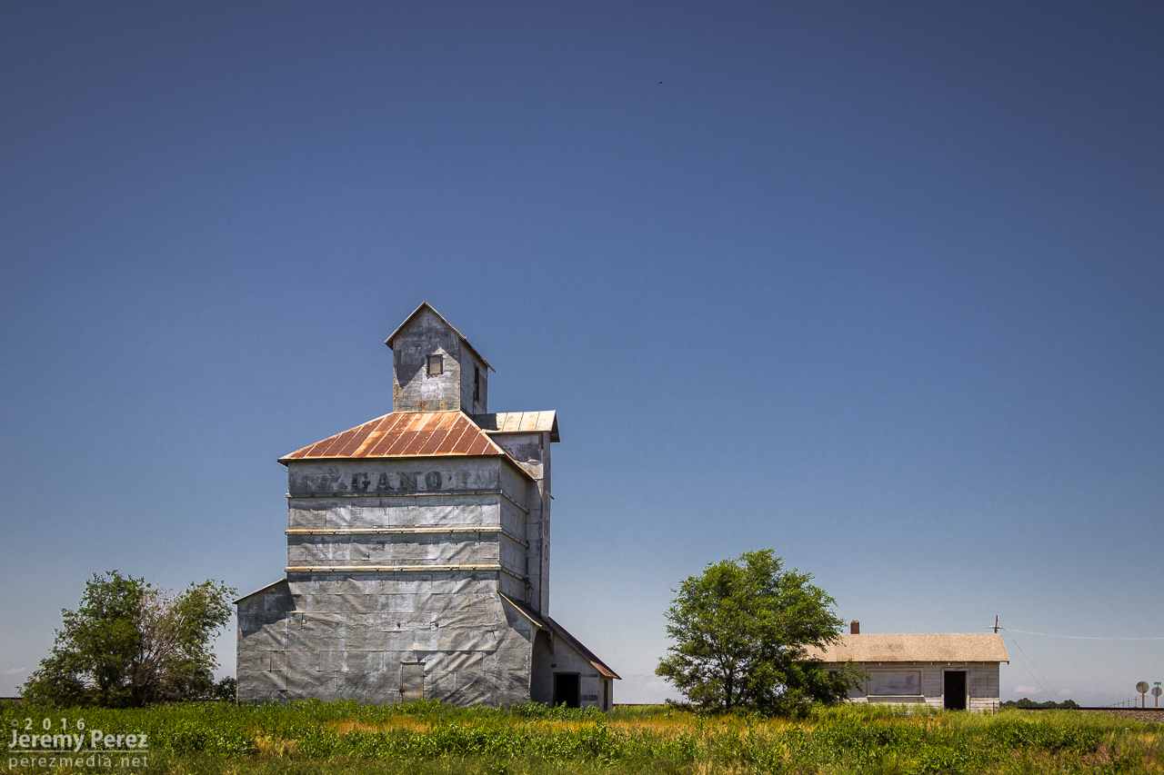
The western suburbs of Ardell, Kansas :)
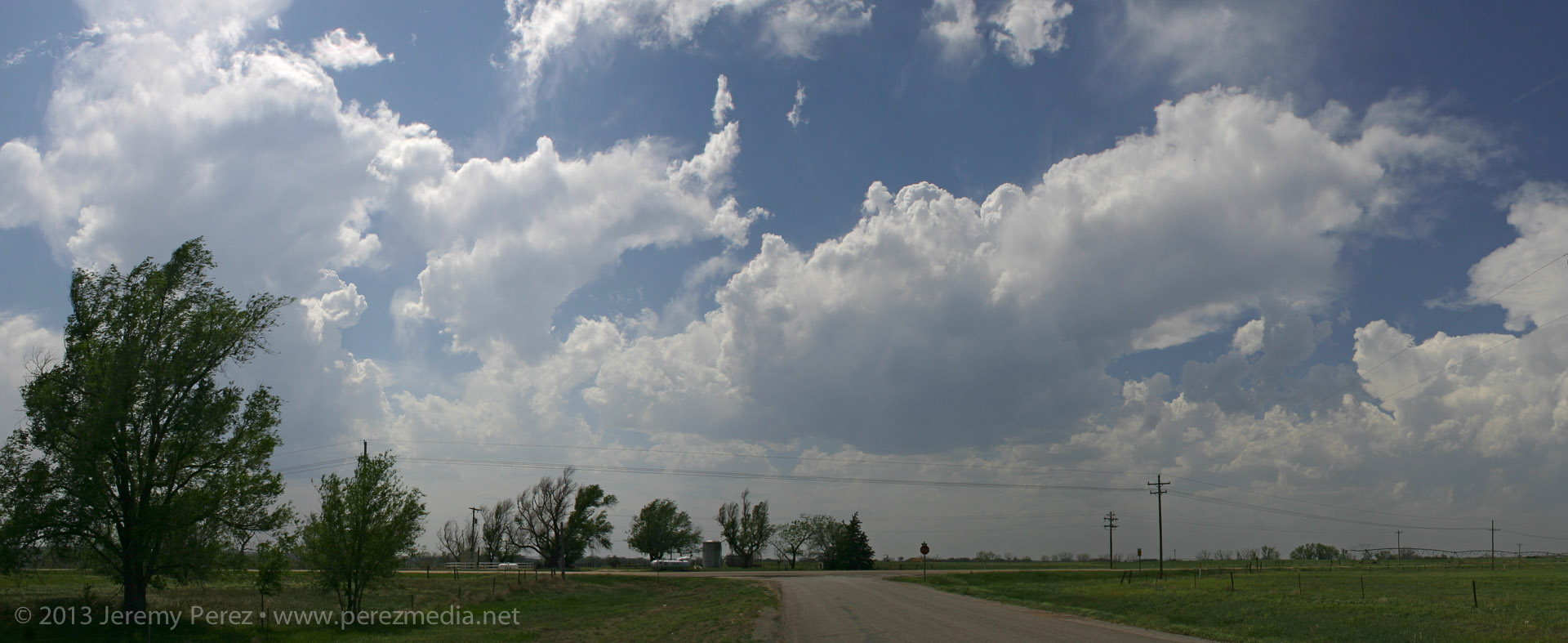
As we got further east, a long arc of clouds bordering hazy skies announced the dryline bulge. It was extremely cool to see it stretched out like that visually without even needing satellite. Although the satellite view was pretty impressive too, showing both the arc of the dryline and a boundary further east. Towers were trying to build on this eastern boundary, while others were brewing to our north near the triple (quadruple?) point. We gradually made our way eastward shooting landscapes along the way, watching the boundaries percolate, trying to decide between east or north.
Approaching the moist boundary of the dryline bulge [2010Z].
Radar view of the dryline boundary [2011Z].
Satellite view of swirling boundaries and growing cumulus fields [2030Z]
Landscape east of Macksville.
Triple point cumulus far north of Macksville [2031Z]
By the time we reached Hutchinson around 2145Z, convection was gushing anvils to our north near Claflin while the Wichita towers appeared to still be working on the cap, so we headed northwest to head for the northern target. When we got to a few miles southeast of Lyons by 2215Z, those anvils had gone orphan while a Wichita storm was finally taking off and looked like it had a nice, muscular updraft going. More self doubt followed as we drifted eastward and a new growing tower between Minneapolis and Lincoln to our north got going. I watched these two towers compete for attention north and southeast until Rt 61 a few miles southwest of McPherson when a final decision had to be made. I opted north, thinking that storm’s convection looked sturdier, had a backsheared anvil, overshooting top, hopefully the benefit of a boundary and better backed inflow to work with, and an easier intercept by this point.
By 2254Z, southwest of McPherson, the choice of storm target finally became clear. (Left: storm northwest of Salina—check! / Right: storm east of Wichita—farewell…)
As we got further north on I-135, the storm was looking pretty impressive as it approached the north side of Salina. I wondered if Bennington would see a repeat 2013 performance—and apparently a tornado did briefly touch down there while we were still making our way north.
Blossoming supercell north of Salina [2317Z]
We headed off onto the grid about 4 miles north of I-70 and had our first look at the base. It was working on an RFD notch, but didn’t look too impressive at the moment.
RFD notch nudging into the base east of Bennington [2339Z]
A corkscrew in the updraft west of Bennington [2349Z]
We got a little behind for a few minutes, but worked some very nice dirt road grid to catch up. After heading west another 5 miles, the storm really pulled together and we caught sight of a hazy, dark, cone tornado behind a thin veil of RFD precipitation. The pace of the chase really picked up after that. As we paced and worked to gain ground on the storm, the tornado grew in size while the choppy barrel meso above it took on Bowdle stylings.
First view of the growing tornado as seen from 7 miles west of Solomon [0009Z]
Strengthening cone tornado as seen from 5 miles west of Solomon [0013Z]
Wide view of the tornado and sculpted RFD cut [0013Z]
Growing tornado and chaotically detailed meso [0016Z]
At 240th road, I headed south and got onto I-70 to try and gain some ground on it, snagging blind photos out the window along the way. Just a bit before the Solomon exit, we encountered a sheriff hollering at a tour van operator who was parked on the side of the interstate while his tour group was loping across the median. Yikes.
Dashcam view of tour group getting busted for Interstate frolicking [0025Z]
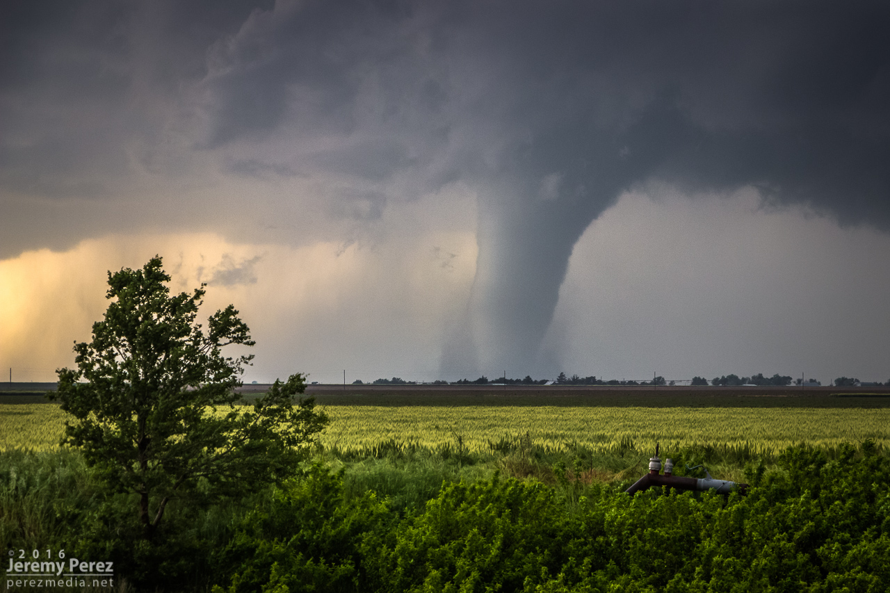
Shrouded tornado lurking north of Solomon [0026Z]
View to the northwest from the northwest side of Abilene [0038Z]
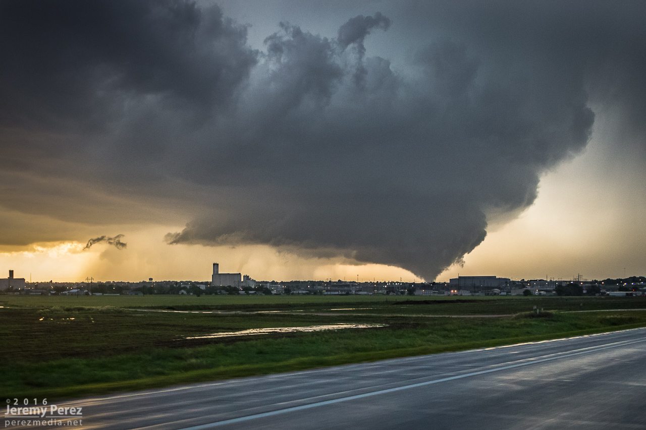
We made our way to the east side of Abilene and Indy Road just north of I-70. It was a perfectly elevated spot to watch the dusty, stovepipe tornado approach and widen into a large cone as it crossed our road a little over 2 miles to the north. It served up the best set of photos and video I’ve ever gotten of a tornado. A couple of locals, a father and I think his teenage daughter pulled up and talked about this being the first they’d seen even though he’d lived in Abilene his entire life.
View from Indy Rd north of I-70/northeast of Abilene as a stovepipe moves across the landscape [0050Z]
Close view of the dusty stovepipe [0053Z]
Tornado and rippling RFD cut getting ready to cross Indy Rd. a little over 2 miles to the north [0054Z]
Crossing Indy Rd [0055Z]
Tight video frame view of tornado base after crossing Indy Rd. [0057Z]
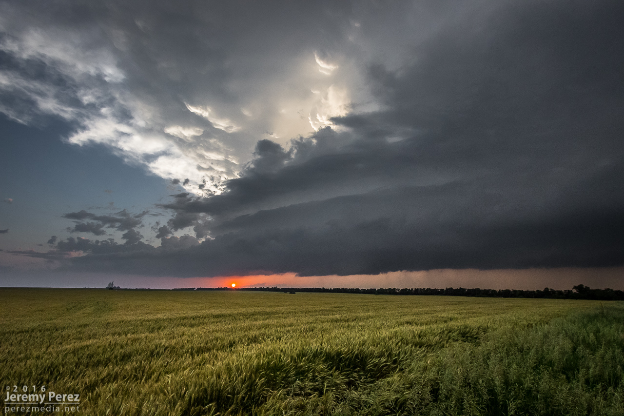
As it passed to the east, RFD shrouded the view and was pretty intent on knocking my tripods over, so we packed up and pulled back east onto Old US 40. Because the storm was nudging increasingly south and we didn’t want to play tag with the approaching tornado, we turned south on Rt 43 at Detroit to get some distance from it. I was concerned that by the time we found a good east-west road we might not catch back up until the river infested, choppy road network south of Junction City. So we lost it at that point and snagged sunset photos of a beautiful trailing cell before heading further south and shooting some nightscape shots with fireflies, stars and receding lightning near Antelope.
Sunset and striated structure on trailing supercell [0134Z]
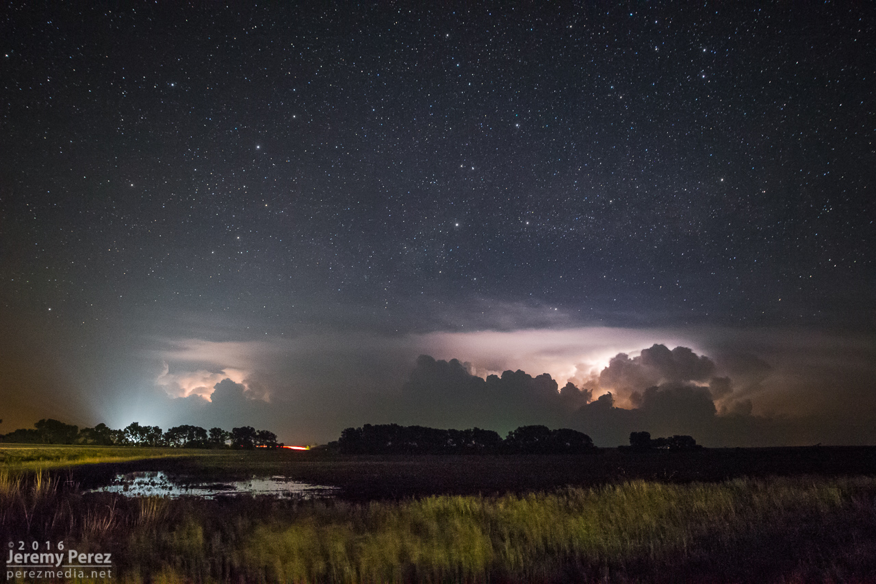
Stars, lightning and headlights reach into the sky near Antelope [0411Z]
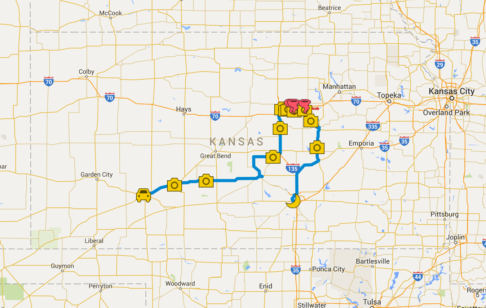
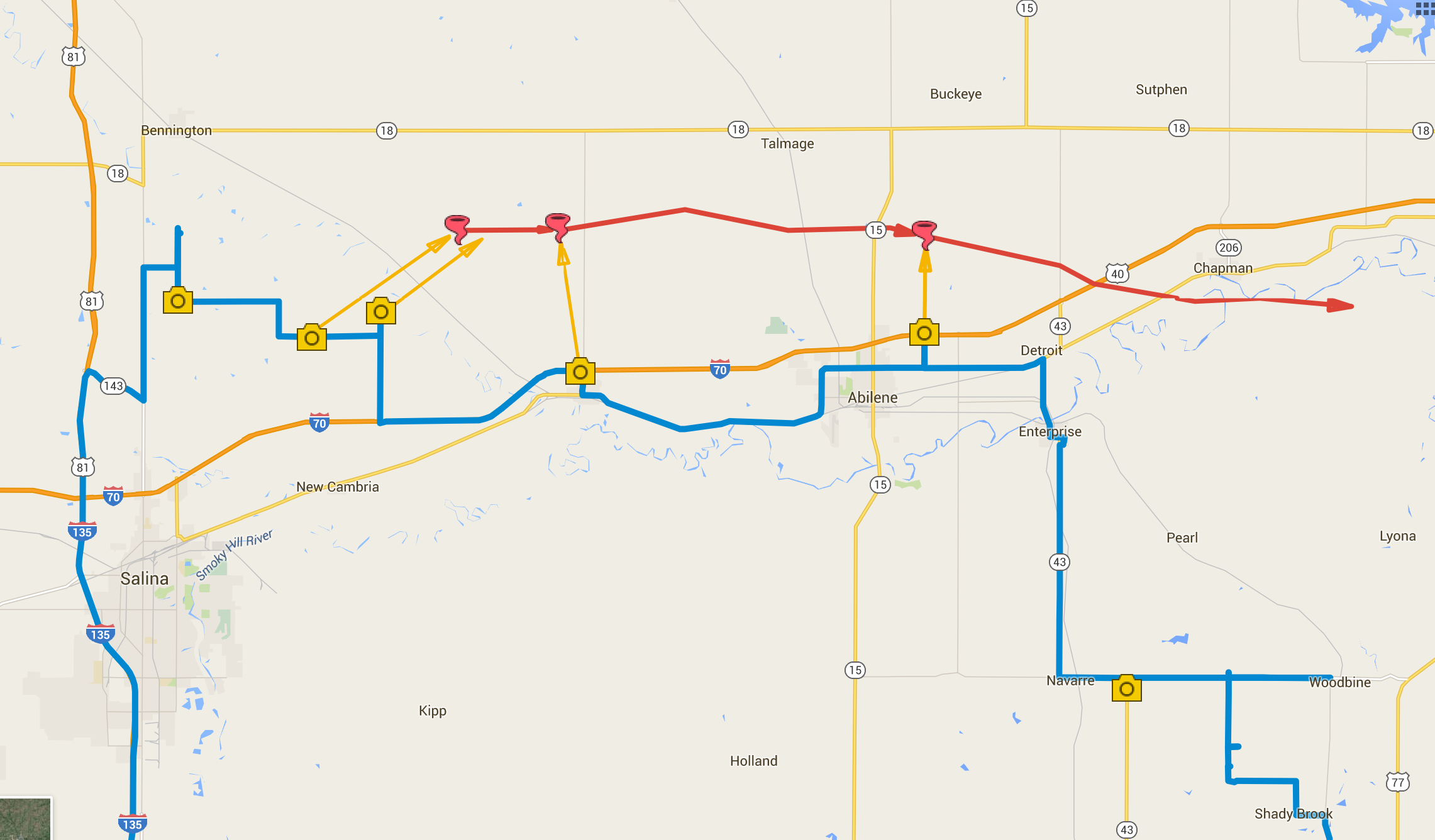
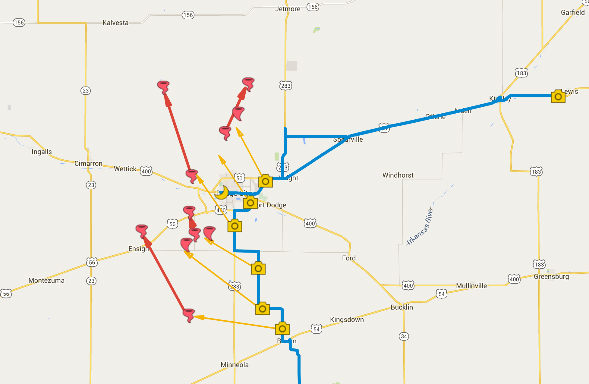
Chase map for the day — 25 May 2016
Close up chase map showing photo locations and approximate tornado locations.
Our May 24th chase started out in Shamrock, OK. We got a really good rate at the Shamrock Country Inn—it was clean, new beds, recently refurbished by a motivated new owner. The doors are a bit sticky, but I can definitely recommend it.
We made our way north, looking for likely spots for storm initiation along the dryline or intersecting boundaries from the Oklahoma Panhandle up into southwest Kansas.
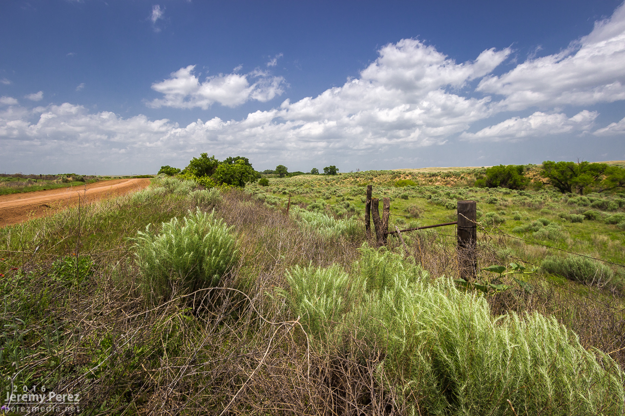
Backroad scenery in the Oklahoma Panhandle between Logan and Slapout.
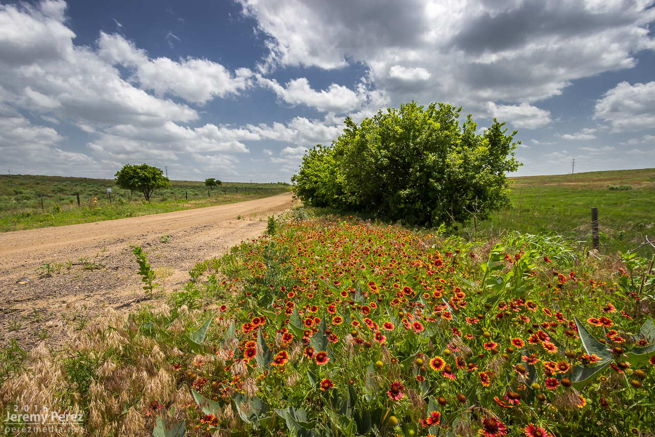
Indian blanket flowers east of Slapout, OK.
Eventually, satellite imagery showed the cumulus field getting more agitated north of Englewood, KS. This gave us a chance to drive through Englewood and revisit a view we had over four years ago when we chased a lonely, low-topped LP supercell north of town (14 March 2012). I noticed Stephen Locke—another storm chaser whosephotography I admire—filling up at the gas pump. I had a chance to say hi before moving on to the growing towers to the north.
Silos and developing towers from Englewood, KS. [2102Z]
We made our way to about six miles west of Ashland and shot time lapse of the building towers to see what would take hold. The one I was shooting wound up gaining strength and we headed off to watch it develop.
Vorticity and random high-based funnels showing up in the developing cumulus field. [2138Z]
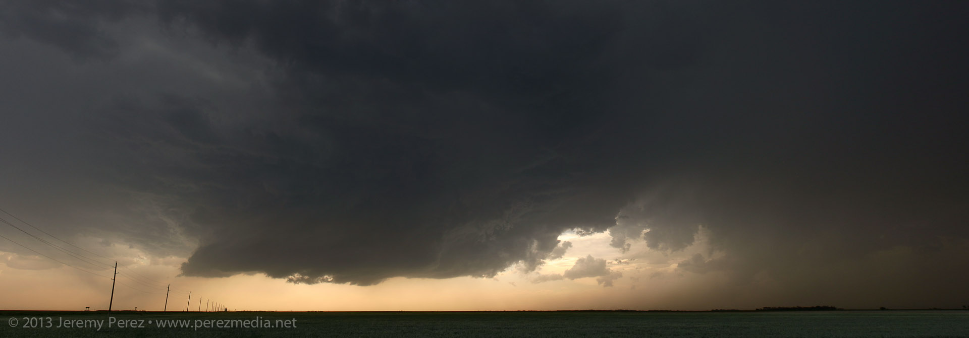
The storm of the day looms in the distance—west of Ashland, KS. [2156Z]
Roads were dry and in pretty good shape, so we stayed off the main highways for hopefully more unique perspectives and less crowds. It worked out pretty well. As we got about eight miles east-southeast of Minneola, the storm was developing a wall cloud that looked like it had potential.
Traveling the dirt roads but avoiding the dicier ones. [2238Z]
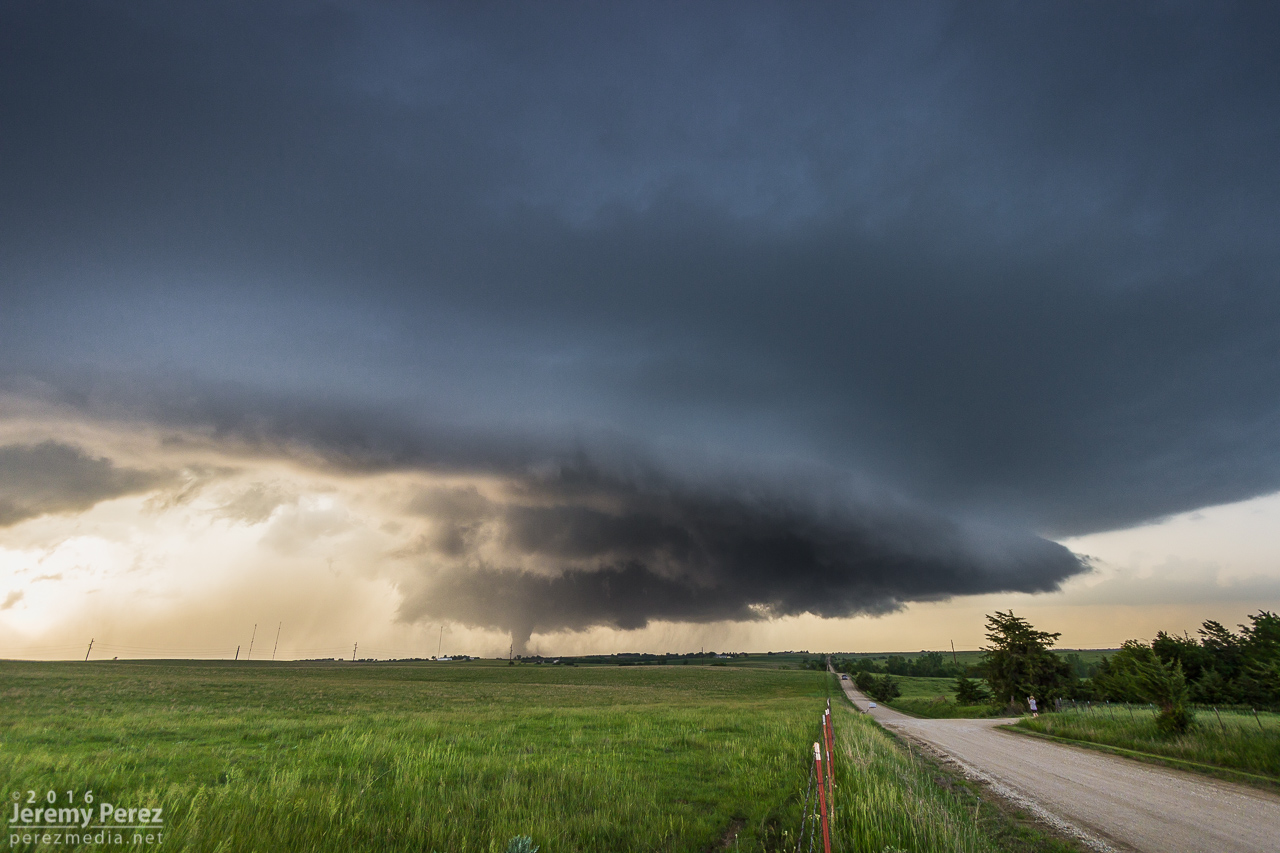
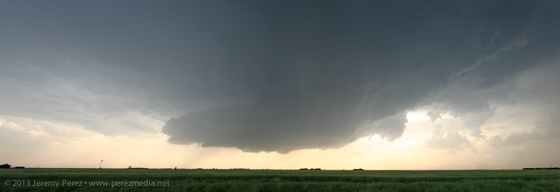
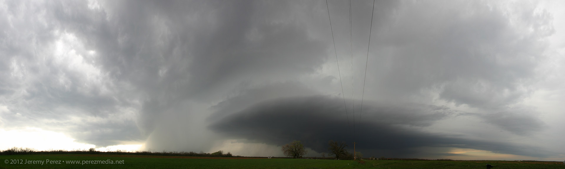
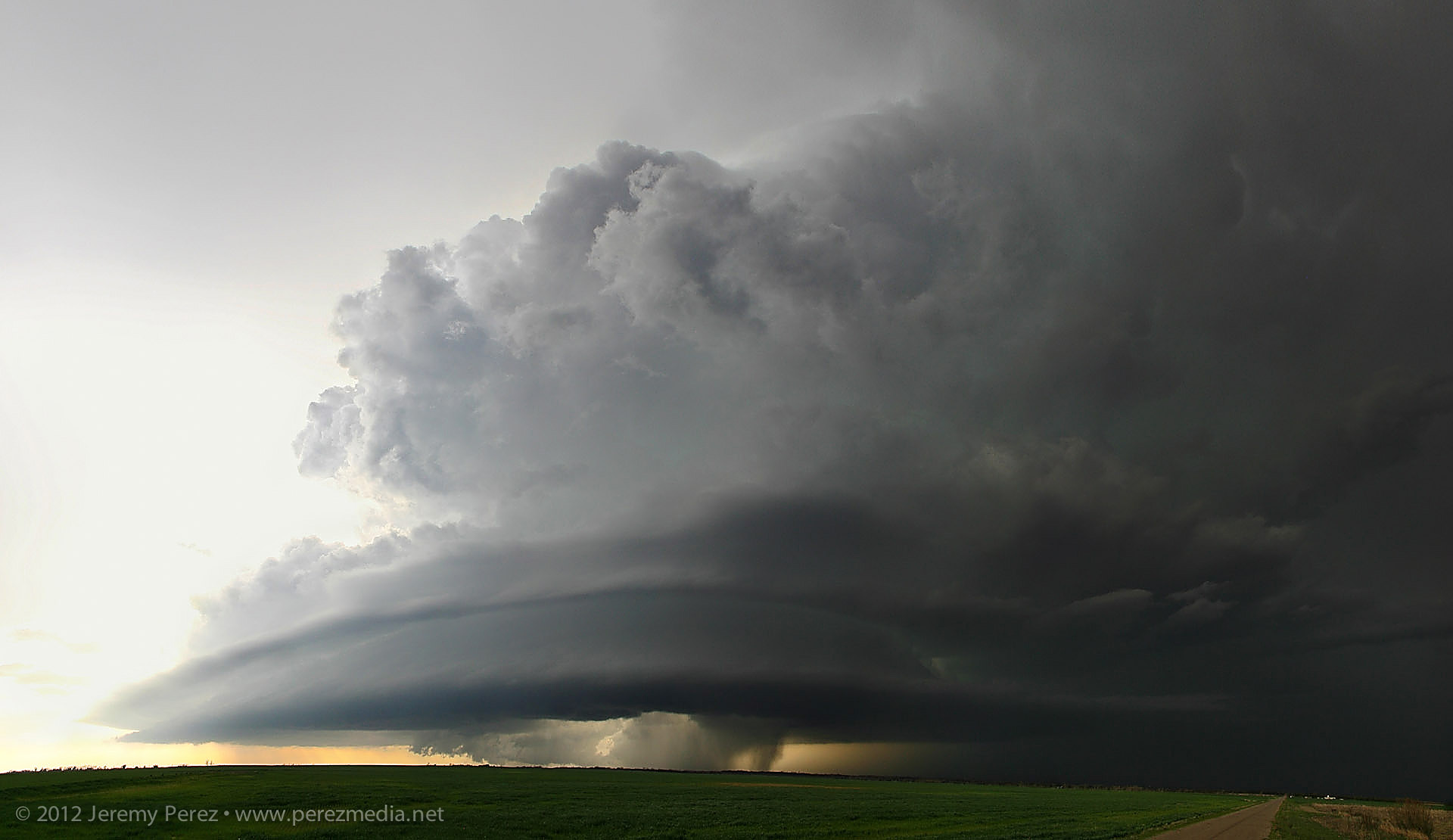
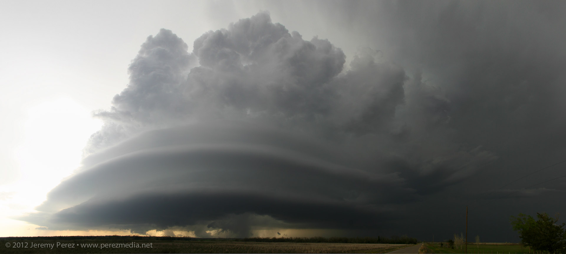
Wall cloud developing in the base of our rapidly strengthening supercell near Minneola, KS. [2240Z]
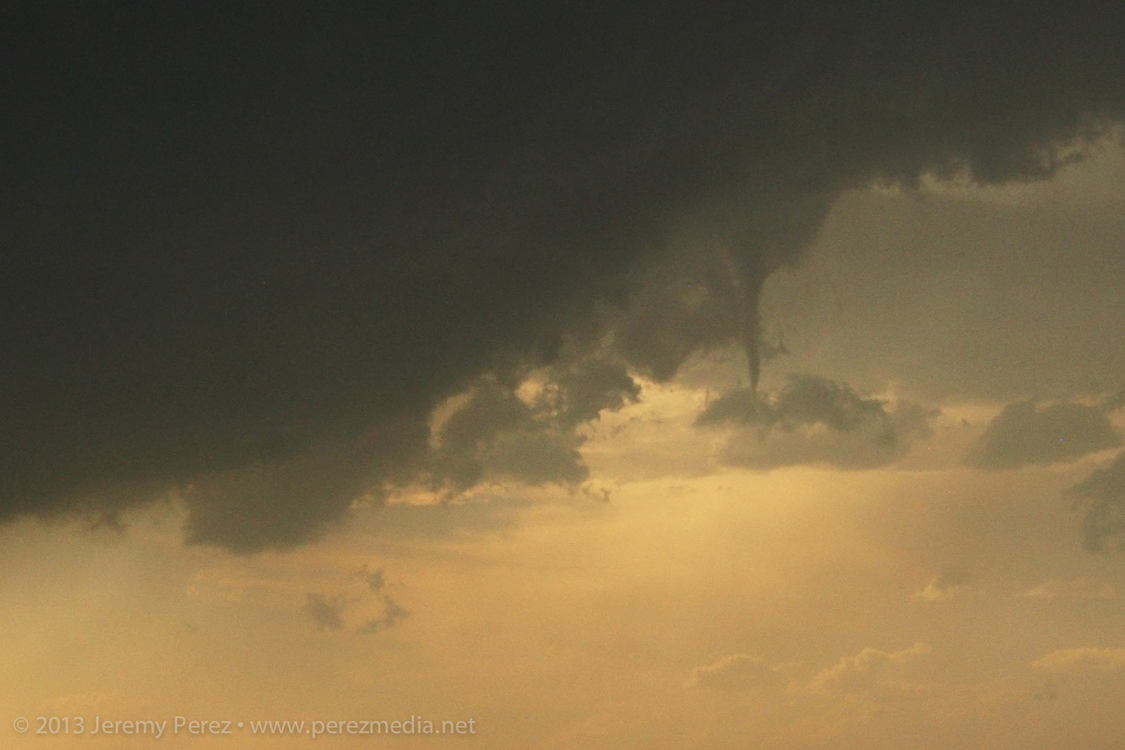
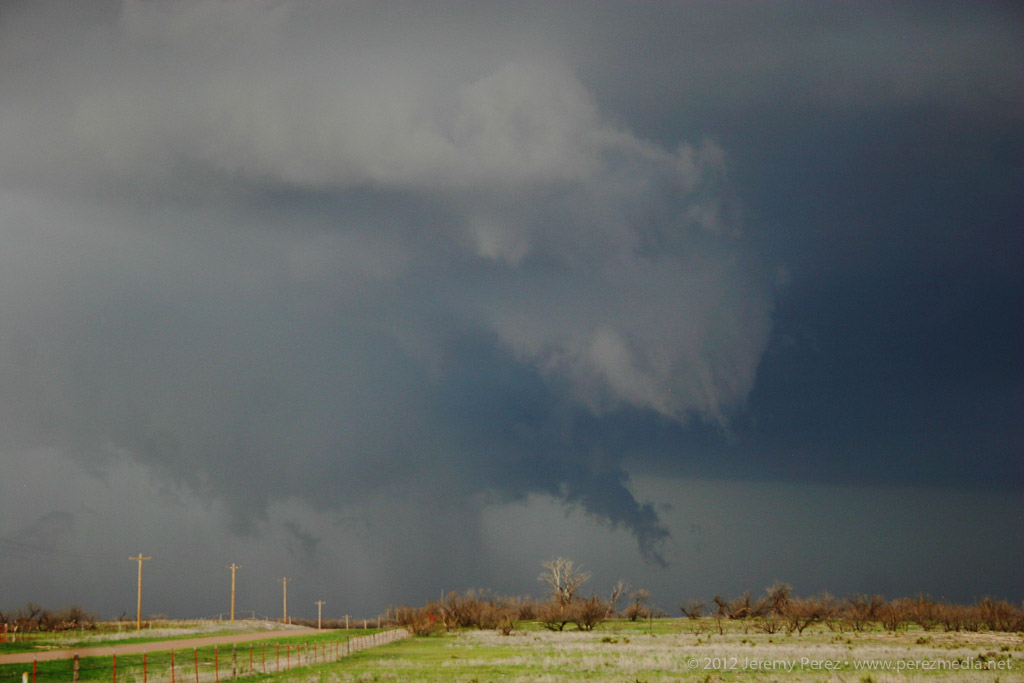
I hated to leave our spot in case it put down a brief tornado while we were on the move, but we needed to keep up. We made our way north and by the time we were a couple miles north of Bloom, the tendrils dropping out of the wall cloud looked pretty imminent. So we stopped in time to capture a developing condensation funnel touch down for our first tornado of the day. It turned out to be a great spot, with enough altitude to capture some intervening countryside as the silhouetted funnel danced and twisted against a distant tree line. We were about 12 miles away at this point, but the view was great. We hung out at this spot for nearly 15 minutes as it grew in size. At one point I was thinking that this must be how Rozel looked in silhouette—apparently this one is being referred to as Rozel #2 by some :)
Condensation funnel of the first tornado reaches for the ground. [2301Z]
Tornado #1 churns in silhouette west of Minneola—about 12 miles from our location. [2303Z]
Inflow tugs at my daughter and chase partner as the first tornado strengthens north of Minneola. [2308Z]
Tornado #1 bulks up as it moves northward. [2313Z]
We eventually had to keep moving to stay with the storm. While repositioning, the original tornado began to occlude behind a haze of precipitation. My daughter asked if there was a different tornado forming further to the right. Sure enough, a thin rope had descended from the fresher wall cloud while the previous tornado was still in progress. This was our first tornado pair. I hate to call them twins, because the emaciated second one wasn't even close in appearance to the first—more like the mole that shows up on the stronger twin when it absorbs its sibling I guess.
Tornado #1 occludes while whisker-thin tornado #2 reaches down to the right. [2321Z]
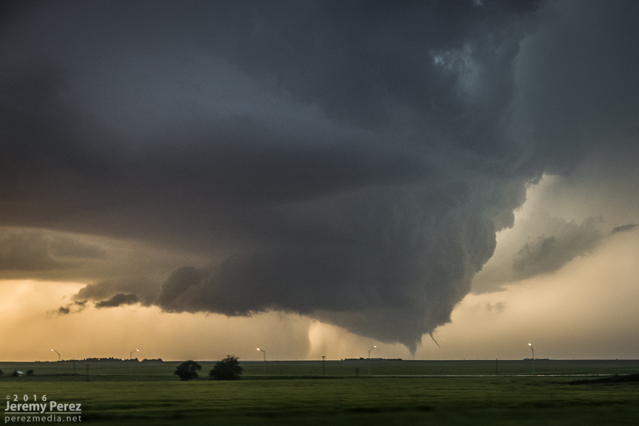
About seven miles south of Dodge City and still on the dirt roads, we found a really good spot to watch as a new tornado took on Rozel-like proportions as a thin rope tornado flicked around on the east edge of the elongated wall cloud. There may even have been another tornado intertwined with that rope, but from my perspective I couldn't tell if it was just extra scud tendrils. The view of the main tornado at this point was spectacular. We were further south of it, so now it had some side lighting and showed a lot of dimension. We hung out at this spot for another 13 minutes or so before heading off to the dreaded main highway. (Rain was starting to effect the area and I didn't want to get us stuck in the mud.)
Tornado #3 gains strength while at least one rope—tornado #4—reaches down at far right. [2330Z]
A wider view of tornado #3 as it is southwest of Dodge City and about 10 miles to our northwest. [2331Z]
Tornado #3 taking on Rozel characteristics. [2332Z]
A wide view of tornado #3 as seen from about 7 miles south of Dodge City. [2333Z]
Wide view of the second pair of tornadoes we observed. [2335Z]
A wide structure view as the storm feigns being tornado-less. [2338Z]
Ropeout of tornado #3 rematerializes while its parent supercell continues northward. [2338Z]
Closer view of tornado #3 ropeout. Wall cloud at right is producing ground circulation—not sure if it's a continuation of tornado #4. [2339Z]
Hwy 283 was about as insane as I was worried it would be—absolutely packed with chasers and locals. Despite how crowded it was, most everyone was driving, parking and loitering in an orderly fashion. We parked at a couple spots to get photos as a fifth tornado morphed into various forms—barrel/multi-vortex/cone/elephant trunk/rope—west of Dodge City. We took the highways around the east side of the city, watching as the #5 occluded and roped out while a new, sixth tornado descended from the apex of a wasp-nest shaped meso. The highway was at a decent elevation, so we had pretty good views of the action north of the city as we made our way around. By the time we got northeast of Dodge, the sixth tornado had sprouted a satellite rope funnel of its own—video from other chasers shows this in contact with the ground as well, so—tornado number seven.
One of the many forms of tornado #5 as it was moving northwest of Dodge City—as seen from Hwy 283, about 9 miles away. [0002Z]
Ropeout sequence of tornado #5 as we navigated the east side of Dodge City. [0004-0008Z]
Tornado #5 occludes while tornado #6 drops north of Dodge City. [0010Z]
Tornado #6 sports a satellite, tornado #7 north of Dodge City—about 9 miles to our northwest. [0016Z]
By this time, new supercells were encroaching from the south it looked like our original cell was jogging to the east. So to avoid getting pinched, we bailed out to the east and made a half-hearted attempt to get on some other tornado warned cells east of Kinsley. That wound up seeming like more effort than it was worth, especially after the spectacle we just experienced, so we hung out for a while just west of Lewis on Hwy 50 and grabbed sunset photos.
One of the DOW vehicles samples a different storm east of Kinsley. [0109Z]
Sunset lights up the cold west flank of a passing supercell east of Kinsley. [0134Z]
Sunset and flooded back roads east of Kinsley. [0144Z]
A fire rages south of Lewis—presumably lightning caused. [0150Z]
A spectacular roll cloud sporting Kelvin-Helmholtz waves drifts by west of Lewis, KS. [0215Z]
After the stunning sunset, we headed back to Dodge City for dinner and a hotel for the night. While eating dinner, Arizona storm chasers Adri Mozeris, Trey Greenwood and Corbin Jaeger stopped by to say hi and we got a chance to talk about all the unbelievable things we had seen that afternoon.
Throughout our chase, I'm pretty sure we observed seven tornadoes, where two were on the ground at the same time on four occasions. I'm still having trouble believing we actually witnessed all of this. Other chasers reported seeing on the order of twelve tornadoes. So the numbers in my account don't represent the actual sequence of tornadoes on the storm—just the ones we saw ourselves. Like the Rozel/Sanford tornadoes, I could be convinced that what I counted as two tornadoes may have been continuations—where say one of the thin ropes seemed to disappear, but may have actually still been stirring up ground circulation before turning into a larger tornado later. I'll update things if I find out differently.
Chase map for the day — 24 May 2016
Close up chase map showing photo locations and approximate tornado locations.
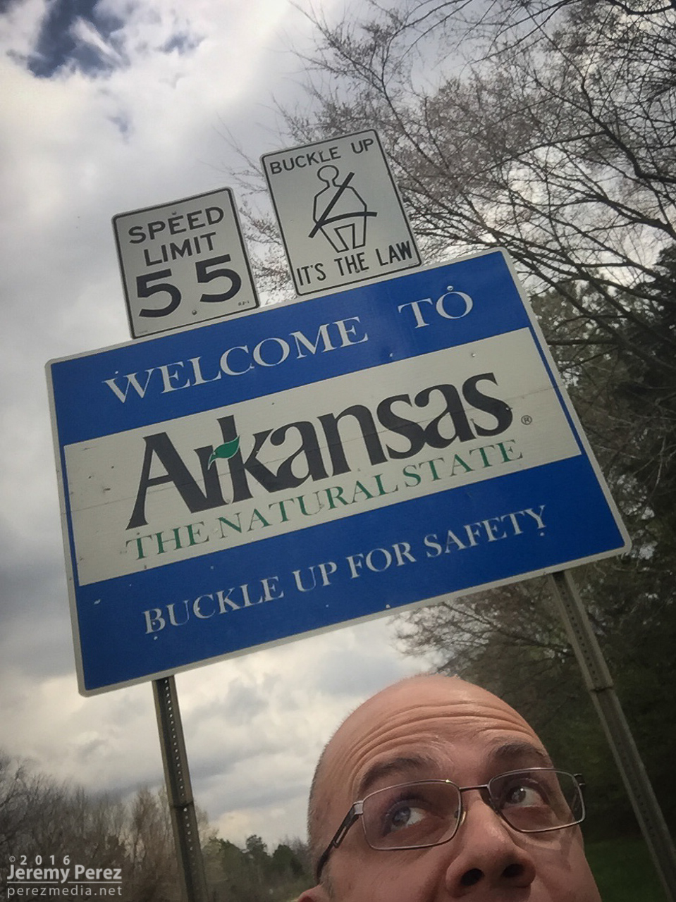
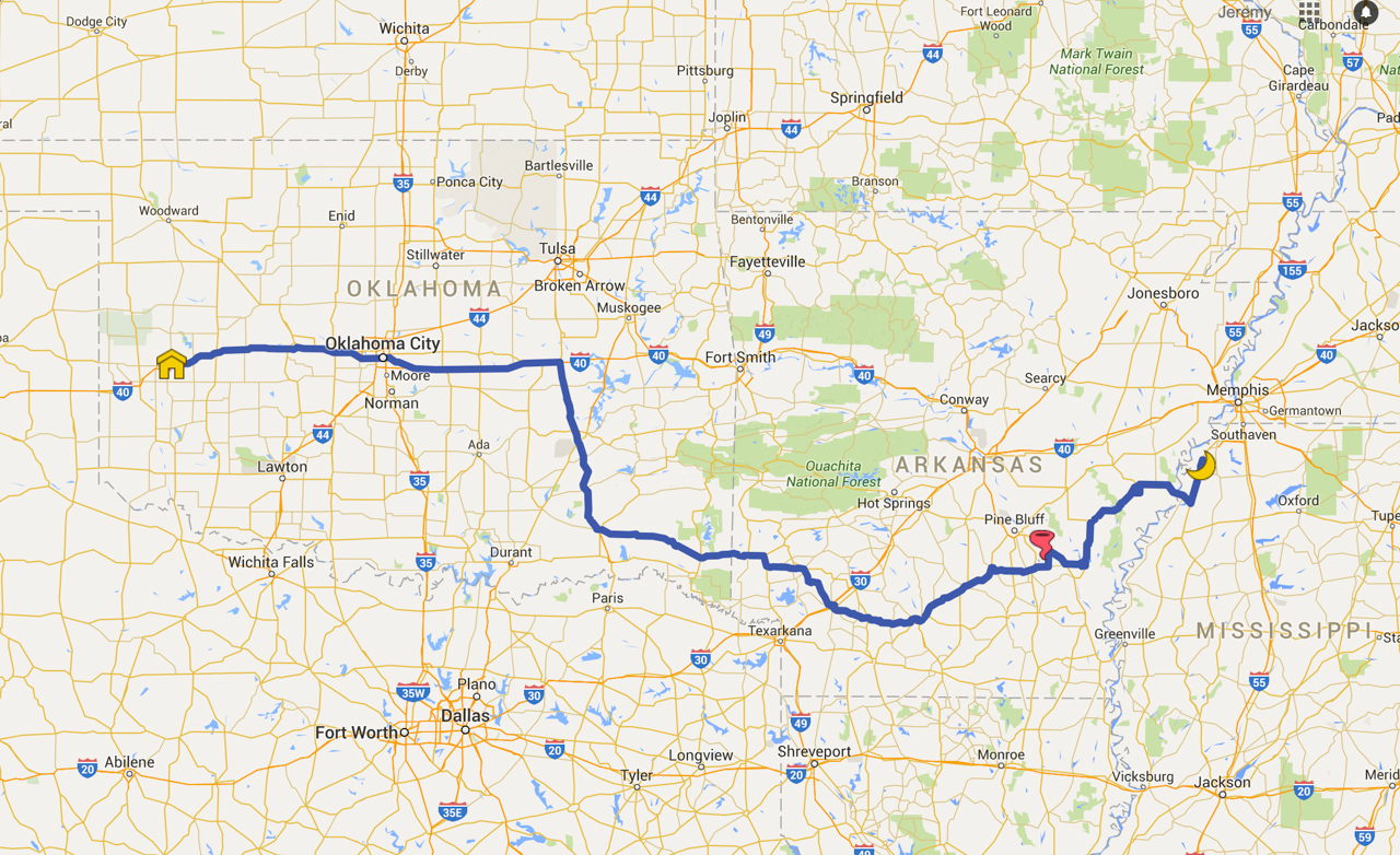
I had my eye on potential for this setup in the days leading up to an annual visit to Elk City. I headed out about 7AM with an initial check-in target at Hope, Arkansas.
Crossing the threshold on Hwy 70
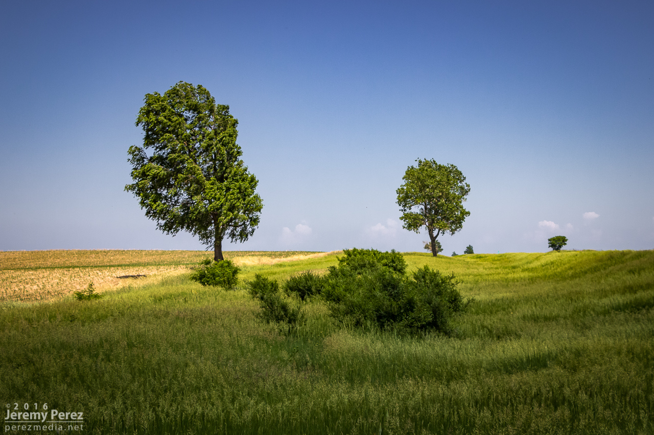
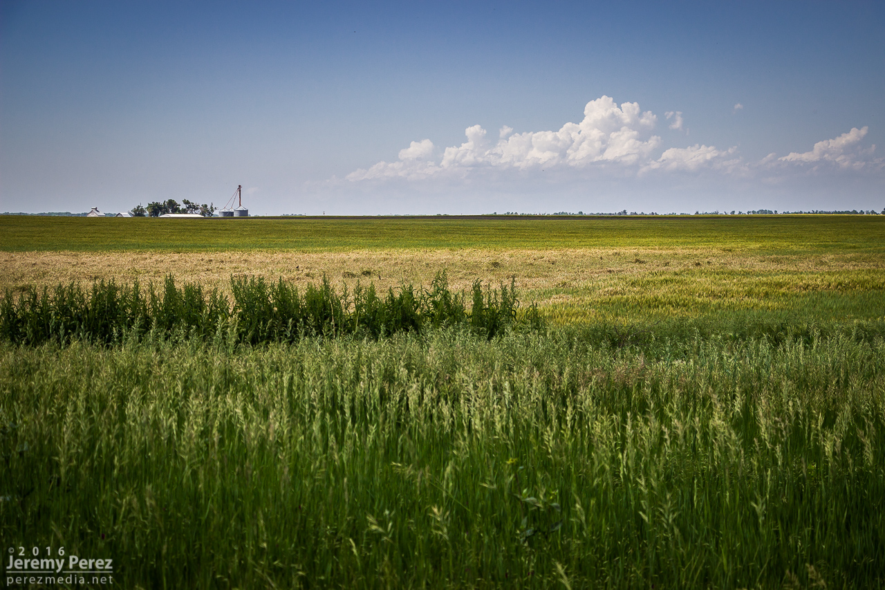
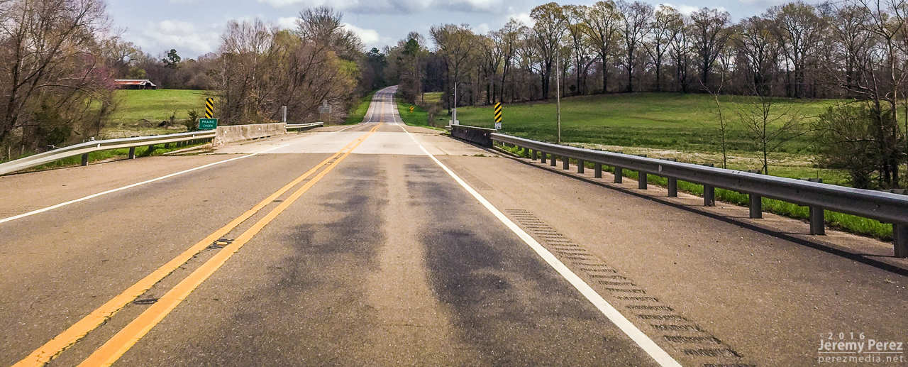
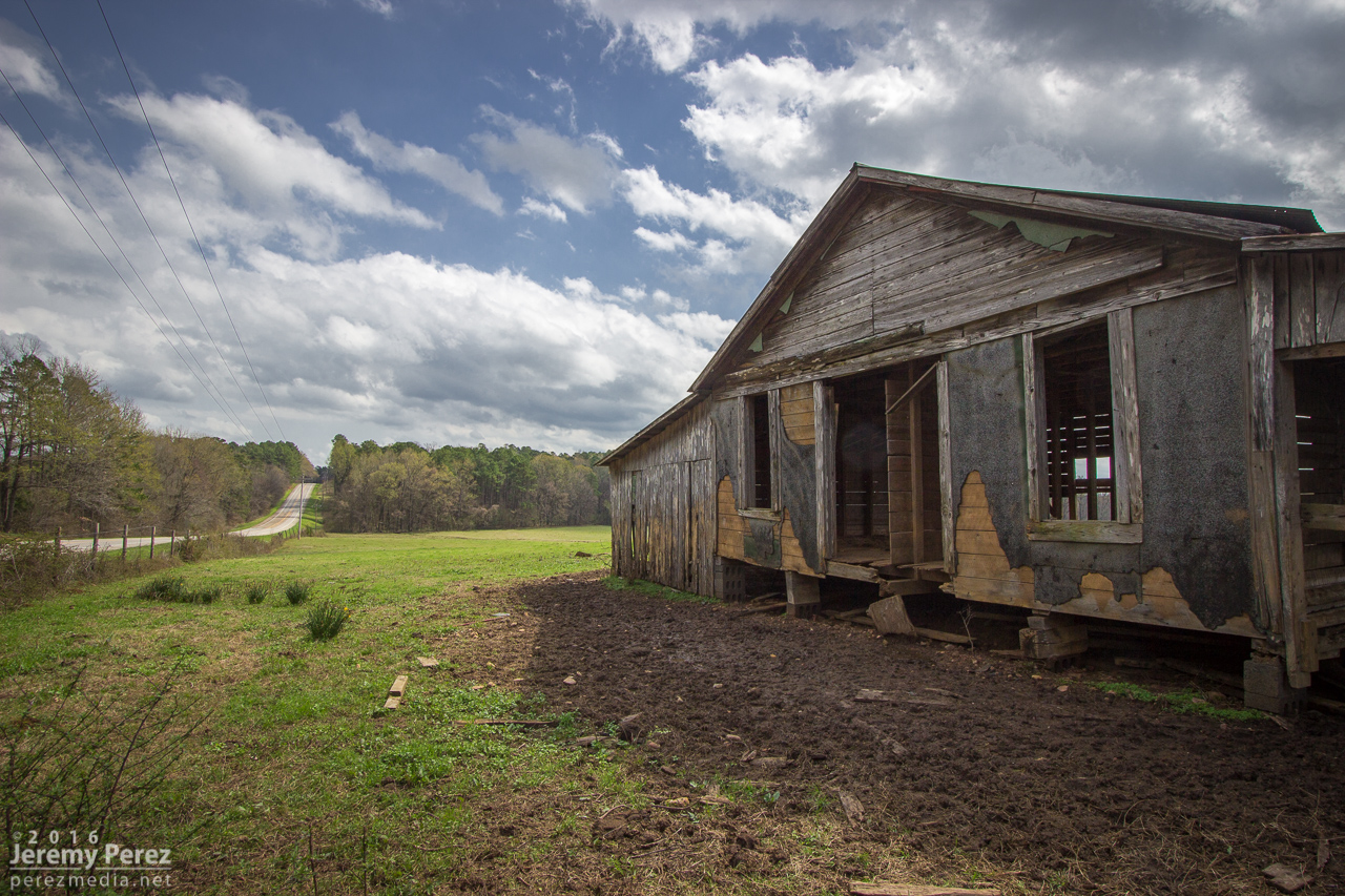
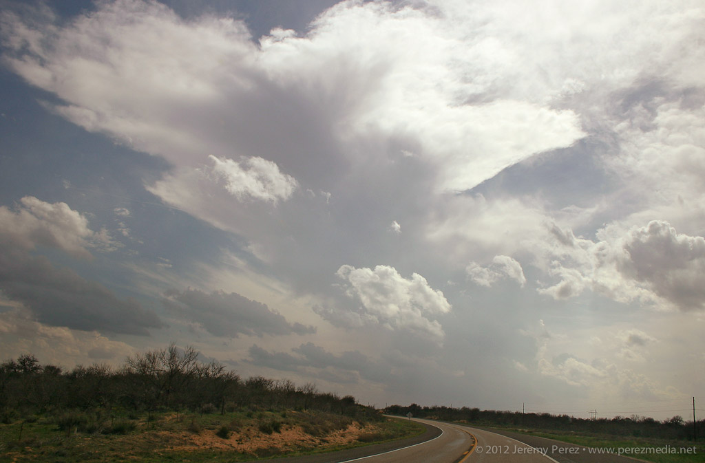
I wasn’t sure I’d ever take the plunge into chasing Arkansas, but after working on my chase map last year I had a better idea where potentially decent chase terrain/road network would be. I also spent the night before studying how highway/secondary roads would play out with northeast moving storms. Even the heavily treed areas (outside the mountains) still have patches of farmland where some peeks can be taken. I had resolved to stay far ahead of storms as long as I was in the heavy trees. Turns out I didn't need to mess around with them in the thicker areas. I figured I had time to shoot some landscape photos on the way—southwest Arkansas is beautiful.
Hwy 371 and Prairie Creek - Howard County
Outbuilding along Hwy 371 - Howard County
Fenceline along Hwy 278 in Washington, AR
Once I got to Hope about 2:30PM, I knew I had to keep moving. Convection was initiating and I was going to be in the middle of it instead of out ahead.
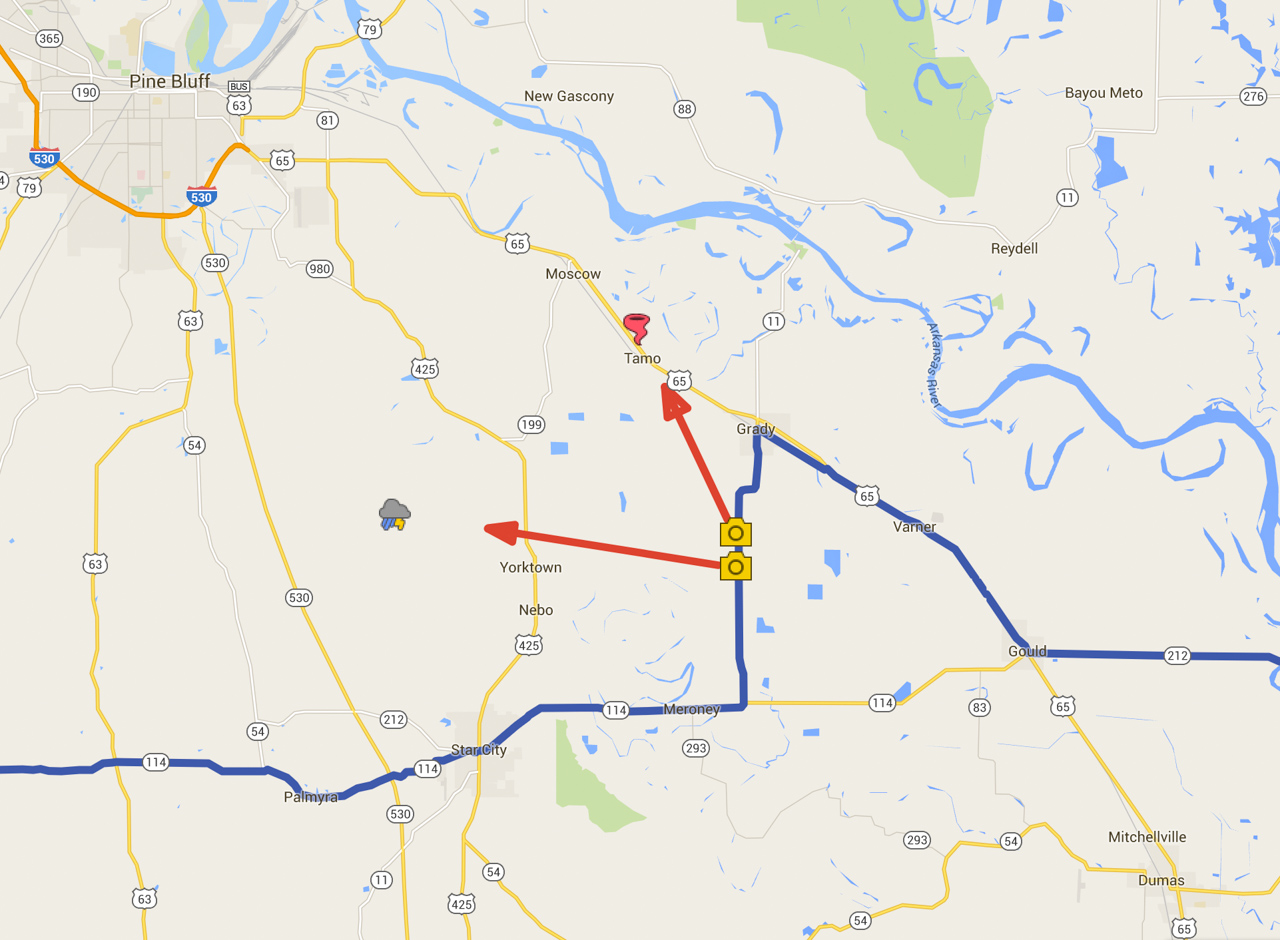
I made my way through Camden, Fordyce, and then to Star City where I was far enough ahead of the developing line of storms to figure out the best option. I wanted tail-end-charlie in the southernmost batch of convection—closest to better moisture before the cap pinched the line off. At 2230Z, the southernmost convection was about 30 miles to my west near Fordyce. There would be clearer views in farmland just to my east, so I headed that way and looked for a good intercept spot along AR-11 about 3 miles south of Grady.
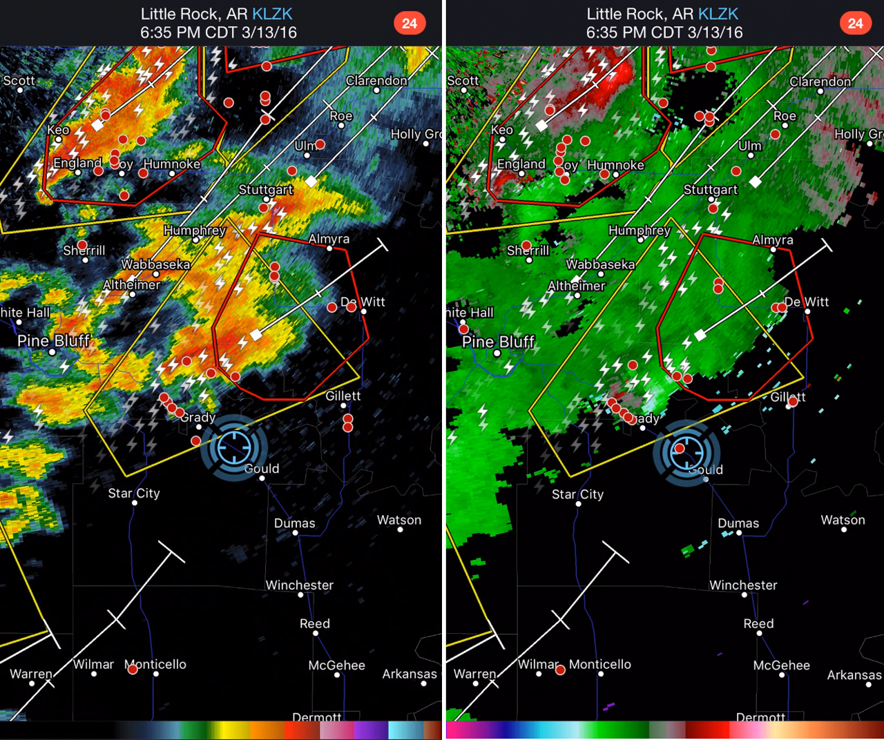
Reflectivity at 2238Z
Fields and farm roads were flooded everywhere, so I knew any use of the road grid was out of the question. Paved roads were dense enough to get within 5 miles of anything in the area, with the main issue being river crossings for the Arkansas River spaced about 35-40 miles apart at Little Rock, Pine Bluff and Pendleton. The end cell did me a lot of favors and strengthened nicely as it approached. The flooded fields made for some interesting photography options that I wasn’t planning for.
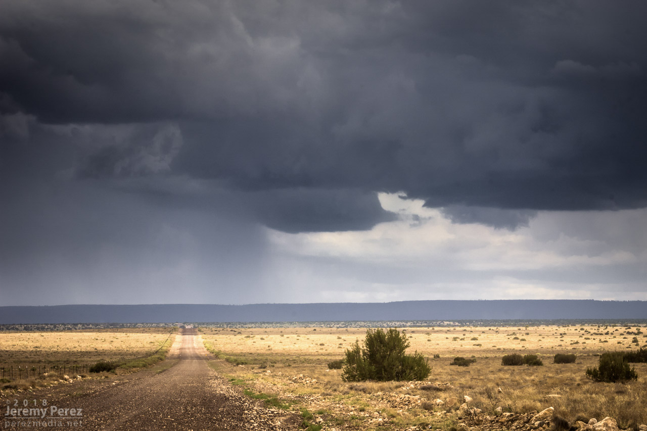
Tail end cell approaching on AR11 - 2239Z
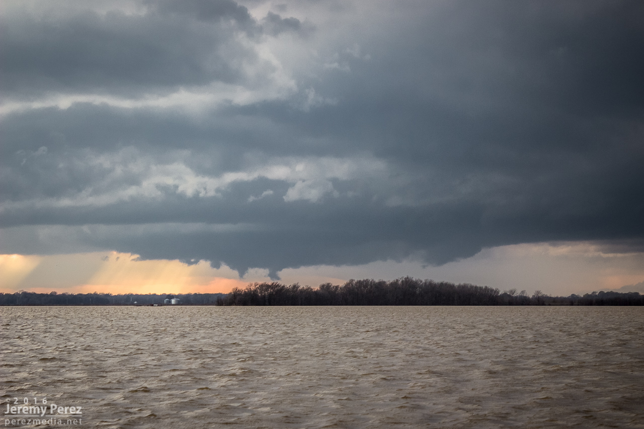
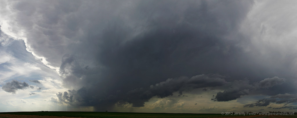
As the rain free base moved closer, I could finally see that RFD was carving out a glowing hole punctuated by a wall cloud with nice tendrils and rising motion.
Rain free base sturdying up with rising scud - 2306Z
Lightning strike poses with my time lapse and video setup - 2315Z
Wall cloud taking shape across flooded fields - 2322Z
Closer view of rotating wall cloud - 2322Z
It was far enough off that I had plenty of time to set up for time lapse and lightning shots as it moved in. As the cell got more to my north, RFD finally punched a huge skylight in the base. A line of trees was blocking my view somewhat, so I raced about a half mile up the road and did another quick setup to watch events unfold.
Looking up AR-11 as RFD cuts open the rain free base - 2330Z
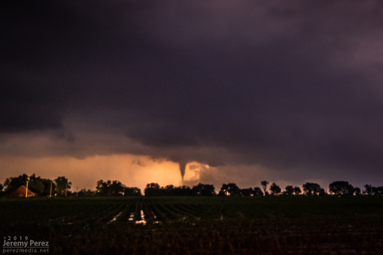
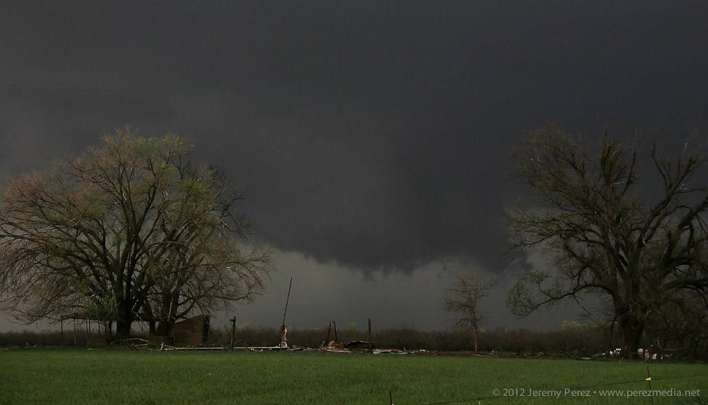
I got video and still cameras tripoded up for shots just seconds before a noodle slipped out of the wall cloud and made contact (2335Z). The fact that I just broke a three year tornado drought with an Arkansas tornado was freaking me out. The seemingly imminent grief of chasing Arkansas with trees, vegetation and flooding actually made for the best tornado photos I’ve gotten so far.
Funnel reaching for the ground - 2334Z
Funnel making contact - 2334Z
Evidence of debris - 2336Z
Arkansas tornado over flooded fields - 2338Z
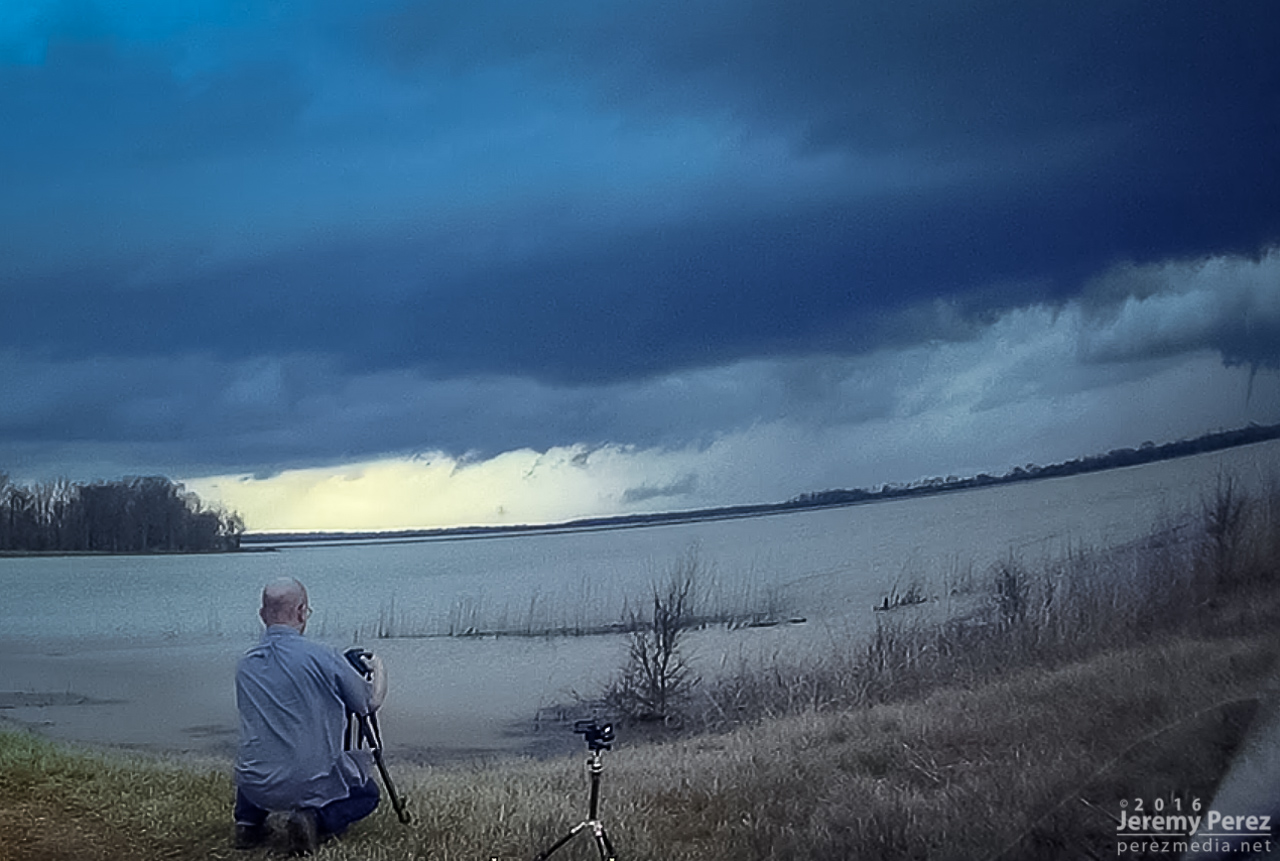
While I was snapping away, a couple drove up in a car, motioning for me to come over. Trusting that the video camera was doing its job, I headed over to find them in Heightened-Awareness-Mode (understandably), fumbling with a cell phone trying to show me a picture of a tornado that just touched down, and how careful I needed to be. It took a few tries before they understood that, yes, I was actually trying to take pictures of it right now. Meanwhile my unattended SLR & tripod had blown over and face planted into the soil while I wasn’t watching. So as they took off, I ran back, lamented my fallen camera, unscrewed the thank-goodness-for-that UV filter and kept shooting.
Inflow winds and the toppling of a camera
Still can’t believe I’m watching a tornado over this waterscape - 2340Z
The tornado roped out about 9 minute after it touched down and I took off for the Pendleton river crossing.
Starting to rope out - 2341Z
Last bits of the rope out - 2343Z
I couldn’t catch back up or get in good position to catch some newer convection to the south, so I tried for parting lightning shots that didn’t turn out any good. After that, I crossed the Mississippi at Helena and boondocked along US 61 before heading north for the March 15th setup.
Reflectivity and Velocity at 2335Z
As I downloaded my photo and video media, something didn't seem right about my video footage—there wasn't enough of it. As I dug into it, I came to the terrible realization that I had the video camera in pause mode during the entire 9 minute tornado sequence. The anguish is making my guts clench as I type this. I had that video framed and focused perfectly the entire time. But I guess I was juggling too much photography and planning the next move to get everything right. I keep working on the fact that I got a lot of good still shots and just a tidbit of the first touchdown on the far edge of my dashcam video.
Not realizing at this crazy moment that the video camera (bottom center) is not recording — ouch
Chase Map - 13 March 2016
Photography locations for approaching supercell and tornado
This was the third day of a week-long trip to the plains and the first heightened possibility for strong supercells.
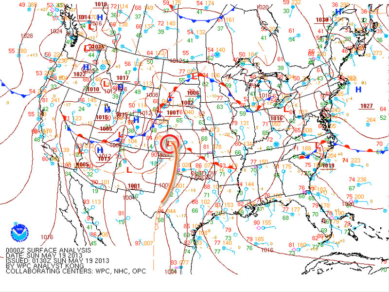
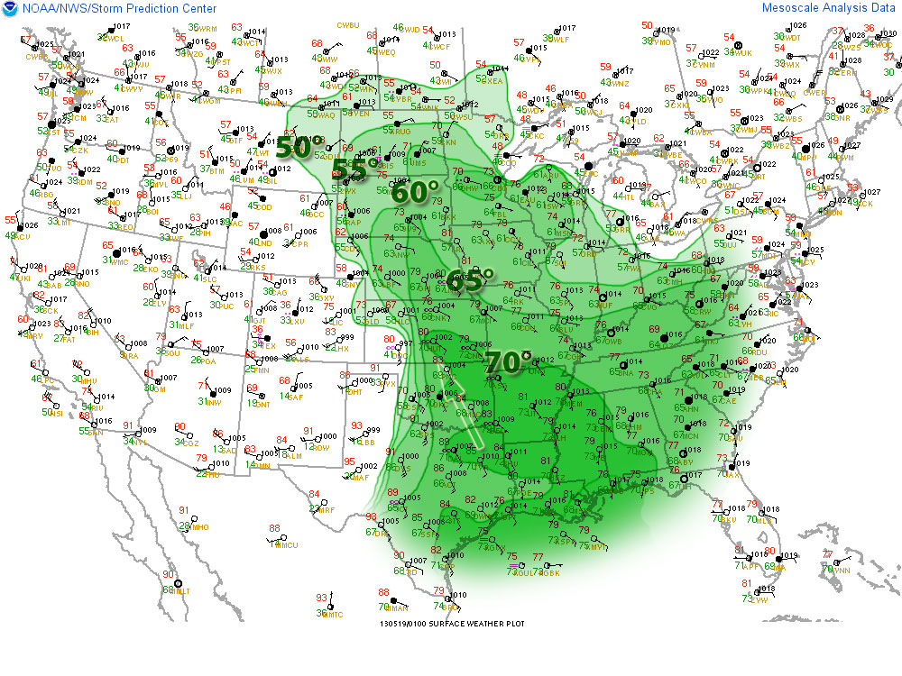
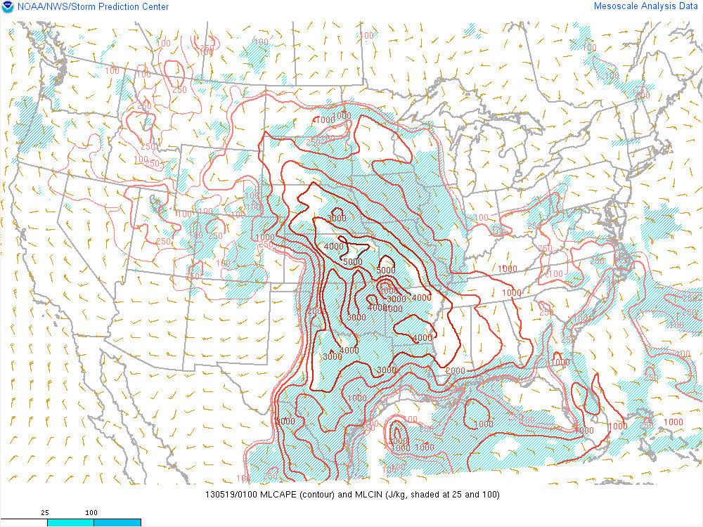
The setup featured a negatively tilted upper level trough over the western US that put southwesterly flow over the plains. This led to the formation of a surface low over southwest Kansas with a dryline draping from the low down through the panhandles. Rich moisture being advected into the area on southeast surface winds brought dewpoints in the mid to upper 60s through the southern and central plains and up to 70 degrees into Kansas. All the moisture and heating coupled with steep lapse rates led to mixed layer cape values in the extreme range from 3 to 4 thousand j/kg.
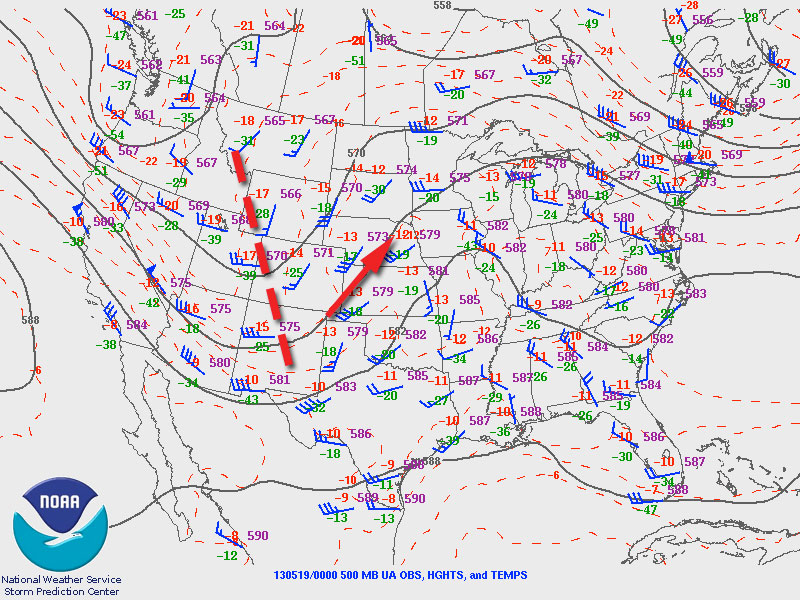
500 MB
Synoptic
Surface Obs/DP
MLCAPE
With these conditions in place, agitated cumulus began to develop along the dryline and north of the surface low, and by mid afternoon storms were firing in eastern Colorado and northwest Kansas.
21Z Visible Satellite
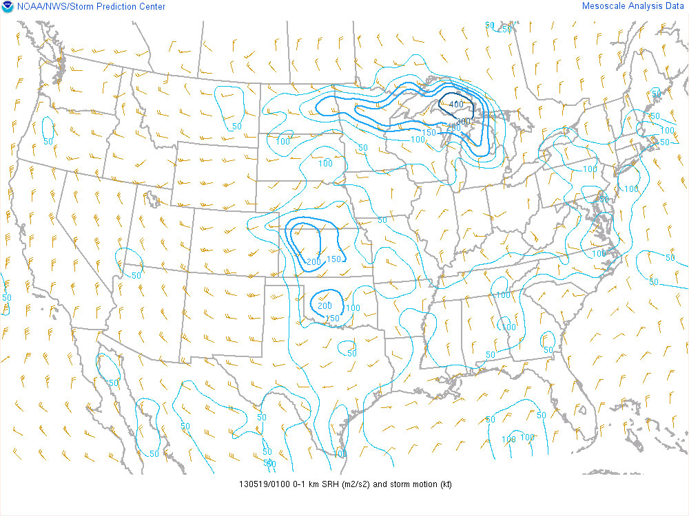
A shortwave ejecting over the panhandles and Kansas by mid to late afternoon along with strong heating along the dryline helped convection overcome the strong cap and develop further south along the dryline. By 7 to 8 pm, deep layer shear had reached 40 to 50 knots along a corridor from northeast Colorado to west central Kansas. Low level storm relative helicity also ramped up with the strengthening low level jet, reaching 200 m2/sec2. The combination of adequate deep layer shear and storm relative helicity combined with extreme instability led to supercells capable of producing tornadoes.
500 MB Shortwave Trough
23Z Satellite
0-6km Shear
0-1km SRH
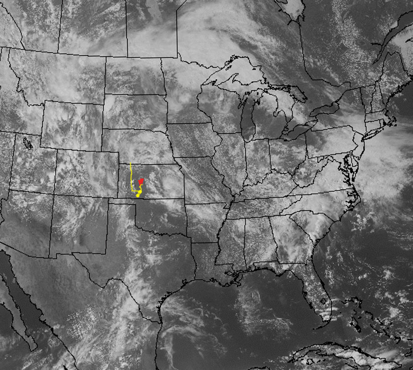
My initial target was the vicinity of Ashland in far south Kansas. After noting where development was occurring along the dryline, I moved up to southwest of Greensburg and waited for convection along this section of the dryline to take off. I followed a cell that finally started to strengthen southeast of Spearville. And it eventually produced two tornadoes near Rozell and Sanford.
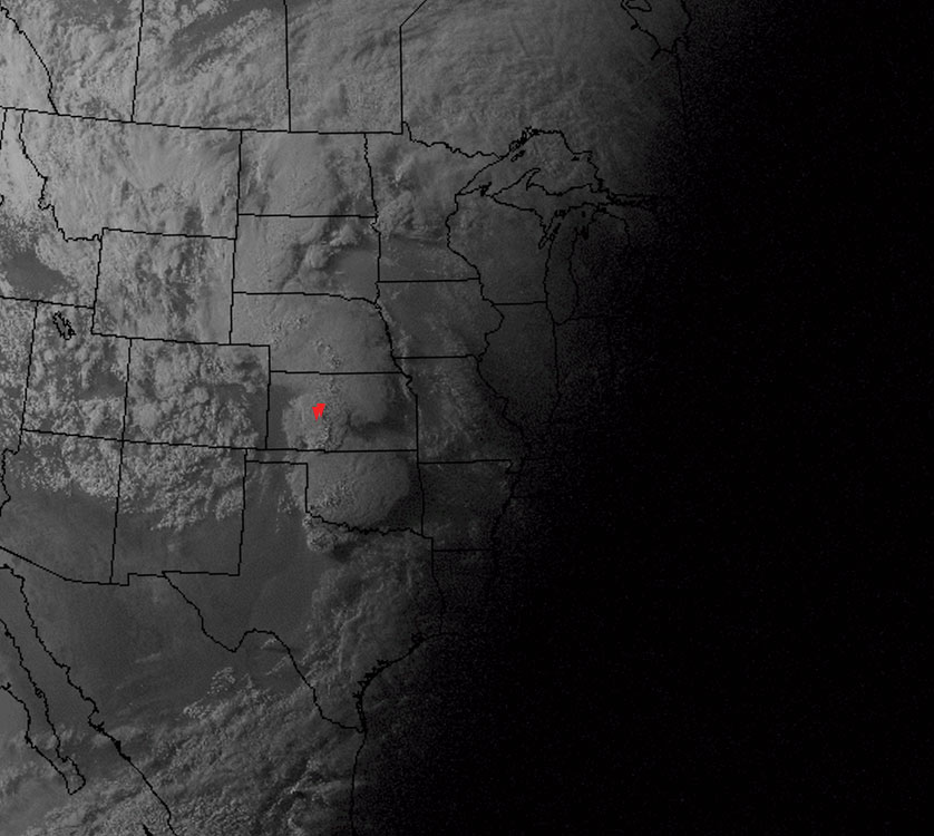
20Z Satellite
01Z Satellite
Video documentary of the chase.
Overnight spot south of McCook Nebraska (1300Z)
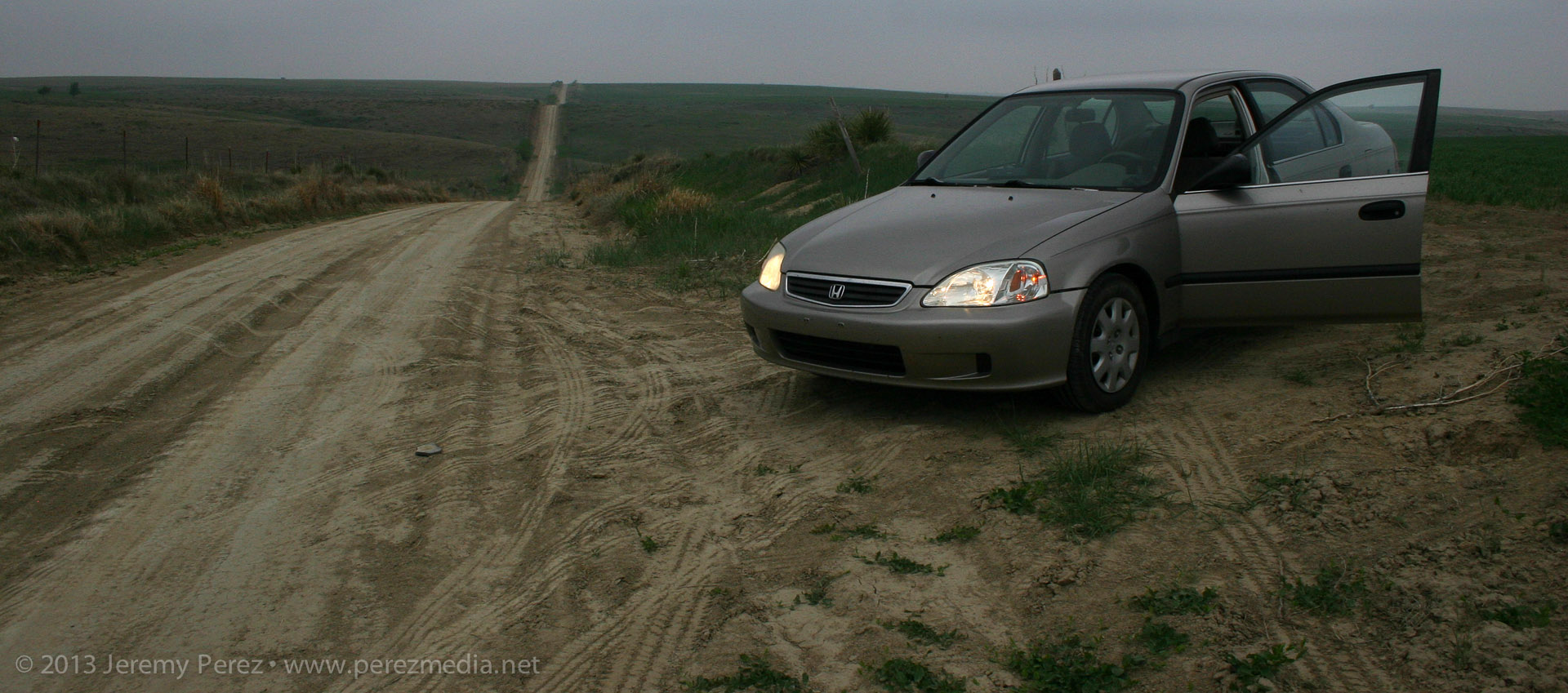
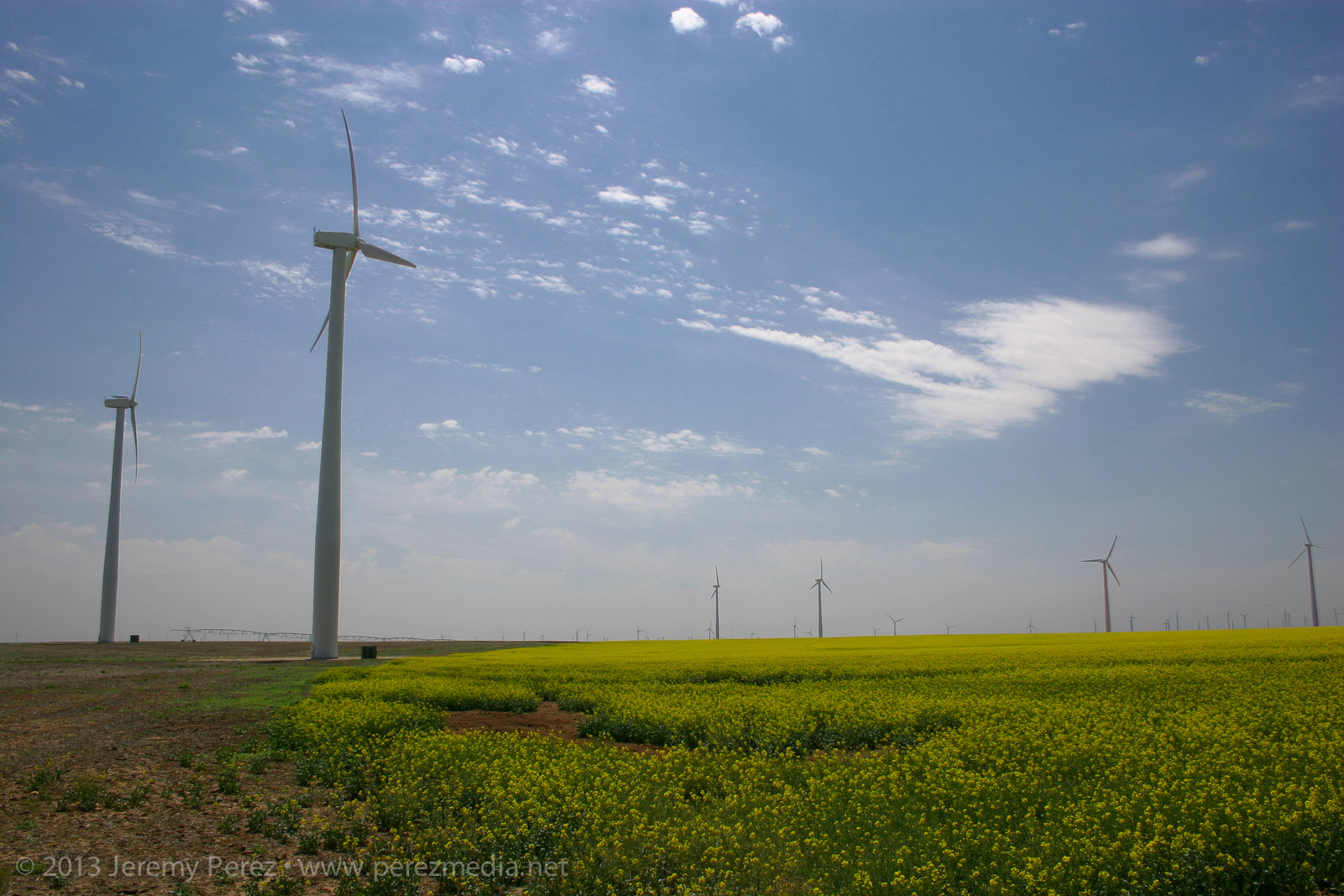
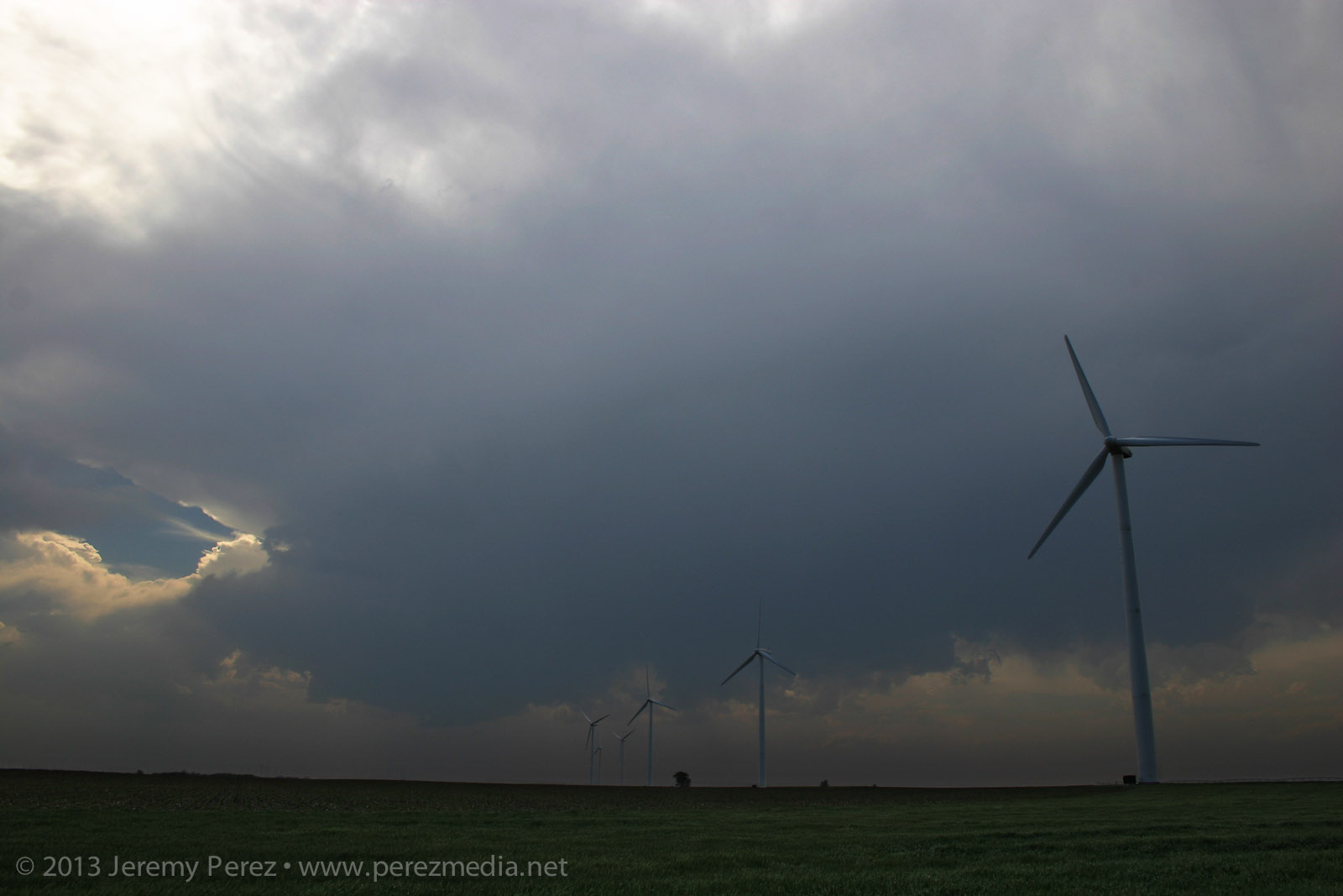
After car camping for the night, south of McCook Nebraska, I made my way south through Kansas, toward my initial target near the Oklahoma border. Along the way, I took advantage of a few photo opportunities. As I drove down one farm road, looking for a secluded spot to brush my teeth, wash my face and do a Clark Kent clothing swap—because I’m Super that way—and I ran across this blaze of yellow flowers beneath a series of wind turbines. It’s hard to capture how striking that was in a photograph, but here you go:
Turbines and flowers near Cimmaron, Kansas (1700Z)
Skies were clearing the further south I went, and really priming the atmosphere for storms later in the afternoon. As I cruised along the dryline from Ashland towards Greensburg, towers started going up. And then dying...leaving behind a bunch of sad orphan anvils that were drifting away in disappointment.
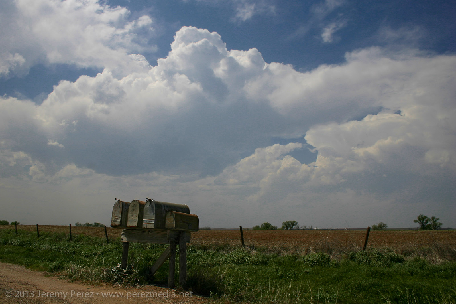
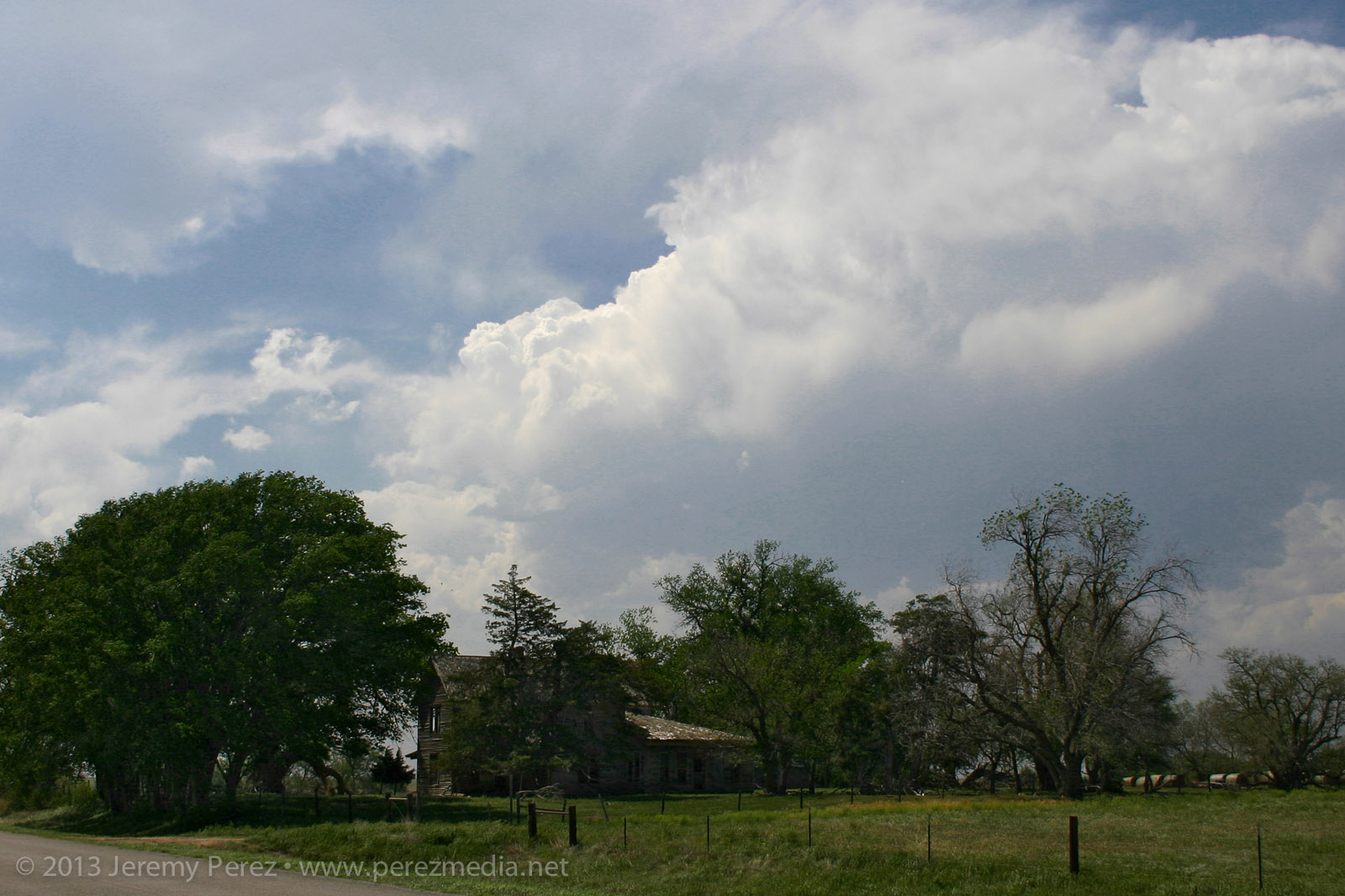
The past couple days, I had been working on being conscious of foreground elements to complement the sky in any photographs. It’s so easy to see this awesome sky and shoot with a bland, flat foreground that you don’t notice how boring it is until later when you’re processing images. So: mailboxes, wind turbines, farmsteads, any given stand of trees...I took them where I could get them. (Doesn’t mean my heat-of-the-moment tornado & funnel photos always benefited from decent composition...see down the page.)
Convection developing along the dryline (2045Z)
Mailboxes and dryline convection (2052Z)
Little House on the Dryline (2057Z)
Finally a cell managed to outwit the cap near Spearville and the chase was on.
Developing supercell near Spearville, Kansas (2205Z)
As I made my way east of Kinsley, the cell started to get rooted into the boundary layer. And now we finally had a nice looking supercell with structure that really started to beef up. It had a bit of the mothership flavor to it. The way I see it, this is a Star Trek (The Next Generation) model dropping down out of the clouds. And because after the J. J. Abrams’ reboot, Federation Starships goof around in the atmosphere these days like it weren’t nothin’ but a thing.
Panoramas of the supercell near Offerle, Kansas (2310-2318Z)
I was working the dirt roads as much as possible, which turned out pretty nice as long as I was paralleling the storms. (I didn’t get too comfy with those roads though when things were more inbound.) As I was driving north on 50th Avenue, about 4 miles west of Kinsley, I was surprised to see a little shear funnel up in the vault. It was very persistent and lasted several minutes.
Shear funnel in the vault (2326Z)
As I jogged along, north and east, trying to stay a bit ahead of the storm, I drove past what looked like the Storm Rider crew with their contingent.
Storm Riders crew (2342Z)
RFD was making various attempts at nudging into the base when another cell popped up and started encroaching from the south. I wasn’t sure if it was going to wreck the leading cell or which base to focus on. So I split the difference and got a bit behind the lead cell I was originally pacing.
Cell merger under way (2345Z)
The lead cell ended up eating the trailing cell, and then it really took off. The RFD started making a major push and digging a deep pocket into the rain free base. Rotation started ramping up behind the clear slot and it was looking pretty imminent.
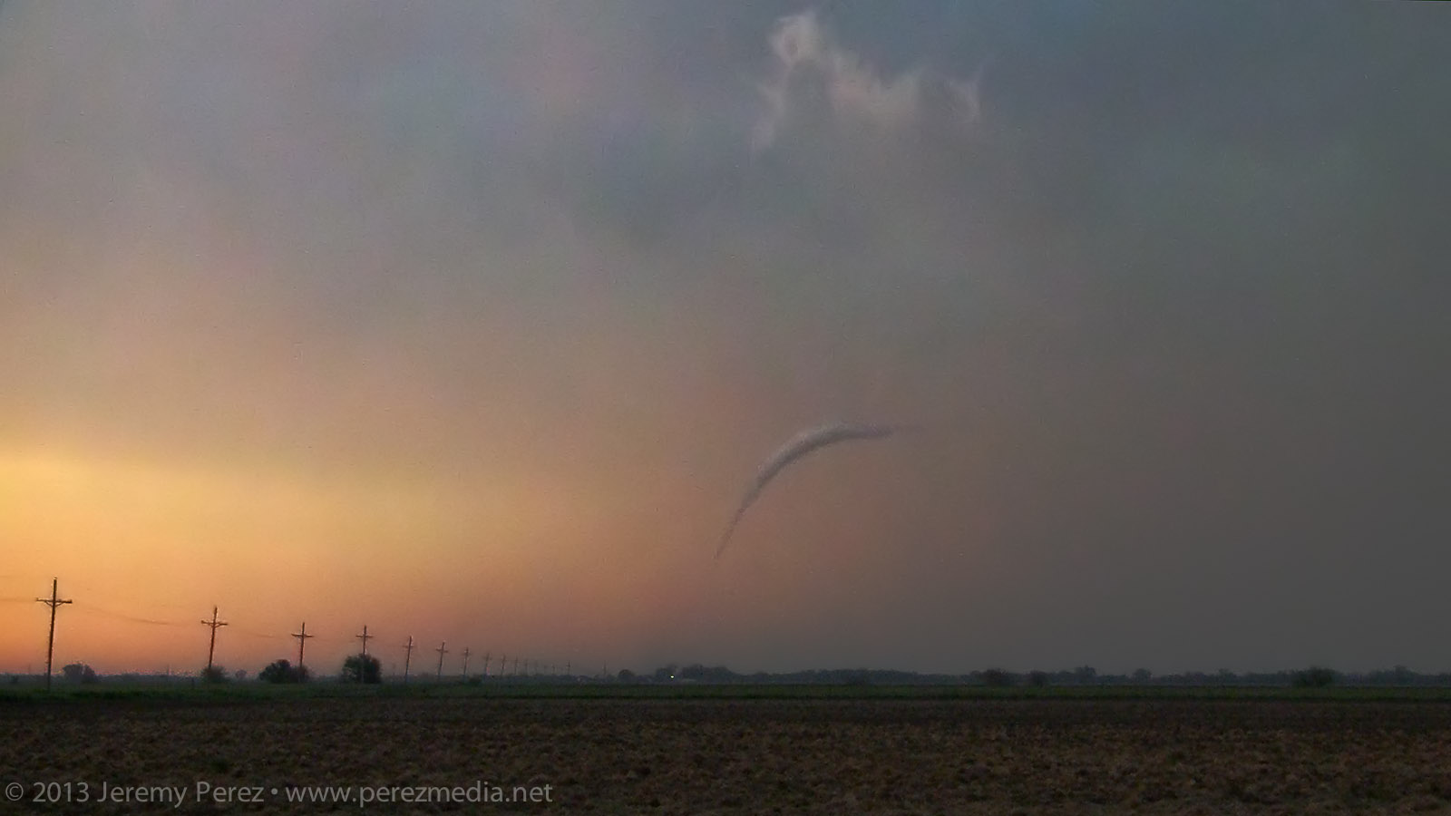
Rotating wall cloud south of Rozel, Kansas (0021Z)
About 5 miles southwest of Rozel, it started winding up a funnel that gradually made its way to the ground and grew into a sturdy, long-lived tornado spinning away behind a remarkably clear RFD slot.
Developing condensation funnel (0025Z)
Rozel tornado fully condenses (0029Z)
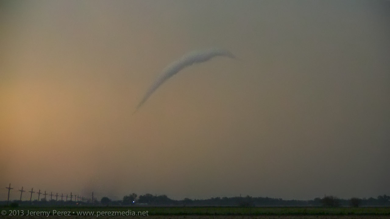
Rozel tornado (0032-0033Z)
After photographing and filming it for several minutes, it started to dissipate. So, I moved up to keep pace, and noticed a new funnel condensing and then roping back out. This was actually still the original circulation, which was apparently still on the ground, and more of a last, condensational hurrah.
Rozel tornado ropes out (0050Z)
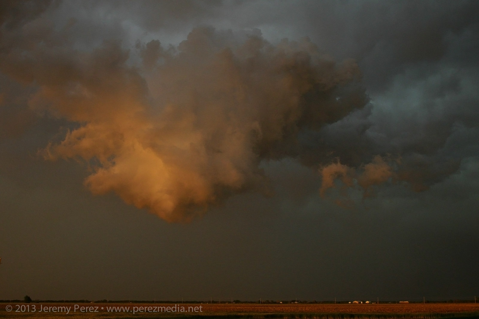
I made my way further east on L Road, another hefty funnel appeared to my northeast, near Sanford. Light was starting to fade and it was backed by its forward flank. So contrast was low, and camera noise was high. I sampled some frames from the video where lightning helped silhouette the tornado. It was interesting to watch the axis of the tornado move counterclockwise around the larger meso circulation. So it was drifting westward for a while before running its cycloid pattern back eastward.
Sanford tornado (0102-0104Z)
Sanford tornado panorama (0107Z)
It eventually started to rope out and bend back way to the west, lit by purple, turquoise and orange twilight colors. There’s so much going on—I wish I’d have popped the camera on a tripod and gotten a decent low-ISO exposure. As it is, still lots of high-ISO noise so I could go hand-held.
Weakening tornadic funnel drifts west of Sanford, Kansas (0110Z)
Just when I thought it was done, I called my wife to see how things were going and talk about everything I had just seen. While talking on the phone, this floating earthworm of a funnel suddenly popped into view, off to the northwest. Just this cool little disembodied funnel twisting around, way west of its parent storm. Circulation was still on the ground as it drifted westward before finally winking out.
Sanford tornado ropeout
Sunset cloudscape over Sanford, Kansas
Unfortunately, a home and a couple farm buildings were damaged by the tornadoes; thankfully however, there were no injuries. It was an amazing spectacle. Slow storm speeds. Clear RFD. Incredible structure and an assortment of tornado morphologies. If only the next two days had worked out that way...
While visiting family in Elk City, I chased some storms on March 14, 16 and 18, and wound up seeing three tornadoes on the 18th. (I'll post details of the other two chases later).
I made the Sunday chase after a convective shambles in the TX panhandle on March 16. This turned out to be an incredible follow-up. Deciding between better moisture south near the Red River vs. better H5 winds north by the OK panhandle was my biggest challenge as I made my way toward Shamrock, TX on I-40. Based on reliable results with NAM and HRRR forecast models on March 14 and 16, I was relying on them more heavily.
By the time I got to Shamrock, HRRR was forecasting some convection up by the OK panhandle and southwest KS, but it was showing this to be short-lived. The more robust, sustained development was forecast along the dryline west and southwest of Childress and moving into southwest OK. When I got to Shamrock, the cumulus field was congesting along the dryline in agreement with that area proving to be a successful initiation point, so I fueled up, cleaned the windshield and headed south.
As I approached the Red River, towers were going up, and as I moved into Childress, a really nice updraft and anvil were overshadowing the town.
Storm Initiation
Developing Cell Panorama
Following the storm back over the Red River meant either racing the core along Hwy 62 and glomming with an inbound stream of chasers, or taking some side roads over to Rt. 680 just NE of the OK/TX border. I chose 680, and after sledding along several miles of farm road whose last maintenance heralds from before the dust bowl days, I made it to an I-Dare-You type bridge crossing with the storm moving over the OK border just ahead.
Bridge Crossing at the Red River
After cringing at the forbidding screeching noises as I rolled across the bridge, I parked about a mile further north and shot some time lapse video and panorama shots. The lead cell was being hugged by a trailing cell with an incredibly solid hail core. I wondered if this would be like the mess on Friday near Lubbock with each batch of convection being demolished by whatever formed behind or in its inflow. For a while, both cells sported great structure and inflow features, and I couldn't decide what to photograph.
Wall Cloud on Lead Cell
Structure on Trailing Cell
Solid FFD Core on Trailing Cell
Panorama of Both Cells
As I followed at a hail-safe, happy-rental-car distance, the lead cell became dominant and from there, the RFD did all sorts of wonderful things to the updraft base and enclosed wall cloud. From that distance, I was having a hard time resolving details behind the nearly constant precipitation curtain, but rotation had become sustained and it was one great photo op after another with some very tantalizing wall cloud structures emerging periodically through the hazy mists.
RFD Shelf and Wall Cloud Behind Precipitation Curtain
RFD with Rotating Wall Cloud Structure in Background
Structure Panoramas
I travelled the smaller county roads as much as possible, which lowered the convergence factor with chaser hordes. I still encountered smaller groups at key intersections and vantage points. This small group was enjoying a perfect RFD donut hole backed by a shaggy wall cloud and tail.
Chaser Audience, RFD Donut Hole and Wall Cloud/Tail Cloud
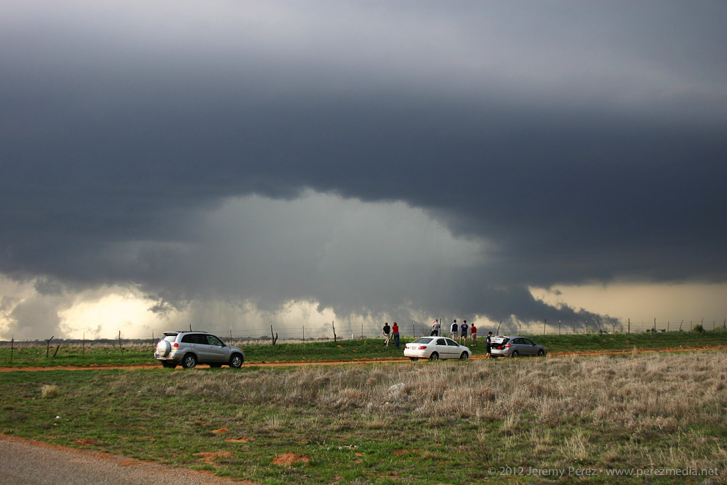
About the time the tornado warning went up for the storm, I was back on a main road headed north, trying to get in better position when I was passed by law enforcement blazing north with lights flashing. I figured they were getting ready to road block my route, so I started to detour east to find another dicey county road, when a quick check out the side window showed a funnel snaking down (7:04 PM). I squeezed off some still shots, but wasn't in time with the video camera. The slender funnel I saw may have been a small satellite to something bigger happening behind the precipitation curtain--there appears to something ominous going on along the right edge of that rain curtain in the photo.
Satellite Tornado and Rain Wrapped Circulation (7:04 PM)
As I stepped my way north and east, I was awestruck by the incredible structure on this storm. While I wish I could have been closer to view the detail in and around the wall cloud and the tornadoes it spawned, I can't complain in the slightest about the views I got of the entire storm from a few miles away.
More Awesome Structure
As I navigated northward near Granite, OK, I found a high vantage that gave me a view of a second tornado spinning up near Willow, OK (7:30 PM).
Willow Tornado (7:30 PM)
My third for the day spun up a few minutes later at 7:38 PM. This one lasted a couple minutes before the slender rope dissipated.
Third Tornado (7:38 PM)
I followed the storm a bit more as it approached Clinton, but lightning was too sporadic to make out any more features, so I made my way into Elk City for a big steak and fries at Western Sizzlin. Chasing solo, trying to run two cameras and experiencing this unbelievable storm gave me a case of full-blown sensory overload--I'm still having vivid flashbacks. It was a great chase and I can't wait for my next opportunity in the northern plains in June.
Video of Supercell and Tornadoes in Southwest Oklahoma
Links to reports and photos from others chasing the storm:
What a strange weather day. I was aware of the potential for severe weather today, but since it was a work day I didn't give it too much thought the night before.
Then I awoke to the sounds of the emergency broadcast system issuing a tornado warning on the TV in the living room (where Harrison was enjoying some early morning cartoons).
I turned on the computer, pulled up local radar and saw a train of red tornado warning polygons piling up and following a line of storms just west of Flagstaff. So yeah, it was a work day, but 10 miles from town? I'd be a mess if I didn't at least try. I asked to take a few hours off at the office, and then headed west on I-40 to Bellemont.
I had no overall plan, it was spur of the moment, and I hadn't spent any time going over the synoptic situation or models. No mobile data either. I just figured, one tornado-warned storm after another was cooking northward and ending up between Bellemont and Flagstaff...I'd surely see at LEAST some interesting structure.
Wrong.
No understanding of the overall setup, no data, towering ponderosas packed against 90% of any given roadway, very low cloud bases, storms moving at 40 mph, and a sparse road network that forces you to commit with no options for fine-tuned adjustment made for endless frustration.
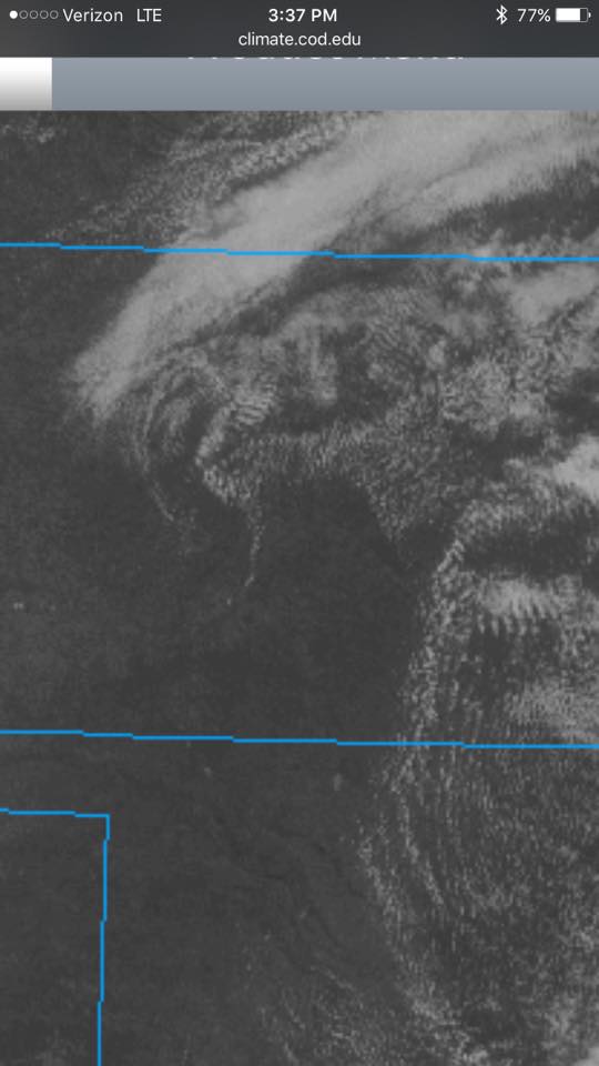
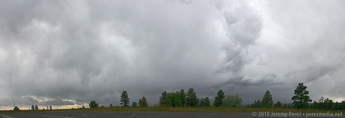
I spent most of the time in drenching rain and pea-sized hail or looking up at racing clouds from inside a canyon of trees. As I cruised along I-40, one cooperative gap in the trees gave me about a 3 second glimpse of a nicely flared rain free base on a storm that had been tornado-warned near Sedona. I wasn't able to re-acquire it. Just too much terrain. Hindsight: I should have worked south on I-17...once the storms started training eastward they lost their punch after moving north over the rim.
The Bellemont truck stop is situated in a nice, open prairie landscape, which provides a better visual if that's where a mesocyclone plans to traipse. Which, none did while I was sitting there without radar data.
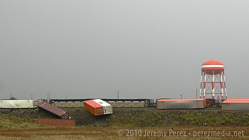
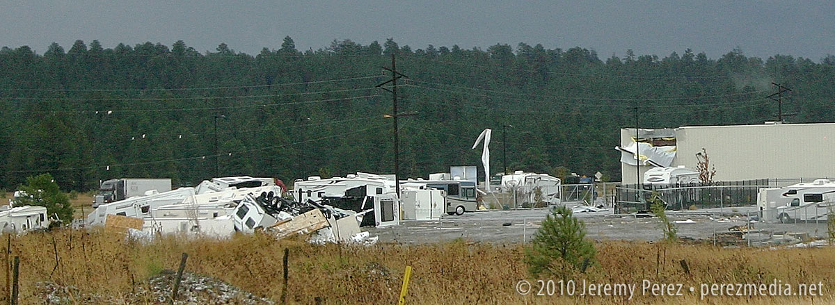
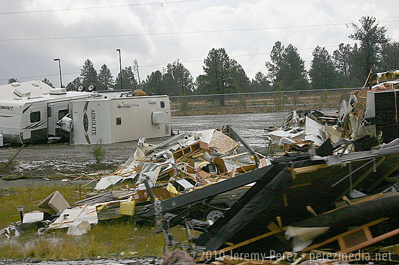
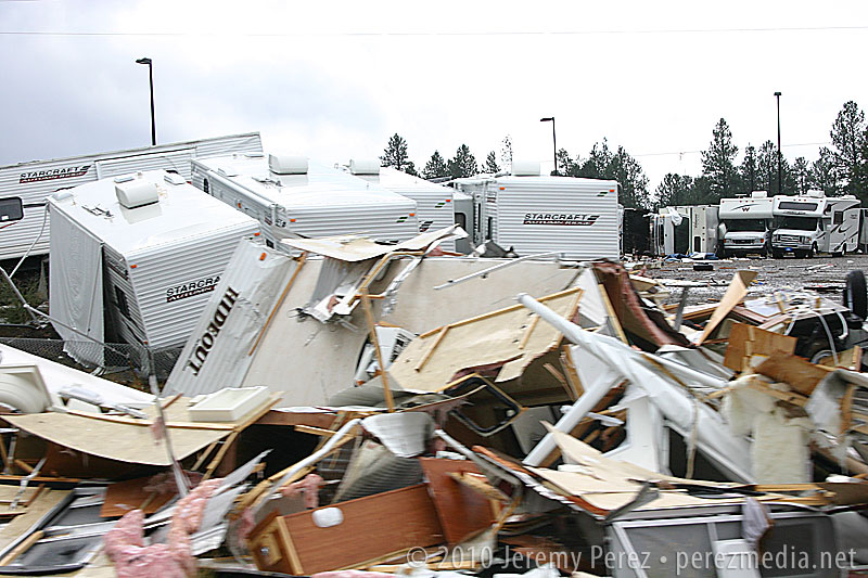
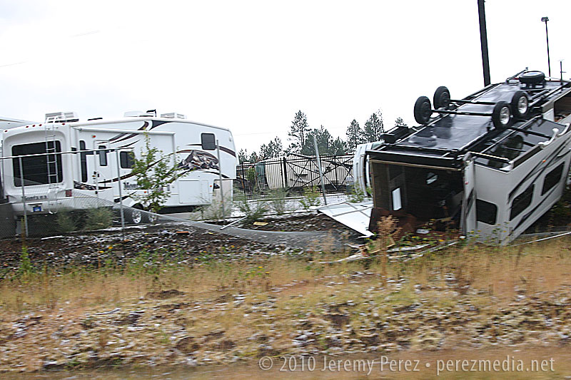
If I had been there several hours earlier, it would have been a completely different situation. Severe storms are fascinating, but not when lives and livelihoods are threatened. One confirmed tornado, and likely some serious straight-line winds were unloaded and wreaked havoc with this little community between 6:00 and 7:30 this morning. As I drove around looking for an open vantage point to watch the incoming storms, DPS was everywhere. Several rail cars were laying on their sides, demolished semi frames were in the median of I-40, buildings had their roofs and siding peeled away, and an RV lot looked like gravity had suddenly shifted, toppling and bursting random campers open. Fortunately, there were no fatalities; however seven were injured.
So, yeah, I was frustrated by how the chase went, but how can that even compare to the frustration of having your home ravaged, pieces of your life blown off into the mountains, or someone you love having glass and debris picked out of them in the ER?
Anyway, a very strange weather day. See below for some photos.
Train derailment at Bellemont
RV Lot and Building Damage
RV Lot Damage
RV Lot Damage
RV Lot Damage
This was about as good as it got for views of incoming storms if you were anywhere near my car. :P