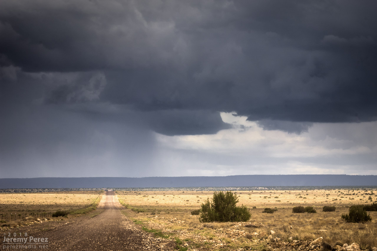
This started as a pretty simple, 20 mile local chase that wound up overperforming. The day featured northwest flow with storms firing on the higher terrain and moving along the Mogollon Rim which is oriented northwest to southeast. I headed east of Flagstaff on I-40 and drove down a dirt road to a vantage point less than a mile south of Twin Arrows. I was trying to catch the collision between a cell building south of Flagstaff with a fresh outflow boundary to its southeast. Sometimes these dish out some pretty structure before everything fills in. I figured I’d try some Lightning Trigger shots while I was at it.
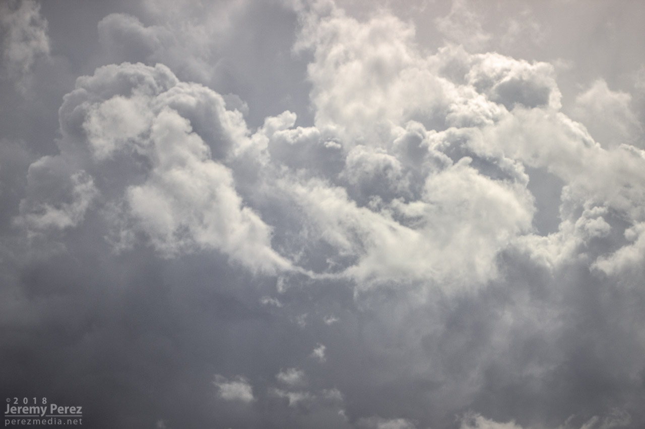
The growing cell was a thing of beauty by monsoon pop-up standards, with a solid updraft fist punching a big ripple into a doughy anvil.
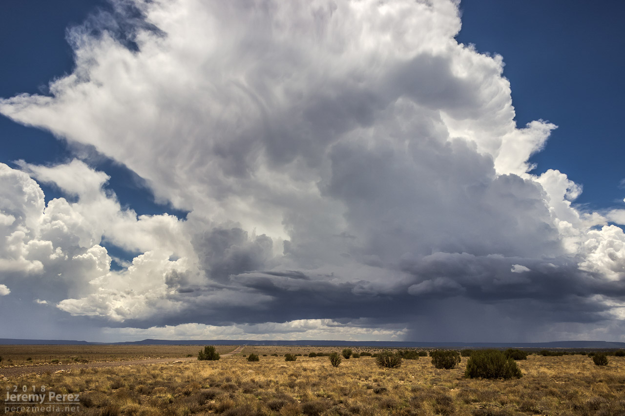
— 12:36PM / 1936Z —
As that cell approached the outflow boundary of the dying storm downstream, it sprouted up a choppy arcus cloud, but that was about it. Not quite what I was hoping for, but there was still plenty of afternoon left and I thought maybe something closer and further north would light up.
— 12:44PM / 1944Z —
It wasn’t long before another cell went up near where the previous one had started, and from then on, it seemed Anderson Mesa was going to be the tracks for a steady train of storms cruising southeast. By then, another Arizona chaser, John Sirlin, had situated himself about a mile and a half further south and was watching from a good hilltop vantage.
Storm chaser, John Sirlin, parked at the next hilltop
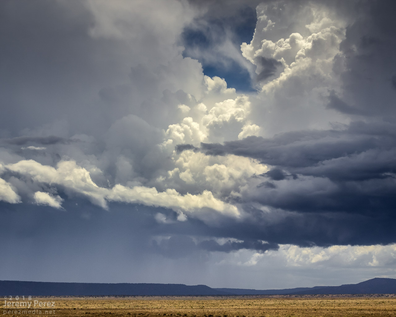
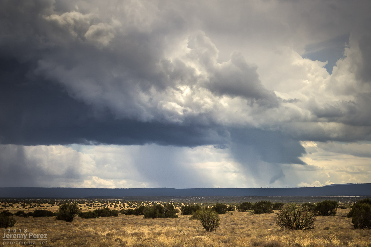
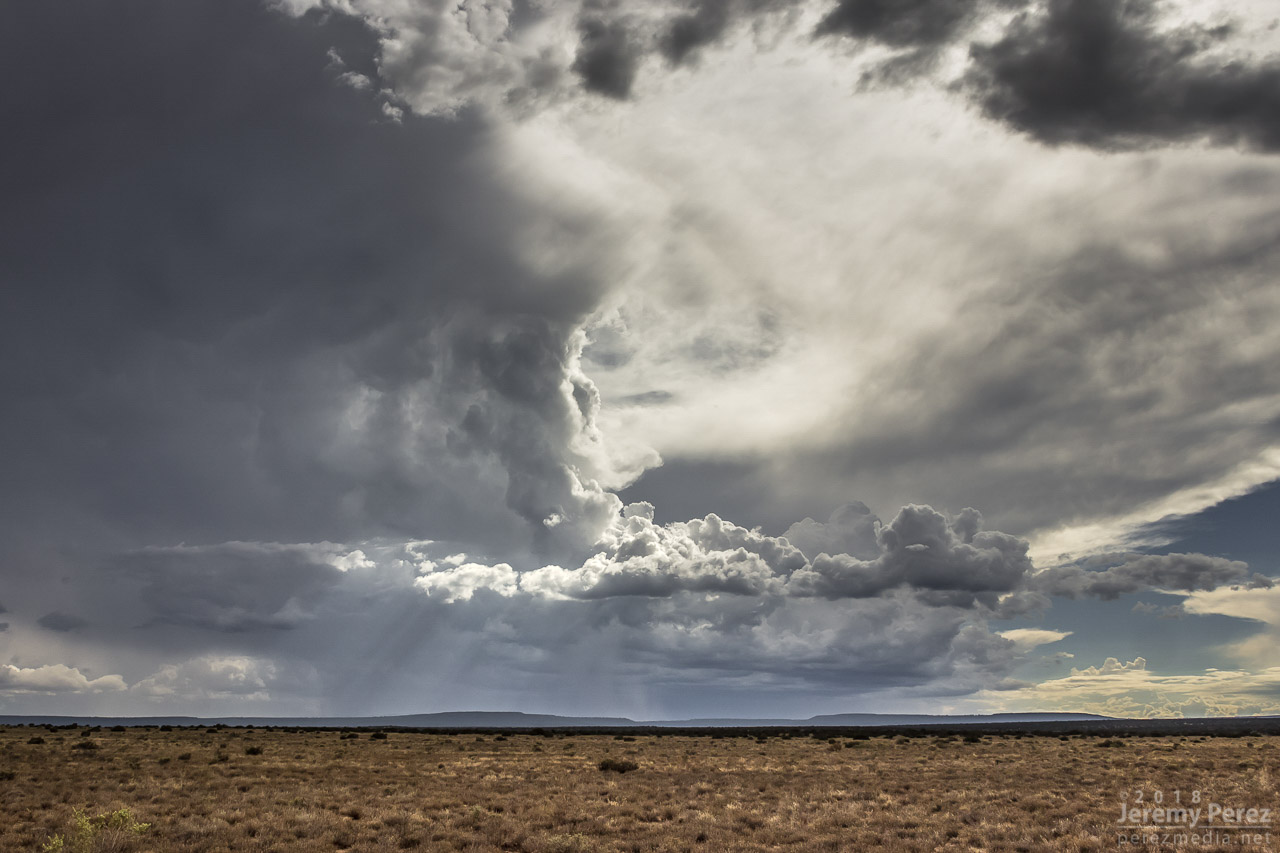
Over the next hour, I noticed that storms were picking up laminar striations in their bases and had a couple eye-catching silhouettes taunting me from 11 miles away.
— 1:19PM / 2019Z SSW of Twin Arrows —
— 2:00PM / 2100Z SSW of Twin Arrows —
— 2:01PM / 2101Z SSW of Twin Arrows —
— 2:10PM / 2110Z SW of Twin Arrows —
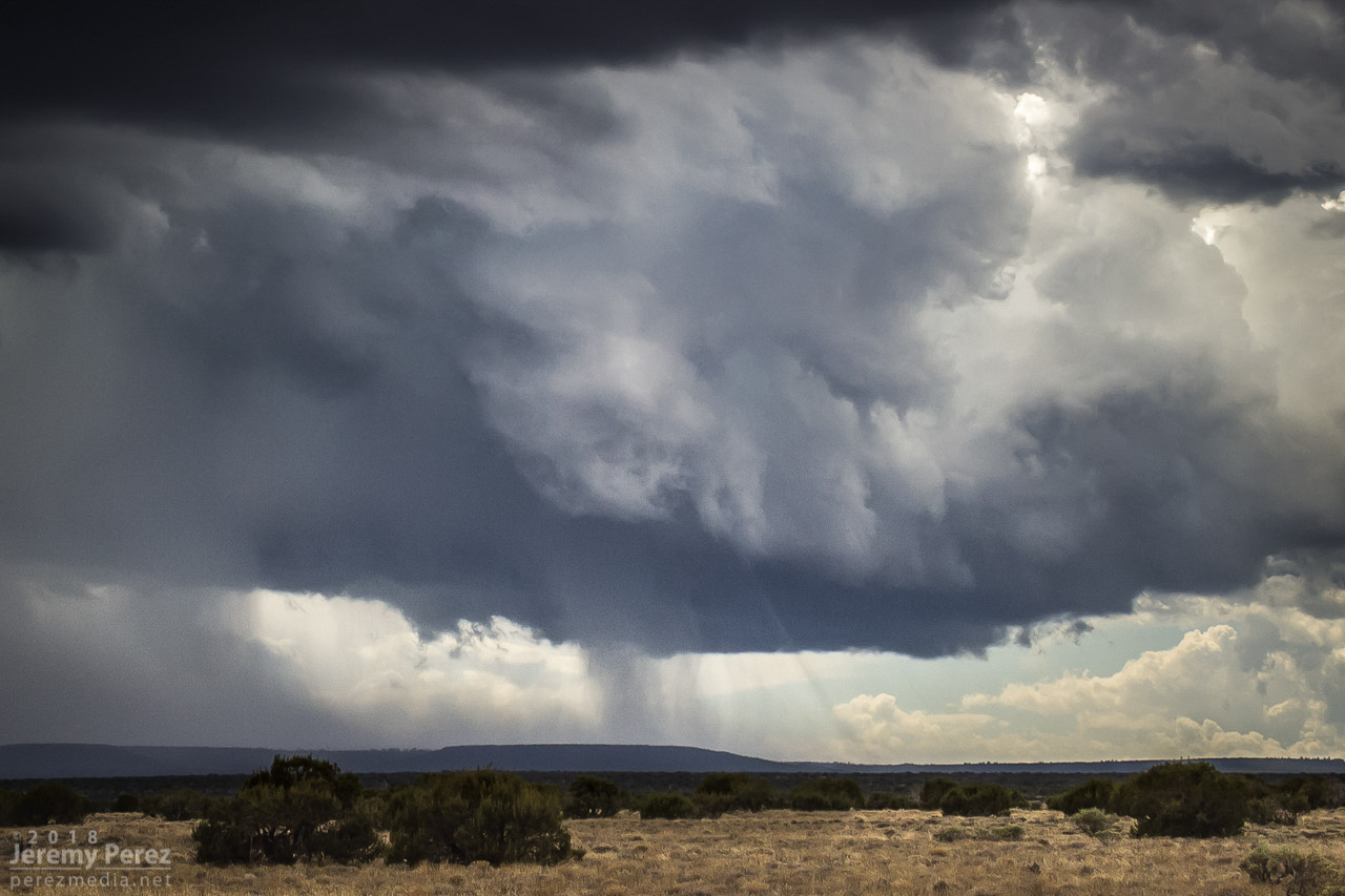
As that last funnel looking thing materialized, another storm had taken root northwest of it and was growing stronger. It was being led by a lowered, shelfy base while the trailing core looked cupped and hollowed out. I was noticing thin rain shafts on this and previous storms that kept catching my eye, but I wrote them off.
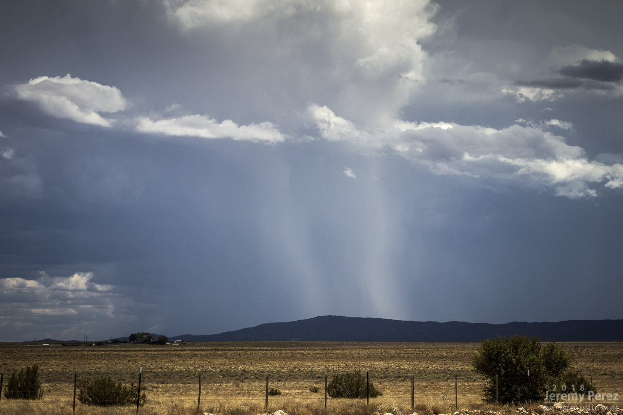
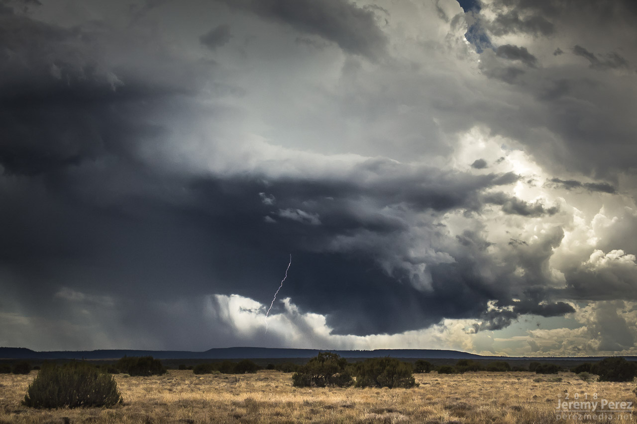
— Earlier pair of rain shafts 12:47PM / 1947Z S of Twin Arrows —
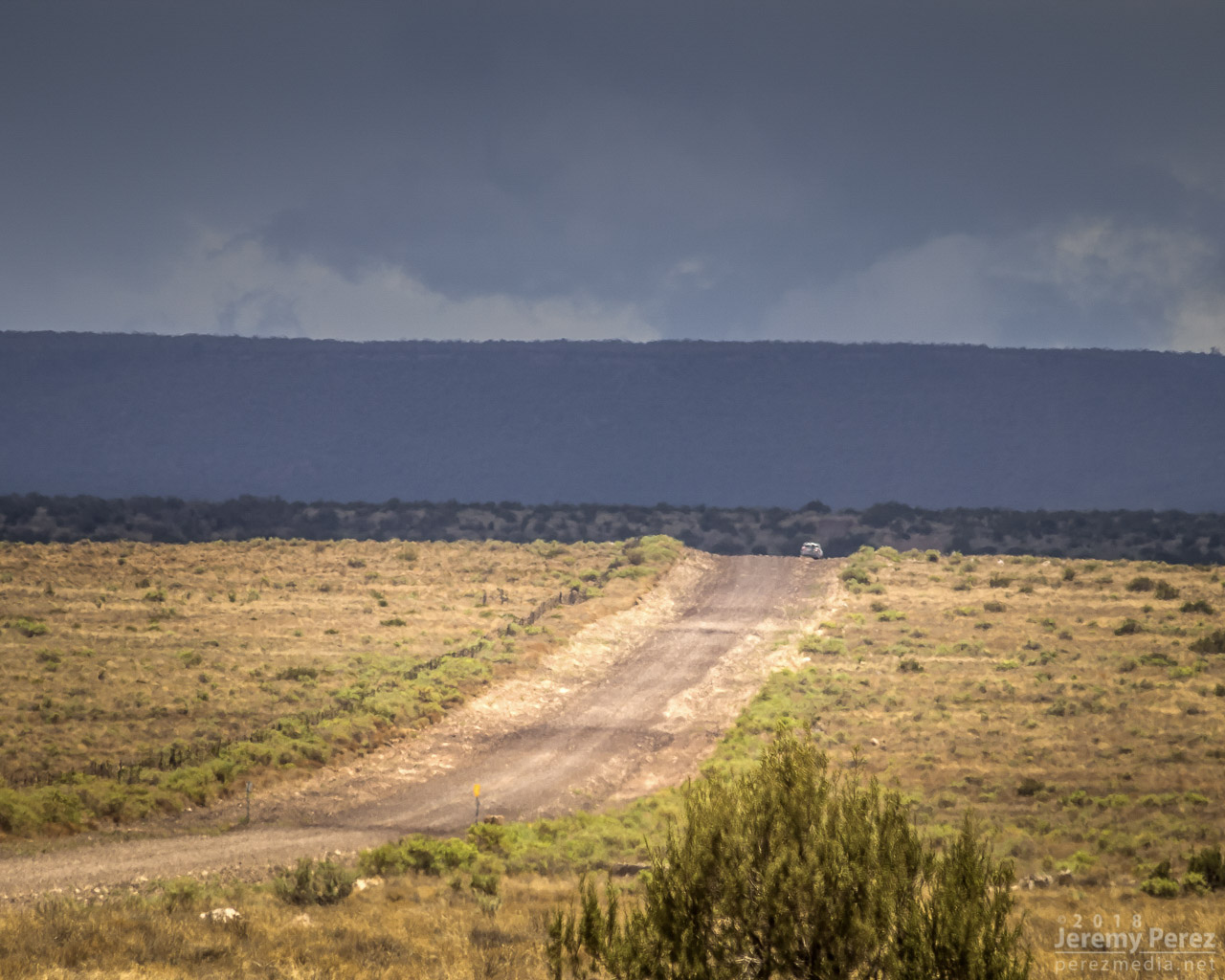
This new storm started to develop broad anti-cyclonic rotation on its north side but eventually picked up a tighter cyclonic couplet and a decent wall cloud on the opposite/south side of the core. And that core was gradually hiding the action. I wish I had been out on Lake Mary Road watching this, but road options require a huge commitment. Investing in a 35 mile drive through mostly trees to get to a probably-not-long-to-live storm with an unobstructed view 11 miles away is a tough call to make.
— 2:35PM / 2135Z lightning strike and developing wall cloud —
About the time rain popped up overhead and chased me into my car, I got a message from John asking “Did you get it?” Cold chill time. What did I miss? The pic he sent afterward showed a close up view of one of those ‘rain shafts’ stretching out at a 30 degree angle from the storm. I was time lapsing the cell at that time, and figured I should have caught the feature I wrote off. We finished watching a couple more cells develop and chatting with another chaser that had set up in the area, Nick Pease.
— 3:18PM / 2218Z severe-warned storm —
— 4:10PM / 2310Z last cell over Anderson Mesa —
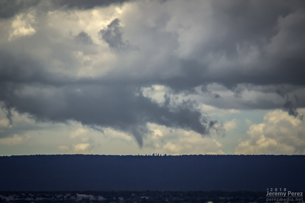
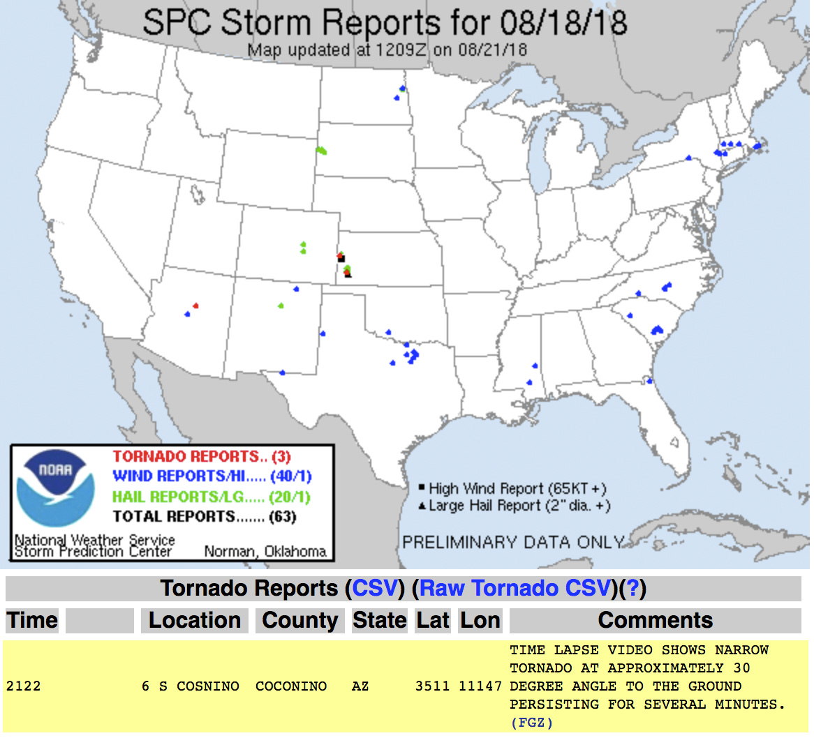
Getting home and processing the shots, sure enough, that thin feature dangled cloud to ground, getting pulled along with the anticylonic rotation for about 6 minutes. In addition to John’s shot, I posted the time lapse and a line-of-sight map for the Flagstaff NWS office to review. Their assessment aligned with John’s earlier heads-up and the SPC storm report was updated to plot it as a landspout tornado.
— 2:26PM / 2126Z landspout about 12 miles SW of Twin Arrows —
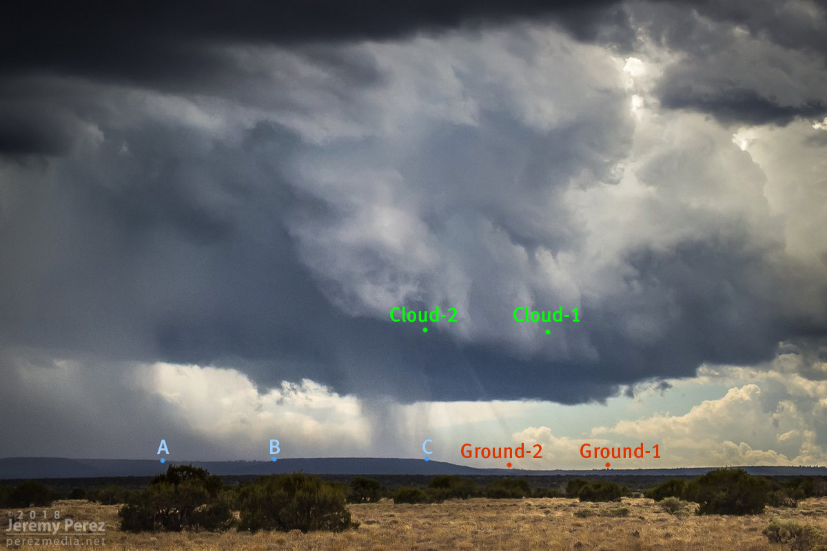
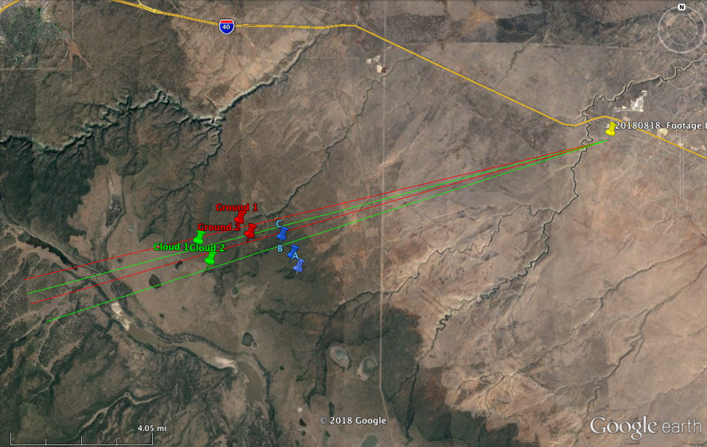
Line of site points and map markup
Definitely not the hit-you-over-the-head variety that we saw in Colorado a few months ago, but it was pretty rewarding to finally document one in Arizona.
