August 2015 Archives

On my way home after photographing monsoon thunderstorms northeast of Flagstaff, I noticed smoke rising over the hills along Townsend-Winona Road. I thought it might be another tree fire, but as I rounded a bend, it turned out to be a terrible house fire. Checking radar, it looks like there were 3 lightning strikes over that location from 2:45-3:00 PM. Several fire trucks were on the scene but the fire was overwhelming and it took quite a while before it seemed to be brought under control. I'm afraid the house may have been completely lost.

A couple of the lightning strikes along Townsend-Winona Rd.

img20150815_20150815-IMG_9112_lg.jpg

img20150815_20150815-IMG_9145_lg.jpg

The house fire at Townsend-Winona and Bullion Hill Rd.

img20150815_20150815-IMG_9028_lg.jpg

img20150815_20150815-IMG_9024_lg.jpg

img20150815_20150815-MVI_9030-13_lg.jpg

img20150815_20150815-MVI_9030-6_lg-2.jpg

Arizona Storm Chase - 9 August 2015

After noting a great supercell near Winslow, I opted to head toward Twin Arrows to see if some developing convection would take off there. It was good for a lot of heavy rain, but hardly any lightning and it didn't manage to organize.


img20150809_20150809-IMG_8439_lg.jpg

While I was toying with that mess, another storm north of Flagstaff crossed the threshold to the Colorado River Valley, west of Wupatki and went supercellular.


img20150810_IMG_6278-Edit_md.jpg

As I pondered my situation and whether I could race to that storm in time before it drifted into the extremely hard to navigate spaces west of Hwy 89, it picked up a tornado warning. So I dropped the slop I was on—to at least give it a try. By the time I had visibility on Hwy 89, it had the merest remnants of an elevated base.


img20150809_20150809-IMG_8445_lg.jpg

On the chance it might cycle up on some new convection to the south, I took a pretty decent forest service road along the cinder cones north of Sunset Crater. What did pop up didn't develop rotation but still managed to make for some nice storms and lightning.

img20150809_20150809-IMG_8451_lg.jpg

img20150809_20150809-IMG_8459_lg.jpg

img20150809_20150809-IMG_8464_lg.jpg

img20150809_20150809-IMG_8473_lg.jpg

Arizona Storm Chase - 8 August 2015

More storms showing up with couplets this day, but I didn't manage to intercept them during prime structure. The landscape made up for a lot of those issues. These shots are from Hwy 89 north of Flagstaff along the Mogollon Rim/Colorado River Valley margin.

A scud bomb merging into the updraft between Sunset Crater and Wupatki National Monuments.
img20150808_20150808-IMG_7988_lg.jpg


More disorganized convection playing with sunbeams north of the San Francisco Peaks.
img20150808_20150808-IMG_8232_lg.jpg

Benign convection percolating as the atmosphere begins to stabilize.
img20150808_20150808-IMG_8409_lg.jpg

Sunset Crater is trying to peek between the trees on the right.
img20150808_20150808-IMG_8421_lg.jpg

Convection has turned to mush almost everywhere, leaving a great sunset aftermath—just northwest of Sunset Crater National Monument, looking toward the San Francisco Peaks.

img20150808_20150808-IMG_8428_lg.jpg

img20150808_20150808-IMG_8434_lg.jpg

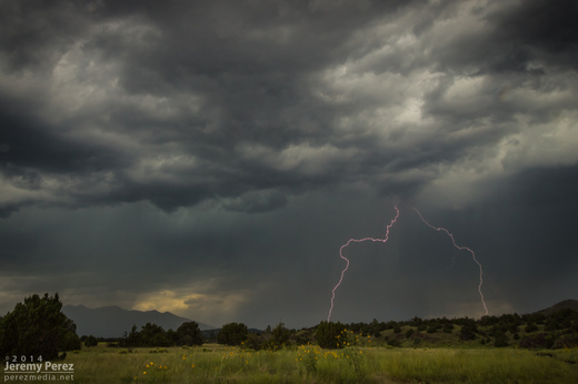
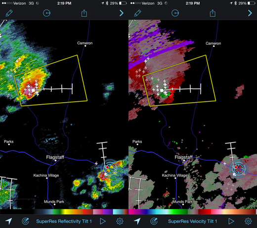
The Mogollon Rim Convergence Zone worked its magic the past 3 days with southwest flow leading to some especially favorable shear along the Colorado River Valley.

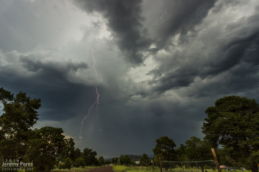
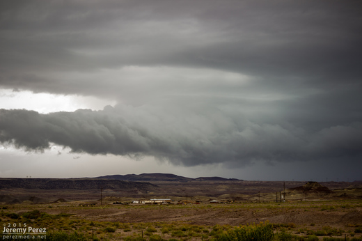
On my way north to meet the best shear parameters—which I thought would be best near Page and the Arizona Strip, I encountered some heavy convection and a nice roll cloud and gust front north of Cameron on Hwy 89.
img20150807_20150807-IMG_9011_lg.jpg

img20150807_20150807-IMG_7708_lg.jpg

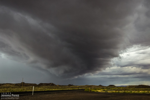
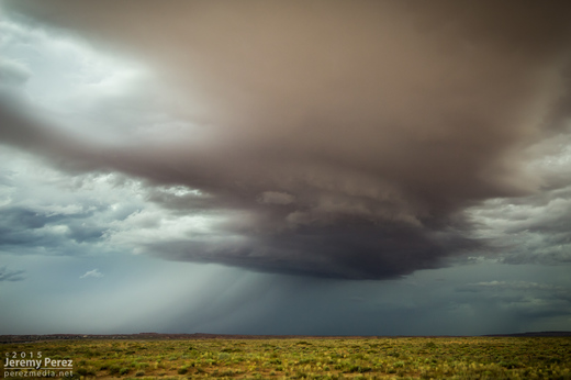
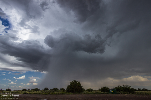
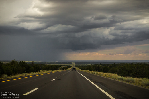
I figured this one would probably stabilize the air mass pretty solidly, so after following it a bit, getting photos, looking for lightning and doing some roadside nowcasting, I started making my way towards Page. A couple hours later I found myself at The Gap to pick up a replacement 9-volt battery for the lightning trigger. Radar showed a couple strong storms lighting up to my south—where I thought things had already been played. So I raced back south and started catching sight of a very healthy looking anvil peeeking over the plateau to my west. Once I cleared the horizon-blocking hills, I got to meet a beautiful Arizona supercell drifting toward me from the west.

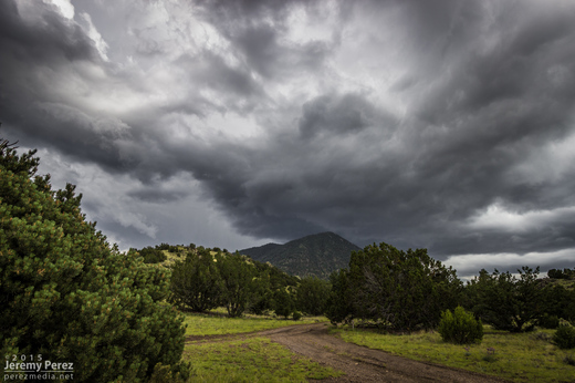
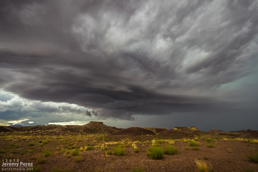
This is the first time I've caught Kelvin-Helmholtz waves along the elevated base of a supercell—and it was an hour from home. This view faces northwest as the cell moves over the edge of the Painted Desert.
img20150807_20150807-IMG_7730_lg.jpg

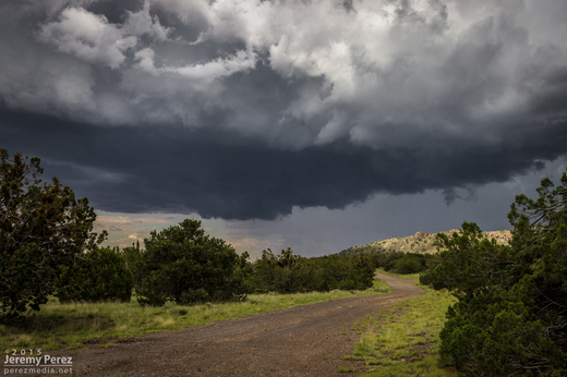
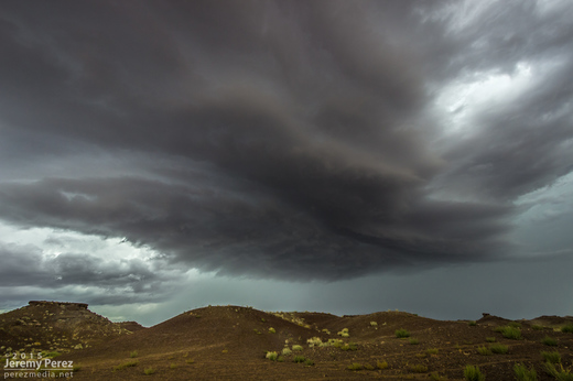
Another view as the storm starts to pass to the north
img20150807_20150807-IMG_7749_lg.jpg

I followed it through Tuba City and further east where it was trying to hand off to a new base before slowly withering.
img20150807_20150807-IMG_7755_lg.jpg