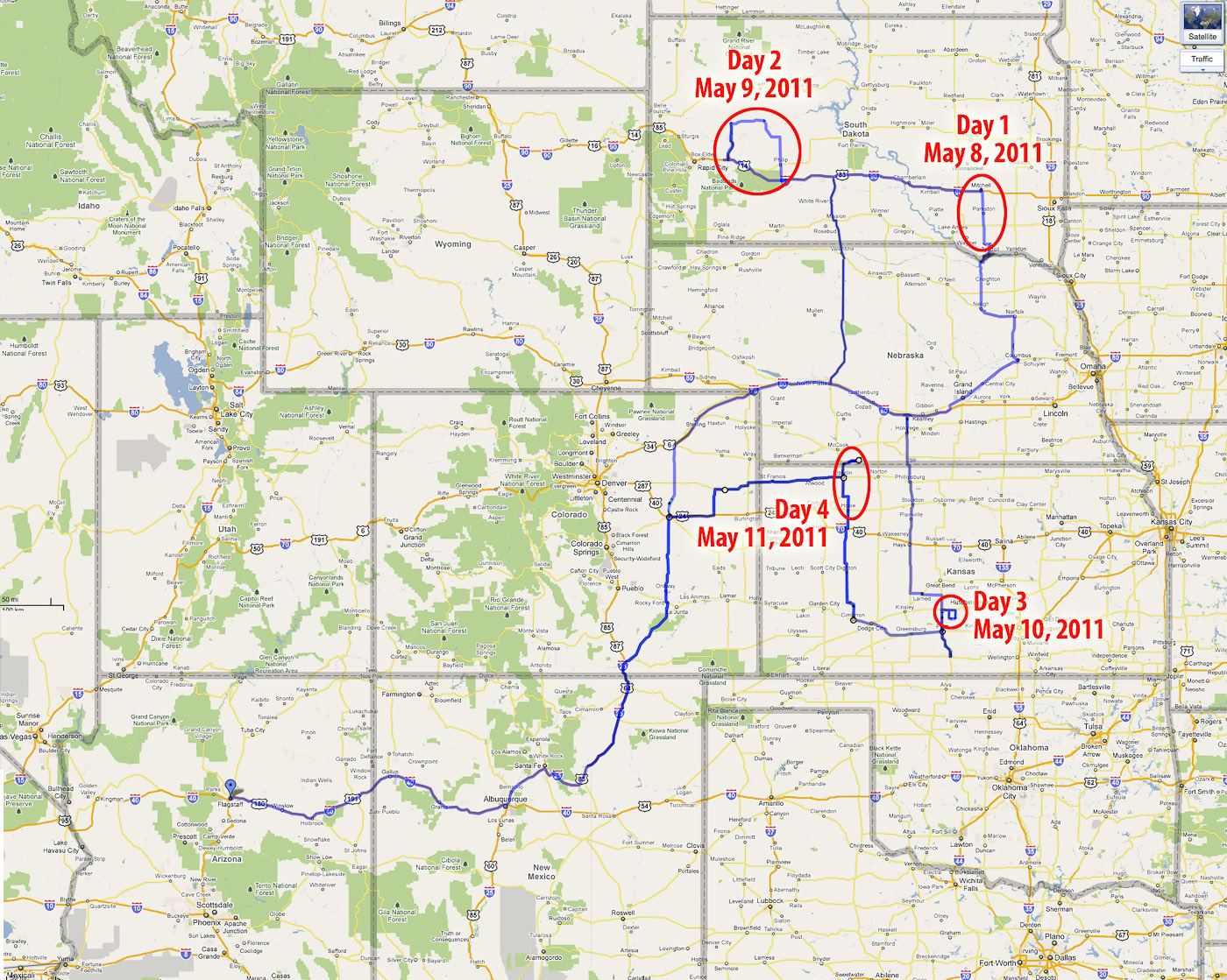
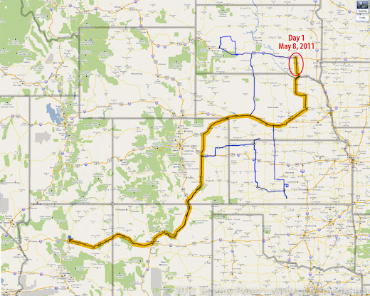
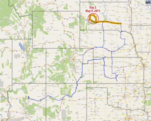
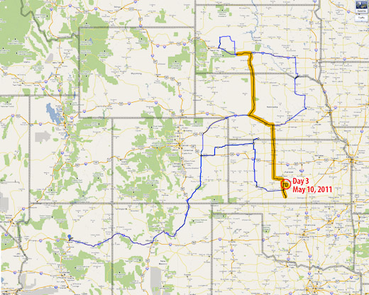
It's been over 8 months since my May 2011 chase trip, and I finally got around to finishing my reports and photos for the 3,750 mile round trip. This was a tough one for me from a forecast and positioning standpoint. No tornadoes, and only one halfway decent supercell intercept. Everything else was incidental, fringe, weak storm interactions. As frustrating as that was, I have to remind myself of the beautiful things I did witness along the way, and a lot of important lessons learned. I'm taking a cue from Skip Talbot and posting a "Lessons Learned" section at the end of each day's report. I'm looking forward to another chase trip in 2012 and hope I can manage to improve my forecasting and positioning and see some more amazing weather on the plains.
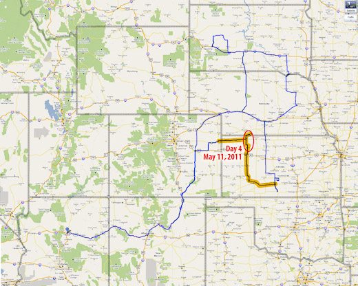
I got on the road Saturday afternoon, left Flagstaff, drove most of the night, and made it to eastern Nebraska by Sunday late afternoon.
I'll try to do a more detailed summary later with more photos. (I'm extremely worn out.)
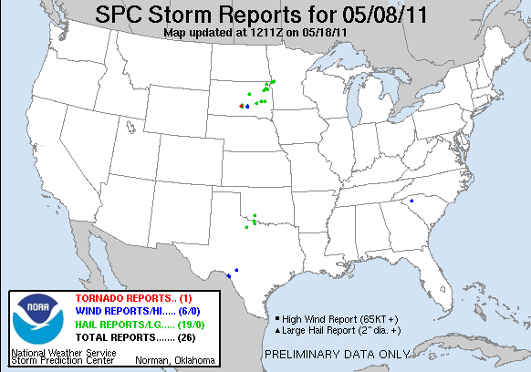
After checking models and spc discussion each time I stopped to fuel up, I decided I would head to the warm front. Unfortunately, eastern Nebraska turned out to be a wasteland of uncooperative cloud streets. The cap wasn't budging there at all. I figured I was going to have a complete bust on my first day out. But then inhibition started to part in South Dakota, a few storms started to blossom. Most were too far to consider, but a small, fresh one was within reach, so I raced north. As I got closer, I realized the cap had clamped down and nothing was left but an orphan anvil.
I kept going north, just in case, and was suprised by a view of a new tower going up on the other side of the Missouri river, half-lit by the coppery light of the setting sun.
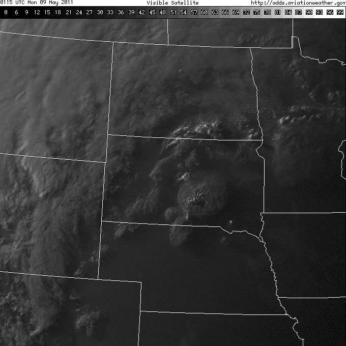
Satellite view showing my target storm as a bright blip in the far south-southeast corner of South Dakota. (Note the only tornado-producing cell in the south-central part of the state--too far out of reach.)
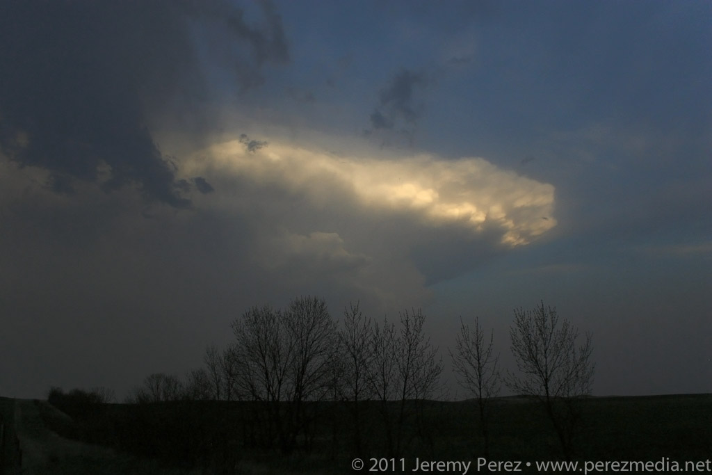
The new tower was farther north than I thought, and was moving north at about 25 knots. I decided not to keep chasing it in the dark, so I broke off, satisfied to see it sputter with lightning as it drifted away. At least I got a distant storm and some lightning for day 1.
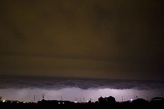
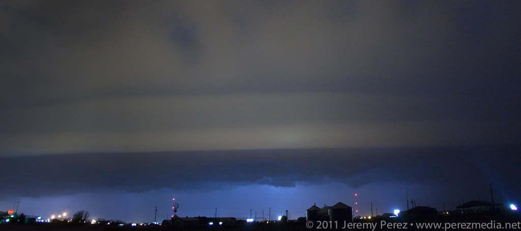
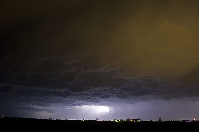
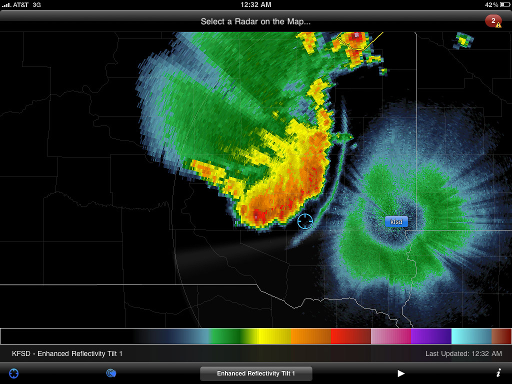
I fueled up again and did some supply shopping. Afterward, as I drove to a section of gravel roads south of Mitchell, SD to park for the night, I was overwhelmed by nonstop lightning behind me. I pulled over to figure out where it was coming from. Sprawled out to my west was a huge, sculpted shelf cloud, gaping with rain, wind and lightning--and it was visibly expanding in my direction. I didn't want to get the car golf-balled, so I raced down the dirt roads, going after a good north-south paved road. Along the way, I made some brief stops to photograph this majestic thing.
At one stop alongside a small lake, the sound of katydids, frogs and other nocturnal creatures blended in with the non-stop thunder of the approaching storm. It was wonderful. As I continued south and east, I realized the entire gust front was going to chase me into Missouri if I let it. So I hunkered down in a farm field access and embraced the drenching rain and unceasing lightning. It was an amazing way to end the day.
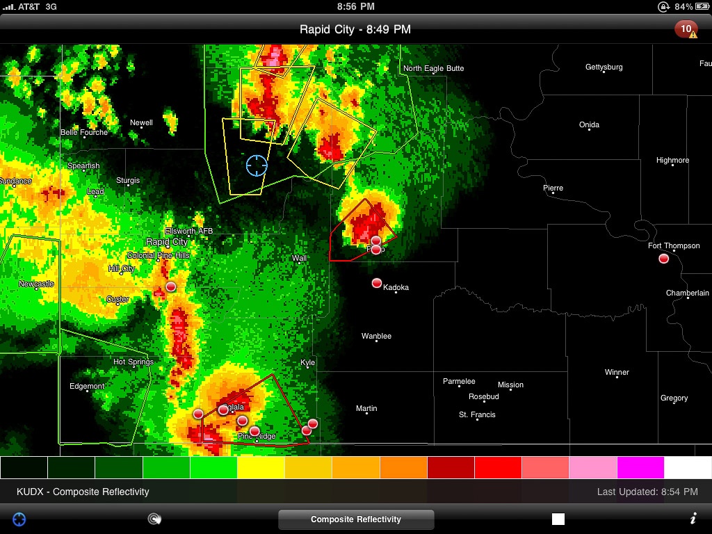
Radar showing my position with the approaching gust front.
Lessons Learned
Argh. Just play closer to the triple point--don't get creative with points further out along the warm front.
The cap likes to be stronger further south.
A shorter focal length lens would be nice for capturing massive gust fronts and shelf clouds.
After night fall, shut off the car, get outside and enjoy the sights and sounds of lightning, thunder, and wildlife.
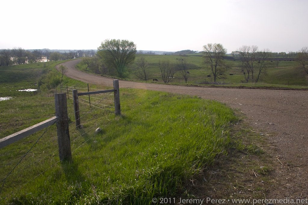
Day 1 - MAY 8, 2011 - Night Storms in South Dakota
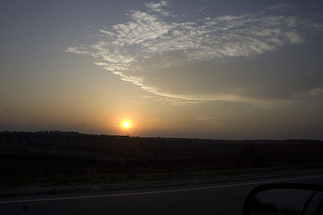
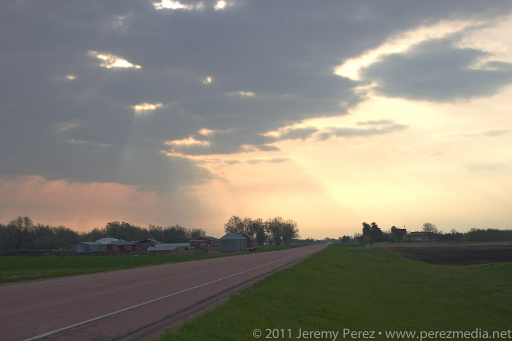
My second chase day started with the sun's warm rays piercing broken clouds above a nearby farm. I slept a little later than I wanted, but had plenty of time jump on I-90 and head west toward Murdo where I waited for signs of initiation along points further west. This setup was difficult to forecast. The best moisture/instability/shear was wrapping north and northeast of the surface low, north of the warm front. I had a hard time picking the best spot for storm initiation and was really hoping visual cues and satellite would point me toward development with enough time to adjust and intercept.
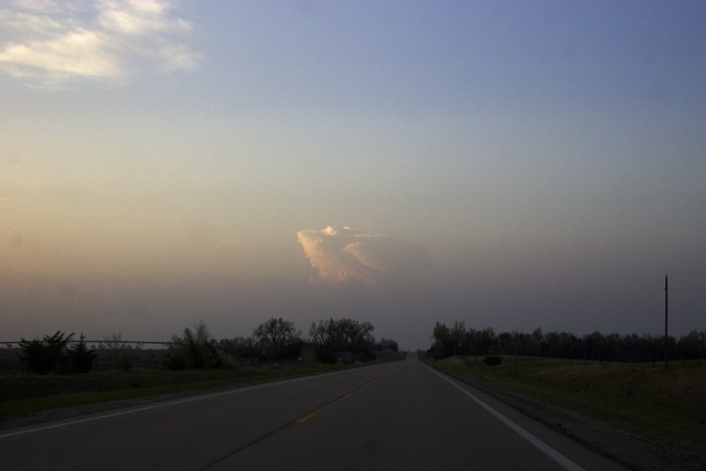
I wasn't the only one in Murdo watching the sky and refreshing satellite views and SPC observations. The Dominator crew and about a hundred other chasers were parked in various hotel and gas station parking lots hanging out, scarfing convenience store food, throwing frisbees, scrubbing windshields, jaywalking, and checking out each other's chase vehicles. I was concerned that the best, first storm would collect an instant caravan and I wanted to get out before that happened. Turns out this wouldn't be the problem. As I headed further west, the sky grew heavy with fast moving stratocumulus. It was frustrating to realize that I was going to have a terrible time visually spotting points of storm initiation.
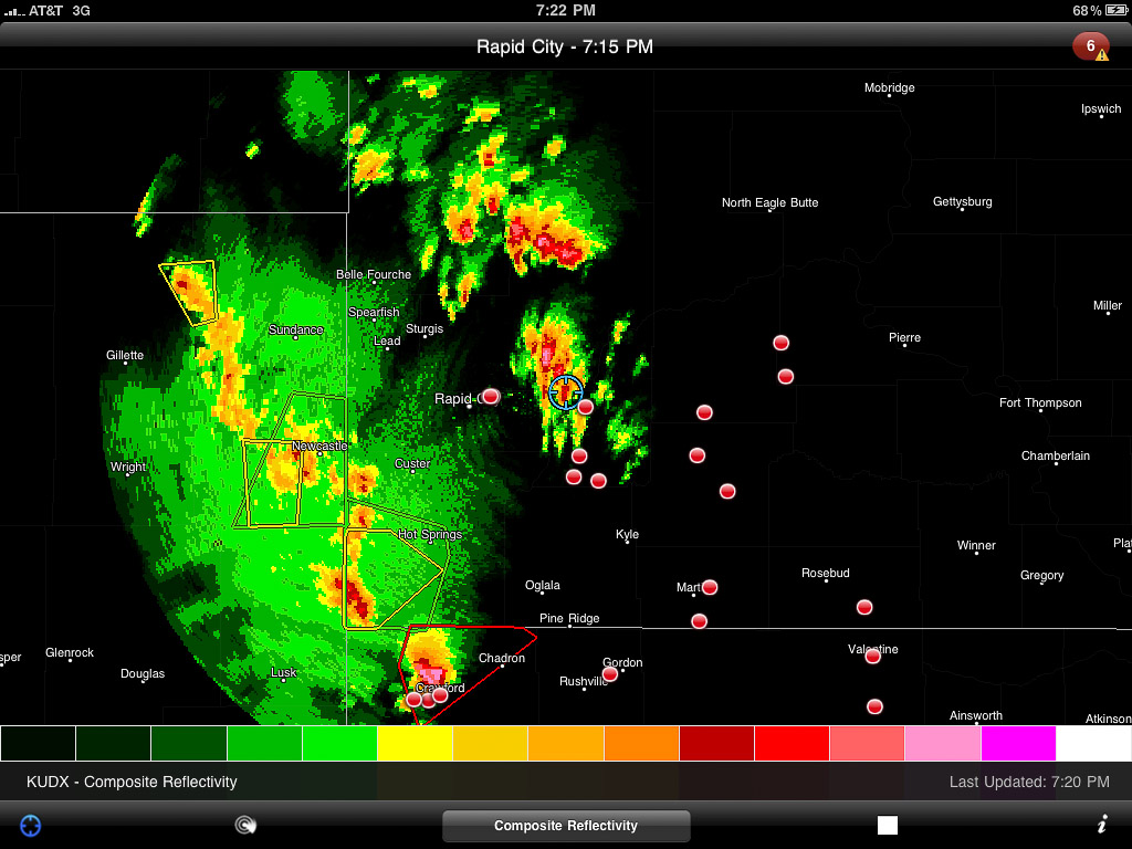
Eventually, northbound radar returns started to pop up along I-90, east of Rapid City as well as a nice, tornado-warned cell far to the south near Crawford Nebraska. I started to drive south, thinking I could intercept the Nebraska storm somewhere near Wounded Knee. But then I second guessed myself and figured that I'd probably make this long drive through the badlands with difficult terrain and bad road options and the storm would be past its prime by the time I intercepted. So I headed back north of I-90 and traded one set of bad road options for another. I was positioned right at the southern end of several developing radar returns and finally caught a glimpse of one of the new towers to my east. To my north: wet gravel roads. I thought, ok, let's try these roads out and see if I can get ahead of the development and intercept around from the northwest.
Developing radar returns just before I began my long drive north to try and intercept the pick of the litter. (My location is shown by the blue target.)
Rough Kelvin-Helmholtz clouds forming in a nicely sheared environment.
A sunlit anvil blossoms to the east of my position.
My Honda Civic and the wet South Dakota dirt roads played nicely with each other. However, what with the Belle Fourche River Valley, majorly broken road grid, and wet dirt-gravel surface, I was no match for the storm motions. It didn't take long to realize that I wasn't going to intercept any of the storms I thought I would. So I plotted a path to hit Route 34, then Route 73 and work my way back toward I-90 and see if any new development would head my way.
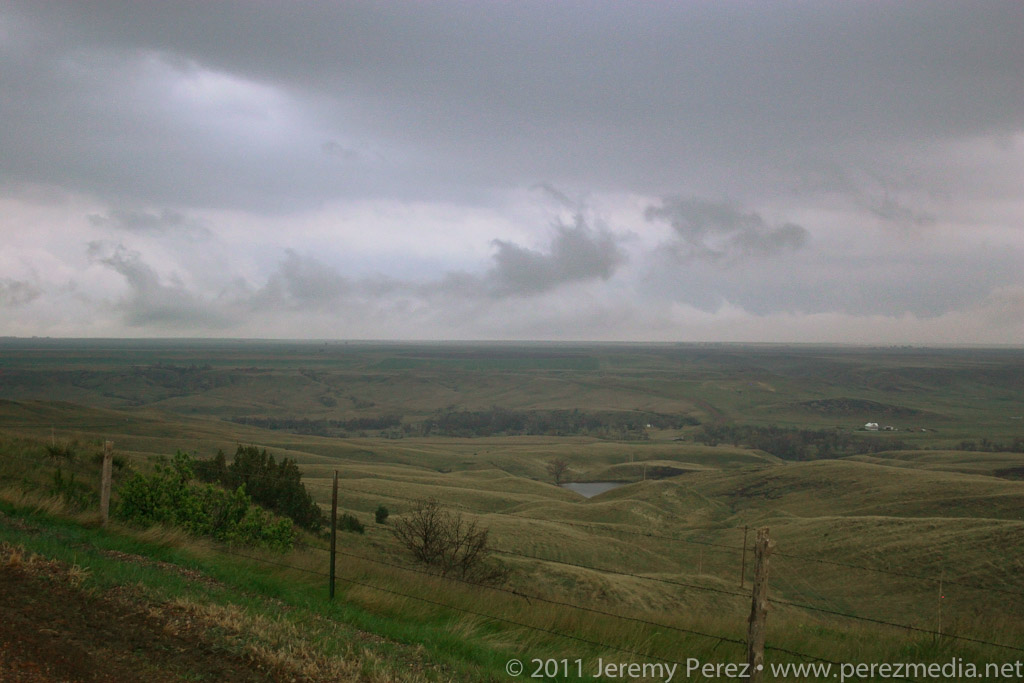
Stunning overlook of the Belle Fourche River Valley.
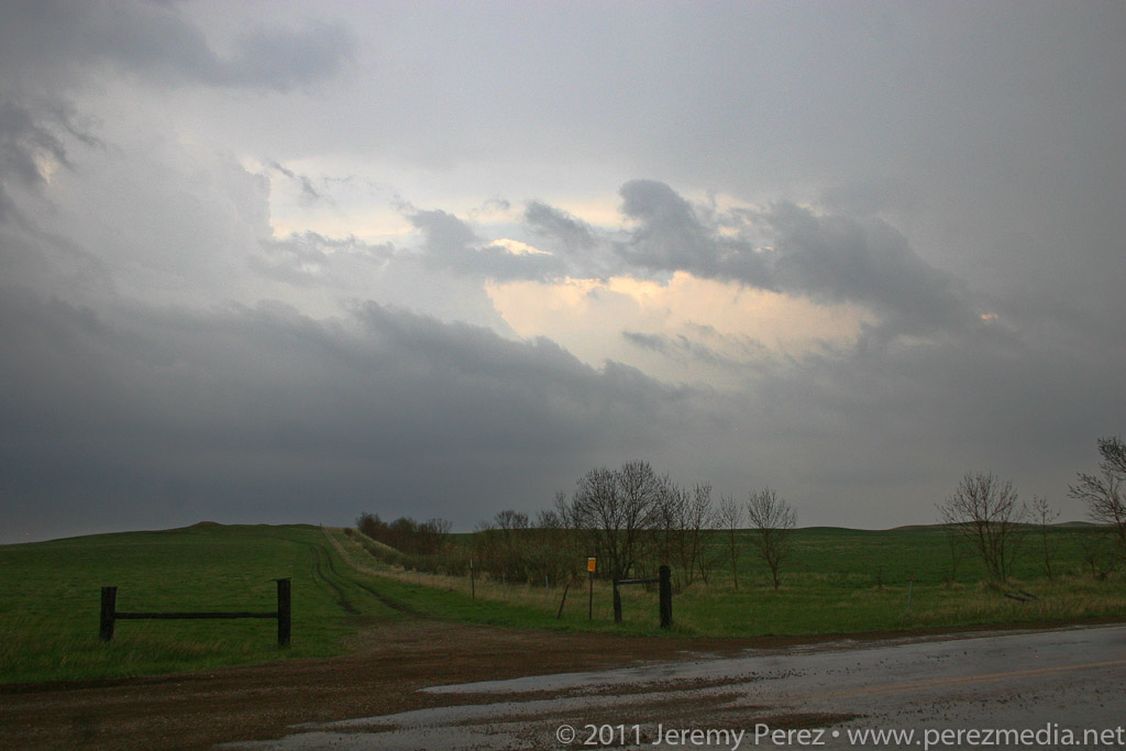
It took forever to get back to a paved road, and night had fallen by the time I hit asphalt again. As I made my way back east, then south, severe and tornado-warned storms lit up the sky to the north and east. I was frustrated that I had failed so miserably at positioning myself, but the non-stop lightning show was a beautiful parting gift as I drifted along the lonely South Dakota highways.
Severe and tornado warned cells avoid my chosen route.
I parked for a few hours of sleep near Kadoka, SD, where the drizzling remains of the tornado-producing Crawford storm finally passed overhead and drifted off into the flickering night.
Lessons Learned:
If dirt roads are the only way to intercept a target already to my north, and there is a good possibility of a southern target, opt for the southern target.
Committing to a long, unpaved route in an area that is not fully gridded is probably a one-shot deal.
The Honda is compatible with at least some of the wet, unpaved roads in southwest South Dakota--although copiously wet would probably be a different story.
Setups where the target area is north of the surface low are a serious weakness for me to anticipate development.
My third day on the plains was a travel and practice day, in anticipation of the big Kansas outbreak day on Wednesday. South Dakota, Nebraska and northern Kansas fell away behind me as I made my way to Pratt, Kansas by late afternoon. A chance for a few elevated storms was forecast, and I took the opportunity to practice navigating around one of them on the awesome Kansas road network. As my sample storm drifted north-northeast, I gave the sandy, dusty farm roads a try, and got a good feel for how some of the dodgier ones were mingled in with the better-maintained roads. The consistency was a lot sloppier than the South Dakota experience the day before--definitely not something I want to be on when it's wet. I gradually let the storm slip by to my north as it put on a nice lightning display for me.
An elevated storm drifts along north of Pratt, Kansas, providing a nice opportunity to practice pacing and positioning along the local farm roads.
Radar view of my little practice storm.
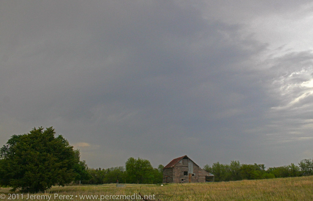
Appreciating the sights along the way. This patched up old farm building was loaded with personality.
This was the one night I set aside for a motel to rest up for the big day on Wednesday. Money was tight, so I picked a low cost option on the east side of Pratt. The various long-term motel residents on the south wing were tailgate-partying and I probably would have been a little more unsettled if I wasn't so tired. There were no bedbugs that I could see, but I kept everything off the floor anyway. I asked for replacement sheets that didn't have hair on them. The new set of sheets had holes in them too, but thankfully no spare hair. I layered bath towels along my sleep area, maintained posture and had zero contact with the rest of the bed. Not ideal, but it was a great relief compared to the car seat sleeping position. It was so nice to have a shower too--don't touch the walls, or shower curtains of course.
Lessons Learned:
Less maintained Kansas roads can be dicey for a Honda Civic even when dry--stay away when wet.
Budget $60 for a less grungy motel experience. Bring a sleeping bag just in case.
Set video camera to 1/30 sec. exposure to keep lightning from being chopped up by rolling shutter effect.
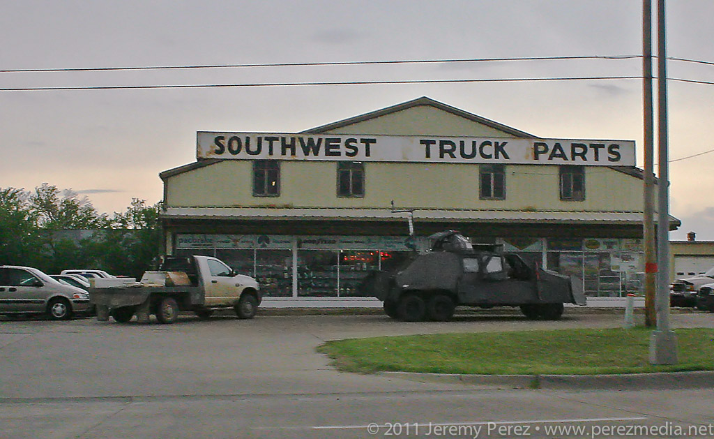
I woke up on day 4 ready for an awesome day chasing some powerful storms across Kansas. Hopes dashed: a quick check of satellite showed something had gone wrong. A huge MCS was moving northeast out of the panhandles and raining all over everything. The forecast for an explosive day took a nosedive and the south-Kansas target was getting washed away with cool, cloud-covered stability. There was a chance that all the elevated convection would move out in time for the sun to warm it back up and try for a recovery, but it was looking pretty slim. I bailed out of the grunge hotel and hung out at a gas station refreshing satellite, forecast models and SPC analysis. Some chasers were hoping for an earlier recovery in southwest Oklahoma while others were hanging tight for renewed hopes in southern Kansas.
Just across the street from the grunge hotel, the TIV team scavenges for parts.
Gradually, the MCS moved out and clear skies started to edge in from the west. At the same time, I noticed that new convection in north Texas was sending huge, dense anvils racing northward just in time to block out the sun again. That was all I needed to see. My forecast area was toast. I headed west toward Dodge City to look for a opportunities closer to the surface low and in clear air. By the time I reached Dodge CIty, the SPC had posted a tornado watch discussion for northwest Kansas. The dryline was sticking out like a sore thumb from my position and on northward, but the cirrus canopy was hugging right along its eastern edge. So I got on Route 23 and took off for northwest Kansas. As I made my way north, a check of the rear view mirror showed new convection popping up right over Dodge City and looked like it was reaching for the ground and trying to get surface based. I almost turned around to give it a shot, but that cirrus deck was heavy and I figured the storm was going to have a horrible fetch of inflow. So I kept hauling north.
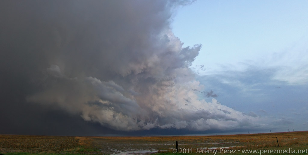
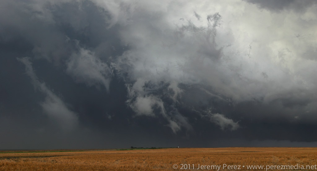
As I got closer to I-70, I could see storms to the north along the stationary/warm front beginning to go up. And here I was approaching from the south again. One of these days, I figure I'll position myself to not be playing catch up. Spending 15 minutes with stop-sign guy on a one lane stretch of road construction, waiting for the pilot car was a time of great sadness and anxiety. Somehow I still managed to catch up with a decent severe-warned storm on Highway 83 south of Oberlin. I was on the wrong side, and it was outflow dominant, but it was still the best thing I had intercepted the entire trip. I caught sight of an interesting lowering behind the rain curtains, but it didn't go any further than that before gusting out in a spectacular torrent of ragged scud and spindled shear vortices. I followed its remains past Oberlin where I caught the beautifully lit sight of another cell to the southeast. Radar show it to be weakening, so I decided to head north then east and sample its core.
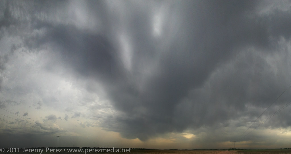
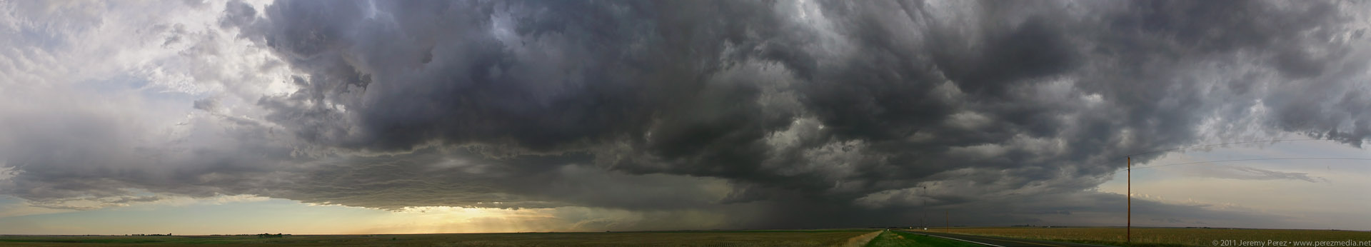
Panorama of convection looking north along Highway 83 in NW Kansas.
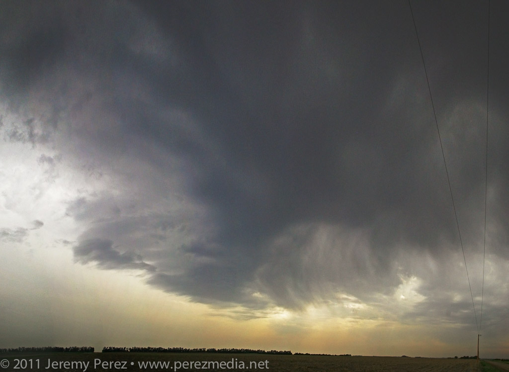
Very wide panorama of severe-warned cell south of Oberlin, Kansas.
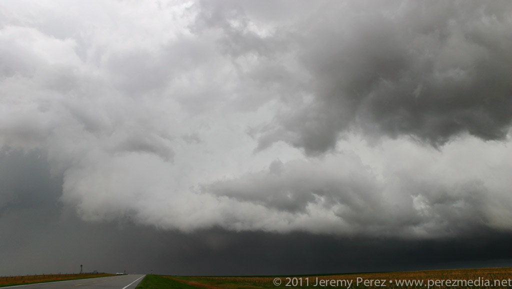
Rain free base with tantalizing lowering.
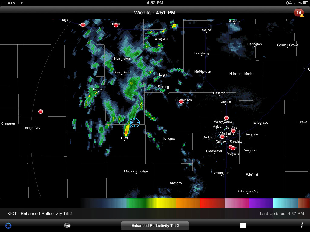
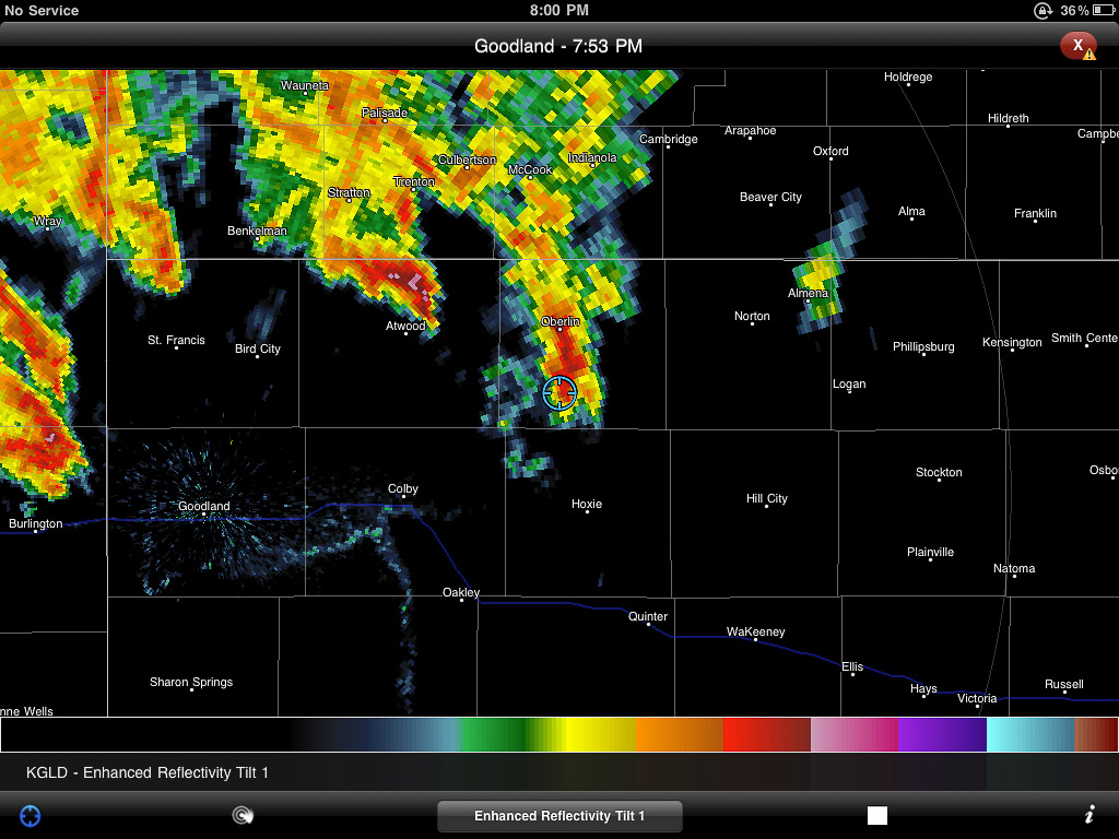
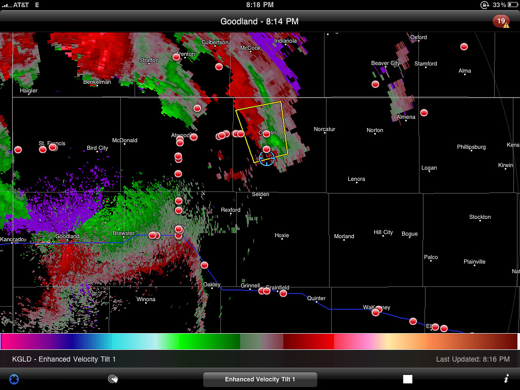
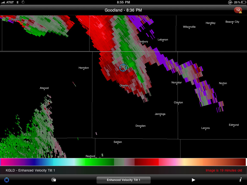
Enhanced reflectivity view of the Oberlin storm.
Velocity scan showing broad rotation
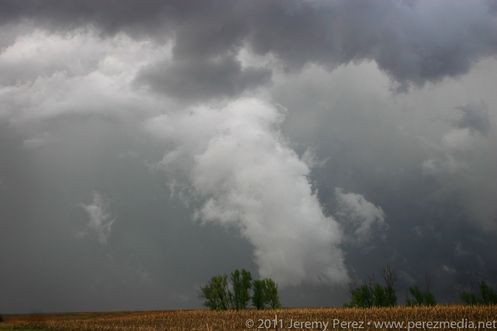
Tattered scud and shear vortices twist and fray as the Oberlin storm gusts out.
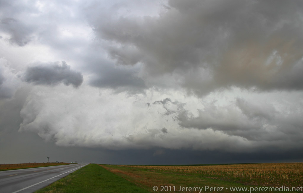
Nicely sculpted pillar of scud flows along the gust front.
Dwindling light reveals another dying cell to the southeast.
Time lapse video of the day's chase. Click through to YouTube to view in HD.
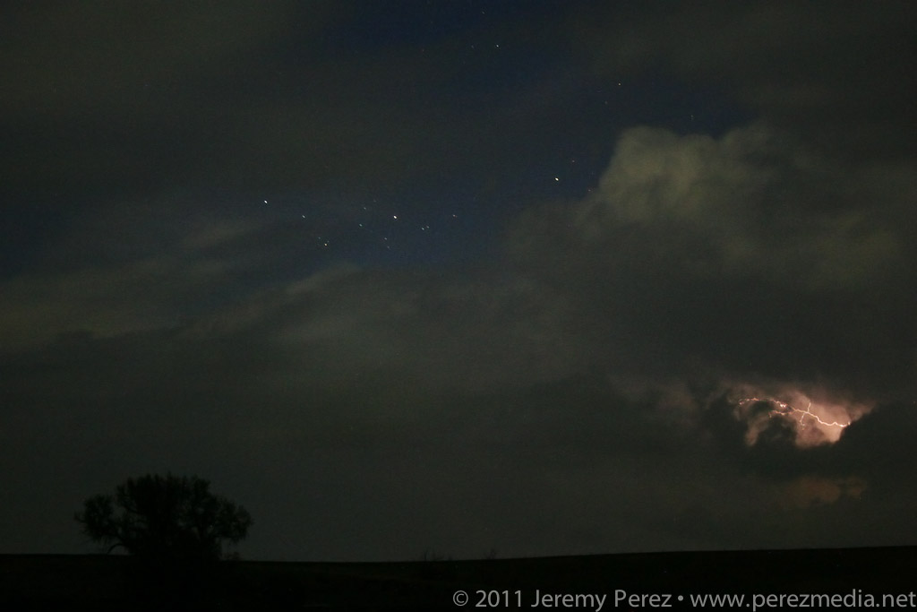
As I drove through the blinding rain, I noticed a car riding my tail. If they want to go play Hydroplane-on-the-Highway, I figured that's their business. So I pulled off the side and motioned them to pass. Instead they pulled alongside and told me I better hurry since the worst was headed this way. I hollered over the pounding rain, that yes, thank you, I know, but that I wasn't willing to drive as fast as them. So off they went. A couple more miles got me out of the core, and a great view of another nice lightning display on a dark Nebraska road with the frogs and crickets jamming away into the night.
The last of the convection moves north, flickering with lightning as night descends.
I eventually made my way back down to Highway 36 and west to just beyond the Colorado border. I pulled off on a dirt road and caught bursts of sleep while the surface low spun overhead entertaining and distracting me with bursts of rain and lightning all night long.
Lessons Learned:
Even the best setups can be demolished by situations that the forecast models didn't anticipate.
I made a good call abandoning the southern target when I did. The early convection and continued cloud cover destroyed all hope for that area. I'm also happy with making the decision to not go after the Dodge City cell. The cirrus canopy strangled it and it died out soon after.