I had my eye on potential for this setup in the days leading up to an annual visit to Elk City. I headed out about 7AM with an initial check-in target at Hope, Arkansas.
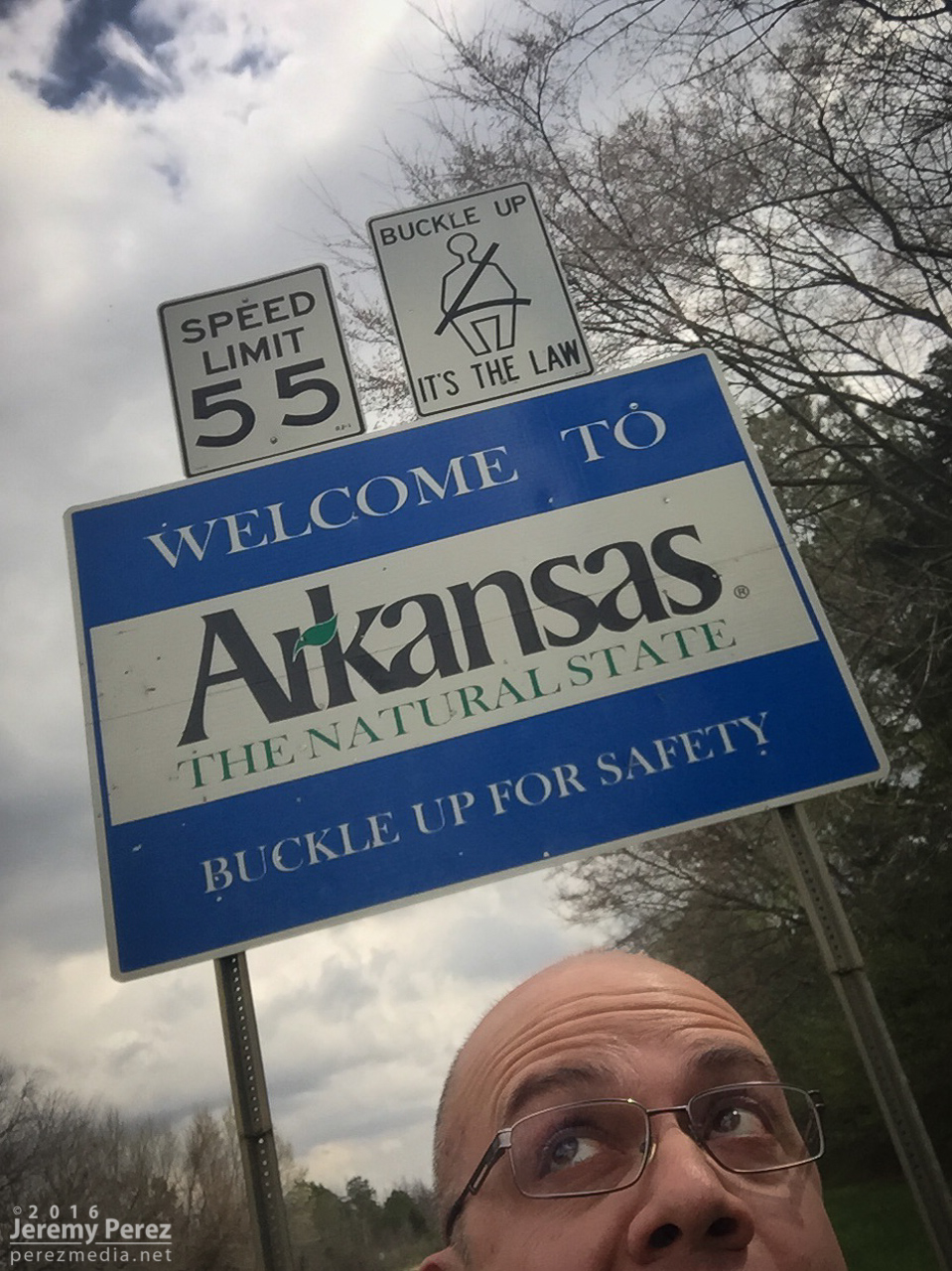
Crossing the threshold on Hwy 70
I wasn’t sure I’d ever take the plunge into chasing Arkansas, but after working on my chase map last year I had a better idea where potentially decent chase terrain/road network would be. I also spent the night before studying how highway/secondary roads would play out with northeast moving storms. Even the heavily treed areas (outside the mountains) still have patches of farmland where some peeks can be taken. I had resolved to stay far ahead of storms as long as I was in the heavy trees. Turns out I didn't need to mess around with them in the thicker areas. I figured I had time to shoot some landscape photos on the way—southwest Arkansas is beautiful.
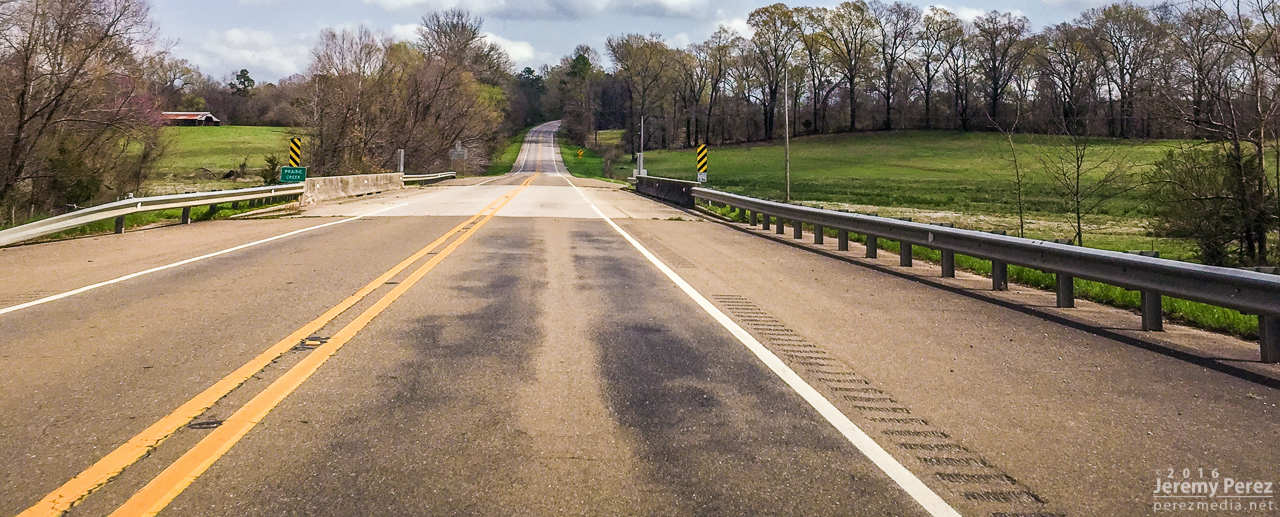
Hwy 371 and Prairie Creek - Howard County
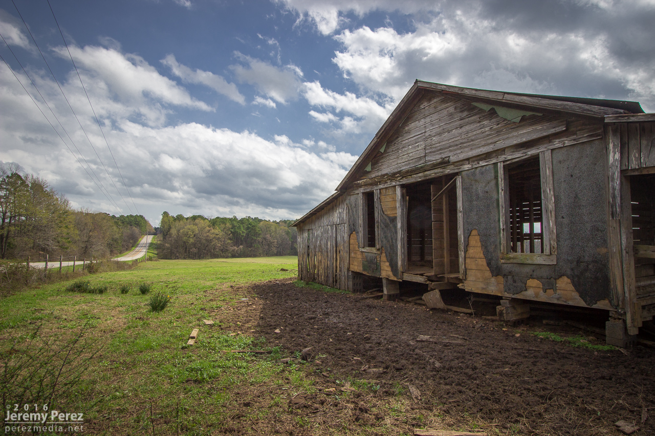
Outbuilding along Hwy 371 - Howard County
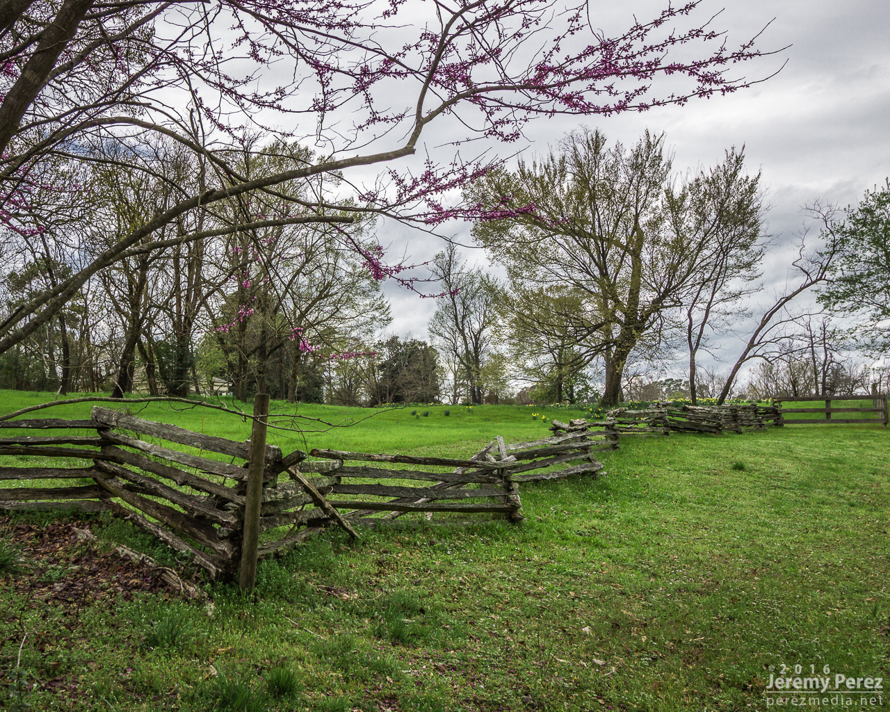
Fenceline along Hwy 278 in Washington, AR
Once I got to Hope about 2:30PM, I knew I had to keep moving. Convection was initiating and I was going to be in the middle of it instead of out ahead.
I made my way through Camden, Fordyce, and then to Star City where I was far enough ahead of the developing line of storms to figure out the best option. I wanted tail-end-charlie in the southernmost batch of convection—closest to better moisture before the cap pinched the line off. At 2230Z, the southernmost convection was about 30 miles to my west near Fordyce. There would be clearer views in farmland just to my east, so I headed that way and looked for a good intercept spot along AR-11 about 3 miles south of Grady.
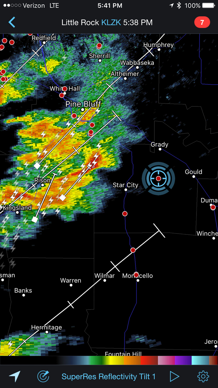
Reflectivity at 2238Z
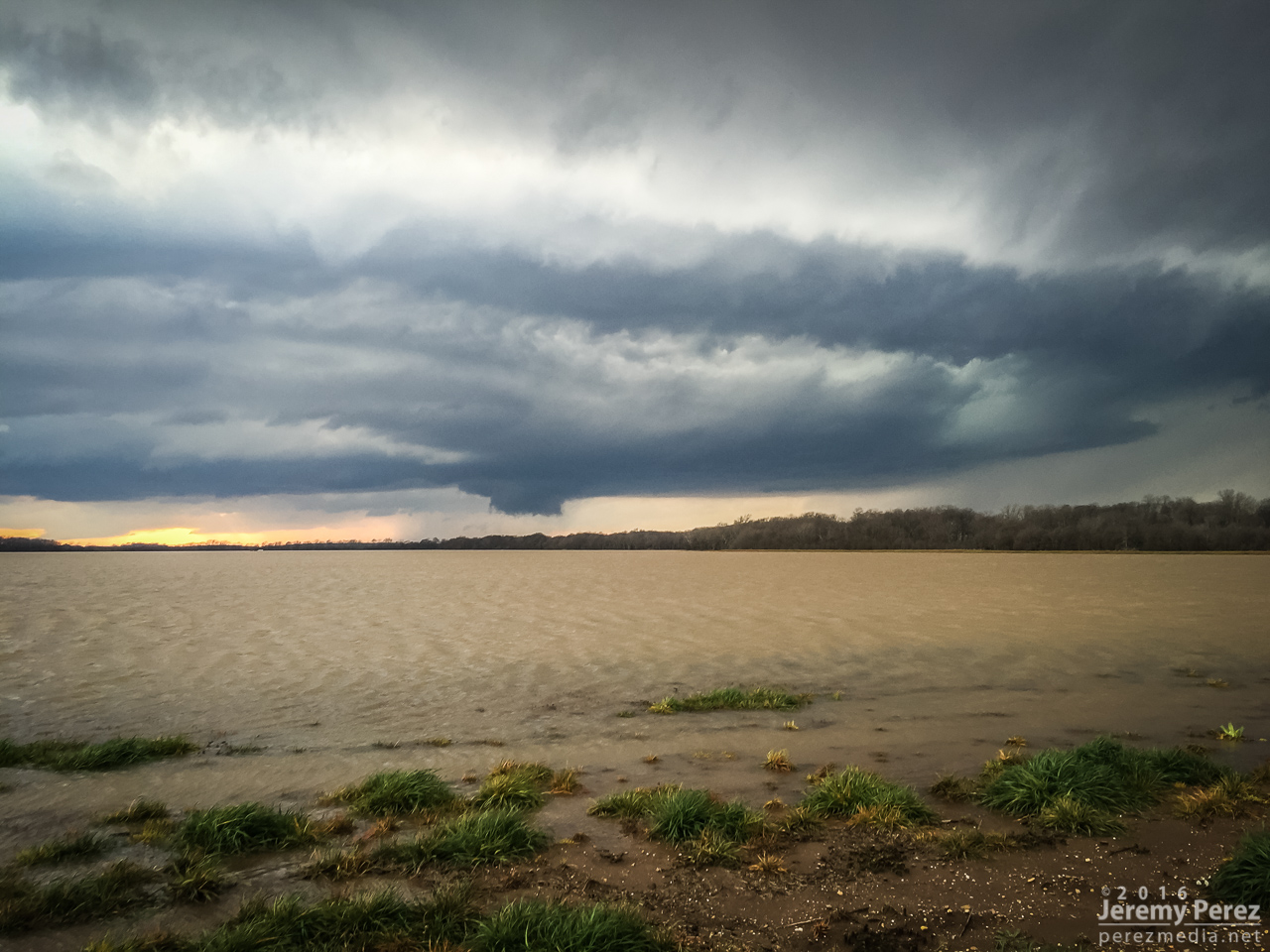
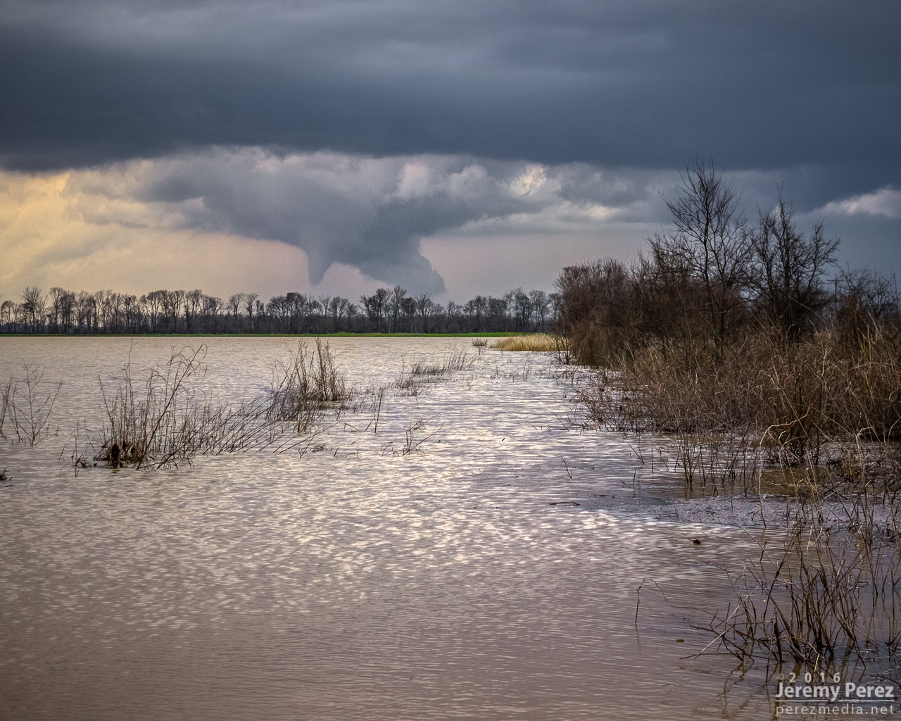
Fields and farm roads were flooded everywhere, so I knew any use of the road grid was out of the question. Paved roads were dense enough to get within 5 miles of anything in the area, with the main issue being river crossings for the Arkansas River spaced about 35-40 miles apart at Little Rock, Pine Bluff and Pendleton. The end cell did me a lot of favors and strengthened nicely as it approached. The flooded fields made for some interesting photography options that I wasn’t planning for.
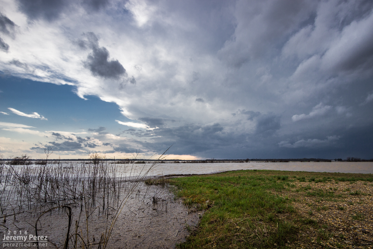
Tail end cell approaching on AR11 - 2239Z
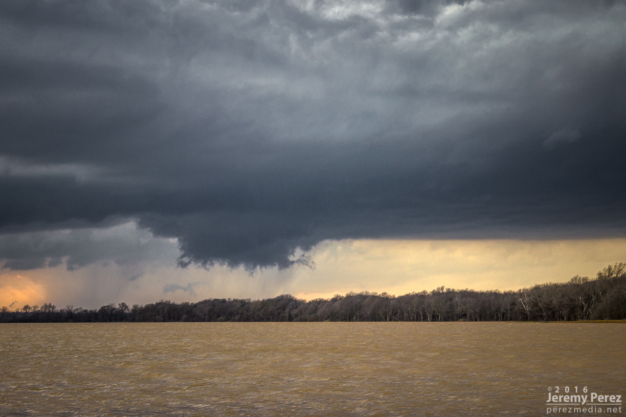
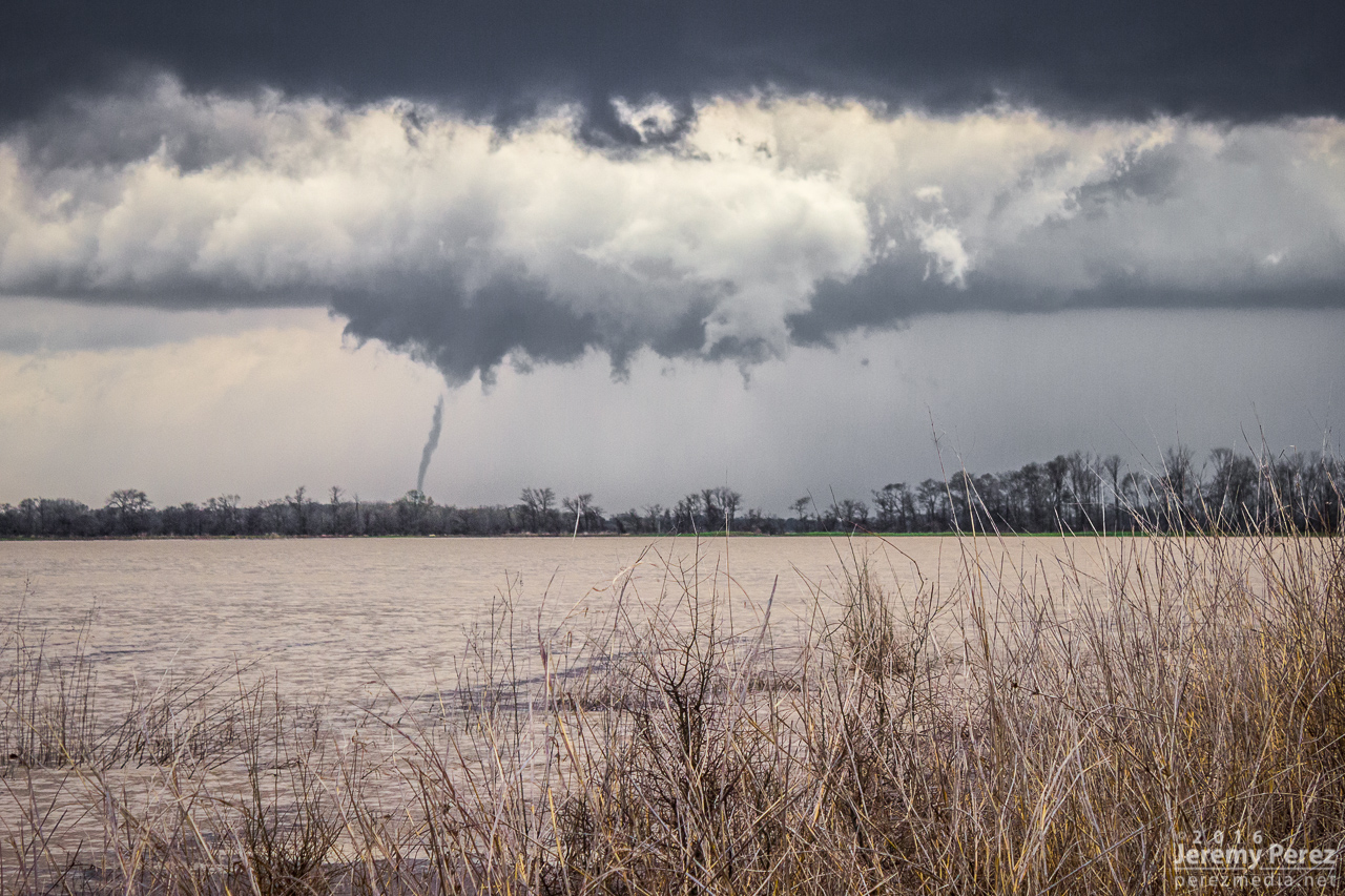
As the rain free base moved closer, I could finally see that RFD was carving out a glowing hole punctuated by a wall cloud with nice tendrils and rising motion.
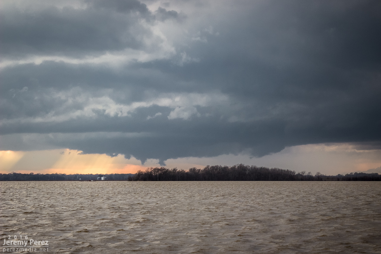
Rain free base sturdying up with rising scud - 2306Z
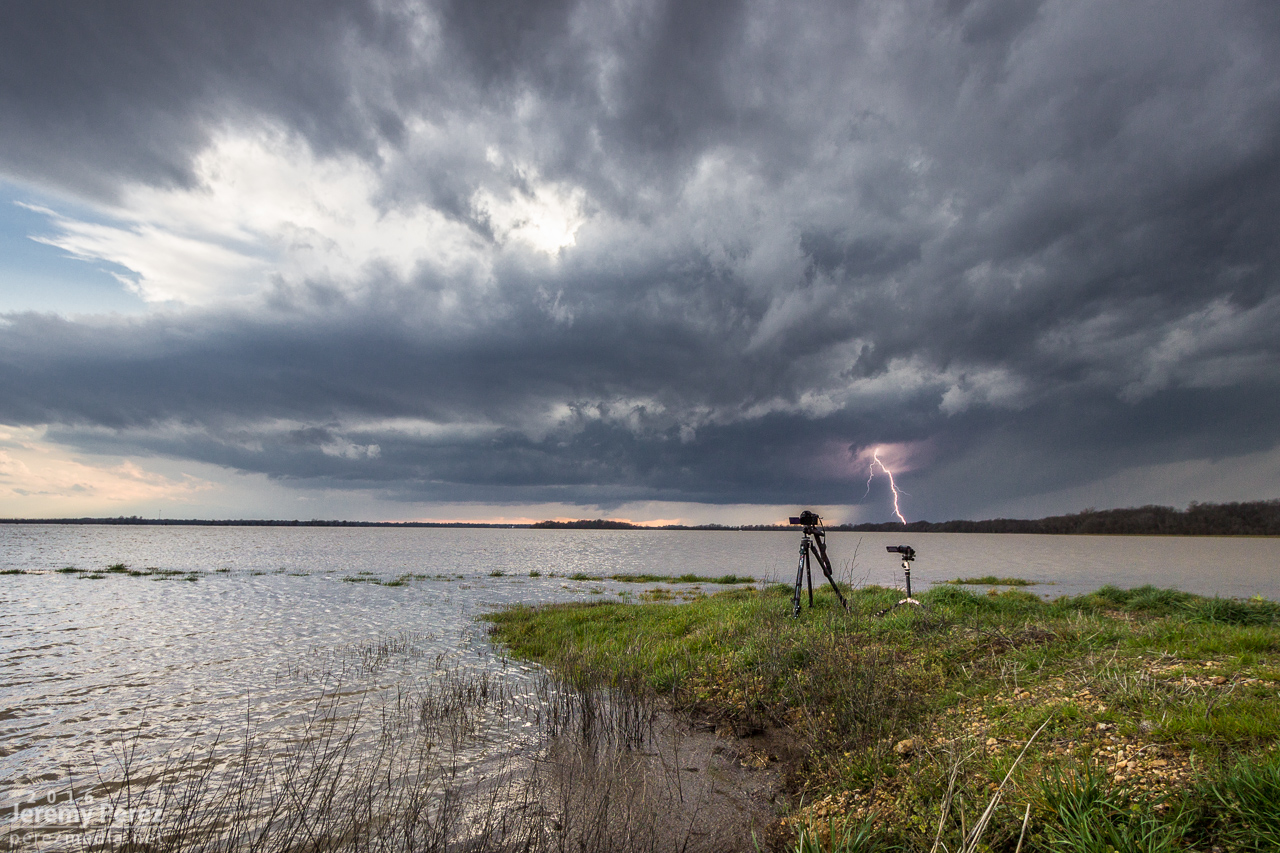
Lightning strike poses with my time lapse and video setup - 2315Z
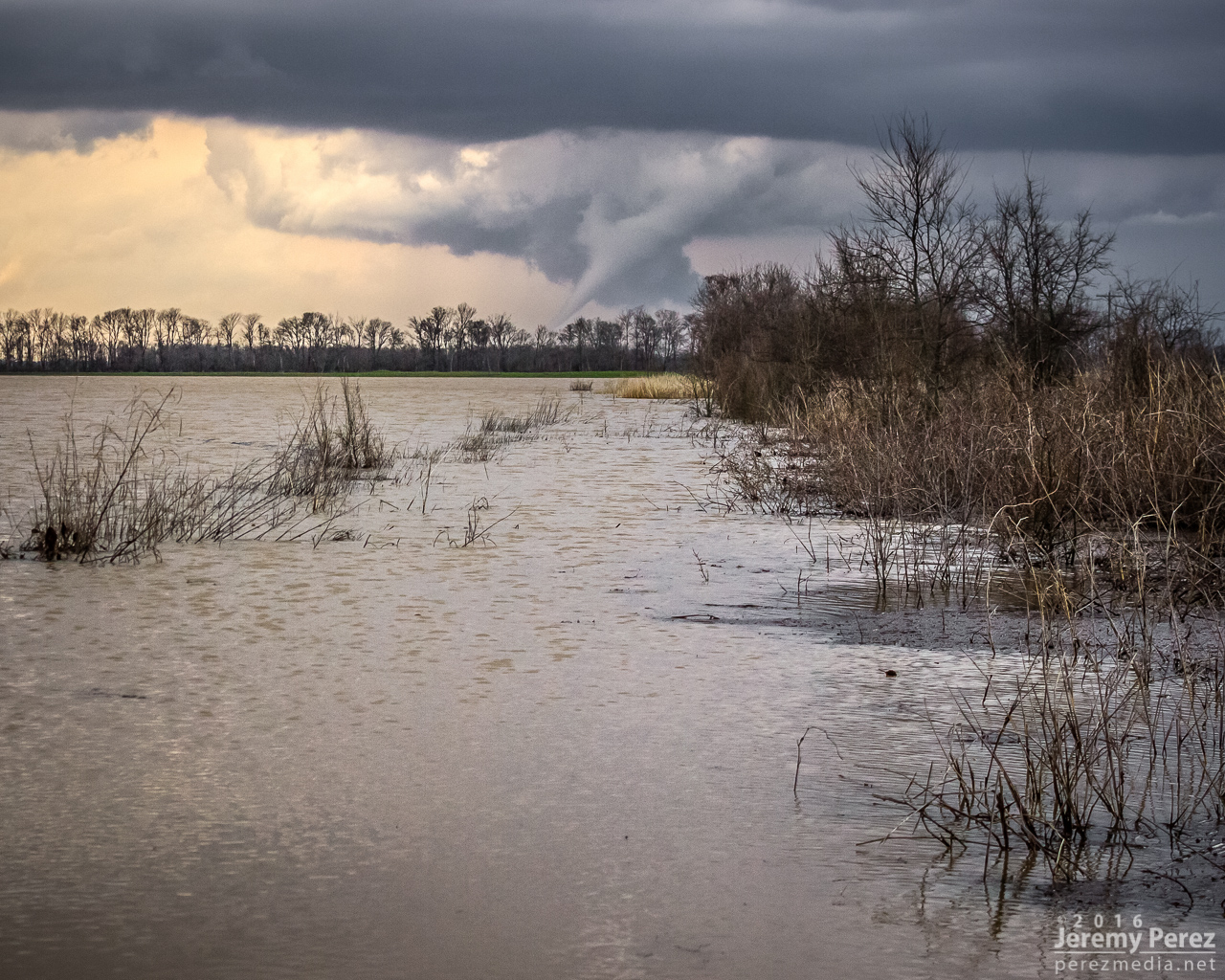
Wall cloud taking shape across flooded fields - 2322Z
Closer view of rotating wall cloud - 2322Z
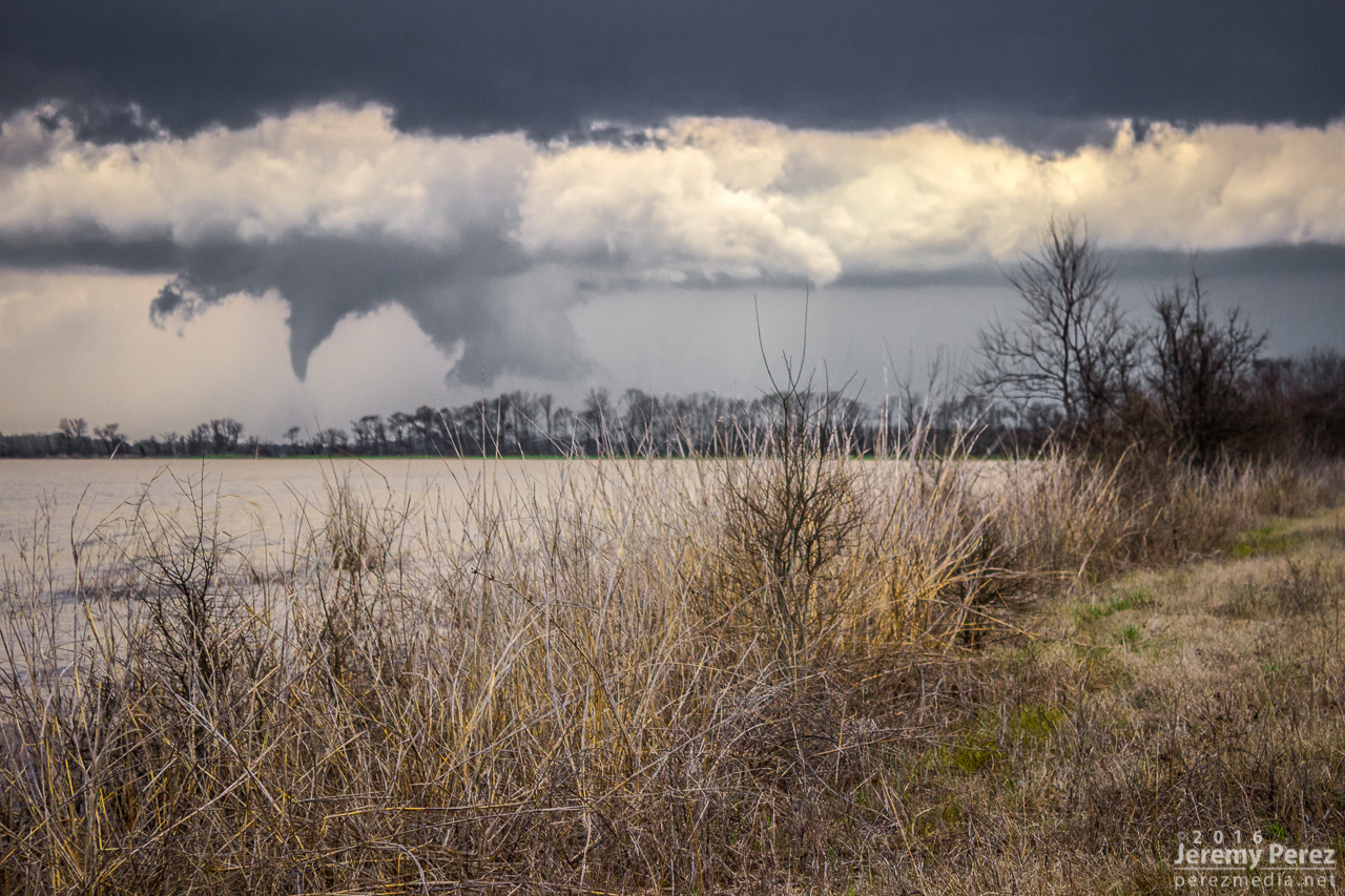
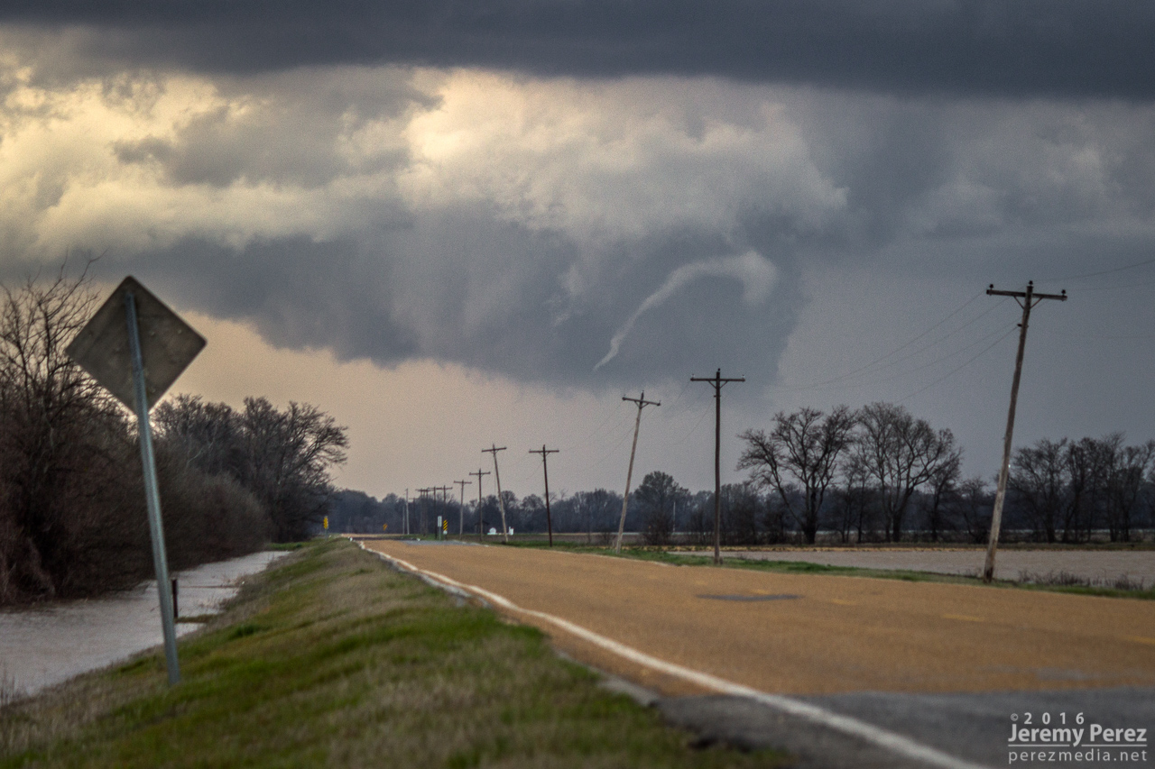
It was far enough off that I had plenty of time to set up for time lapse and lightning shots as it moved in. As the cell got more to my north, RFD finally punched a huge skylight in the base. A line of trees was blocking my view somewhat, so I raced about a half mile up the road and did another quick setup to watch events unfold.
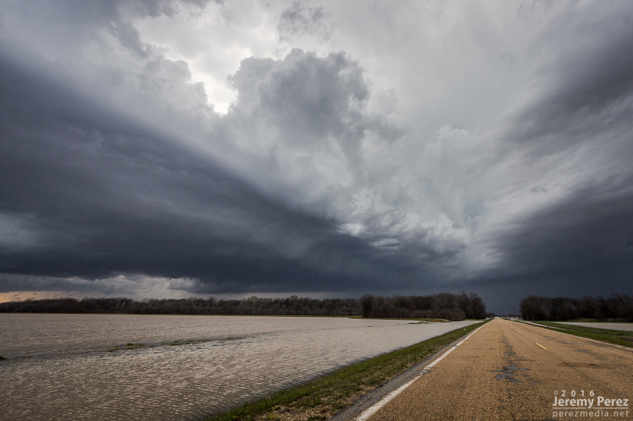
Looking up AR-11 as RFD cuts open the rain free base - 2330Z
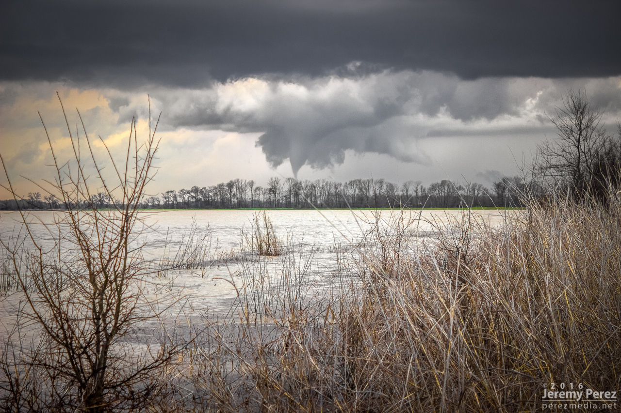
I got video and still cameras tripoded up for shots just seconds before a noodle slipped out of the wall cloud and made contact (2335Z). The fact that I just broke a three year tornado drought with an Arkansas tornado was freaking me out. The seemingly imminent grief of chasing Arkansas with trees, vegetation and flooding actually made for the best tornado photos I’ve gotten so far.
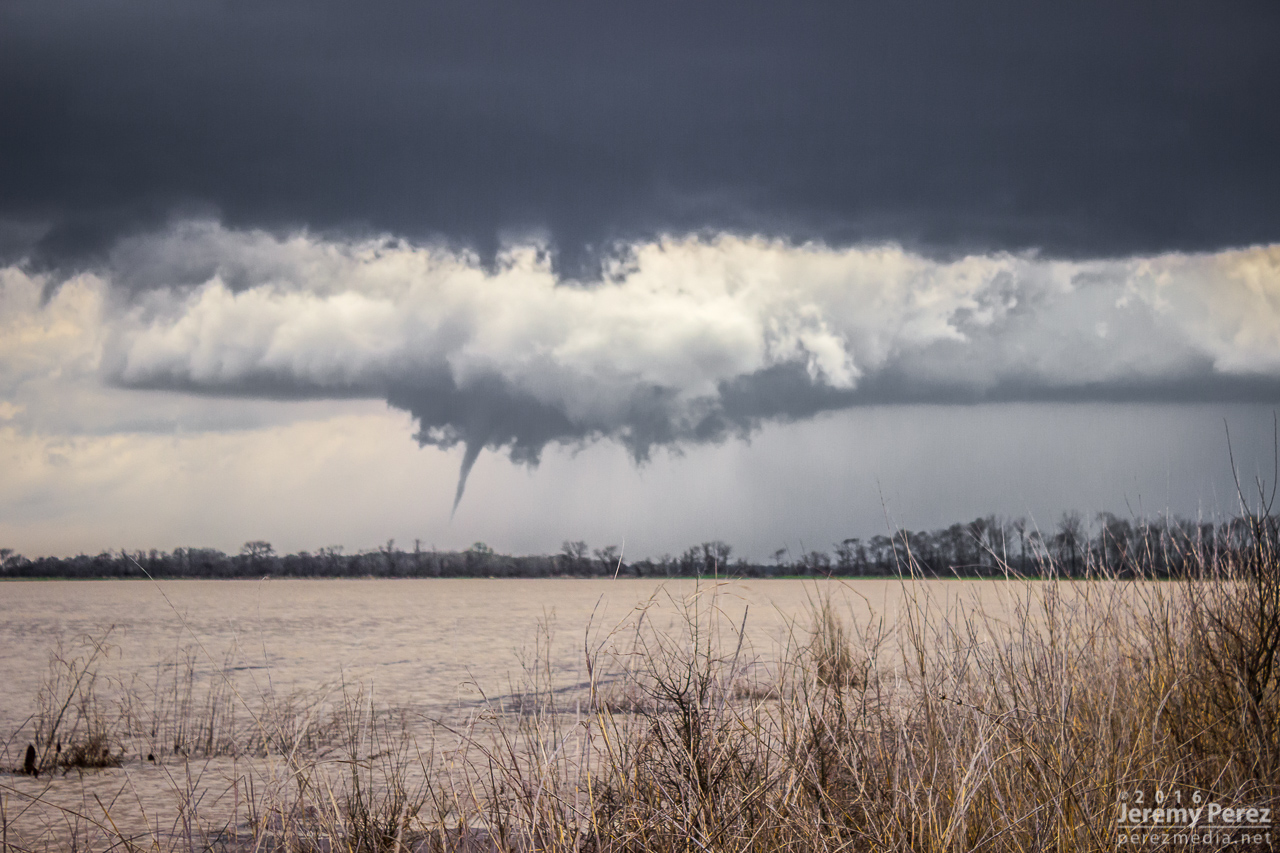
Funnel reaching for the ground - 2334Z
Funnel making contact - 2334Z
Evidence of debris - 2336Z
Arkansas tornado over flooded fields - 2338Z
While I was snapping away, a couple drove up in a car, motioning for me to come over. Trusting that the video camera was doing its job, I headed over to find them in Heightened-Awareness-Mode (understandably), fumbling with a cell phone trying to show me a picture of a tornado that just touched down, and how careful I needed to be. It took a few tries before they understood that, yes, I was actually trying to take pictures of it right now. Meanwhile my unattended SLR & tripod had blown over and face planted into the soil while I wasn’t watching. So as they took off, I ran back, lamented my fallen camera, unscrewed the thank-goodness-for-that UV filter and kept shooting.
Inflow winds and the toppling of a camera
Still can’t believe I’m watching a tornado over this waterscape - 2340Z
The tornado roped out about 9 minute after it touched down and I took off for the Pendleton river crossing.
Starting to rope out - 2341Z
Last bits of the rope out - 2343Z
I couldn’t catch back up or get in good position to catch some newer convection to the south, so I tried for parting lightning shots that didn’t turn out any good. After that, I crossed the Mississippi at Helena and boondocked along US 61 before heading north for the March 15th setup.
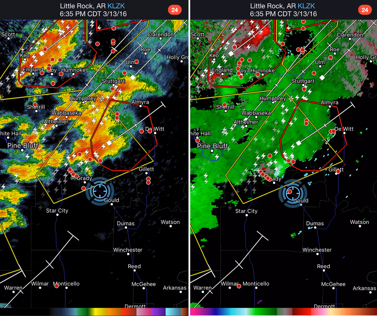
Reflectivity and Velocity at 2335Z
As I downloaded my photo and video media, something didn't seem right about my video footage—there wasn't enough of it. As I dug into it, I came to the terrible realization that I had the video camera in pause mode during the entire 9 minute tornado sequence. The anguish is making my guts clench as I type this. I had that video framed and focused perfectly the entire time. But I guess I was juggling too much photography and planning the next move to get everything right. I keep working on the fact that I got a lot of good still shots and just a tidbit of the first touchdown on the far edge of my dashcam video.
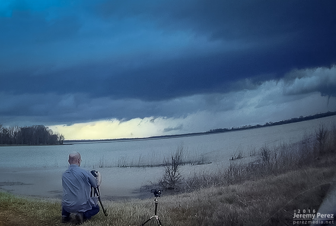
Not realizing at this crazy moment that the video camera (bottom center) is not recording — ouch
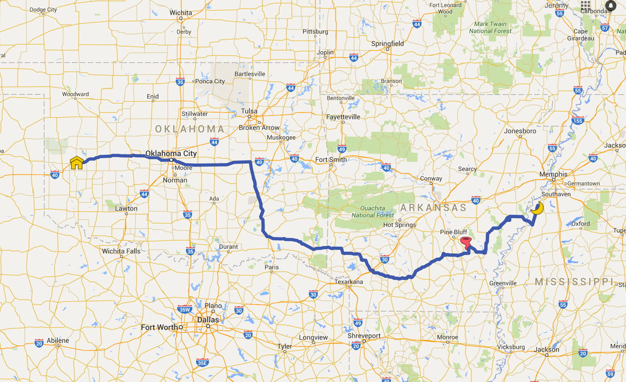
Chase Map - 13 March 2016
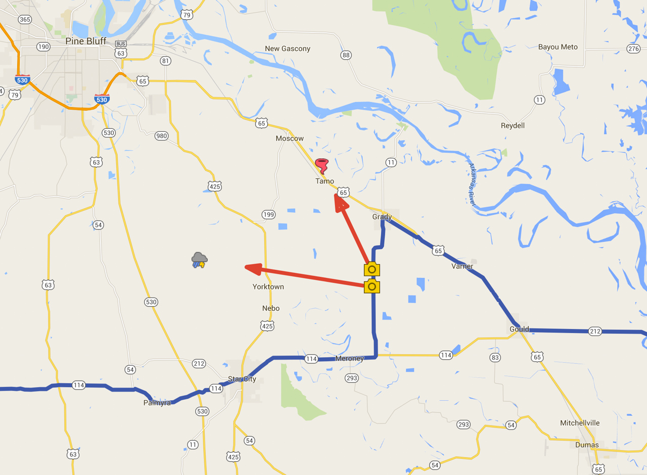
Photography locations for approaching supercell and tornado
Although this tornado is not plotted on the SPC Storm Reports for 13 March 2016, it is documented here: NWS DAMAGE SURVEY FOR THE 03/13/2016 TORNADO EVENT
