Our May 24th chase started out in Shamrock, OK. We got a really good rate at the Shamrock Country Inn—it was clean, new beds, recently refurbished by a motivated new owner. The doors are a bit sticky, but I can definitely recommend it.
We made our way north, looking for likely spots for storm initiation along the dryline or intersecting boundaries from the Oklahoma Panhandle up into southwest Kansas.
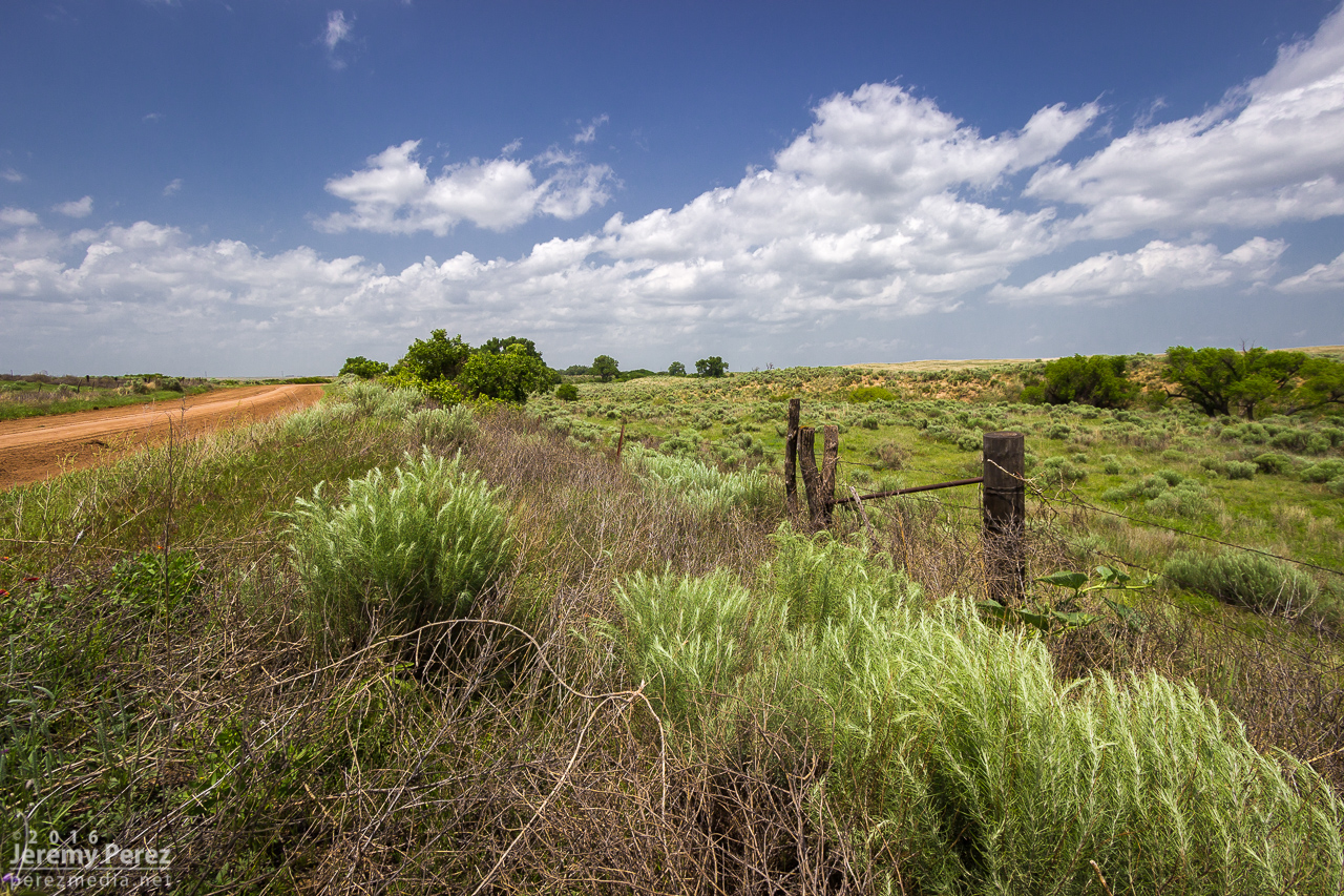
Backroad scenery in the Oklahoma Panhandle between Logan and Slapout.
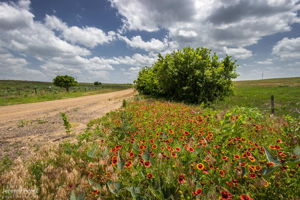
Indian blanket flowers east of Slapout, OK.
Eventually, satellite imagery showed the cumulus field getting more agitated north of Englewood, KS. This gave us a chance to drive through Englewood and revisit a view we had over four years ago when we chased a lonely, low-topped LP supercell north of town (14 March 2012). I noticed Stephen Locke—another storm chaser whosephotography I admire—filling up at the gas pump. I had a chance to say hi before moving on to the growing towers to the north.
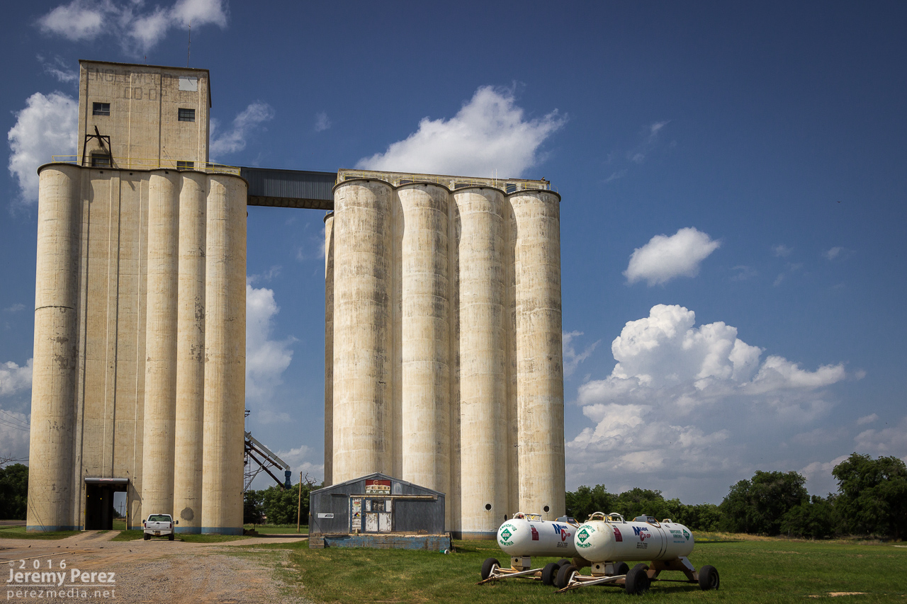
Silos and developing towers from Englewood, KS. [2102Z]
We made our way to about six miles west of Ashland and shot time lapse of the building towers to see what would take hold. The one I was shooting wound up gaining strength and we headed off to watch it develop.

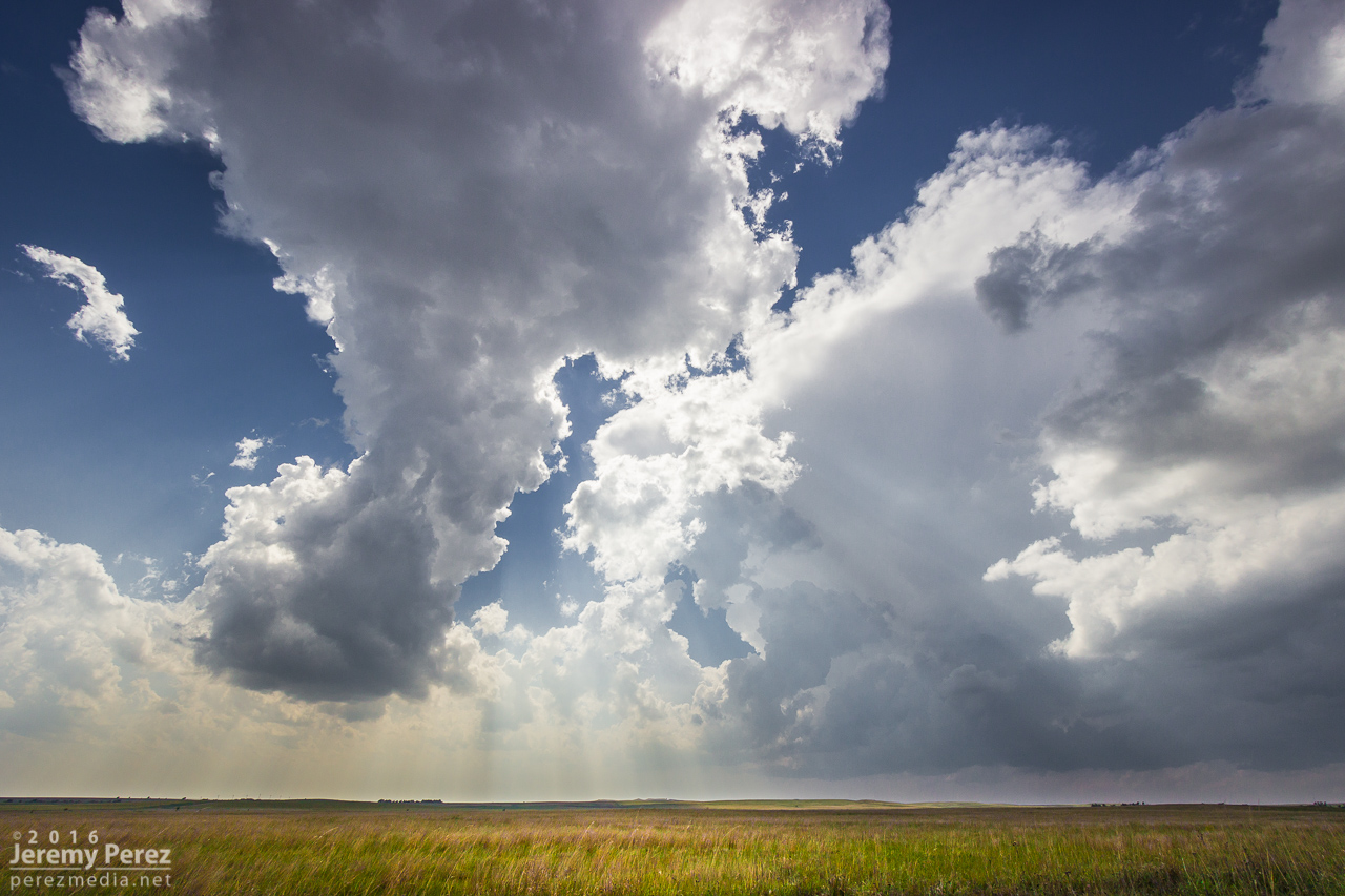
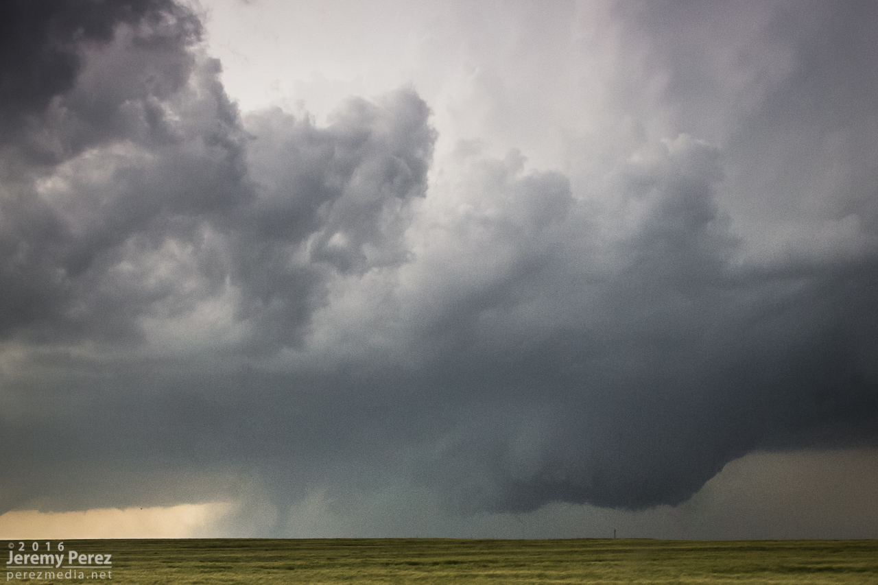
Vorticity and random high-based funnels showing up in the developing cumulus field. [2138Z]
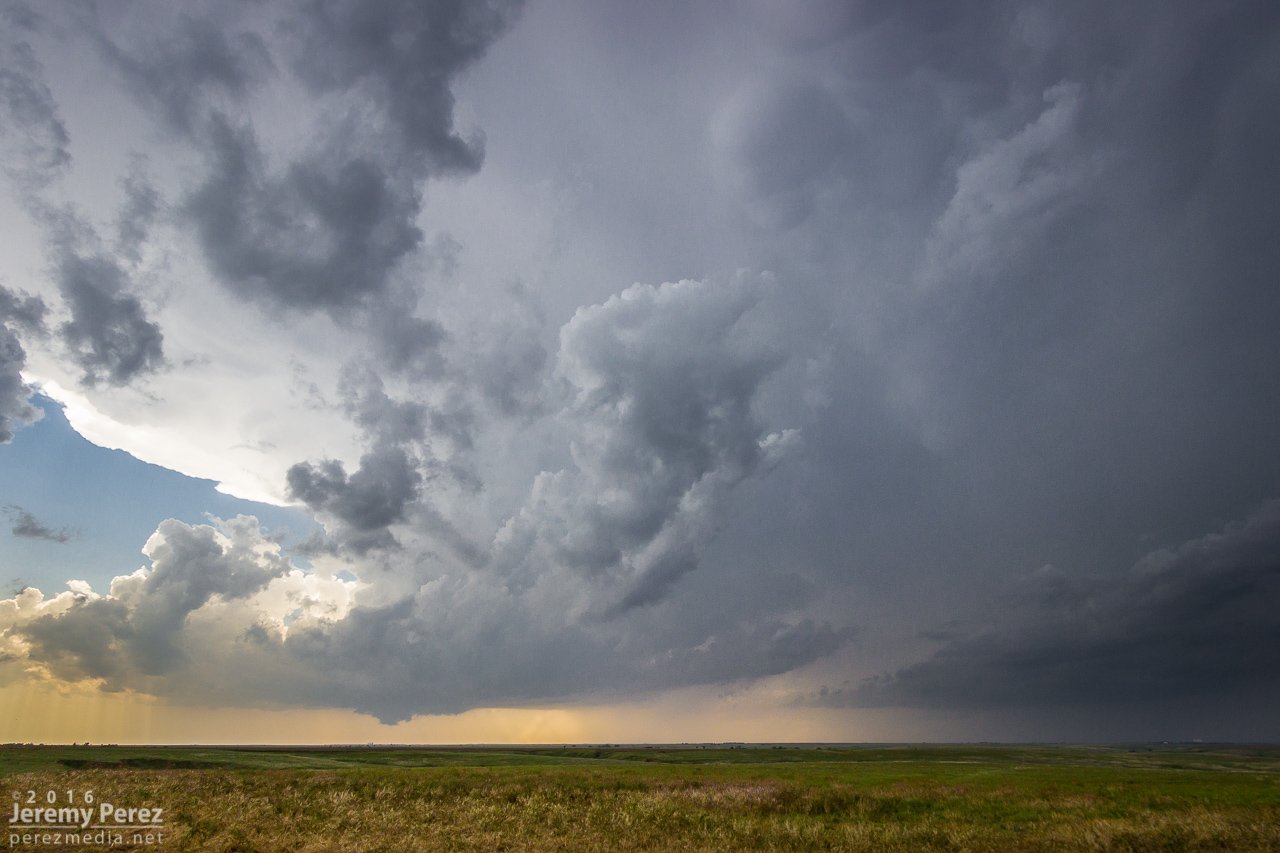
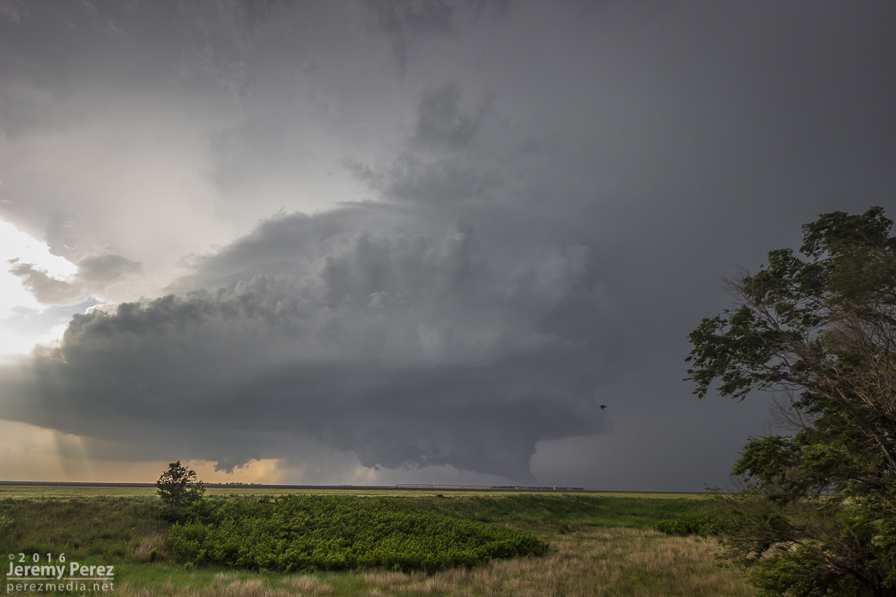
The storm of the day looms in the distance—west of Ashland, KS. [2156Z]
Roads were dry and in pretty good shape, so we stayed off the main highways for hopefully more unique perspectives and less crowds. It worked out pretty well. As we got about eight miles east-southeast of Minneola, the storm was developing a wall cloud that looked like it had potential.
Traveling the dirt roads but avoiding the dicier ones. [2238Z]
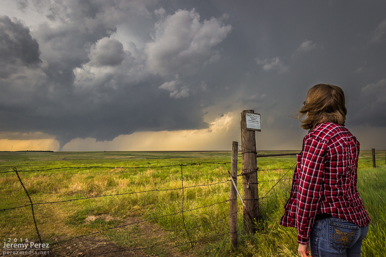
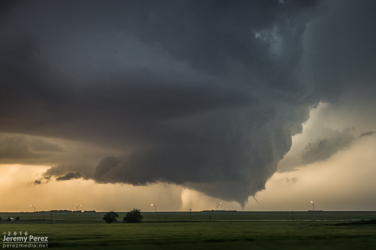
Wall cloud developing in the base of our rapidly strengthening supercell near Minneola, KS. [2240Z]
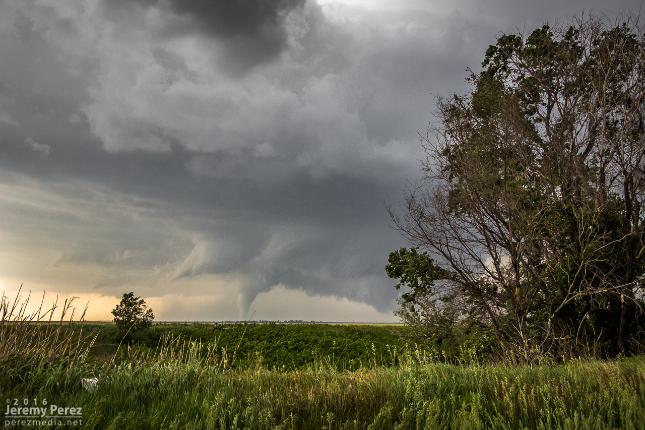
I hated to leave our spot in case it put down a brief tornado while we were on the move, but we needed to keep up. We made our way north and by the time we were a couple miles north of Bloom, the tendrils dropping out of the wall cloud looked pretty imminent. So we stopped in time to capture a developing condensation funnel touch down for our first tornado of the day. It turned out to be a great spot, with enough altitude to capture some intervening countryside as the silhouetted funnel danced and twisted against a distant tree line. We were about 12 miles away at this point, but the view was great. We hung out at this spot for nearly 15 minutes as it grew in size. At one point I was thinking that this must be how Rozel looked in silhouette—apparently this one is being referred to as Rozel #2 by some :)
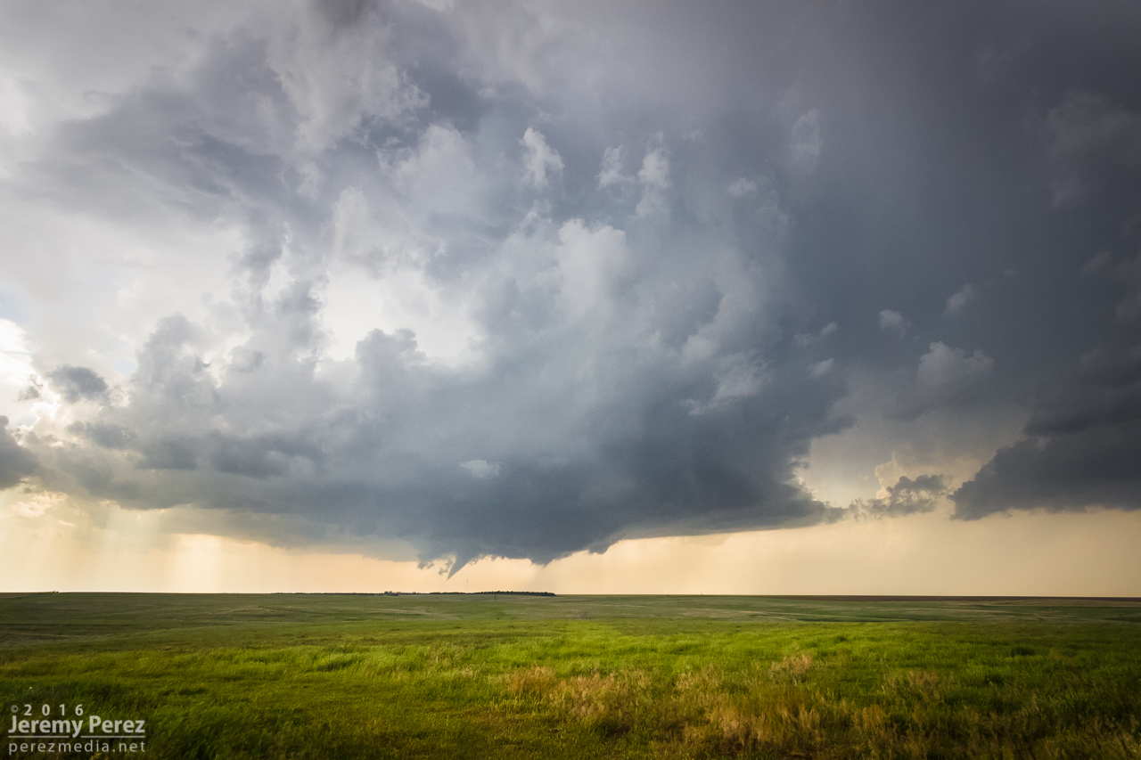
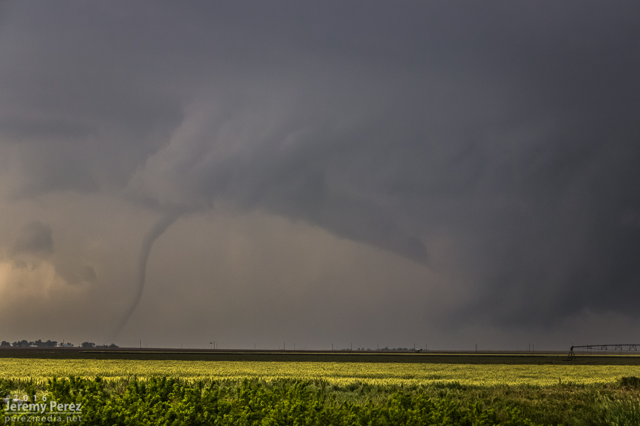
Condensation funnel of the first tornado reaches for the ground. [2301Z]
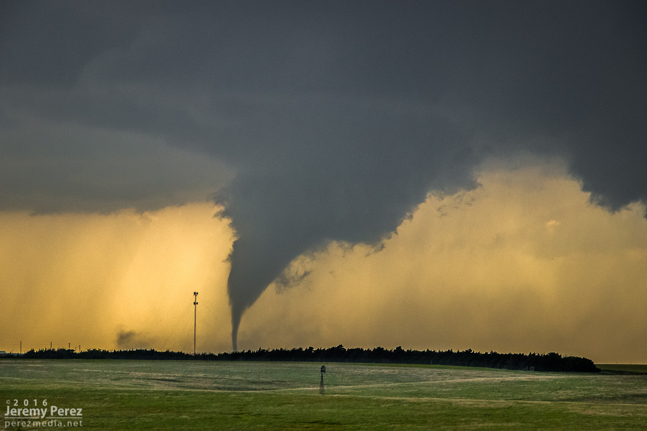
Tornado #1 churns in silhouette west of Minneola—about 12 miles from our location. [2303Z]
Inflow tugs at my daughter and chase partner as the first tornado strengthens north of Minneola. [2308Z]
Tornado #1 bulks up as it moves northward. [2313Z]
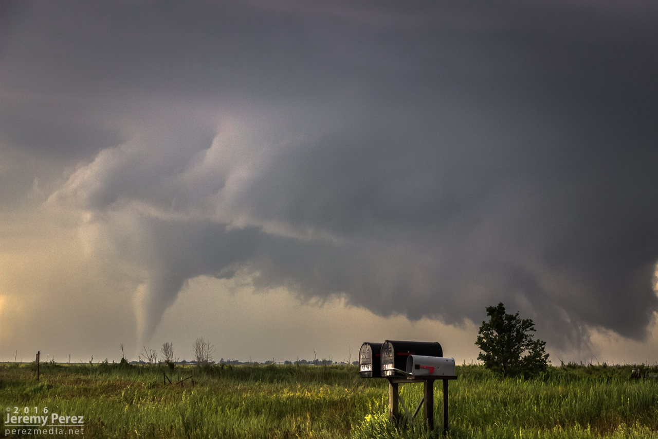
We eventually had to keep moving to stay with the storm. While repositioning, the original tornado began to occlude behind a haze of precipitation. My daughter asked if there was a different tornado forming further to the right. Sure enough, a thin rope had descended from the fresher wall cloud while the previous tornado was still in progress. This was our first tornado pair. I hate to call them twins, because the emaciated second one wasn't even close in appearance to the first—more like the mole that shows up on the stronger twin when it absorbs its sibling I guess.
Tornado #1 occludes while whisker-thin tornado #2 reaches down to the right. [2321Z]
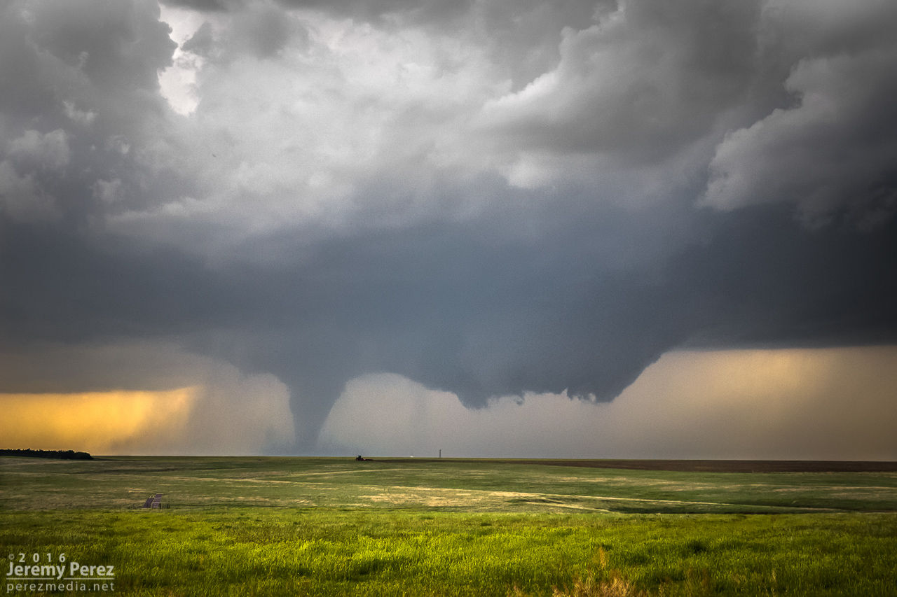
About seven miles south of Dodge City and still on the dirt roads, we found a really good spot to watch as a new tornado took on Rozel-like proportions as a thin rope tornado flicked around on the east edge of the elongated wall cloud. There may even have been another tornado intertwined with that rope, but from my perspective I couldn't tell if it was just extra scud tendrils. The view of the main tornado at this point was spectacular. We were further south of it, so now it had some side lighting and showed a lot of dimension. We hung out at this spot for another 13 minutes or so before heading off to the dreaded main highway. (Rain was starting to effect the area and I didn't want to get us stuck in the mud.)
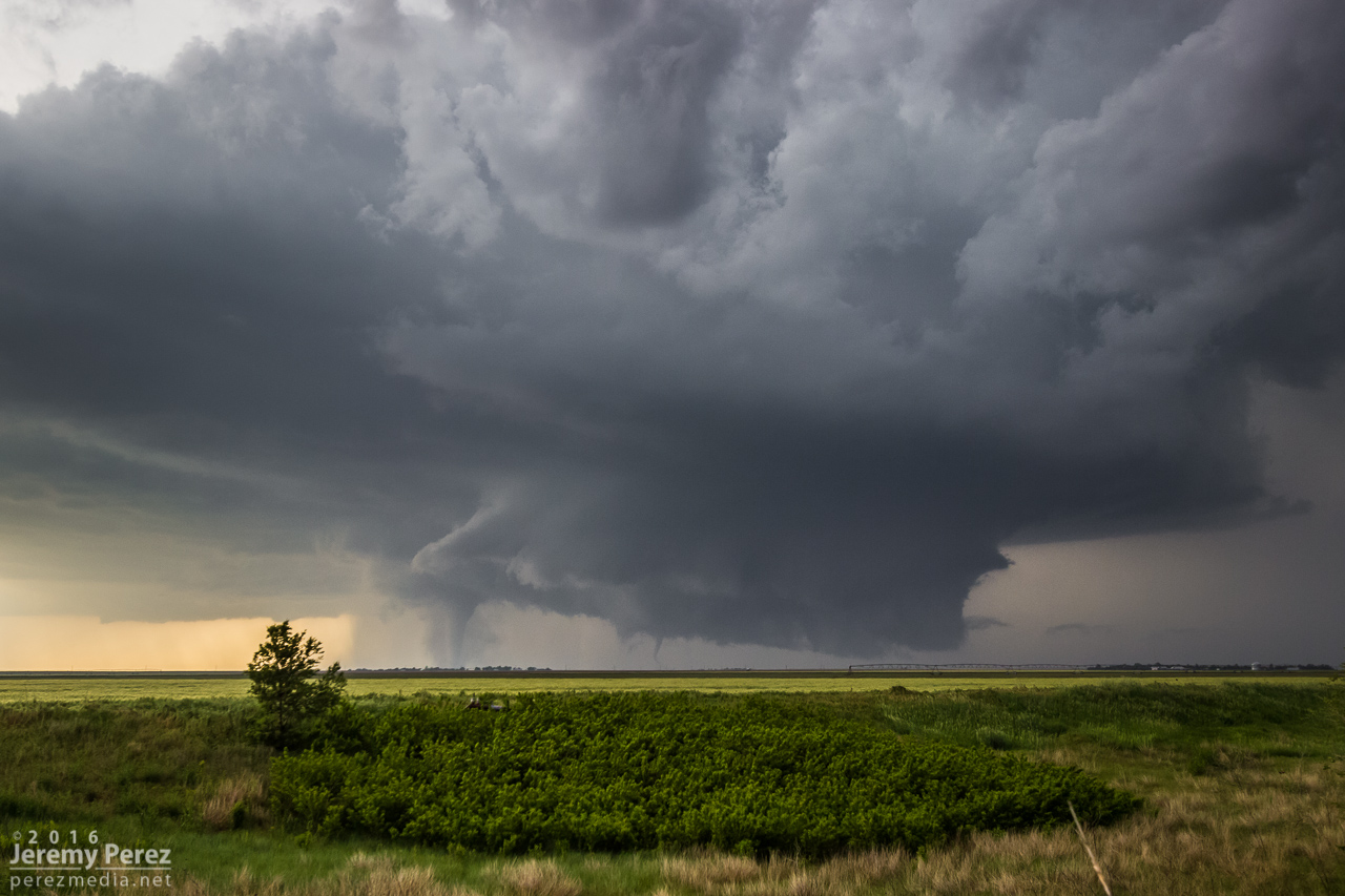
Tornado #3 gains strength while at least one rope—tornado #4—reaches down at far right. [2330Z]
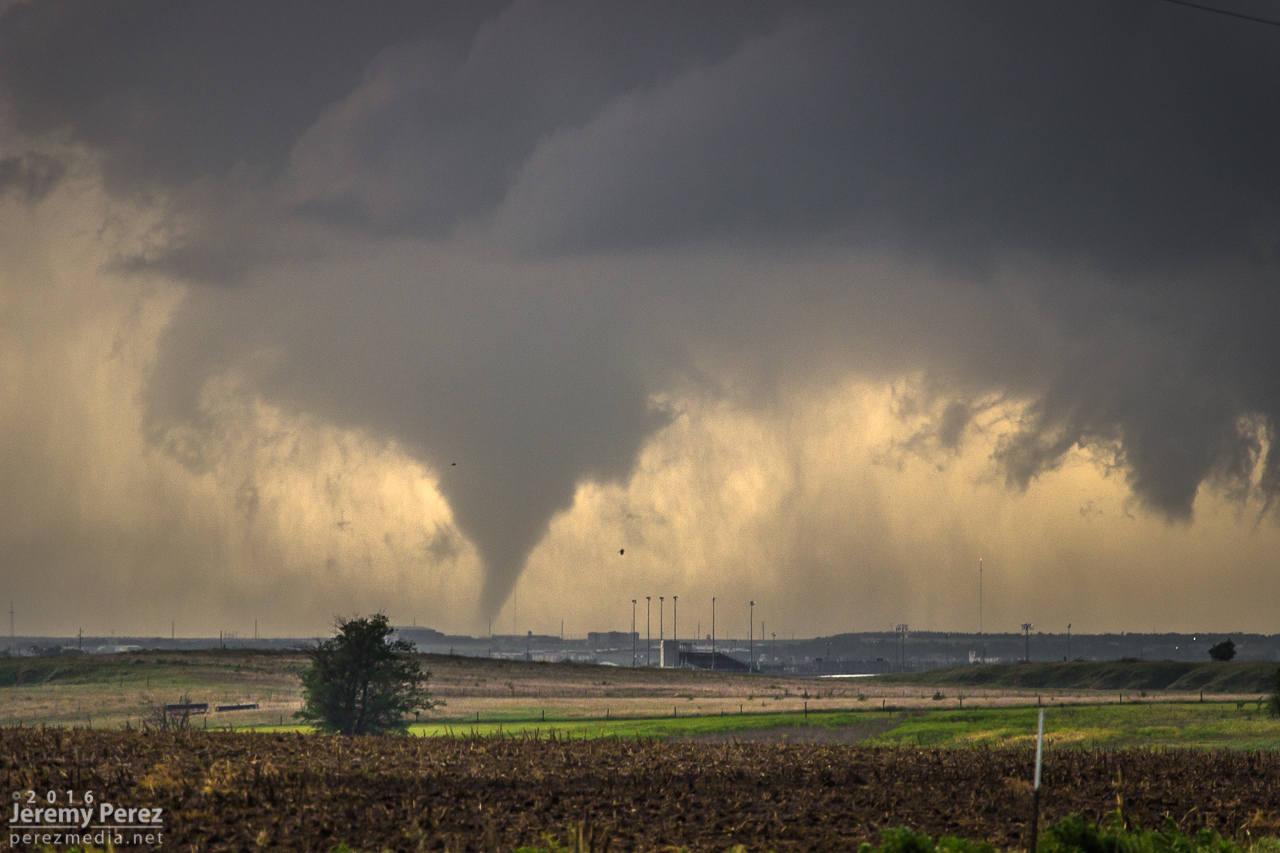
A wider view of tornado #3 as it is southwest of Dodge City and about 10 miles to our northwest. [2331Z]
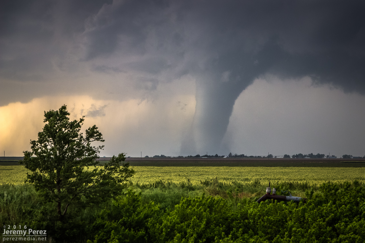
Tornado #3 taking on Rozel characteristics. [2332Z]
A wide view of tornado #3 as seen from about 7 miles south of Dodge City. [2333Z]
Wide view of the second pair of tornadoes we observed. [2335Z]
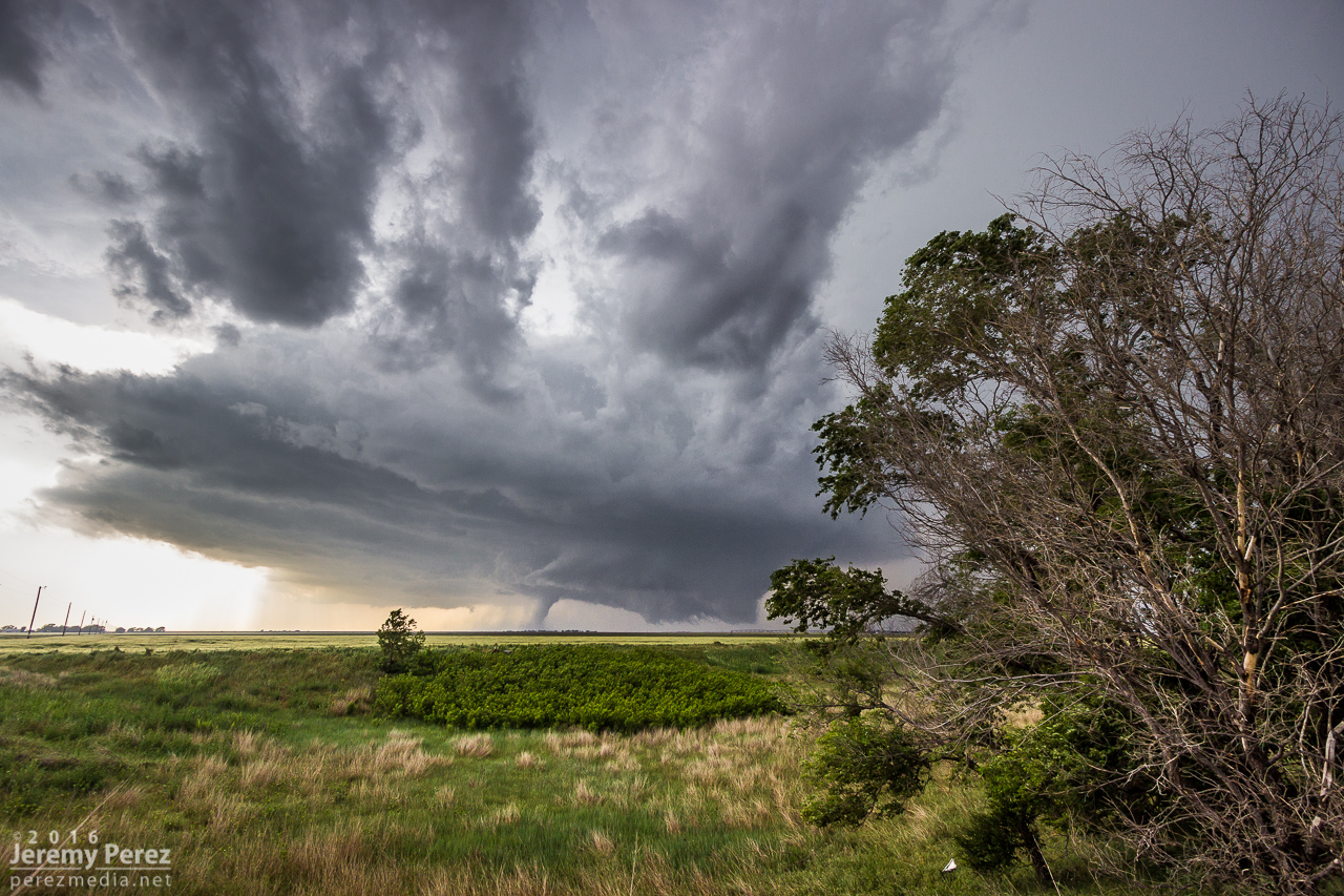
A wide structure view as the storm feigns being tornado-less. [2338Z]

Ropeout of tornado #3 rematerializes while its parent supercell continues northward. [2338Z]
Closer view of tornado #3 ropeout. Wall cloud at right is producing ground circulation—not sure if it's a continuation of tornado #4. [2339Z]
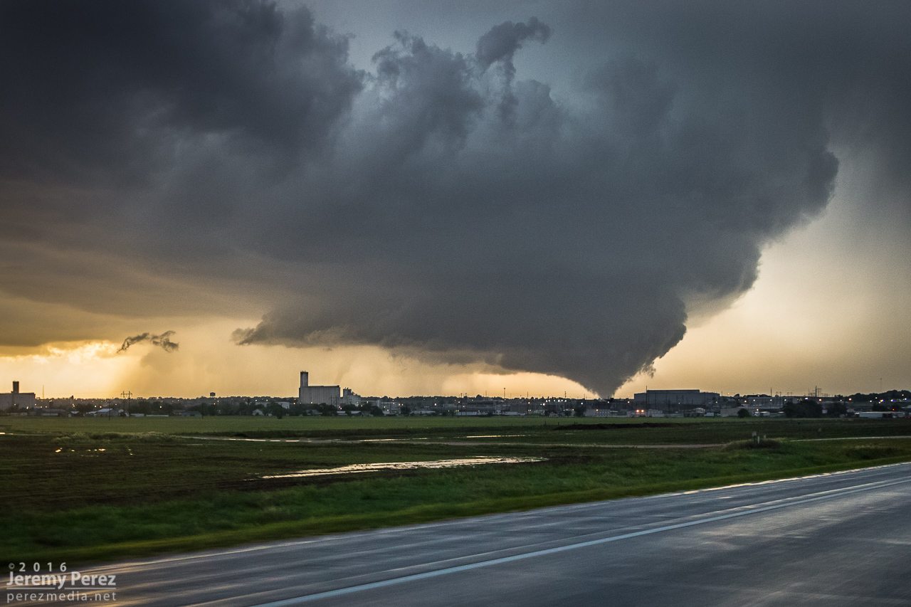
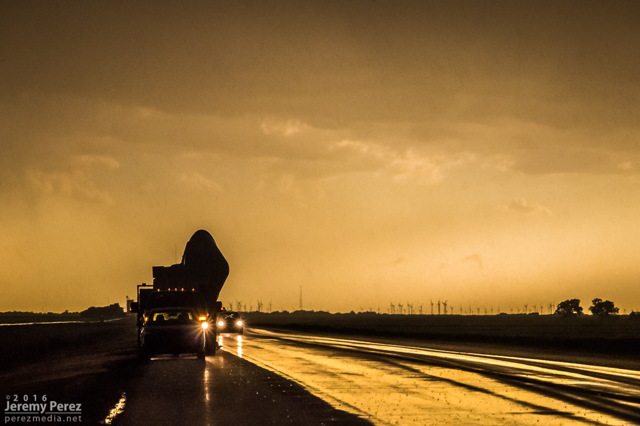
Hwy 283 was about as insane as I was worried it would be—absolutely packed with chasers and locals. Despite how crowded it was, most everyone was driving, parking and loitering in an orderly fashion. We parked at a couple spots to get photos as a fifth tornado morphed into various forms—barrel/multi-vortex/cone/elephant trunk/rope—west of Dodge City. We took the highways around the east side of the city, watching as the #5 occluded and roped out while a new, sixth tornado descended from the apex of a wasp-nest shaped meso. The highway was at a decent elevation, so we had pretty good views of the action north of the city as we made our way around. By the time we got northeast of Dodge, the sixth tornado had sprouted a satellite rope funnel of its own—video from other chasers shows this in contact with the ground as well, so—tornado number seven.
One of the many forms of tornado #5 as it was moving northwest of Dodge City—as seen from Hwy 283, about 9 miles away. [0002Z]

Ropeout sequence of tornado #5 as we navigated the east side of Dodge City. [0004-0008Z]
Tornado #5 occludes while tornado #6 drops north of Dodge City. [0010Z]
Tornado #6 sports a satellite, tornado #7 north of Dodge City—about 9 miles to our northwest. [0016Z]
By this time, new supercells were encroaching from the south it looked like our original cell was jogging to the east. So to avoid getting pinched, we bailed out to the east and made a half-hearted attempt to get on some other tornado warned cells east of Kinsley. That wound up seeming like more effort than it was worth, especially after the spectacle we just experienced, so we hung out for a while just west of Lewis on Hwy 50 and grabbed sunset photos.
One of the DOW vehicles samples a different storm east of Kinsley. [0109Z]
Sunset lights up the cold west flank of a passing supercell east of Kinsley. [0134Z]
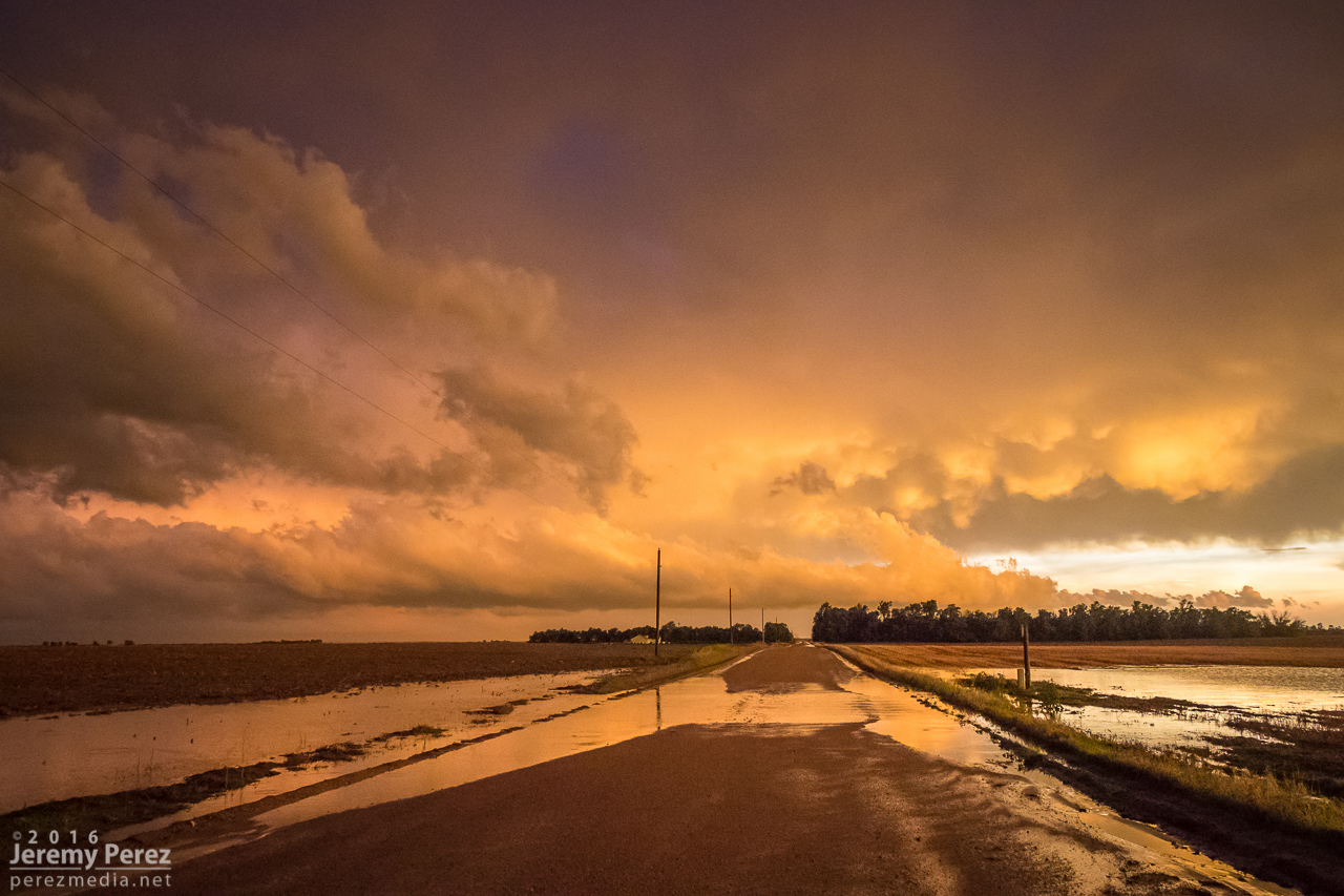
Sunset and flooded back roads east of Kinsley. [0144Z]

A fire rages south of Lewis—presumably lightning caused. [0150Z]
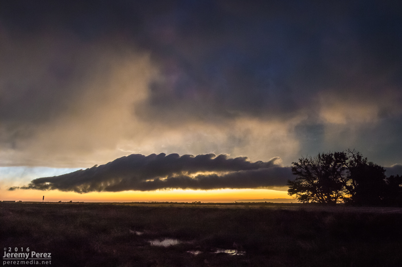
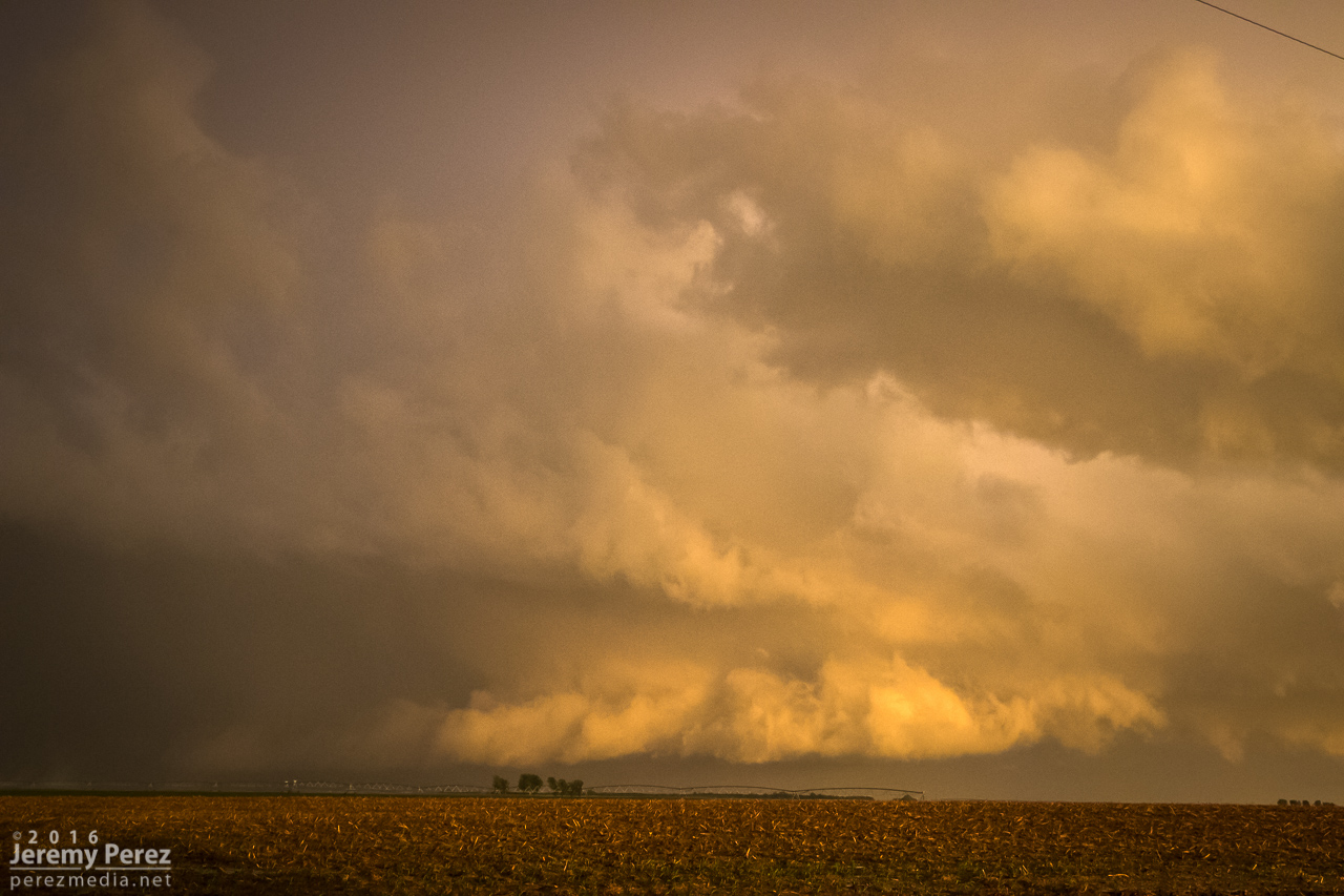
A spectacular roll cloud sporting Kelvin-Helmholtz waves drifts by west of Lewis, KS. [0215Z]
After the stunning sunset, we headed back to Dodge City for dinner and a hotel for the night. While eating dinner, Arizona storm chasers Adri Mozeris, Trey Greenwood and Corbin Jaeger stopped by to say hi and we got a chance to talk about all the unbelievable things we had seen that afternoon.
Throughout our chase, I'm pretty sure we observed seven tornadoes, where two were on the ground at the same time on four occasions. I'm still having trouble believing we actually witnessed all of this. Other chasers reported seeing on the order of twelve tornadoes. So the numbers in my account don't represent the actual sequence of tornadoes on the storm—just the ones we saw ourselves. Like the Rozel/Sanford tornadoes, I could be convinced that what I counted as two tornadoes may have been continuations—where say one of the thin ropes seemed to disappear, but may have actually still been stirring up ground circulation before turning into a larger tornado later. I'll update things if I find out differently.
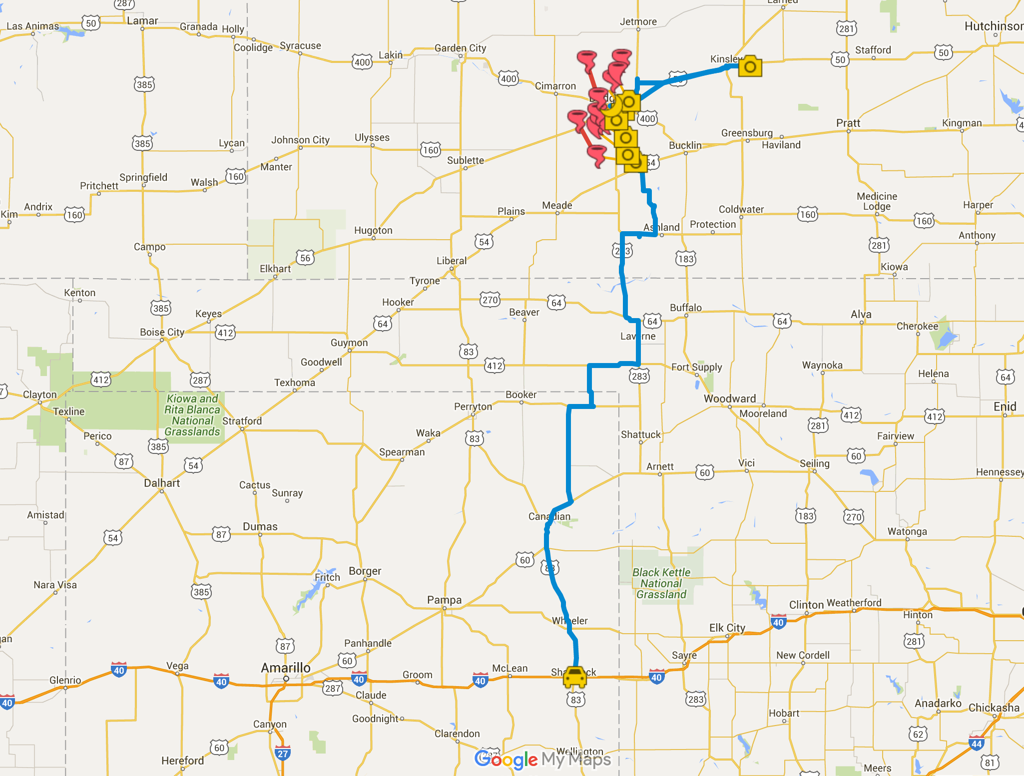
Chase map for the day — 24 May 2016
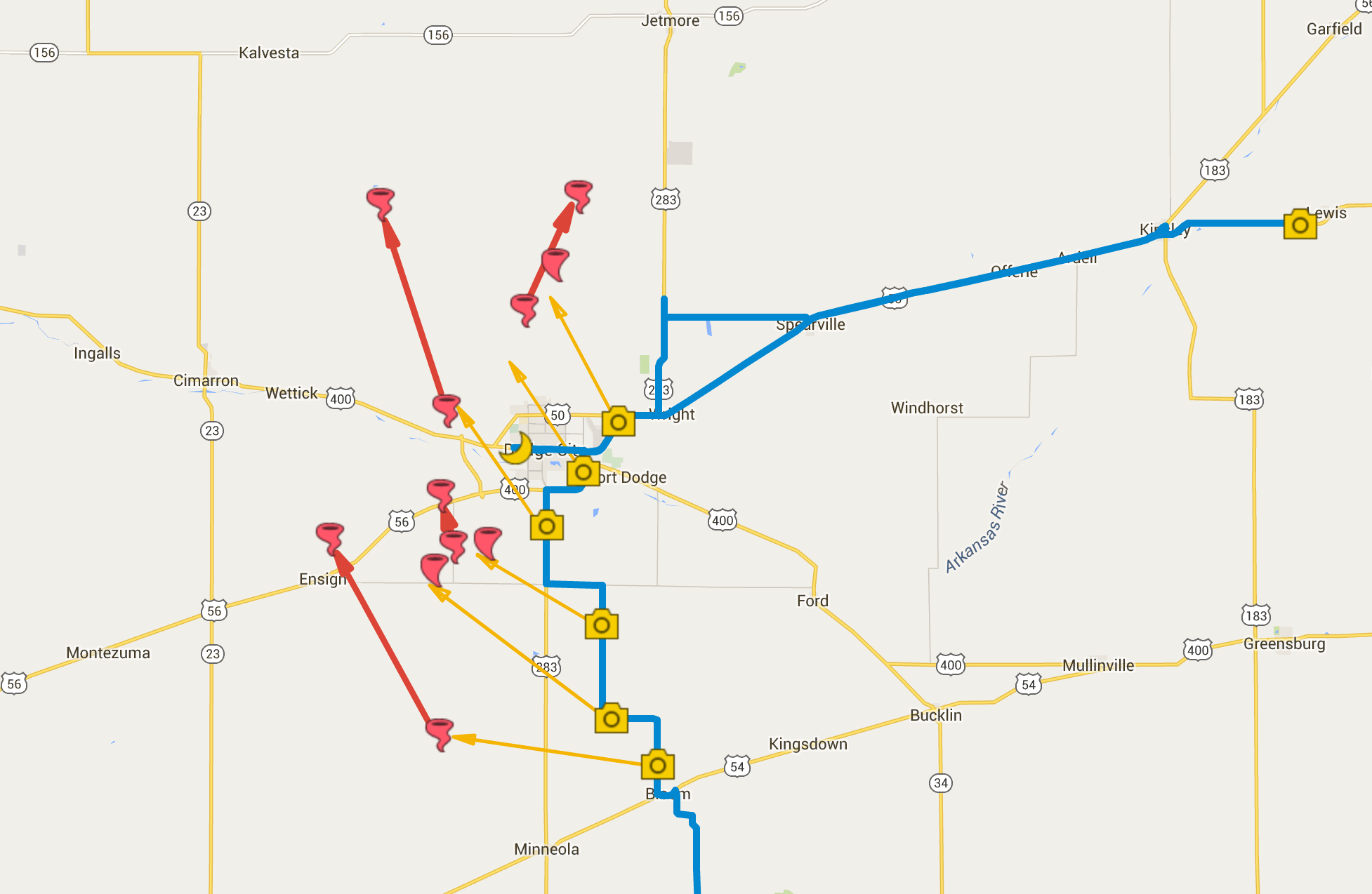
Close up chase map showing photo locations and approximate tornado locations.
Zoomable/interactive chase map
Video highlights from the chase
