I hadn’t been forecasting this day to death…not even close. I was pretty much keeping a lazy eye on it for any option for strong storms as low pressure worked its way into southern Arizona. SPC had marked out southeast Arizona and southwest New Mexico for marginal severe probabilities, but a quick check of HRRR this morning hinted at some fun further north in the Little Colorado River Valley.
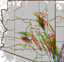
Six overlapping runs of HRRR helicity swaths
Several runs were pretty consistently bringing up to 750 j/kg SBCAPE, 20-40 knots of 6km shear, low 50 degree dew points up into the LCRV. Those runs were also consistently laying down decent helicity swaths across I40 between Winslow and Holbrook. As the day wore on, dew points looked like they might cross the 50 degree threshold. By 2PM, convection was starting to strengthen south of Holbrook, so I took off to sample the goods.
And what goods there were.
As I headed east, one cell took over and picked up a very nice, cyclonic velocity couplet as it drifted north-northwest.
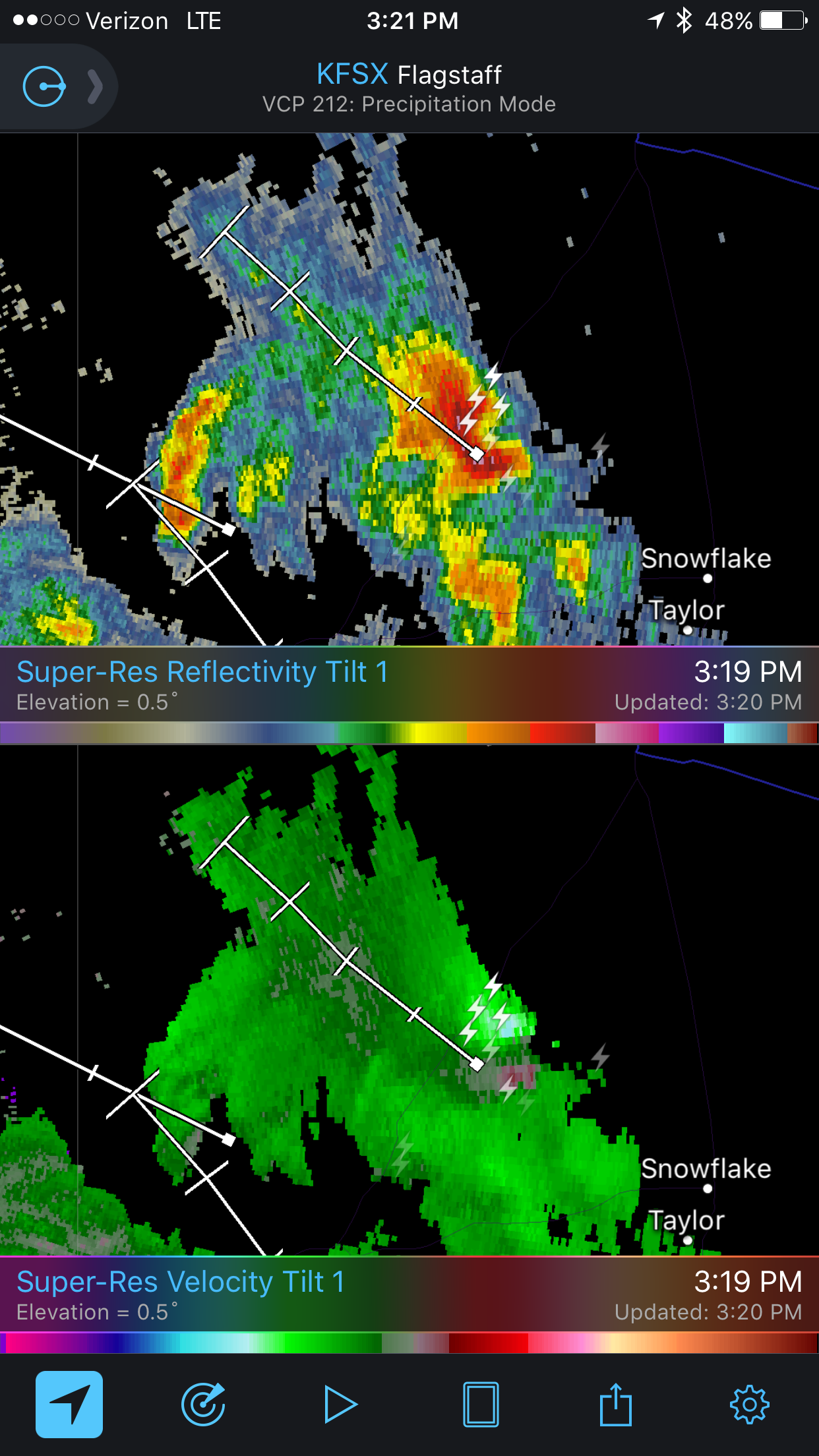
Reflectivity/Velocity Radar at 3:19PM (2219Z)
By the time I was within 50 miles, I could start to make out a couple layers of bell-shaped lowerings sweeping beneath the lurking darkness of the storm. As good as the couplet looked, I was pretty sure the storm was peaking and I’d probably missed the best.
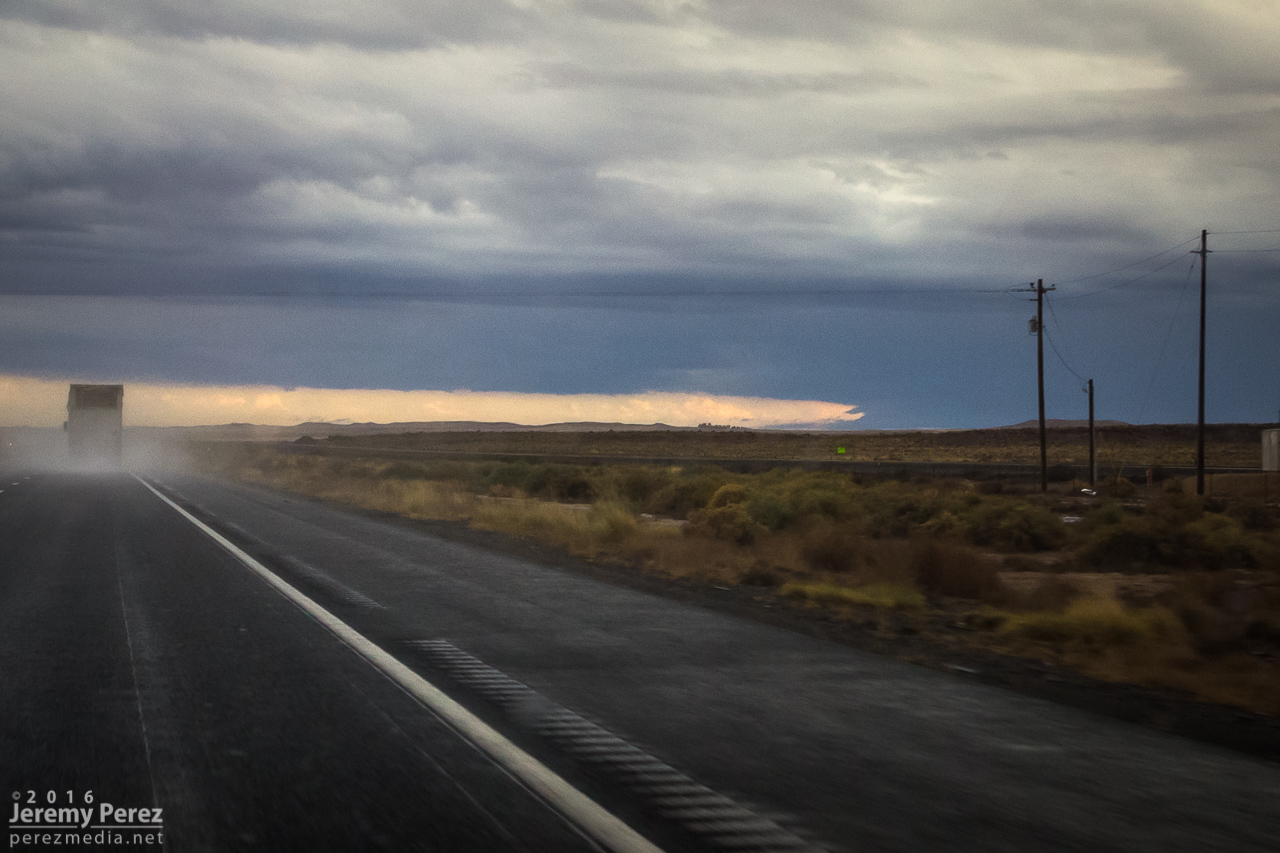
Distant view of the storm base looking east from I-40 (2246Z)
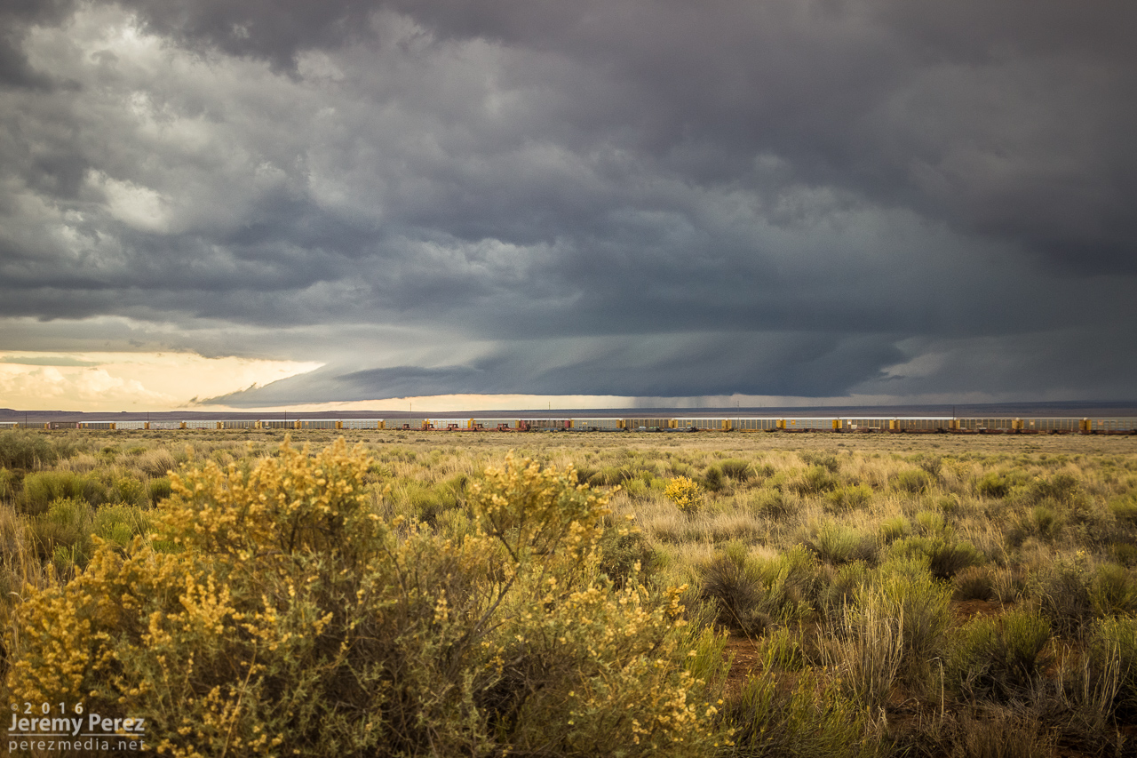
Looking southeast during a quick stop at Hibbard Rd. before continuing east (2302Z)
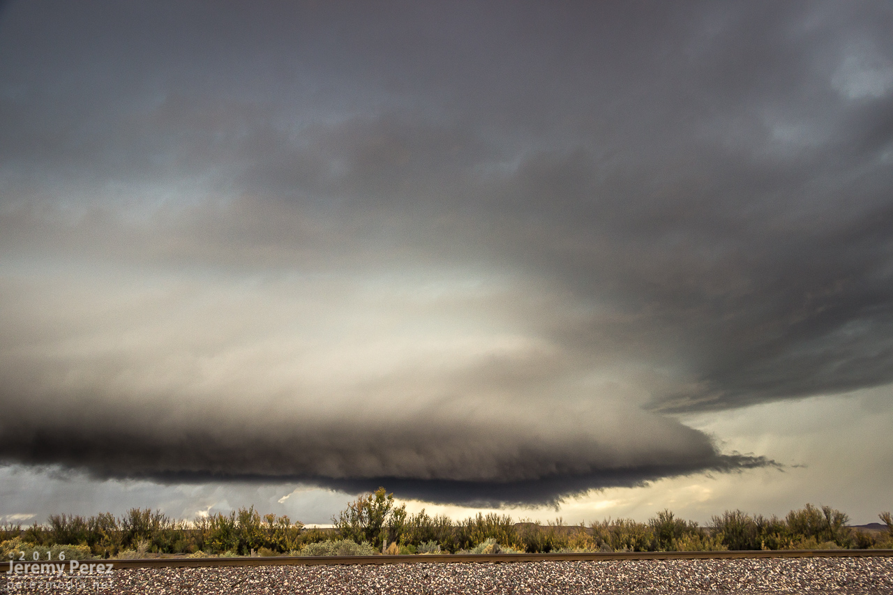
About 10 miles east of Winslow, I exited at Jackrabbit road, trying to position a couple miles east of where I thought the storm would cross. I haven't scouted this area before, and got stuck with some pretty bland landscape options…shooting perpendicular across railroad tracks makes me sad. But the storm…the storm was incredible. The RFD gust front had scooped up a gigantic cowcatcher shelf cloud as it loomed closer. After snagging a few still photos, I set both cameras up to catch both wide and tight video as it moved in.
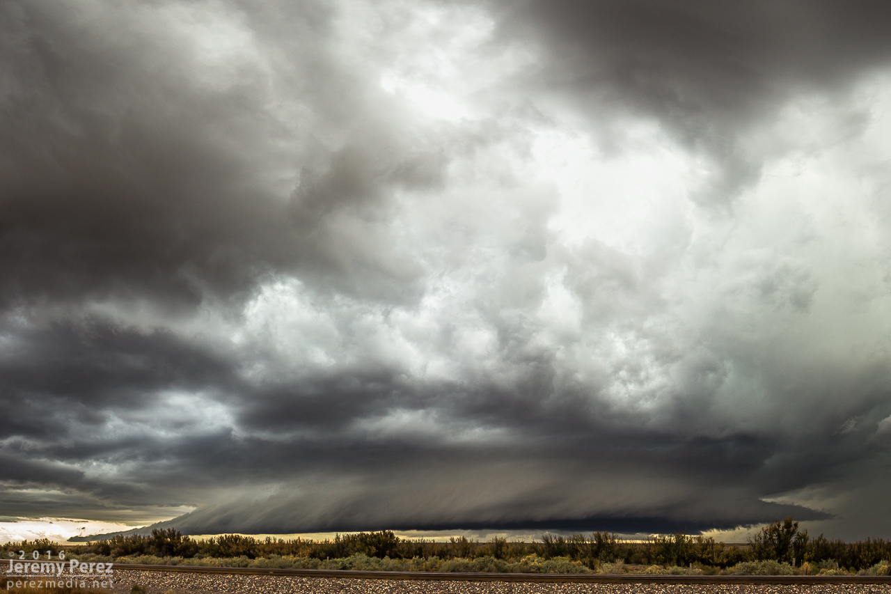
Five-frame stitched pano looking south at the approaching supercell from 10 miles east of Winslow (2315Z)
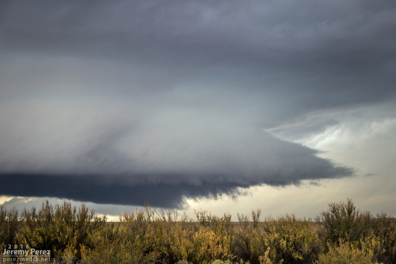
Close up of the leading edge of the RFD shelf (2319Z)
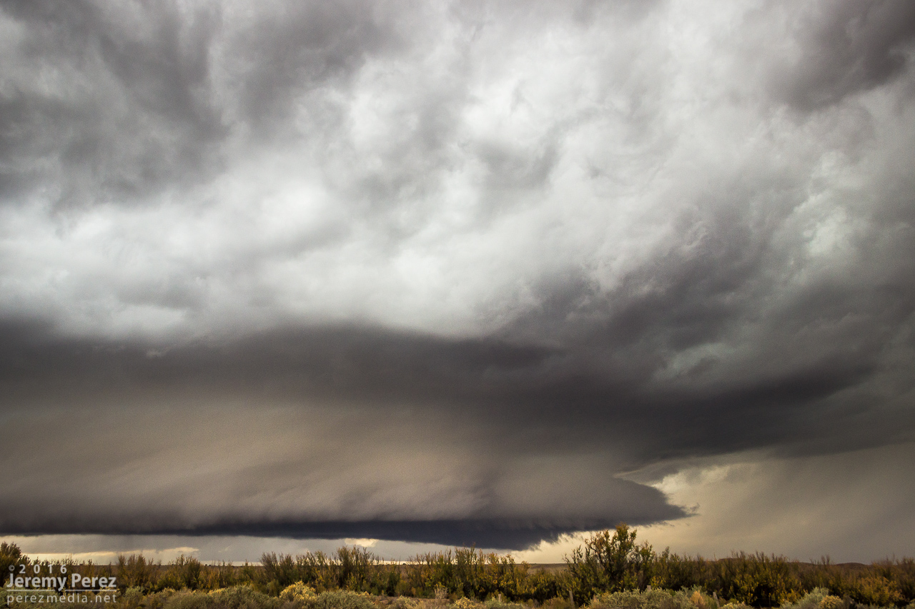
(2320Z)
Within a few minutes, my phone belted out a warning alarm, and there I was smack dab in the middle of a tornado warning polygon. Although there was broad rotation, I didn’t notice anything tightening up apart from some fun eddies underneath the gust front.
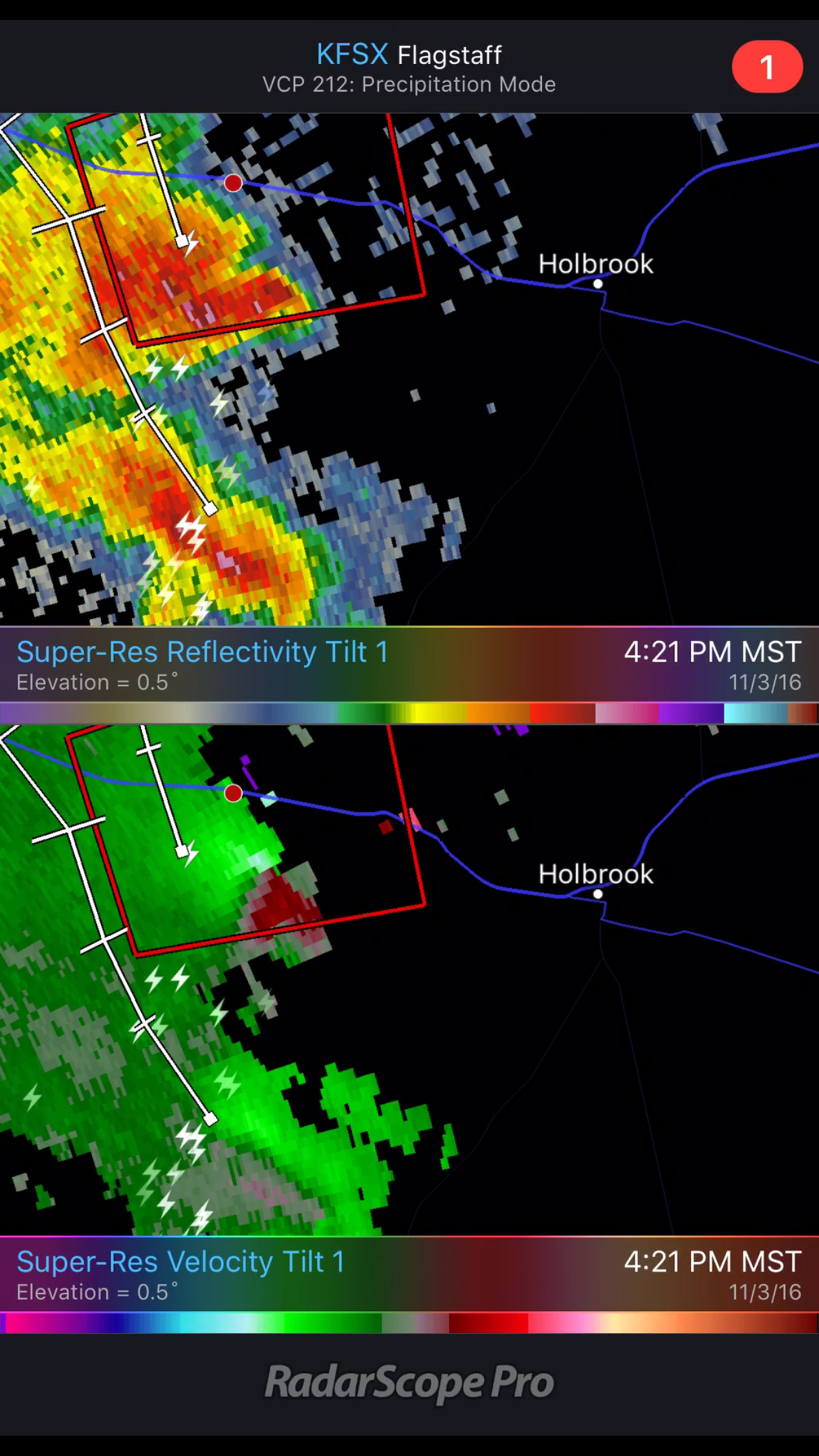
Finding myself in the center of a tornado warning polygon (2321Z)
(2326Z)

Both cameras shooting video (2326Z)
Road options were no good once it crossed the interstate and I headed back west to Winslow to take Highway 87 north. From there I watched a trailing cell try to make good on whatever was left to chew on.
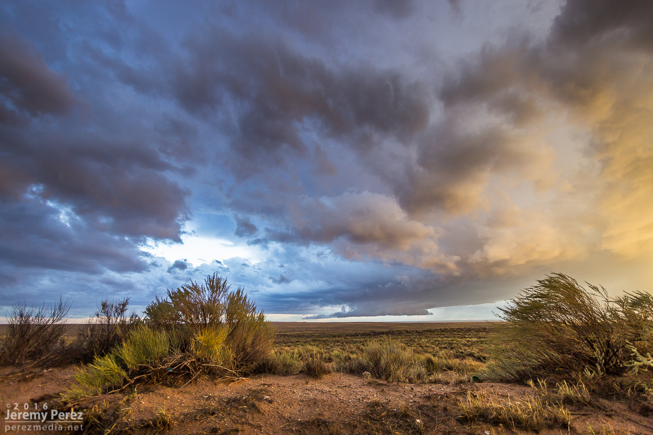
Looking southeast at the weakening remains of a trailing cell from a few miles north of Winslow (0006Z)
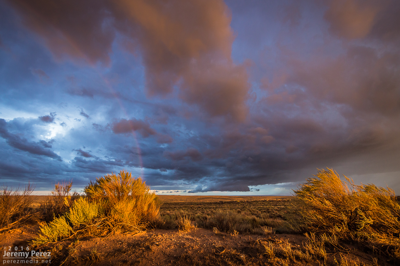
…and the very important rainbow shot (0016Z)
So, yeah, it feels great to finally have been on a tornado-warned Arizona supercell!
Tornado Warned Supercell—Joseph City, Arizona—3 November 2016 from Jeremy Perez on Vimeo.
