What a strange weather day. I was aware of the potential for severe weather today, but since it was a work day I didn't give it too much thought the night before.
Then I awoke to the sounds of the emergency broadcast system issuing a tornado warning on the TV in the living room (where Harrison was enjoying some early morning cartoons).
I turned on the computer, pulled up local radar and saw a train of red tornado warning polygons piling up and following a line of storms just west of Flagstaff. So yeah, it was a work day, but 10 miles from town? I'd be a mess if I didn't at least try. I asked to take a few hours off at the office, and then headed west on I-40 to Bellemont.
I had no overall plan, it was spur of the moment, and I hadn't spent any time going over the synoptic situation or models. No mobile data either. I just figured, one tornado-warned storm after another was cooking northward and ending up between Bellemont and Flagstaff...I'd surely see at LEAST some interesting structure.
Wrong.
No understanding of the overall setup, no data, towering ponderosas packed against 90% of any given roadway, very low cloud bases, storms moving at 40 mph, and a sparse road network that forces you to commit with no options for fine-tuned adjustment made for endless frustration.
I spent most of the time in drenching rain and pea-sized hail or looking up at racing clouds from inside a canyon of trees. As I cruised along I-40, one cooperative gap in the trees gave me about a 3 second glimpse of a nicely flared rain free base on a storm that had been tornado-warned near Sedona. I wasn't able to re-acquire it. Just too much terrain. Hindsight: I should have worked south on I-17...once the storms started training eastward they lost their punch after moving north over the rim.
The Bellemont truck stop is situated in a nice, open prairie landscape, which provides a better visual if that's where a mesocyclone plans to traipse. Which, none did while I was sitting there without radar data.
If I had been there several hours earlier, it would have been a completely different situation. Severe storms are fascinating, but not when lives and livelihoods are threatened. One confirmed tornado, and likely some serious straight-line winds were unloaded and wreaked havoc with this little community between 6:00 and 7:30 this morning. As I drove around looking for an open vantage point to watch the incoming storms, DPS was everywhere. Several rail cars were laying on their sides, demolished semi frames were in the median of I-40, buildings had their roofs and siding peeled away, and an RV lot looked like gravity had suddenly shifted, toppling and bursting random campers open. Fortunately, there were no fatalities; however seven were injured.
So, yeah, I was frustrated by how the chase went, but how can that even compare to the frustration of having your home ravaged, pieces of your life blown off into the mountains, or someone you love having glass and debris picked out of them in the ER?
Anyway, a very strange weather day. See below for some photos.
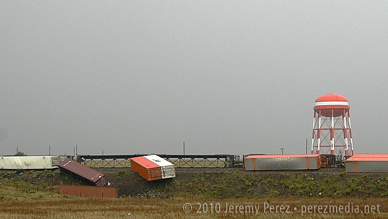
Train derailment at Bellemont
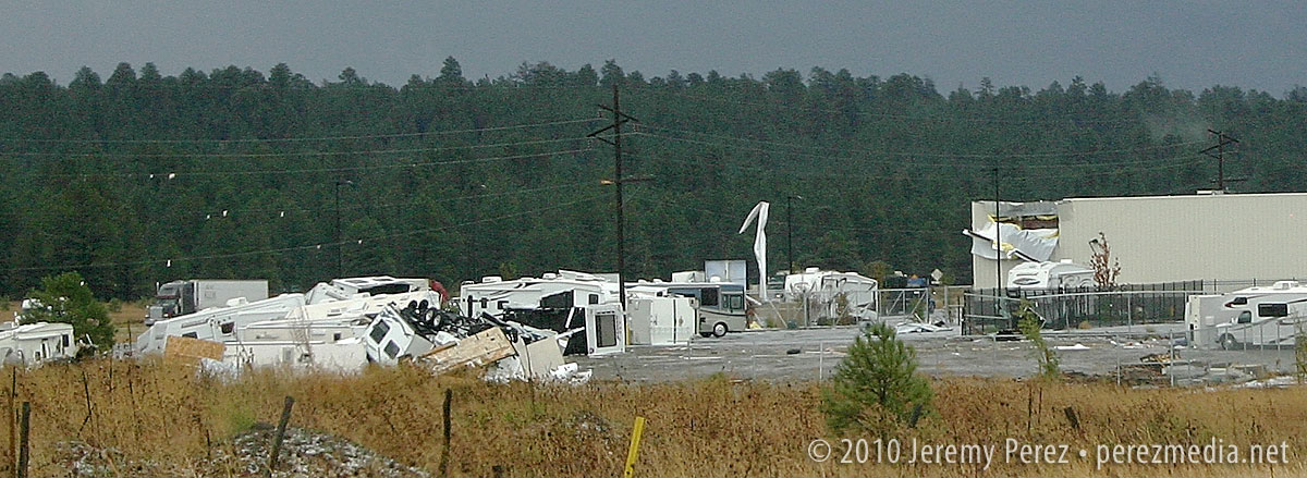
RV Lot and Building Damage
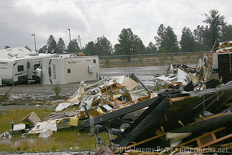
RV Lot Damage
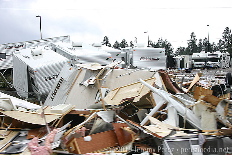
RV Lot Damage
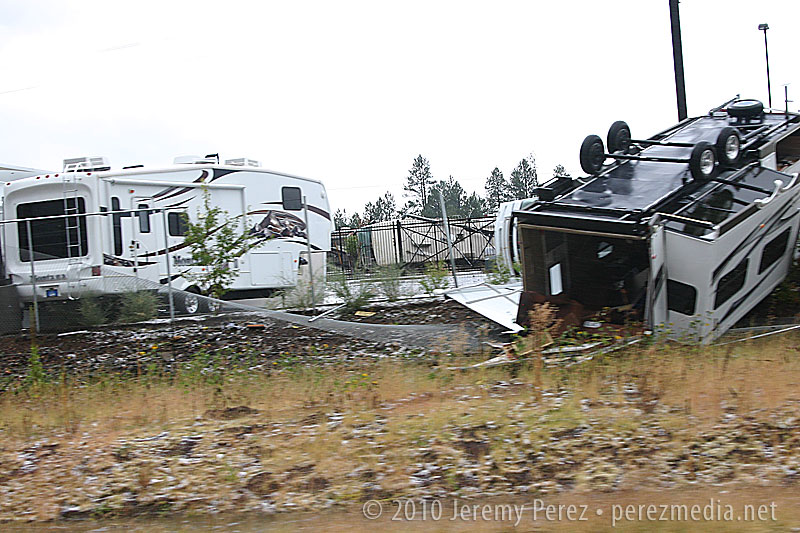
RV Lot Damage
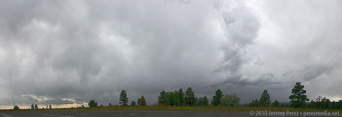
This was about as good as it got for views of incoming storms if you were anywhere near my car. :P
