In 2010 after my first Great Plains chase, I spent a lot of time going through my photos and working to improve my understanding of storm structure. For one of those exercises, I diagrammed the Bowdle supercell. There was a lot of excellent feedback and discussion on all the structure in that beautiful, terrible, amazing storm.
Each new supercell I chase broadens my appreciation for all the ingredients and dynamics that make each one unique and awesome. I enjoy recapping each one and visualizing what was happening, so I've been keen to diagram some more recent storms.
What I especially wanted to work on were transition points in space or time where a shelf cloud is merging or morphing into a wall cloud/tail cloud and vice-versa. A lot of times it's pretty clear what's what. But because the storm and its environment don't care about taxonomy, there are plenty of cases where things ride along a diffuse spectrum. To me, it's educational to watch these things unfold and look for transitions where one thing becomes another, and what that means for the fluid movement and interaction of near-storm air masses.
So, here is a batch of a few more.
Denver Supercell - May 21, 2014
While this storm was still strengthening over Denver Metro and headed toward the airport, it had a very compact RFD shelf that I wanted to call a wall cloud at first glance. But the RFD appears to be responsible for lifting this prominent feature out ahead of the base while the true wall clouds spins away behind. Mike Olbinski's time lapse nicely demonstrates the dynamics (See the 6:24 segment of the video).
Goshen County Supercell - May 20, 2014
This was a view that to me, beautifully demonstrates the source of a weak wall cloud’s formation as the forward flank's rain foot intrudes into the updraft, drastically lowering the condensation level in that area. How much of the foreground lowering would technically be considered a wall cloud vs. RFD shelf was questionable to me.
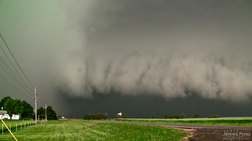
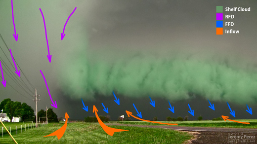
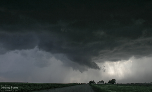
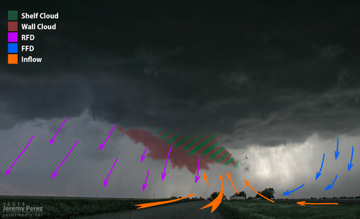
Newkirk, Oklahoma Supercell - May 19, 2013
This is an example of a transition point where the RFD is smearing a weak wall cloud into a shelf cloud. At least that's how it seems to me. You can see that the foreground lowering is "pointing" toward the forward flank, and benefiting from lowered condensation as it rises into the base. But now it's being hurried and lifted on its way by the RFD gust front (which it "points" away from). It seems to be in a place between both 'definitions' and both dynamic conditions.
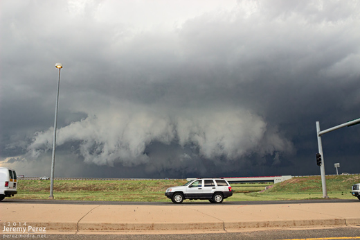
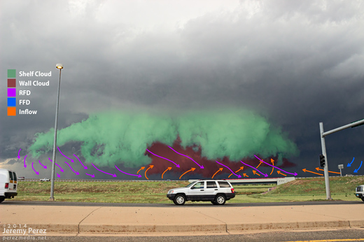
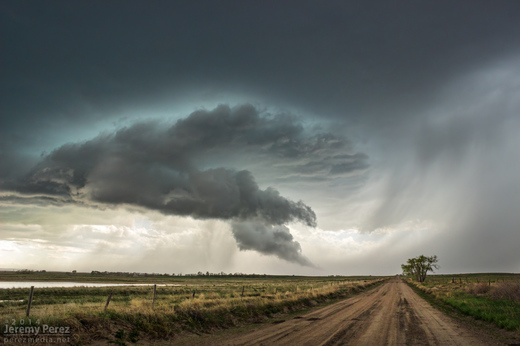
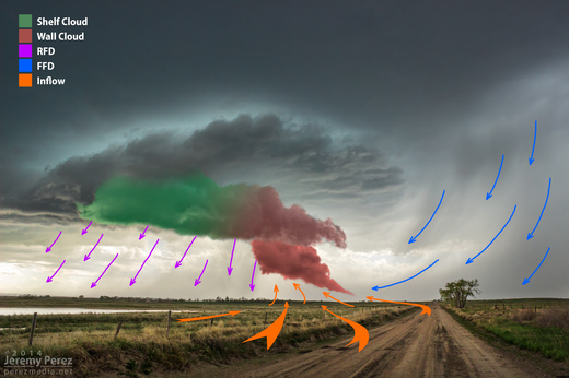
Oxford, Kansas Supercell - May 19, 2013
This storm had a shelf feature on the forward flank leading straight into the the RFD core that made me think of video of the Long Point, Illinois storm on November 17, 2013. Skip Talbot had commented that the forward flank shelf on that storm seemed to behave like a hybrid shelf cloud and inflow band.