The second week of September has been a great week for organized storms in Arizona. A cutoff low developed over southern California, and has been drawing up moisture for several days and providing decent shear aloft. Lower level winds haven't been very strong and veering with height in the first kilometer not very promising. However, bulk shear from 30-40 knots, cooling and diffluence aloft, and ample moisture led to strong storms and support for occasional supercells.
Supercell thunderstorms are not common in Arizona, but after missing the storms that led to last year's Arizona tornado outbreak, I've been keeping an eye out for California cutoff lows. Being at the right place at the right time to view and film a rare Arizona tornado is so close to being unrealistic, that I'm not too anxious about it. However, catching an Arizona supercell seemed doable and would be a very nice gem to collect.
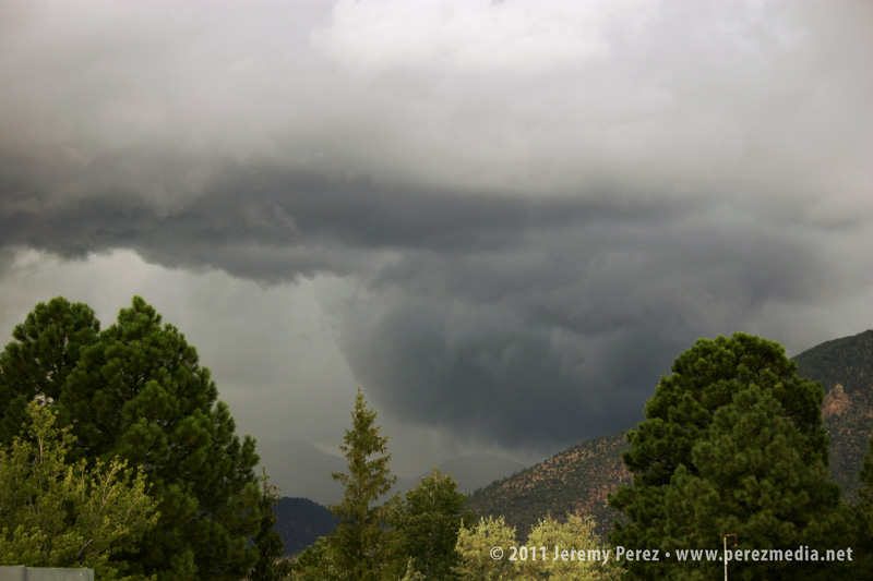
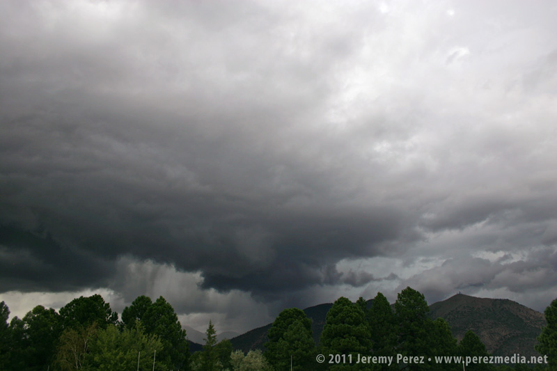
I've had my cameras ready in the car and kept an eye on radar in hopes of catching a good storm. I made a couple local chases the week before, caught some broad rotation in one storm and brief barber pole structure in another, but not much else. Then on the afternoon of September 13, I noticed weak, but sustained, rotation on a couple storms on doppler radar. I headed outside to get a look and to the north I saw a robust storm perched over the San Francisco Peaks. The rain free base sported a zone of rising scud, and I was surprised to see what appeared to be a wet RFD slot slicing into it. As the razor edged rain band pushed in, the rising scud quickly congealed into a wall cloud with a laminar profile and nice rising motion. All I had was my cell phone, so I had to suffice with a couple low-quality photos.
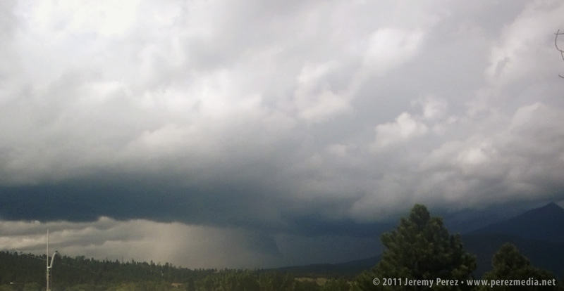
RFD and brief wall cloud southwest of San Francisco Peaks about 2:30 PM
Move mouse over image to view labels. Click for larger version.
RFD and wall cloud progressing
Hoping it would hold together, I quickly ran to my car to grab my cameras. By the time I got back to a good clearing in the trees, the original updraft cycle had eased off and the wall cloud had broken up. I was pretty disappointed, but the storm still looked strong, so I found a new vantage point along a stairway leading to the roof of my office building. I set the video camera up for a time lapse while shooting still photos as the storm cycled two more times.
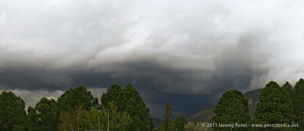
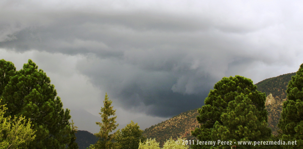
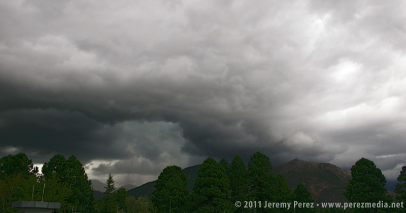
Storm base moving over Schultz Pass
Panorama showing storm structure 3:00 PM
Move mouse over image to view labels. Click for larger version.
While shooting photos, I called my wife while she was running errands about a mile further north, closer to the rain free base. Besides describing a wicked looking storm and an occasional spray of hail, she mentioned the warm inflow that was feeding it.
The videos below show a time lapse view of the storm. I suggest clicking through to Youtube and viewing in high res
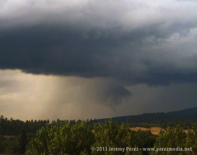
By now, a flanking line and gust front had developed along the storms southwest flank, and there appeared to be an inflow tail stretching eastward behind Mt. Elden. One area of rotation drifted eastward through Shultz Pass and dropped a broad, tattered wall cloud. This area seemed to be occluding while new circulation was trying to develop just south of it on the other side of the RFD gust front.
This second video shows detail in the wall cloud, including an interesting, conical structure drifting through it. The structure persisted for about 40 seconds. Although I wonder if it was an embedded funnel, I can't be sure--I can't discern motion in the dark silhouette.
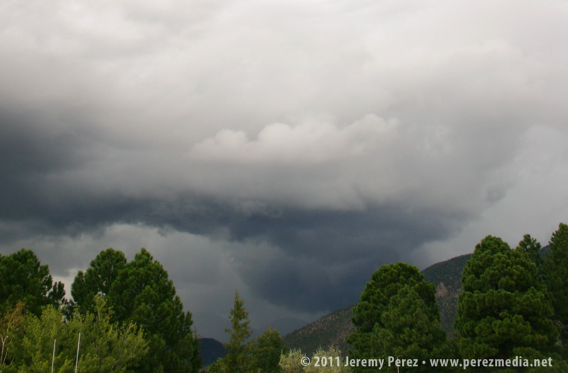
Wall cloud drifting behind Mt. Elden.
Suspected funnel embedded in wall cloud.
Move mouse over image to view labels. Click for larger version.
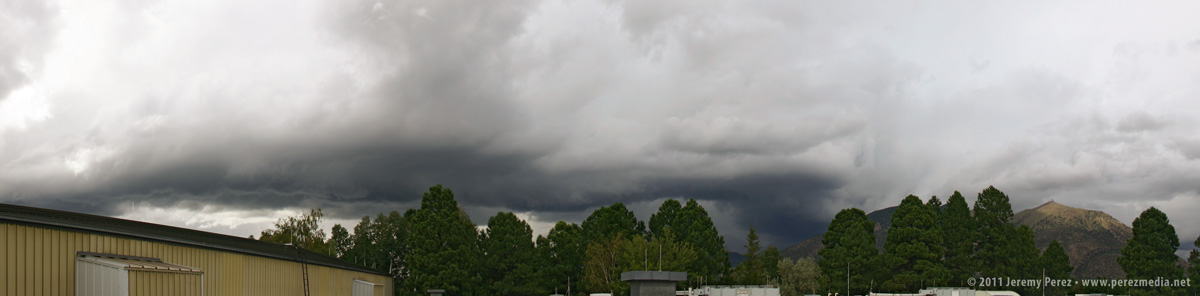
Storm structure as new base forms.
The new area of rotation began to pull in rising scud and even started to form a tail cloud. It was definitely exciting to see it try to tighten up as rotation got faster, but it lost cohesion, and the storm pulled away to the northeast and out of view over the mountain.
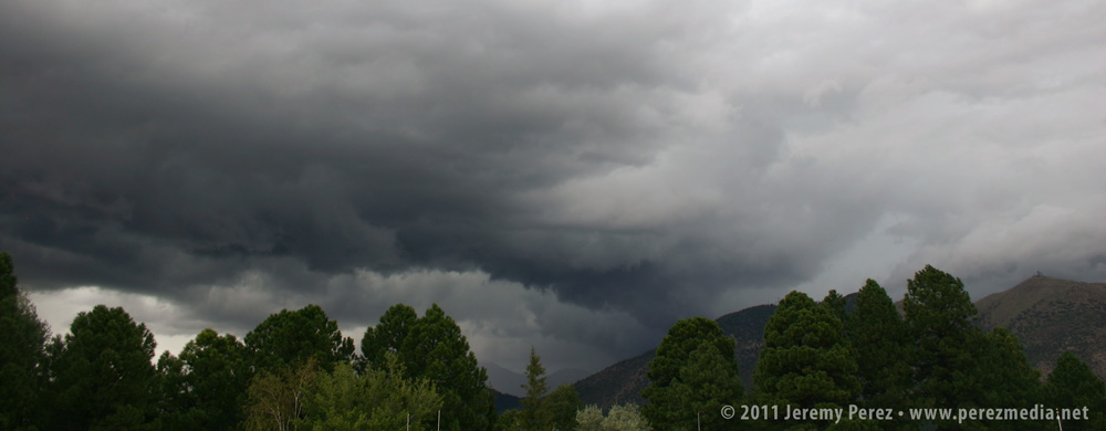
RFD gust front makes a strong push.
Tail cloud begins to feed into new lowering.
RFD Slot.
This cycling supercell was a real treat to view. While I imagine it would be a disappointment by plains standards, it was pretty awesome as Arizona storms go. Unfortunately, the core was planted right over the Schultz Fire burn area and led to another round of serious flooding for neighborhoods downstream.
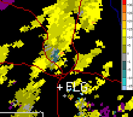
The station that recorded the radar images below is located to the southeast.
Base velocity at 2:30 PM showing 15 kt gate-to-gate shear during first wall cloud photos.
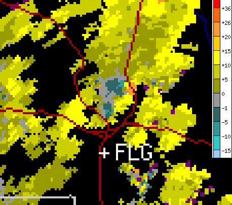
Base velocity at 3:00 PM showing 20 kt gate-to-gate shear in two locations during next sequence of photos.
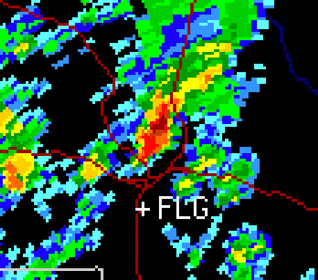
Base reflectivity at 3:00 PM.

Love the pic, I'm a fellow storm chaser from tx, now residing in az, after the hp supercell outbreak of 10-5-10 I've learned that certain parts of az are far more condusive for low topped supercells to occur, just about anywhere in north az or north of tuscon heading north to just south of a.j. is where I get a lot of good photos, this storm that just passed on 2-18-12 using pykle3 nexrad I was able to capture a very nice cold air funnel before it head east and dropped a lot of sleet and graupel over n phx and scottsdale, but again love the video, I can be reached at lpdwinter@live.com
Thanks for the comment, Winter! The landscape and photo opportunities definitely make the frustrating road network worth it. Do you post any of your images online? I'd love to take a look.
Jeremy