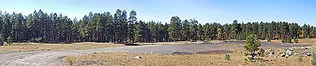
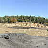
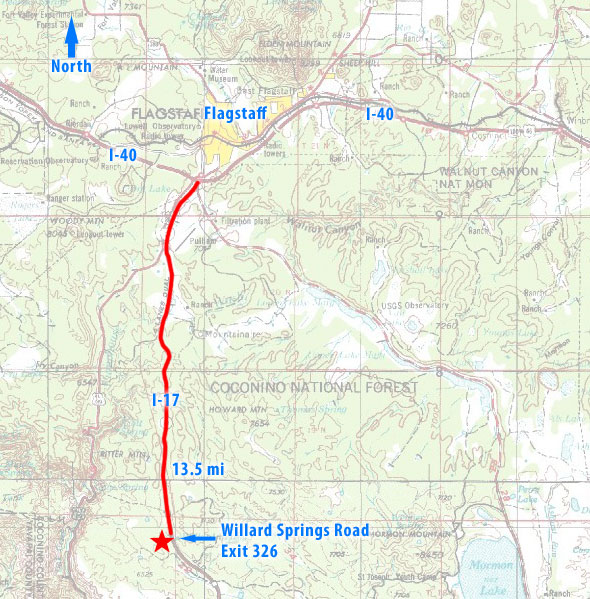
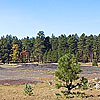
The Willard Springs Road observing site as viewed from the eastern entry point, facing west.
The Willard Springs Road observing site is a cindered clearing in the middle of ponderosa forest 14 miles south of Flagstaff on I-17. The available observing area is large and receives a nice windbreak from the surrounding trees. With the modest Flagstaff light dome positioned to the north, the southern reaches of the sky are left unspoiled. Some incidental vehicle traffic is possible in the area as campers, off-roaders and hunters forage for campsites deeper in the forest.
As with most sites removed from Flagstaff by a few miles, the site provides access to true dark skies and excellent observing conditions. At an altitude of 6750 feet, the Willard Springs Road observing site gets cold--especially in the winter--so observers will want to bring warm clothing no matter what time of year.
Panorama
786KRequires Quicktime
Area Topo Map
Site Information
| Site Name | Willard Springs Road |
| Coordinates | 34° 58' 13.9" N / 111° 41' 29.7" W |
| Elevation | 6750 ft (2057 m) |
| Directions | From the I-40/I-17 interchange, head south from Flagstaff. Travel about 13.5 miles and take exit 326: Willard Springs Road. Turn right at the stop sign and follow Willard Springs Road .8 miles to a point just past a radio tower. The road will curve sharply to the right with a dirt road branching off straight ahead. Take the dirt road about 500 feet down into a gravel and cinder clearing where you can park and set up. |
| Accessibility | Easy access. Paved road all the way to the observing field with a short drive on a dirt/cinder road to the parking area. Parking area is semi-packed cinder. |
| Capacity | The observing area is large and could easily accommodate a large number of vehicles and equipment. Note: as with any events in the middle of forest service lands, large gatherings should be cleared with the forest service first. |
| Horizon | The area surrounding the clearing is a thick ponderosa pine forest, and will not provide horizon-hugging views. However the height of the trees is not a hindrance to most observing needs. A few closer trees to the southwest will block a bit more of the sky in that direction. |
| Light Domes | Modest Flagstaff light dome is noticeable to the north. |
| Weather |
Temperature Ranges Jan: Avg. Max: 44° F / Avg. Min: 14° F Apr: Avg. Max: 57° F / Avg. Min: 25° F Jul: Avg. Max: 80° F / Avg. Min: 47° F Oct: Avg. Max: 63° F / Avg. Min: 29° F Nocturnal cold air drainage is not a problem at this site. All Northern Arizona sites are susceptible to cloudy weather during the monsoon season which runs on average from early July through mid-September. The months of May and June are on average the most reliably dry months of the year. |
| Incidental Traffic | I have not used this site often enough to know how frequently camping or off-road vehicle traffic passes through at night. There is a forest service road that continues along the south and east sides of the observing area before delving into the trees. This road does show evidence of ongoing use. |
| Seeing | Seeing is typically good at this site. |
| Transparency | High elevation and typically dry air make for excellent transparency. |
| Site Assessments from Other Observers |
Photo Gallery
Observing site
facing west
OCT 21 2007
Updated March 9, 2008.